The best gravel rides around Etowah
4.7
(3)
160
riders
13
rides
Gravel biking around Etowah offers access to diverse landscapes, including rolling hills, dense woodlands, and scenic river valleys. The region serves as a gateway to extensive trail networks within Pisgah National Forest and DuPont State Recreational Forest. These areas provide varied terrain suitable for gravel cyclists, from packed dirt to fine crushed gravel roads. The natural features create a backdrop for routes with significant elevation changes and panoramic views.
Best gravel bike trails around Etowah
- The most popular gravel bike…
Last updated: July 11, 2026
40
riders
52.3km
04:07
1,000m
1,000m
Hard gravel ride. Very good fitness required. Mostly paved surfaces. Suitable for all skill levels.
37
riders
50.5km
03:55
880m
880m
Hard gravel ride. Very good fitness required. Mostly paved surfaces. Suitable for all skill levels.

Sign up for free
18
riders
62.4km
04:08
1,060m
1,060m
Hard gravel ride. Very good fitness required. Mostly paved surfaces. Suitable for all skill levels.
4.7
(3)
13
riders
Moderate gravel ride. Good fitness required. Mostly paved surfaces. Suitable for all skill levels.
19
riders
70.5km
04:46
1,320m
1,320m
Hard gravel ride. Very good fitness required. Mostly paved surfaces. Suitable for all skill levels.
Get access to more routes and recommendations from other explorers.
Sign up for free
Already have an account?
Our route recommendations are based on thousands of hikes, rides, and runs completed by other people on komoot.
Start today with a free account
Your next adventure awaits.
Login or Signup

Tips from the Community

The Covered Bridge in DuPont State Forest spans the Little River atop High Falls and is accessible via a short, gently-graded trail just 0.5 miles from the High Falls access area. It is a popular spot in the forest and often has visitors taking photos in front of the bridge.
1
0
Whaleback Falls is in Pisgah National Forest and is a beautiful waterfall and swimming hole into a tranquil bend of the Davidson River. It is a great place to take a quick dip to cool off during a long ride.
0
0
The Pisgah Ranger Station is both the administrative hub for the Pisgah Ranger District and a visitor center with interpretive exhibits, maps, and a gift shop. The visitor center is open year round.
0
0

Davidson River marks the southern start of the Art Loeb Trail. It’s a good spot to filter water before the climb ahead. Expect a gradual but steady ascent as you leave the valley and head into the forested hills. This is a popular fly-fishing spot with crystal-clear waters and abundant trout, including brown, brook, and rainbow.
0
0
Davidson River marks the southern start of the Art Loeb Trail. It’s a good spot to filter water before the climb ahead. Expect a gradual but steady ascent as you leave the valley and head into the forested hills. This is a popular fly-fishing spot with crystal-clear waters and abundant trout, including brown, brook, and rainbow.
0
0

Arriving at the base of the falls may convince many that these are the 'Bridal Veil' but they are further up the rocks! Be very careful as the rocks get very slick and I have ended up on my butt more than once - even with walking poles. Be warned. However, the view at the top of the real falls is well worthwhile.
0
0
Old covered bridge passing over fast flow water. Worth pausing and taking in the noise of rushing water.
0
0

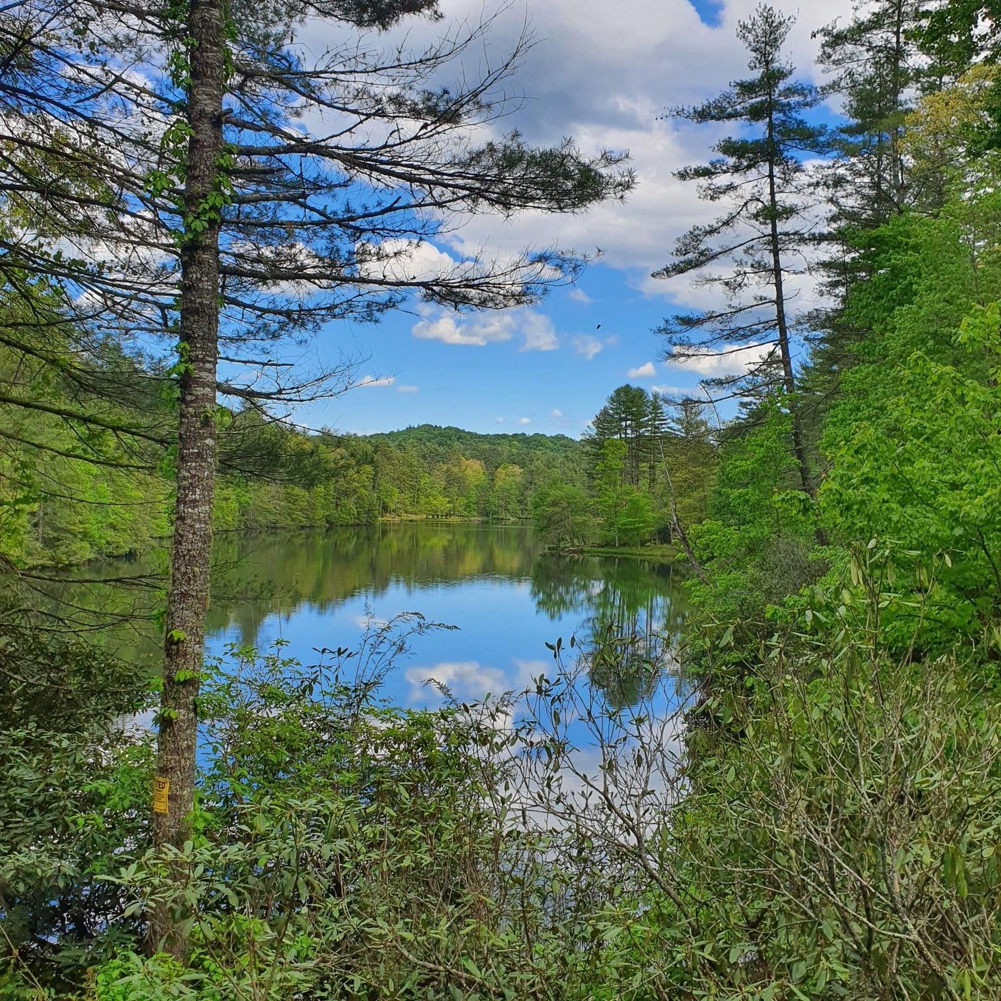
Although small, Reasonover Lake is a quaint spot to pass by while on a ride in Transylvania County.
0
0
Frequently Asked Questions
How many gravel bike trails are available around Etowah?
There are over 10 gravel bike routes documented on komoot for the Etowah area. These routes primarily cater to experienced riders, with most classified as difficult due to significant elevation changes and varied terrain.
Are there any easy gravel bike trails suitable for beginners or families in Etowah?
While many routes in the Etowah area are challenging, the region offers diverse terrain. For easier options, look for routes that stick to packed smooth dirt or fine crushed gravel roads with minimal elevation gain. The Davidson River – Pisgah Ranger Station loop from Pisgah Forest Access, for example, explores varied terrain, but you can often find less demanding sections within larger networks like those in Pisgah National Forest or DuPont State Recreational Forest.
What kind of terrain can I expect on gravel bike routes near Etowah?
Gravel biking around Etowah features a mix of surfaces. You'll encounter packed smooth dirt, fine crushed gravel roads, and some sections on mostly paved roads. The routes often traverse rolling hills and dense woodlands, providing varied and scenic riding experiences.
Are there any gravel bike routes that offer scenic viewpoints or overlooks?
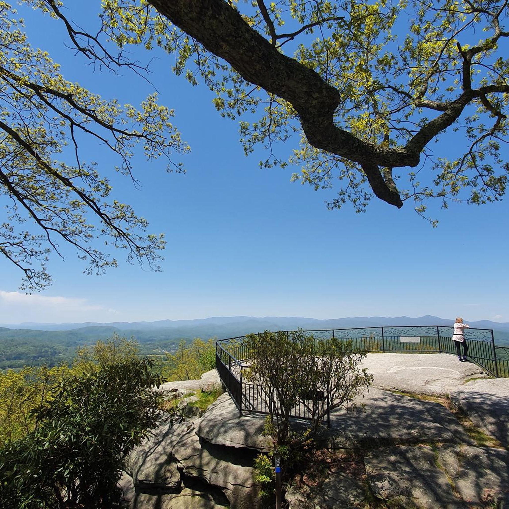
Yes, many routes in the Etowah area provide stunning views. For panoramic vistas, consider routes that climb to exposed granite domes or offer overlooks of the Blue Ridge Mountains. The View of Hominy Valley – Mills River Valley Overlook loop from Mills River is known for its scenic passages through Hominy Valley and past the Mills River Valley Overlook. You can also find specific viewpoints like Triple Falls Overlook or View of High Falls along some routes.
Can I find routes that pass by waterfalls in the Etowah area?
Absolutely. The Etowah region, particularly near Pisgah and DuPont State Recreational Forests, is known for its numerous waterfalls. Routes like the Bad Fork Valley Overlook – Looking Glass Falls loop from Pisgah Forest Access will bring you close to these natural features. You can also explore highlights such as Bridal Veil Falls, Hooker Falls, or the Lake Julia spillway.
Are there any loop gravel bike trails around Etowah?
Yes, many of the gravel bike routes in Etowah are designed as loops, allowing you to start and end at the same point. Examples include the challenging Cascade Lake – Reasonover Lake loop from Little River, which features a mix of gravel surfaces and elevation changes around the lakes, or the Lake Imaging – Grassy Creek loop from Stone Mountain.
What are some notable natural attractions or landmarks near the gravel bike routes?
Beyond the trails themselves, the Etowah area is rich in natural beauty. You can find several lakes, such as Lake Dense and Lake Imaging, which are often incorporated into routes. The region is also home to impressive natural monuments like the Glassy Mountain Summit, offering expansive views.
What do other gravel bikers say about the routes in Etowah?
The gravel biking routes around Etowah are highly regarded by the komoot community. With over 90 visitors, riders often praise the diverse landscapes, challenging climbs, and the immersive experience of riding through dense woodlands and scenic river valleys. The access to extensive trail networks within Pisgah National Forest and DuPont State Recreational Forest is also a frequently highlighted positive aspect.
How long do the gravel bike trails typically take to complete?
The duration of gravel bike trails in Etowah varies significantly depending on the route's length and elevation. For instance, the Davidson River – Pisgah Ranger Station loop typically takes around 4 hours, while longer and more challenging routes like the Bad Fork Valley Overlook – Looking Glass Falls loop can take over 11 hours to complete.
Are there any specific challenges to be aware of when gravel biking in Etowah?
Many of the gravel routes in Etowah are classified as difficult, featuring significant elevation gains, sometimes exceeding 3,000 feet. Riders should be prepared for varied terrain, including steep climbs and descents on gravel surfaces. Some longer routes can take several hours, requiring good fitness and advanced riding skills.
Is there parking available near the gravel bike trailheads in Etowah?
Yes, many popular trailheads and access points for gravel biking in the Etowah area, especially those leading into Pisgah National Forest and DuPont State Recreational Forest, offer designated parking areas. It's advisable to check the specific route details on komoot for information on parking at the starting point of your chosen trail.
Most popular attractions around Etowah

Get inspired with the komoot mobile app


Explore more
Browse the best Gravel rides in other regions.
