The best gravel rides around Alustante
4.8
(4)
124
riders
14
rides
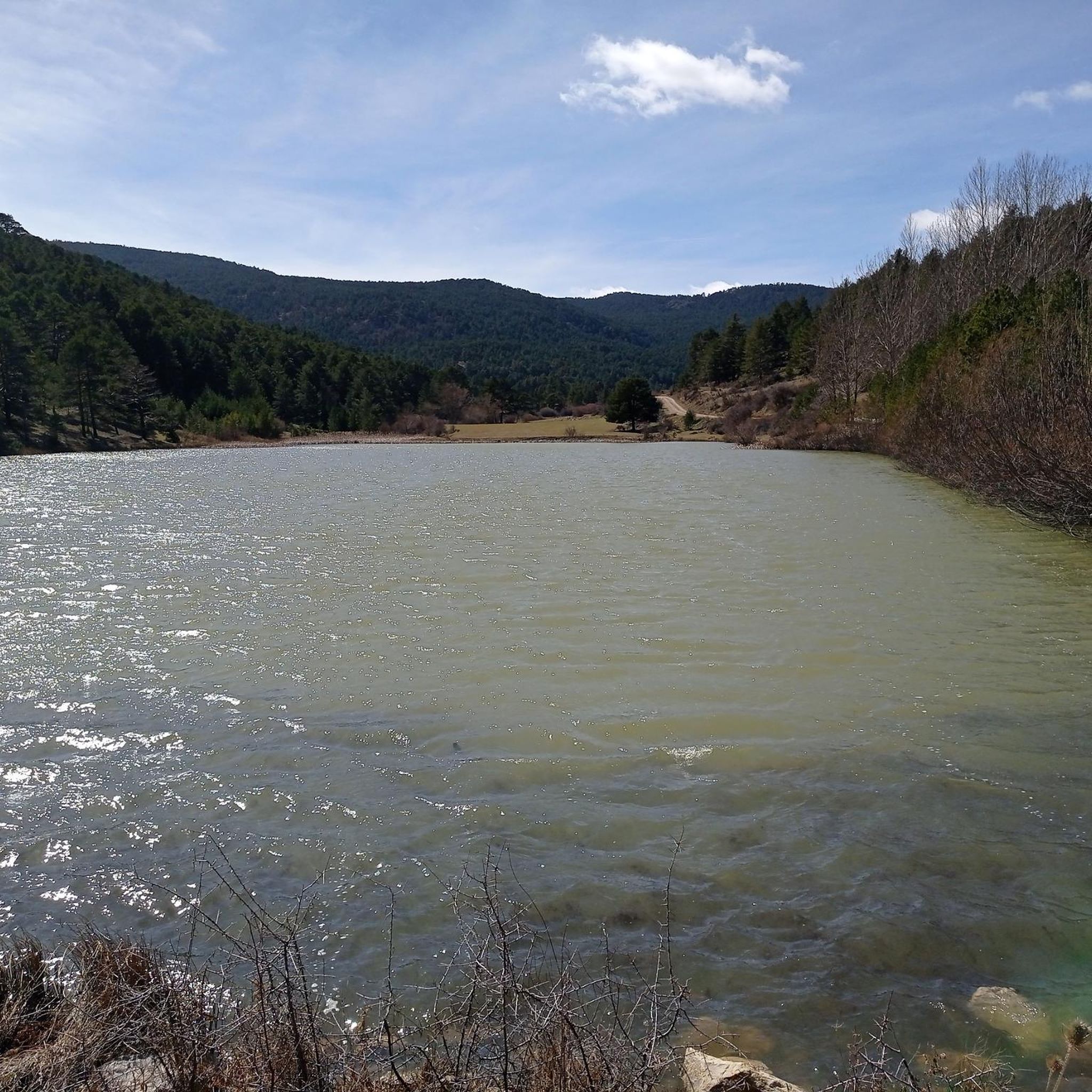
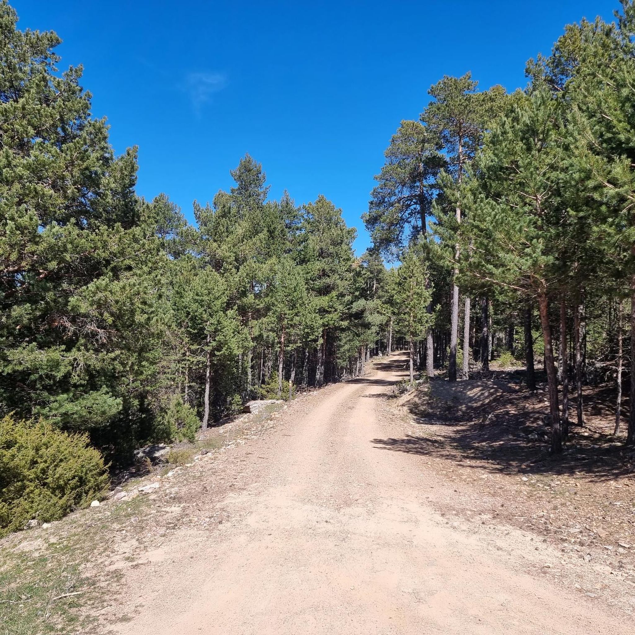
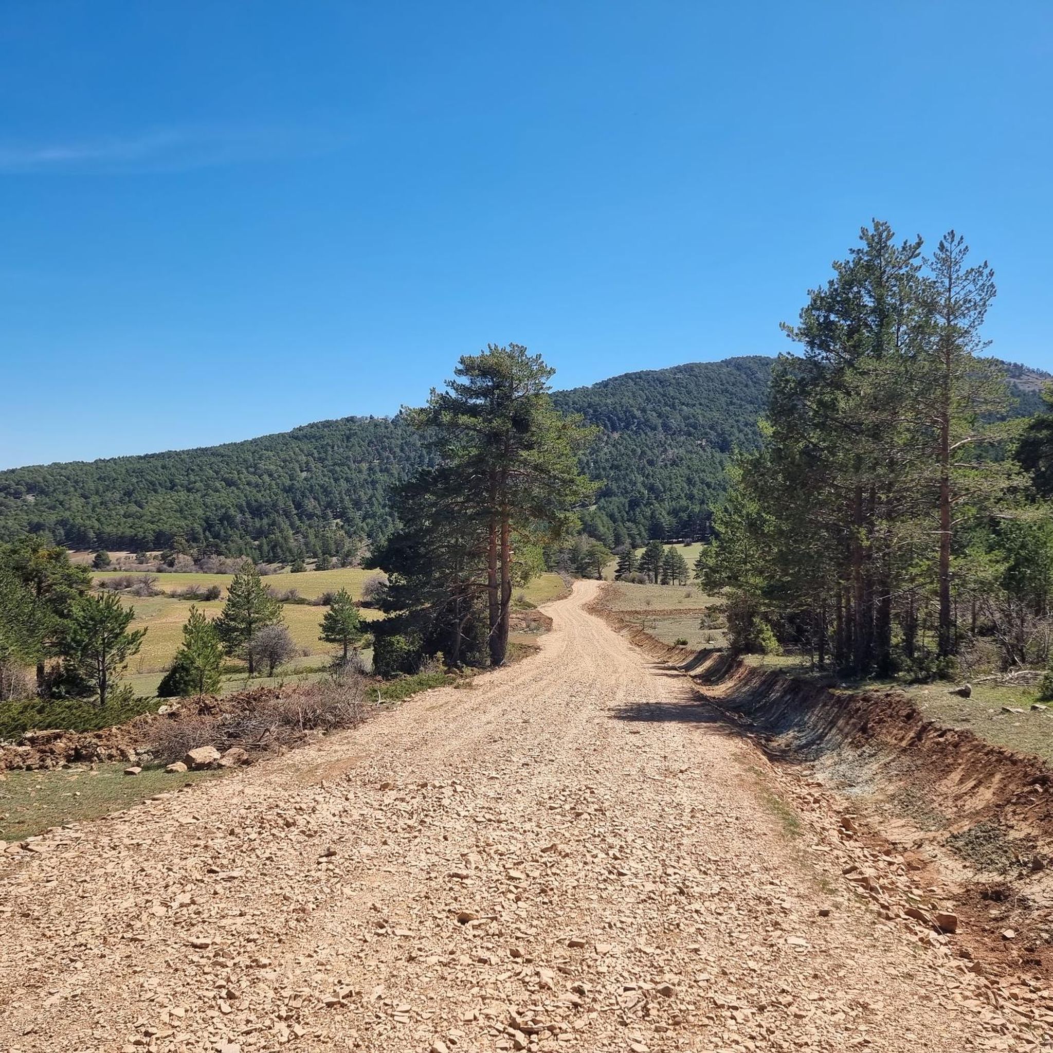
Gravel biking around Alustante offers diverse landscapes within the Alto Tajo Natural Park, characterized by significant elevation changes and varied terrain. The region features mountainous areas with extensive forests of Scots pine, Pyrenean oak, and gall oak, alongside unique relict formations of creeping juniper. Riders encounter a mix of technical sections, fast stretches, and challenging descents across its high peaks, numerous springs, and distinctive geological formations like the red sandstone of Chequilla and the Río de Piedra Borrocal. This environment…
Last updated: August 26, 2026
4.8
(4)
108
riders
141km
10:01
2,360m
2,360m
Hard gravel ride. Very good fitness required. Mostly paved surfaces. Suitable for all skill levels.
5
riders
27.5km
02:24
580m
580m
Hard gravel ride. Very good fitness required. Mostly paved surfaces. Suitable for all skill levels.

Sign up for free
4
riders
Hard gravel ride. Very good fitness required. Mostly paved surfaces. Suitable for all skill levels.
2
riders
23.1km
02:03
450m
450m
Hard gravel ride. Very good fitness required. Mostly paved surfaces. Suitable for all skill levels.
2
riders
19.2km
01:40
380m
370m
Moderate gravel ride. Good fitness required. Mostly paved surfaces. Suitable for all skill levels.
Get access to more routes and recommendations from other explorers.
Sign up for free
Already have an account?
Our route recommendations are based on thousands of hikes, rides, and runs completed by other people on komoot.
Start today with a free account
Your next adventure awaits.
Login or Signup
Tips from the Community

The municipality of Orihuela del Tremedal has many trails and paths in its surroundings available for MTB, in addition to having nearby peaks around 1900 meters.
0
0

Emblematic place, with natural sculptures, visible from the road itself
0
0

Within the great beauty of the Enchanted City of Chequilla are the Towers, near the Church Square.
0
0

This setting couldn't be more spectacular, containing a series of stone figures capriciously created by nature over hundreds of thousands of years. Erosion has exposed the hardest parts of the rocks, which remain as silent witnesses to the passage of time and serve as an attraction for tourists who come to marvel at these strange formations.
9
0
These rock formations create a very unique setting at the entrance to the town of Chequilla. Erosion over hundreds of thousands of years has formed these whimsical figures that serve as a tourist attraction for anyone who visits this small town.
0
0

The official source of water is located at Fuente de García, in the Montes Universales, within the municipality of Frías de Albarracín (Teruel). It is located at an altitude of approximately 1,590 meters, surrounded by pine forests and high mountain meadows. Access is very easy and well signposted. Take the A-1704 highway, which connects Frías de Albarracín with Huélamo (Cuenca). From the highway, a paved detour of approximately 2 km takes you directly to the recreational area and the monument. There is free parking next to the monument.
10
0
Access is very easy and well signposted. Take the A-1704 highway, which connects Frías de Albarracín with Huélamo (Cuenca). From the highway, a paved detour of approximately 2 km takes you directly to the recreational area and the monument. There is free parking next to the monument.
5
0
The official source is located at Fuente de García, in the Montes Universales, within the municipality of Frías de Albarracín (Teruel). It is located at an altitude of approximately 1,590 meters, surrounded by pine forests and high mountain meadows.
5
0
Frequently Asked Questions
How challenging are the gravel bike trails around Alustante?
The gravel biking routes around Alustante offer a range of difficulties, from moderate to difficult. You can expect significant elevation changes, with routes like the Bronchales Town Center – Orihuela del Tremedal loop from Bronchales featuring over 580 meters of ascent. The terrain includes a mix of technical sections, fast stretches, and challenging descents, traversing varied forest and mountain landscapes.
What kind of terrain can I expect on gravel rides in Alustante?
Alustante's gravel trails are characterized by diverse terrain within the Alto Tajo Natural Park. You'll ride through extensive forests of Scots pine, Pyrenean oak, and gall oak, as well as unique relict formations of creeping juniper. The routes often feature high mountain climates, transitioning from drier areas to lush mountainous forests, with surfaces ranging from gravel paths to more technical sections.
When is the best time of year to go gravel biking in Alustante?
Alustante experiences a high mountain climate with distinct seasons. While gravel biking is possible for much of the year, spring and autumn generally offer the most pleasant conditions with moderate temperatures and vibrant landscapes. Summers can be warm, and winters bring colder temperatures and potential snow, especially at higher elevations, which can make some trails more challenging or inaccessible.
Are there family-friendly gravel biking options in Alustante?
While many routes in Alustante are rated moderate to difficult due to elevation changes and varied terrain, some sections or shorter loops might be suitable for families with older, more experienced children. For example, the Bronchales Town Center – Camping Las Corralizas loop from Bronchales is a moderate route that could be considered, though it still involves nearly 380 meters of climbing. Always check the route details for distance and elevation before heading out with family.
Can I bring my dog on the gravel trails in Alustante?
The Alto Tajo Natural Park, where Alustante is located, is generally dog-friendly, but it's crucial to keep your dog under control, preferably on a leash, to protect local wildlife and ensure the safety of other trail users. Always carry water for your dog, especially on longer rides, and be mindful of livestock or protected areas. Check specific regulations for the Alto Tajo Natural Park if you plan to venture off marked trails.
Where can I park my car when gravel biking in Alustante?
Alustante and nearby villages like Bronchales and Orihuela del Tremedal offer various parking options, often in or near their town centers. For instance, routes like the Bronchales – Bronchales Town Center loop from Bronchales typically start and end in areas with accessible parking. Look for designated parking areas in these towns, especially near trailheads or local amenities.
What natural attractions or viewpoints can I see along the gravel trails?
The region around Alustante is rich in natural beauty. You can explore unique geological formations like the red sandstone landscape of The towers of Chequilla or the impressive Chequllia red rocks. High peaks such as Sierra Alta Summit offer stunning panoramic views. The area also features numerous springs and extensive forests, providing a visually engaging ride.
Are there any interesting historical landmarks or villages to visit near the gravel routes?
Yes, beyond the natural landscapes, you can discover historical sites. The picturesque village of Chequilla, with its houses built into striking red sandstone, is a notable stop. The reconstructed Molino de Alustante (an ancient windmill) is a local landmark. Additionally, the nearby medieval town of Orihuela del Tremedal, which features in routes like the Orihuela del Tremedal – Bronchales Town Center loop from Orihuela del Tremedal, offers insights into the region's rich past.
Are there places to eat or stay near the gravel biking routes in Alustante?
Alustante and its surrounding villages, such as Bronchales and Orihuela del Tremedal, offer various options for refreshments and accommodation. You'll find local cafes, pubs, and restaurants where you can refuel after your ride. There are also several accommodation choices, including guesthouses and rural hotels, providing a comfortable base for exploring the region. For example, the Puerto de Orihuela – Orihuela del Tremedal loop from Orihuela del Tremedal passes through areas with amenities.
Are there any circular gravel bike routes available in Alustante?
Yes, many of the gravel routes around Alustante are designed as circular loops, allowing you to start and end in the same location. Examples include the popular Bronchales – Bronchales Town Center loop from Bronchales, which takes you through dense woodlands and open mountain areas, and the Puerto de Orihuela – Orihuela del Tremedal loop from Orihuela del Tremedal. These loops are convenient for day trips and exploring the diverse landscapes.
What is the total number of gravel bike trails available in Alustante on komoot?
There are over 10 gravel bike trails available on komoot for the Alustante region. These routes cater to various skill levels, predominantly featuring moderate to difficult ratings, and showcase the diverse landscapes of the Alto Tajo Natural Park.
Most popular attractions around Alustante

Get inspired with the komoot mobile app


Explore more
Browse the best Gravel rides in other regions.
