The best gravel rides around Gillenfeld
4.4
(20)
74
riders
14
rides
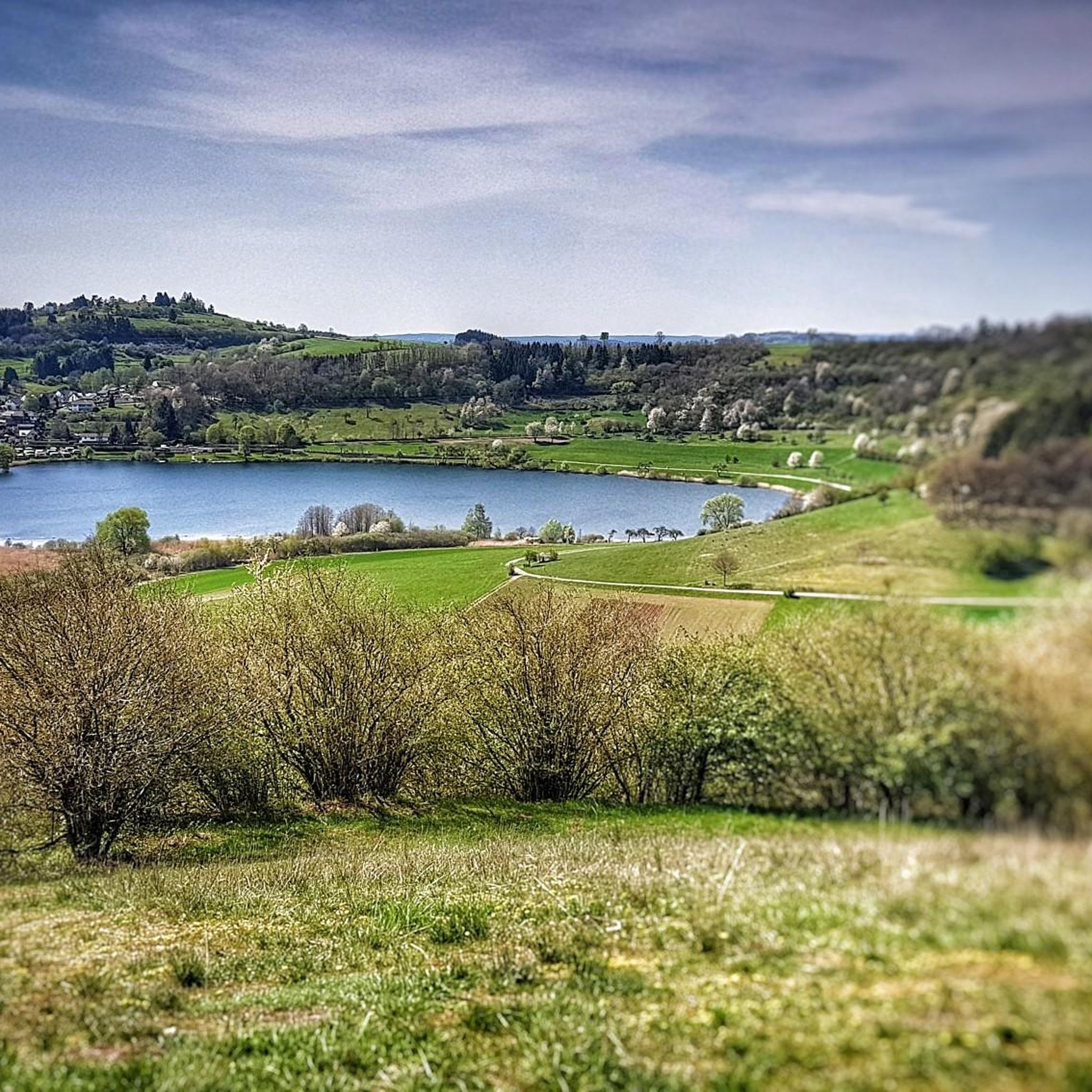
Gravel biking around Gillenfeld offers varied terrain through the unique volcanic landscapes of the Vulkaneifel. The region is characterized by its "Maare," ancient volcanic crater lakes, and dense woodlands. These natural features provide a mix of forest paths, lakeside trails, and elevation changes, creating an engaging environment for gravel cyclists. The area's geological formations present diverse paths with magnificent views.
Best gravel bike trails around Gillenfeld
- The most popular gravel bike trail is View of the Schalkenmehrener Maar – Weinfelder…
Last updated: July 3, 2026
20
riders
43.1km
03:14
750m
750m
Hard gravel ride. Very good fitness required. You may need to push your bike for some segments of this route.
11
riders
48.4km
03:18
780m
780m
Hard gravel ride. Very good fitness required. Mostly paved surfaces. Suitable for all skill levels.

Sign up for free
4.3
(9)
17
riders
Hard gravel ride. Very good fitness required. You may need to push your bike for some segments of this route.
5.0
(3)
7
riders
62.2km
03:57
960m
960m
Hard gravel ride. Very good fitness required. You may need to push your bike for some segments of this route.
5.0
(2)
4
riders
32.5km
02:09
460m
460m
Hard gravel ride. Very good fitness required. Mostly paved surfaces. Suitable for all skill levels.
Get access to more routes and recommendations from other explorers.
Sign up for free
Already have an account?
Our route recommendations are based on thousands of hikes, rides, and runs completed by other people on komoot.
Start today with a free account
Your next adventure awaits.
Login or Signup
Popular around Gillenfeld




Tips from the Community


For those with time, a visit to the Eagle and Wolf Park is certainly interesting.
0
0

Million dollar view of the castle
0
0

Great view of Kasselburg Castle near Pelm.... https://youtu.be/PV6yleBZNYU
0
0


Pleiner Tunnel - Hasborn–Wittlich Directly after the former Plein train station, approximately 5 km beyond Hasborn, the cycle path leads through the 585-meter-long Pleiner Tunnel. It then continues downhill through deciduous and mixed forests to Wittlich. From the rather rugged Volcanic Eifel, the cycle path descends into the Wittlich Valley. The route passes vineyards and leads into the town of Wittlich. Text / Source: wikipedia.org/wiki/Maare-Mosel https://de.wikipedia.org/wiki/Maare-Mosel-Radweg#:~:text=Direkt%20nach%20dem%20ehemaligen%20Bahnhof%20von%20Plein%2C%20ca.,f%C3%BChrt%20der%20Radweg%20hinab%20in%20das%20Wittlicher%20Tal.
13
0
Maare-Mosel Cycle Route Family time on a bike tour along a disused railway line Almost no inclines, but plenty of adventure spots along the way – this Eifel bike tour from Daun to Bernkastel-Kues (58.5 km) is perfect for a family outing. Everyone cycles along at a leisurely pace, and even children can manage the route. The Maare-Mosel Cycle Route runs along a former railway line. Who'll be first to the top? A short race at the beginning leads up to the viaduct near Daun – the first and only challenge is mastered. With a stunning panoramic view of the Eifel, the little ones can catch their breath for a bit, then the next adventure awaits. There's great cheering at the "Großes Schlitzohr" (Great Slacker), as it's the second-longest bike tunnel in Germany – so turn on the lights and off we go. The bike tour continues at a relaxed pace through beech forests and past glittering maars. No car noise, just the gentle rustling of leaves, the chirping of birds, and the laughter of children. From Bernkastel-Kues, a bike bus takes you back to the starting point. The return trip can be booked in advance. Text / Source: Eifel Tourismus (ET) GmbH, Kalvarienbergstraße, D-54595 Prüm https://www.eifel.info/a-maare-mosel-radweg
14
1
Frequently Asked Questions
What kind of terrain can I expect on gravel bike trails around Gillenfeld?
Gravel biking around Gillenfeld offers a diverse mix of terrain, characterized by the unique volcanic landscapes of the Vulkaneifel. You'll find forest paths, lakeside trails around the Maare (volcanic crater lakes), and varied elevation changes. While some routes include paved sections, many feature unpaved and sometimes challenging segments, providing an engaging experience for gravel cyclists.
How many gravel bike routes are available in the Gillenfeld area?
There are over two dozen gravel bike routes available around Gillenfeld on komoot. These routes cater to various preferences, though the majority, specifically 16 out of 23, are rated as difficult due to significant climbs and varied terrain.
Are there any routes that offer panoramic views of the volcanic lakes (Maare)?
Yes, many routes in the region are designed to showcase the stunning Maare. For example, the View of the Schalkenmehrener Maar – Weinfelder Maar loop from Daun is a difficult 42.8 km trail that offers extensive panoramic views over the Schalkenmehrener Maar, Weinfelder Maar, and the surrounding forests.
What are some notable landmarks or attractions I can see while gravel biking in Gillenfeld?
The Gillenfeld region is rich in natural and historical landmarks. You can encounter the impressive Dronke Tower on the Mäuseberg, which offers wonderful views over the Maare. Other highlights include the volcanic lakes themselves, such as the Schalkenmehrener Maar and the Weinfelder Maar. Some routes also pass through interesting man-made structures like the Großes Schlitzohr Tunnel.
Are there any longer gravel bike routes for experienced riders?
For experienced riders seeking a longer challenge, the Viewpoint Meerfelder Maar – View of Kasselburg Castle loop from Meerfeld is a difficult 61.9 km route with nearly 1000 meters of elevation gain. This trail offers a substantial ride through varied landscapes, including views of the Meerfelder Maar and Kasselburg Castle.
What is the best time of year to go gravel biking in Gillenfeld?
The Vulkaneifel region, including Gillenfeld, is beautiful throughout spring, summer, and autumn. Spring brings lush greenery and blooming landscapes, while autumn offers vibrant fall colors. Summers are generally pleasant for cycling. Winter conditions can vary, with potential for snow or ice, so it's advisable to check local weather forecasts if planning a winter ride.
What do other gravel bikers say about the routes in Gillenfeld?
The gravel biking routes in Gillenfeld are highly rated by the komoot community, with an average score of 4.25 stars from over 27 reviews. Riders often praise the diverse volcanic landscapes, the stunning views of the Maare, and the engaging mix of forest paths and challenging climbs.
Are there any routes that follow historic paths or railway lines?
Yes, the region incorporates historical infrastructure into its cycling network. The Lieser Cycle Path – Grünewald Viaduct loop from Greimerath is a difficult 48.4 km route that includes sections along the historic Lieser Cycle Path, offering a unique blend of cultural landscape and challenging terrain.
What kind of elevation changes should I expect on Gillenfeld's gravel trails?
Gillenfeld's gravel trails are known for their varied elevation profiles due to the volcanic landscape. Many routes feature significant climbs. For instance, the Panorama Bench Sarmerzbach – View of Daun from Daun Viaduct loop from Schalkenmehren, a 40.4 km route, includes nearly 600 meters of ascent, providing a good workout and rewarding views.
Are there any routes that pass by viaducts or other impressive structures?
Yes, some routes offer views of impressive engineering. The Großes Schlitzohr Tunnel – View of Daun from Daun Viaduct loop from Niederscheidweiler is a 44.3 km difficult trail that leads through cultural landscapes and past notable viaducts, providing interesting architectural sights alongside natural beauty.
Can I find places to eat or rest along the gravel routes in Gillenfeld?
While specific cafes or pubs directly on every trail are not guaranteed, the region has various options for refreshments. You can find places like the Heidsmühle Hotel & Restaurant, and several huts and shelters such as the Falkenlay Stone Shelter and Viewpoint or Balduin Hut, which can serve as good rest stops.
Most popular routes around Gillenfeld
Most popular attractions around Gillenfeld

Get inspired with the komoot mobile app


Explore more
Browse the best Gravel rides in other regions.
