The 15 Most Amazing Peaks around Kaiserhammer Forst-Ost
Mountain peaks around Kaiserhammer Forst-Ost, located in the Wunsiedel im Fichtelgebirge district of Bavaria, Germany, are characterized by elevated points and hills rather than traditional high-altitude summits. This forest area features several notable locations, often topped with observation towers, that provide scenic views of the surrounding landscape. These elevated points offer accessible viewpoints and walking trails for visitors.
Best mountain peaks around Kaiserhammer Forst-Ost
- The most popular mountain peaks is Schönburgwarte on the Großer Kornberg, a viewpoint that offers…
Last updated: July 7, 2026
Schönburgwarte on the Großer Kornberg
Highlight • Viewpoint
Translated by Google •
Tip by

Waldenfelswarte observation tower on the Kohlberg
Highlight • Viewpoint
Translated by Google •
Tip by

Sign up now to discover places like this
Get recommendations on the best single tracks, peaks, & plenty of other exciting outdoor places.
Sign up for free
Summit and Rock Formations of Großer Hengstberg
Highlight • Summit
Translated by Google •
Tip by

Wartberg Lookout Tower
Highlight • Viewpoint
Translated by Google •
Tip by

Hauknock Summit Cross
Highlight • Summit
Translated by Google •
Tip by

Sign up for free to discover even more peaks around Kaiserhammer Forst-Ost.
Sign up for free
Already have an account?
Start today with a free account
Your next adventure awaits.
Login or Signup
Tips from the Community

In the summit area, there are striking boulder fields made of so-called Weißenstädter Porphyry Granite. This is characterized by feldspar phenocrysts up to ten centimeters in size, which make the soil particularly nutrient-rich – the reason why the surrounding beech forest thrives so magnificently here.
0
0

A beautiful little peak in the forest with benches and a summit cross. The altitude information is a bit confusing. The Hauknock is marked with 691 above sea level, while the sign right next to it says 675 above sea level.
1
0

It's really idyllic there with the big rocks and the beautiful area. The climb was worth it.
0
0

On the 628m high Wartberg there is a small observation tower that used to serve as a signal station for communication. The view is limited, but it is still worth the trip.
5
1
The Kohlberg (632 m above sea level) south of Arzberg is also called the Sugarloaf. The 32 m high Waldenfelswarte observation tower offers a wonderful view of the surrounding area. Binoculars and panoramic overviews that can be used free of charge help with orientation. The Waldenfelswarte is the highest observation tower in the Fichtel Mountains.
6
0

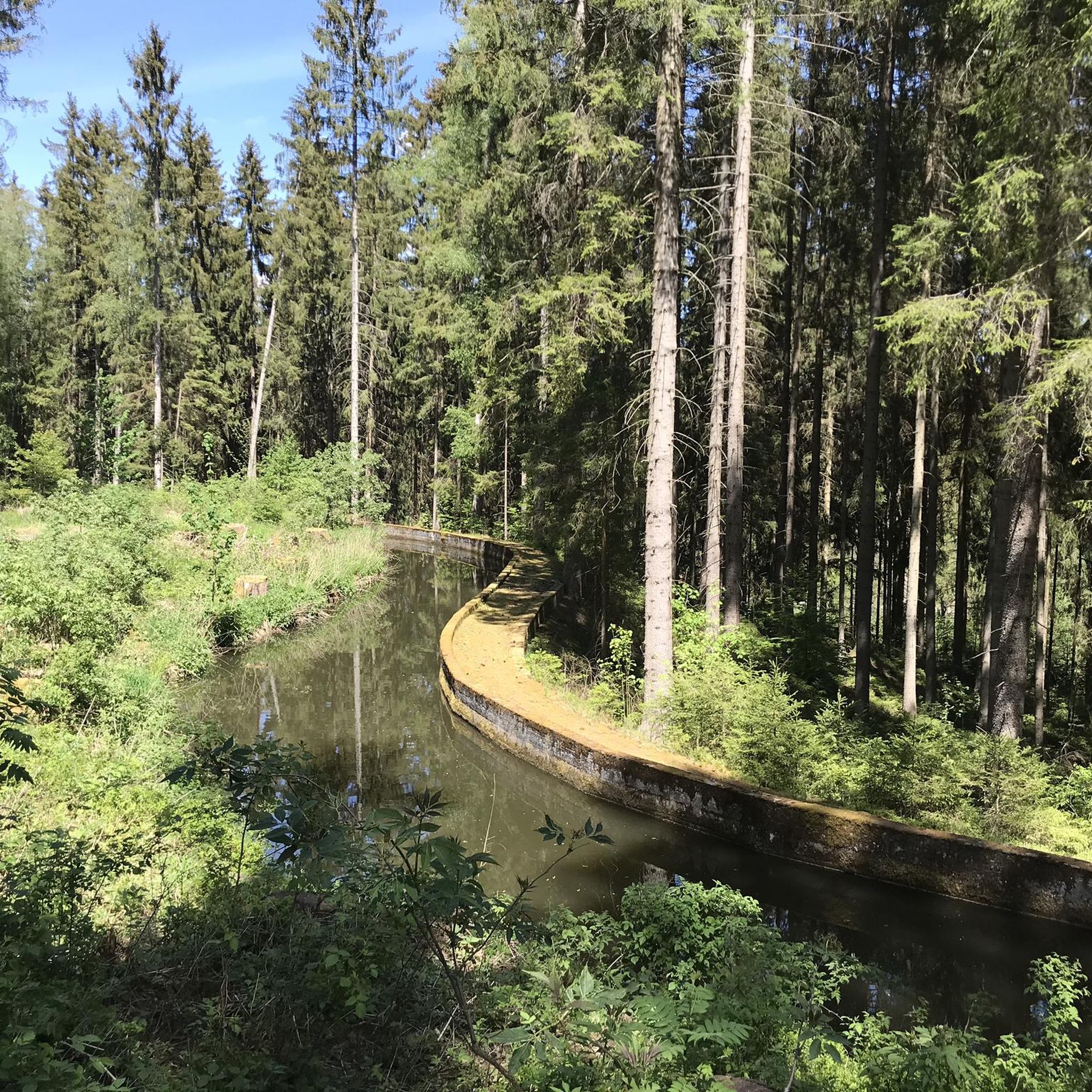
Pretty “summit” with a cozy bench to rest on. Unfortunately, this part of the forest is also affected by emergency clearing...
1
0


In the past, I hiked past it quite often without noticing it. Easily recognizable through the sparse forest. A nice spot with 2 benches.
1
0
Frequently Asked Questions
What types of elevated points can I explore in Kaiserhammer Forst-Ost?
Kaiserhammer Forst-Ost features elevated points and hills, often topped with observation towers, rather than traditional high-altitude mountain peaks. These locations provide scenic views and accessible walking trails. The emphasis is on enjoying the forested terrain and panoramic vistas.
Which observation towers offer the best views in the Kaiserhammer Forst-Ost region?
Several observation towers provide excellent views. The Waldenfelswarte observation tower on the Kohlberg is 33 meters high and offers panoramic views in all directions, even providing free binoculars. Another popular choice is the Schönburgwarte on the Großer Kornberg, which also provides extensive views over the Fichtelgebirge. The Wartberg Lookout Tower, while smaller, offers views of the Egertal and the Ore Mountains.
Are there any historical or unique structures on the peaks around Kaiserhammer Forst-Ost?
Yes, the Wartberg Lookout Tower, located on the 628-meter-high Wartberg, historically functioned as a signal station. The Waldenfelswarte observation tower on the Kohlberg was significantly raised in 2017, making it the highest lookout tower in the Fichtelgebirge Association, and the Kohlberg itself is sometimes referred to as 'Sugarloaf'.
What kind of hiking terrain can I expect around Kaiserhammer Forst-Ost?
The terrain around Kaiserhammer Forst-Ost is primarily forested, featuring accessible viewpoints and walking trails rather than challenging climbs. You'll find paths leading through woods to elevated points like the Hohe Wart (613 m), which is a heavily forested granite hill. Many routes are suitable for intermediate hikers, with some offering more challenging sections like the path to the Hauknock Summit Cross.
Are there family-friendly options for visiting the elevated points?
Yes, several spots are considered family-friendly. The Wartberg Lookout Tower is noted as family-friendly. The general nature of the elevated points, focusing on accessible viewpoints and walking trails, makes many areas suitable for families looking to enjoy nature without extreme difficulty.
Can I bring my dog to the trails around the peaks?
Yes, the Wartberg Lookout Tower is specifically marked as dog-friendly. Generally, many trails in the forested areas around Kaiserhammer Forst-Ost are suitable for dogs, but it's always advisable to keep them on a leash and respect local regulations.
Where can I find parking when visiting these elevated points?
For the Waldenfelswarte observation tower on the Kohlberg, parking is available at a hiking car park on the road to Arzberg, making it easily accessible. For other areas, look for designated hiking car parks near trailheads.
What are some popular hiking routes near the peaks?
The region offers various hiking opportunities. You can find routes like the Eger Reservoir – Weller Valley (Eger Valley) loop or the Eger Reservoir – Hirschsprung Hydropower Plant loop. For more detailed options, explore the Hiking around Kaiserhammer Forst-Ost guide.
Are there options for cycling or mountain biking near the peaks?
Yes, the area around Kaiserhammer Forst-Ost is suitable for various cycling activities. You can find routes for gravel biking, such as the Eger River in Wellertal – Kaiserweg Trail, or road cycling routes like the Selb Town Church – Bridge Cycle Path. For more information, check the Gravel biking around Kaiserhammer Forst-Ost guide and the Road Cycling Routes around Kaiserhammer Forst-Ost guide.
What do visitors particularly enjoy about the peaks in Kaiserhammer Forst-Ost?
Visitors highly appreciate the panoramic views from the observation towers, such as the 'bombastic view over the Fichtelgebirge' from Schönburgwarte on the Großer Kornberg. The opportunities for rest and enjoying nature, along with the accessibility of the trails, are also frequently mentioned as highlights.
What is the Hohe Wart, and what can I expect when visiting it?
The Hohe Wart (613 m) is a 613-meter-high, heavily forested granite hill. While it doesn't feature a prominent summit structure, it represents one of the higher points in the forest, offering a sense of elevation within the natural landscape between Silberbach and Häuselloh.
Is there a less-known elevated point worth discovering for a quiet experience?
The Hauknock Summit Cross is a less prominent elevated point that can be a bit harder to find without aids. It offers a quiet spot with benches, suitable for a peaceful rest amidst the sparse forest, away from more crowded viewpoints.
What is the best time of year to visit the peaks for hiking?
While specific seasonal information isn't detailed, the forested nature of Kaiserhammer Forst-Ost suggests that spring, summer, and autumn are ideal for hiking. Spring brings blooming flora, summer offers lush greenery, and autumn provides beautiful fall colors. Winter hiking is possible but may require appropriate gear for snow and ice conditions.
Most popular routes around Kaiserhammer Forst-Ost
Most popular attractions around Kaiserhammer Forst-Ost

Get inspired with the komoot mobile app


Explore more
See even more amazing summits around Kaiserhammer Forst-Ost with these guides:
