The best walks and hikes in Jordan River Golf Course State Park
4.6
(57)
801
hikers
78
hikes
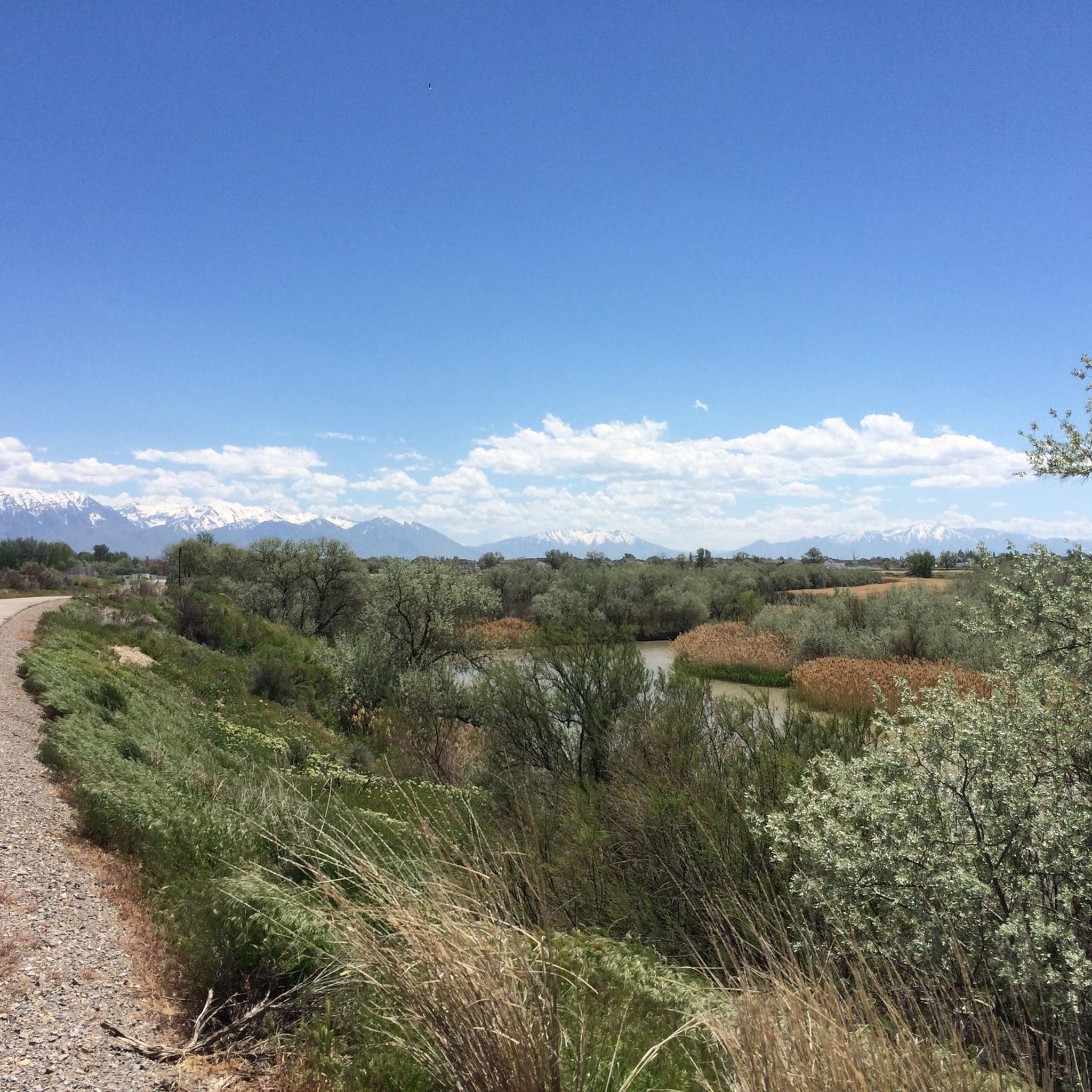
Hiking in Jordan River Golf Course State Park primarily refers to the extensive Jordan River Parkway Trail system, which follows the Jordan River through an urban corridor in Utah. This multi-use trail offers a mix of paved and unpaved sections, providing a relatively flat terrain suitable for various outdoor activities. The landscape features tranquil riverside views, riparian ecosystems, and connects numerous city parks and conservation areas. Hikers can experience natural settings with opportunities for wildlife viewing, often against a backdrop of the Wasatch Mountains.
Best hiking trails in Jordan River Golf Course State Park
- The most popular hiking route is Ensign Peak via Hell Canyon Trail, an easy 2.1 miles (3.4 km) trail that takes about 1 hour to complete, offering views towards Ensign Peak.
- Another top favourite among local hikers is Dude Benchmark Peak Trail, a moderate 5.4 miles (8.7 km) path with significant elevation gain, leading to a prominent benchmark.
- Local hikers also love the Meridian Peak, a 2.5 miles (4.0 km) trail leading through varied terrain, often completed in about 1 hour 25 minutes.
- Hiking in Jordan River Golf Course State Park is defined by riverside paths, urban green spaces, and views of the Wasatch Mountains. The network offers options for different ability levels, from easy strolls to more challenging climbs.
- The routes in Jordan River Golf Course State Park are highly rated by the komoot community with an average score of 4.8 stars from over 40 reviews. More than 700 hikers have used komoot to explore Jordan River Golf Course State Park's varied terrain.
Last updated: October 15, 2026
8
hikers
777m
00:15
0m
90m
The Ensign Peak Trail offers a unique blend of natural beauty and historical significance, making it a standout short hike near Salt Lake City. As you ascend the well-maintained path, the terrain transitions from potentially paved sections to a dirt singletrack. The real payoff comes at the summit, where you're treated to expansive views of the entire Salt Lake Valley, including the city skyline, the majestic Wasatch Mountains, and the distant Great Salt Lake. It's a truly rewarding experience for minimal effort.
Planning your visit to this popular route is straightforward, as the trailhead is just minutes from downtown Salt Lake City. While the trail is considered an easy 0.5-mile (0.8 km) hike with only 3 feet (1 metres) of elevation gain, taking about 14 minutes, remember there's no shade. Bring water, sunscreen, and a hat, especially if you're hiking during the day. The trail is also family-friendly and dog-friendly, though leashes are required.
This trail holds a special place in Utah's history, marking the spot where Brigham Young and early pioneers first surveyed the valley in 1847. An 18-foot monument and interpretive signs at the peak commemorate this event, offering a literal historic viewpoint. Its accessibility and impressive vistas make it a popular choice for both locals and visitors seeking a quick, impactful outdoor experience.
3.44km
01:04
210m
0m
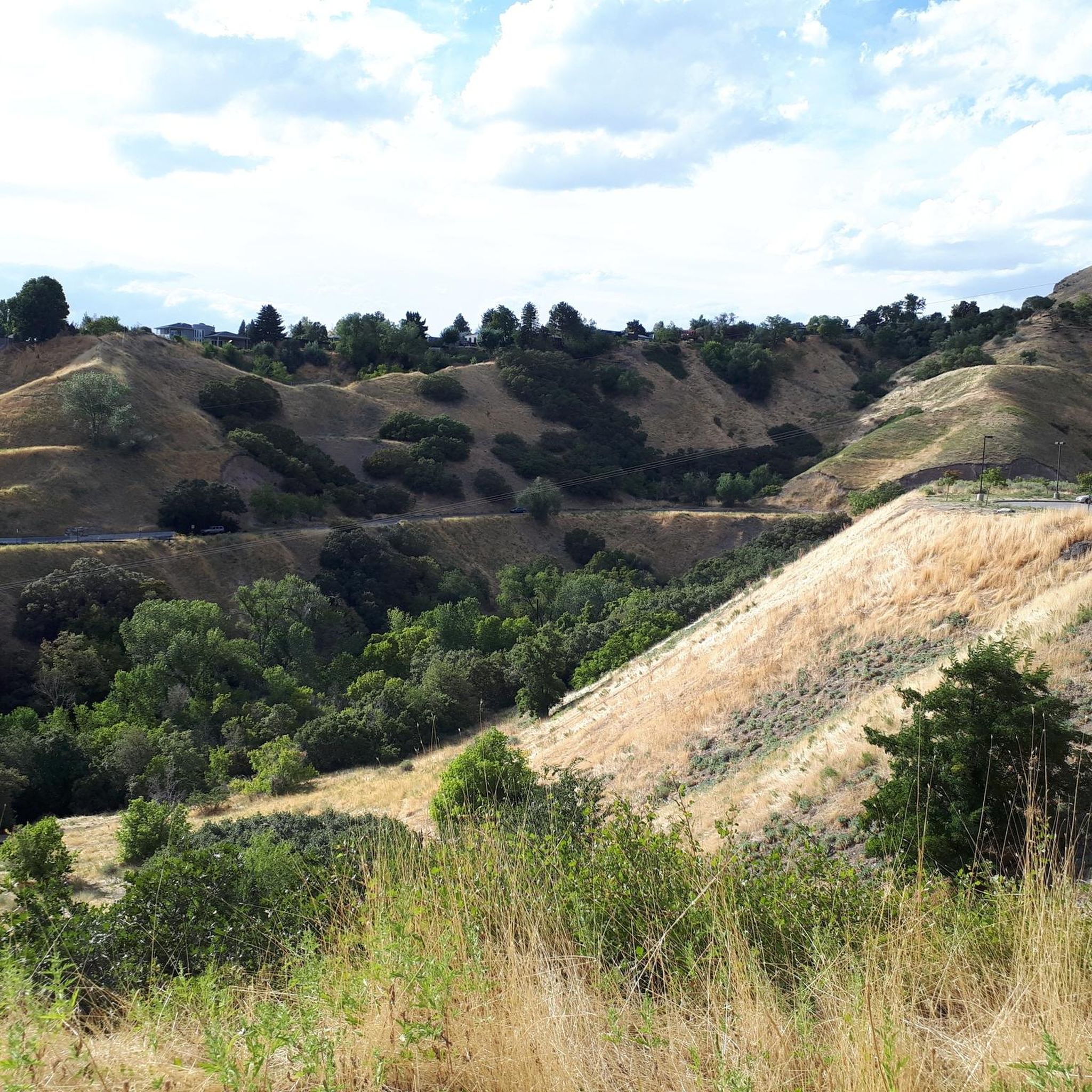
The Ensign Peak via Hell Canyon Trail offers a compact yet rewarding experience just north of Salt Lake City. You'll wind through rugged Hell Canyon, characterized by its grassy meadows and scattered juniper trees, before reaching the summit of Ensign Peak. The terrain varies from well-trodden paths to sections with dirt and loose rocks, providing a dynamic feel underfoot as you climb towards those expansive views.
This easy 2.1-mile (3.4 km) hike involves a steady climb of 676 feet (206 metres) and takes about 1 hour and 3 minutes to complete. It's an ideal choice for a quick outing, especially if you're looking for a short but impactful ascent. For the best experience, plan your visit for early morning or late afternoon to enjoy cooler temperatures and potentially spot local wildlife; supportive hiking footwear is a good idea for the varied surfaces.
Ensign Peak holds significant historical importance, marking the spot where Brigham Young and other Mormon pioneers first surveyed the Salt Lake Valley in 1847. A monument at the peak commemorates this event, adding a layer of historical context to the already stunning panoramic views of the city, the valley, and the Great Salt Lake.

8.71km
02:54
610m
40m
Hike the moderate Dude Benchmark Peak Trail for 5.4 miles, gaining 1989 feet, and enjoy panoramic views of Salt Lake City and beyond.
8
hikers
8.33km
02:12
80m
80m
Explore Salt Lake City on this moderate 5.2-mile (8.3 km) urban hiking loop, featuring landmarks and a scenic canyon escape.
1
hikers
3.95km
01:25
220m
220m
The Meridian Peak trail offers a fantastic opportunity to gain some elevation and soak in sweeping panoramic views of the Salt Lake City skyline and the Great Salt Lake. You'll navigate varied terrain, including some steep, terraced sections that rise above the smaller trees and shrubs, eventually revealing the expansive vistas. Keep an eye out for Matt's Arch, a small natural limestone arch that adds a unique feature to the journey.
This easy 2.5-mile (4.0 km) hiking route involves 734 feet (224 metres) of elevation gain, typically taking about 1 hour and 24 minutes to complete. Access is convenient via the Ensign Peak Trailhead or Tunnel Springs Park. Be sure to bring plenty of water and sun protection, as the trail offers very little shade. For the best experience, consider hiking in May or June for wildflowers, or in autumn for the vibrant fall colors, and aim for a late afternoon start to catch a stunning sunset.
Meridian Peak is a popular option for hikers in the Salt Lake City area, connecting to a larger network of trails including the Bonneville Shoreline Trail and Ensign Peak. It's a dog-friendly trail, though leashes are required. The trail's accessibility and rewarding views make it a local favorite, especially for those looking for a quick, impactful outing without venturing too far from the city.
Get access to more routes and recommendations from other explorers.
Already have an account?
Our route recommendations are based on thousands of hikes, rides, and runs completed by other people on komoot.
Start today with a free account
Your next adventure awaits.
Tips from the Community

The center of the Mormons in Salt Lake City. In the middle of the city a place full of peace. You should definitely see it. You couldn't visit the temple from the inside - but you could visit the Tabernacle with the large organ.
0
0

Very beautiful building complex. Open for visits.
1
0

Utah State Capitol Building, Salt Lake City, United States 🇺🇸 The Utah State Capitol Building is a magnificent example of neoclassical architecture, perched grandly on Capitol Hill overlooking Salt Lake City. Its dome, reminiscent of the U.S. Capitol, is a prominent feature against the dramatic backdrop of the Wasatch Mountains. Inside, visitors are often struck by the grand staircase, intricate murals depicting Utah's history, and the beautiful stained-glass windows. Beyond its architectural beauty, the Capitol serves as the seat of government for the state of Utah, housing the offices of the governor, lieutenant governor, state legislature, and the state supreme court. The building is not only a functional governmental space but also a historical landmark, offering insights into the state's rich past and its legislative processes. It stands as a symbol of Utah's civic pride and enduring heritage. The grounds surrounding the Capitol are equally inviting, with beautifully landscaped gardens and panoramic views of the entire Salt Lake Valley. Many visitors enjoy strolling the pathways, picnicking on the lawns, or simply taking in the breathtaking vistas. The Capitol is a popular destination for tourists and locals alike, offering a blend of history, architecture, and scenic beauty that makes for a truly memorable visit.
1
0


The temple and a large part of the area around it are currently being renovated (May 2024). There are other sites of the Church of Jesus Christ of Latter-day Saints all around.
2
0

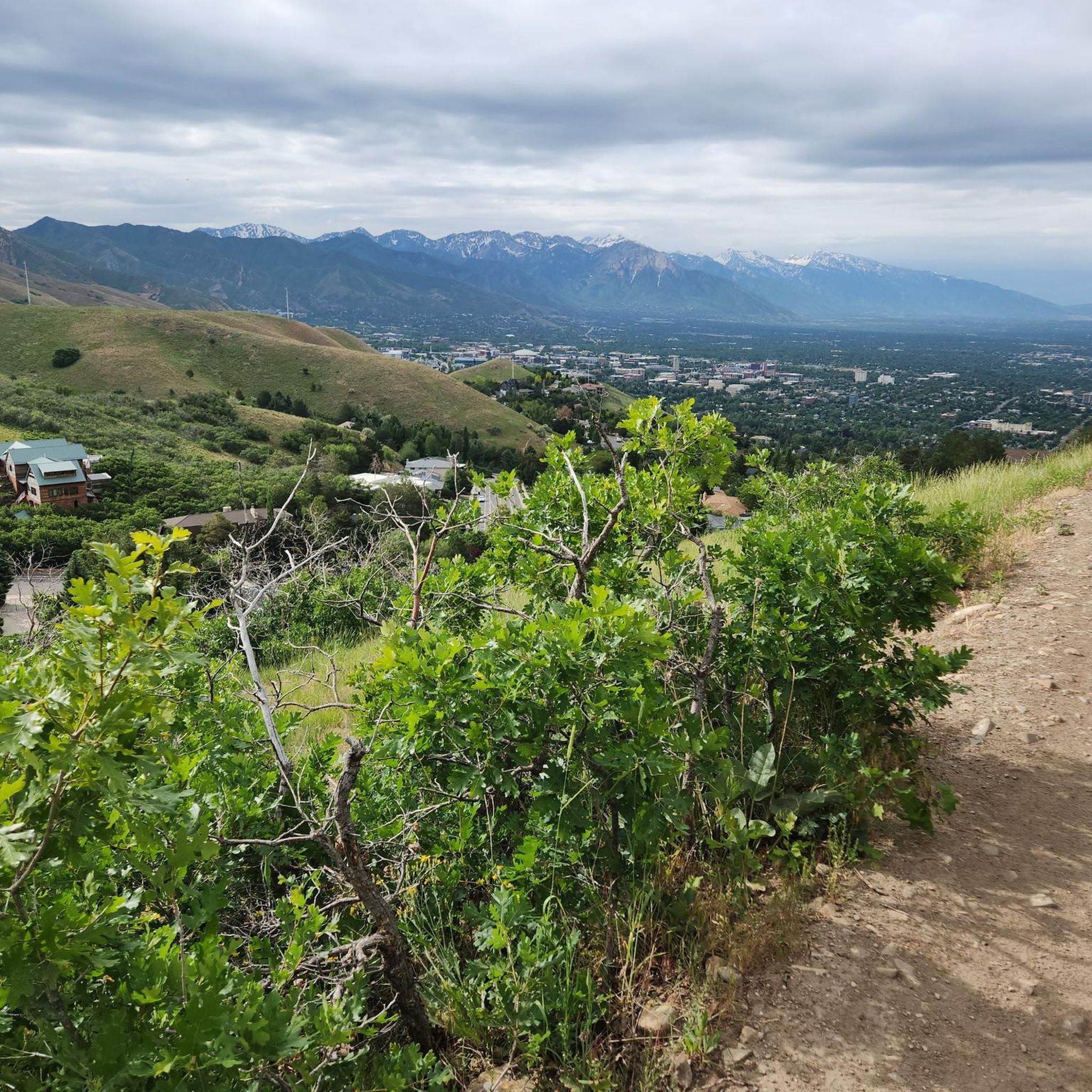
At 7,212 feet, Dude Benchmark is a USGS high point and grassy peak just north of Salt Lake City. You get unobstructed views from the peak and the trail following the ridge that the peak is on.
0
0

Very nice building with free, easy entry, almost no security guards, access to almost all corners, best in the early morning, as visitor requests are limited
3
0

Free entry to the Capitol and many exciting insights into history can be found opposite in the Visitor Center.
3
0
Frequently Asked Questions
How many hiking trails are available along the Jordan River Parkway Trail?
The Jordan River Parkway Trail system offers a wide variety of hiking options, with nearly 80 distinct routes recorded on komoot. These range from easy strolls to more challenging climbs, ensuring there's something for every hiker.
Are there easy or family-friendly hiking options along the Jordan River Parkway Trail?
Yes, the Jordan River Parkway Trail is well-known for its accessible and family-friendly sections. Over 30 of the routes are rated as easy, featuring relatively flat terrain and a mix of paved and unpaved paths. These are perfect for a leisurely walk with children or for beginners. For example, the Ensign Peak via Hell Canyon Trail is an easy 2.1-mile option.
Can I bring my dog on the trails along the Jordan River Parkway?
The Jordan River Parkway Trail is generally dog-friendly, but leash laws and specific regulations may vary by park or section. It's always best to keep your dog on a leash and be prepared to clean up after them. Check local signage for any specific restrictions in certain areas.
What kind of scenery can I expect while hiking the Jordan River Parkway Trail?
Hikers on the Jordan River Parkway Trail can enjoy tranquil riverside views, lush riparian ecosystems, and urban green spaces. Many sections offer stunning backdrop views of the Wasatch Mountains to the east. The trail connects various city parks and conservation areas, providing diverse landscapes throughout its length.
Are there any loop trails available along the Jordan River Parkway?
While the Jordan River Parkway Trail is primarily a linear multi-use path stretching for many miles, many sections within the connected parks and conservation areas offer shorter loop opportunities. You can often create your own loops by combining sections of the Parkway with connecting park trails. Komoot's route planner can help you discover and create these.
What is the best time of year to hike the Jordan River Parkway Trail?
The Jordan River Parkway Trail is enjoyable year-round. Spring and fall offer pleasant temperatures and beautiful foliage, while summer provides lush greenery along the river. Even in winter, many sections remain accessible for a refreshing walk, though conditions can vary with snow and ice.
Where can I find parking for the Jordan River Parkway Trail?
The Jordan River Parkway Trail has numerous access points and trailheads with parking available in the various city and county parks it connects. Due to its extensive length, you'll find parking lots dispersed along its route, making it easy to access different sections. For detailed access points, you can consult resources like the Jordan River Commission map or the Salt Lake County Parks & Recreation website.
What wildlife might I encounter on the Jordan River Parkway Trail?
The natural settings along the Jordan River and in associated parklands provide opportunities to observe local wildlife. You might spot various bird species, including waterfowl, as well as small mammals. The riparian environment is a vital habitat for many creatures.
How long are the typical hikes along the Jordan River Parkway Trail?
Hikes along the Jordan River Parkway Trail vary greatly in length. You can find short, easy strolls of just a mile or two, or embark on longer journeys covering many miles. For instance, the Meridian Peak route is about 2.5 miles, while the Dude Benchmark Peak Trail extends to 5.4 miles.
What makes the Jordan River Parkway Trail unique compared to other hiking areas?
The Jordan River Parkway Trail stands out as a significant urban park and trail system, offering an extensive multi-use path that connects Utah Lake to the Great Salt Lake. Its unique blend of tranquil riverside scenery, urban accessibility, and views of the Wasatch Mountains provides a refreshing escape within a metropolitan area, linking numerous parks and conservation zones.
How do other hikers rate the trails along the Jordan River Parkway?
The trails along the Jordan River Parkway are highly regarded by the komoot community, boasting an impressive average rating of 4.8 stars from over 40 reviews. More than 700 hikers have used komoot to explore this varied terrain, often praising its accessibility, scenic riverside paths, and urban green spaces.
Are there any moderate or challenging hikes for more experienced hikers?
Yes, while many sections are easy, the Jordan River Parkway Trail system also includes moderate options and can be combined for longer, more challenging distances. For example, the Dude Benchmark Peak Trail is a moderate 5.4-mile path with significant elevation gain, offering a more strenuous experience for those seeking a challenge.
Is the Jordan River Parkway Trail suitable for cycling as well as hiking?
Absolutely. The Jordan River Parkway Trail is a multi-use trail designed for a variety of activities, including hiking, running, and cycling. Its extensive paved and unpaved sections make it a popular choice for cyclists looking for a scenic ride along the river.
Most popular routes in Jordan River Golf Course State Park

Get inspired with the komoot mobile app


Explore more
Browse the best Hikes in other regions.
