Routes

Planner

Features

Updates

App

Login or Signup

Get the App

Login or Signup

Routes
Running Trails
Canada
British Columbia

Boundary Bay Regional Park

The best running trails in Boundary Bay Regional Park

4.0

(2)

137

runners

21

runs

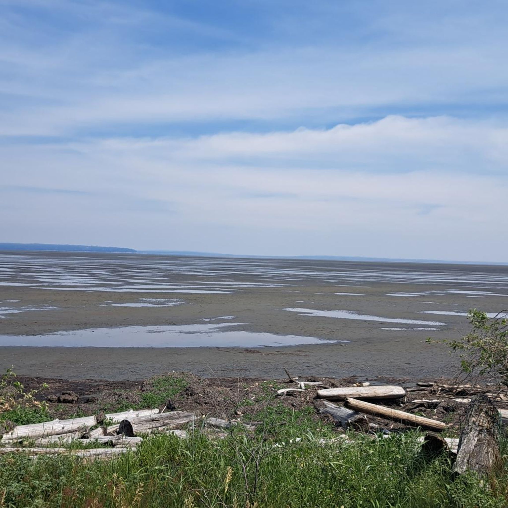
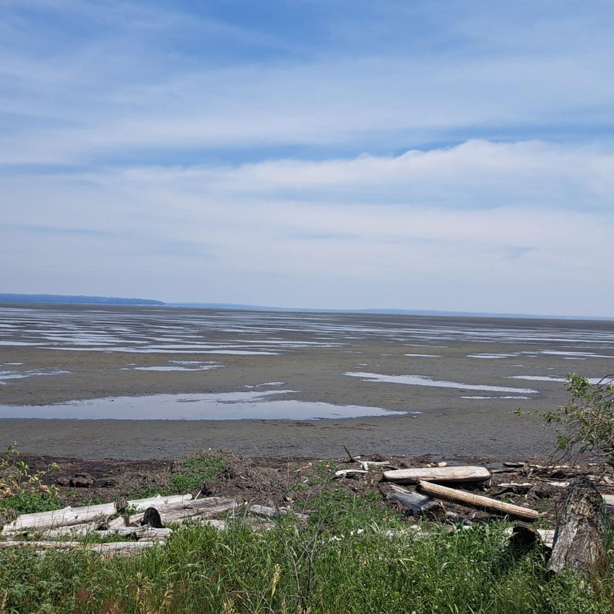
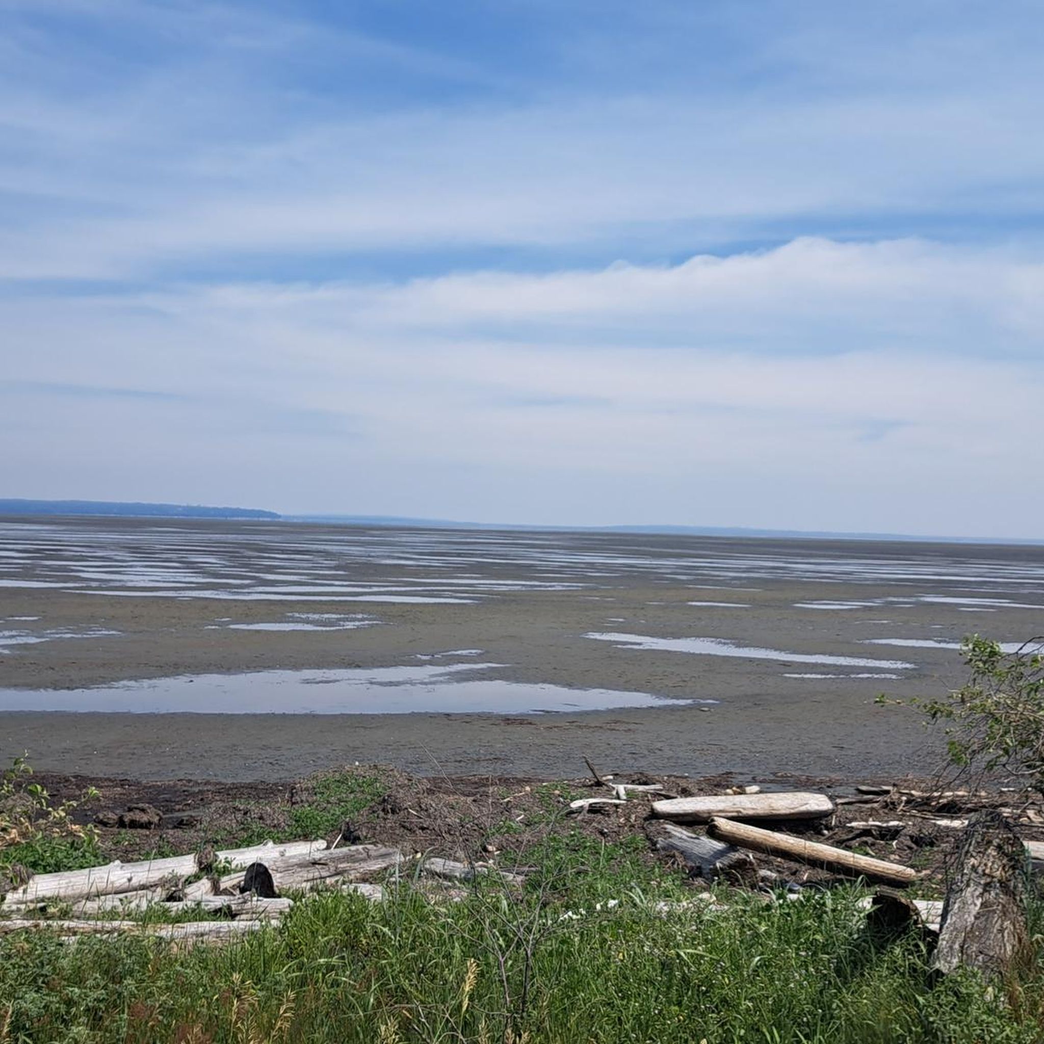
Jogging in Boundary Bay Regional Park offers access to an expansive network of trails, primarily along a 24 km dyke system. The terrain is generally flat, featuring wide gravel paths that provide sweeping views of the shoreline and distant mountains. The park also encompasses coastal sand ecosystems, tidal flats, and open marsh areas, providing varied natural vistas for runners. These well-maintained trails accommodate various fitness levels.

Best jogging routes in Boundary Bay Regional Park

  • The most popular jogging route is Centennial Beach loop from Maple Beach, a 4.1 miles (6.7 km) trail that takes 42 minutes to complete, offering views of the bay and coastal features.
  • Another top favourite among local runners is Running loop from 1st Ave (EB) at 55A St, a moderate 5.5 miles (8.8 km) path. This route provides a longer coastal experience, winding along the dyke with open views.
  • Local runners also love the Centennial Beach loop from Tsawwassen, a 3.7 miles (6.0 km) trail leading through coastal dykes and open fields, often completed in about 37 minutes.
  • Jogging in Boundary Bay Regional Park is defined by extensive dyke trails, coastal sand ecosystems, and open marsh areas. The network offers options for different ability levels, from easy to more challenging routes.
  • The routes in Boundary Bay Regional Park are highly rated by the komoot community with an average score of 4.0 stars from over 2 reviews. More than 100 runners have used komoot to explore Boundary Bay Regional Park's varied terrain.

Last updated: August 19, 2026

7

runners

#1.

Centennial Beach loop from Maple Beach

8.10km

00:50

20m

20m

Moderate run. Good fitness required. Mostly paved surfaces. Suitable for all skill levels.

Navigate with device

Send to Phone

Save

Moderate

Moderate run. Good fitness required. Mostly paved surfaces. Suitable for all skill levels.

Moderate
guide_signup
Let us show you the way with the komoot mobile app
With a free komoot account, you can easily find, customize, and navigate endless outdoor adventures.

Sign up for free

Moderate run. Good fitness required. Mostly paved surfaces. Suitable for all skill levels.

Moderate

Moderate run. Good fitness required. Mostly paved surfaces. Suitable for all skill levels.

Moderate

Moderate run. Good fitness required. Mostly paved surfaces. Suitable for all skill levels.

Moderate
Sign up for free to see 17 more runs in Boundary Bay Regional Park.

Get access to more routes and recommendations from other explorers.

Sign up for free

Already have an account?

Our route recommendations are based on thousands of hikes, rides, and runs completed by other people on komoot.

Start today with a free account

Your next adventure awaits.

Login or Signup

Popular around Boundary Bay Regional Park
Hiking in Boundary Bay Regional Park

Cycling in Boundary Bay Regional Park

Road Cycling Routes in Boundary Bay Regional Park

Tips from the Community

Bhagwan Athare
August 20, 2025, Fred Gingell Park

Fred Gingell Park is a scenic park in Tsawwassen, Delta, BC, overlooking the Strait of Georgia. It’s known for its spectacular bluff-top views, especially at sunrise and sunset. The park features a steep stairway down the cliffside to the beach, which makes it popular for fitness enthusiasts as well as for those looking to enjoy the shoreline. The park is named in memory of Fred Gingell (1930–1999), a respected local politician, community leader, and MLA for Delta South.

0

0

Frequently Asked Questions

What kind of terrain can I expect on the running routes in Boundary Bay Regional Park?

The running routes in Boundary Bay Regional Park are predominantly along an extensive dyke trail system. You can expect wide, generally flat gravel paths, which are ideal for jogging. These trails offer minimal elevation gain, making them accessible for runners of all levels.

Are there any family-friendly jogging paths in Boundary Bay Regional Park?

Yes, the park is considered very family-friendly. The wide, flat gravel paths along the dyke are suitable for all ages and are even accessible for those pushing strollers. The park also features amenities like a playground and picnic areas, making it a great destination for a family outing combined with a jog.

Can I bring my dog on the jogging trails in Boundary Bay Regional Park?

Boundary Bay Regional Park is generally dog-friendly, with many trails allowing leashed dogs. However, it's always a good idea to check specific signage along the trails, as some sensitive ecological areas or bird nesting zones might have restrictions.

What natural features or viewpoints can I enjoy while running in Boundary Bay Regional Park?

Joggers can enjoy expansive views of the bay, shoreline, and distant mountains, especially along the 12th Avenue Dyke Trail. The park also protects unique coastal sand ecosystems, including dunes, and features vast tidal flats at Centennial Beach. It's also a renowned birdwatching hotspot, part of the Pacific Flyway, where you might spot various water birds, raptors, and even snowy owls.

Are there any loop running routes available in the park?

Yes, there are several excellent loop running routes. For instance, the Centennial Beach loop from Pebble Hill is a popular 4.1-mile (6.7 km) option. Another great choice is the Running loop from Tsawwassen, which covers about 3.7 miles (6.0 km) through coastal dykes and open fields.

How long are the running routes in Boundary Bay Regional Park typically?

The running routes in Boundary Bay Regional Park vary in length. For example, the Centennial Beach loop from Beach Grove offers a moderate 5.5-mile (8.8 km) coastal experience. Other routes, like the Running loop from 1st Ave (EB) at 55A St, extend to over 6 miles (10 km), providing options for different distances and durations.

What is the best time of year to go jogging in Boundary Bay Regional Park?

Boundary Bay Regional Park is enjoyable for jogging year-round. The dyke trails are generally well-maintained. Summer months bring vibrant marsh areas and longer daylight, while cooler seasons offer crisp air and unique birdwatching opportunities, including the chance to spot snowy owls. Early mornings or late afternoons often provide spectacular light for scenic views.

Is parking available at Boundary Bay Regional Park for runners?

Yes, parking is available at various access points to Boundary Bay Regional Park. Centennial Beach, for example, offers ample parking facilities, making it convenient to start your run directly from the beach area.

What do other runners say about their experience jogging in Boundary Bay Regional Park?

The running routes in Boundary Bay Regional Park are highly rated by the komoot community, with an average score of 4.0 stars. Runners often praise the expansive views of the bay, the flat and wide gravel paths perfect for a steady pace, and the tranquil natural environment ideal for a refreshing outdoor experience.

Are there any cafes or places to get refreshments near the jogging routes?

While the park itself focuses on natural experiences, there are cafes and eateries in the nearby communities of Tsawwassen and Beach Grove. These are just a short drive or a pleasant walk from various park access points, perfect for a post-run coffee or snack.

How many jogging routes are available in Boundary Bay Regional Park?

Komoot features over 20 jogging routes in Boundary Bay Regional Park, catering to various preferences and fitness levels. These routes range from easy to moderate difficulty, ensuring there's a suitable option for almost every runner.

Most popular routes in Boundary Bay Regional Park

Hiking in Boundary Bay Regional Park

Store rating

Get inspired with the komoot mobile app

With a free komoot account, you can easily find, customize, and navigate endless outdoor adventures.

or

Join komoot Now

Store rating

Explore more

Browse the best Running Trails & Routes in other regions.

Coast MountainsVancouverStanley Park National Historic SiteSelkirk MountainsElectoral Area AArea C (Pemberton Valley/Mount Currie/D'Arcy)Rocky MountainsMetro Vancouver Regional ParksLower Seymour Conservation ReserveVictoriaVancouver IslandVictoria Harbour Migratory Bird SanctuaryBlackcomb Glacier Provincial ParkAlberni-ClayoquotEast Central Okanagan Electoral AreaArea D (Elaho/Garibaldi)SaanichMonashee MountainsBurnabyCypress Provincial ParkOkanagan LakePacific Spirit Regional ParkCentral Okanagan JTantalus Provincial ParkCapilano WatershedStawamus Chief Provincial ParkBrackendale Eagles Provincial ParkMount Seymour Provincial ParkGaribaldi Provincial ParkPacific Rim National Park Reserve - Long Beach UnitNanaimoArea P (Rivers and the Peaks)Oak Bay Islands Ecological ReserveBuntzen Lake Recreation AreaRichmondGrouse Mountain Regional ParkLynn Headwaters Regional ParkLangleyArea A (Kicking Horse/Kinbasket Lake)Area E (Chilliwack River Valley)Burnaby Lake Regional ParkThwaytes Landing Regional ParkCoquitlam WatershedArea B (Shelter Bay/Mica Creek)Burns Bog Ecological Conservancy AreaArea C (Arrowsmith-Benson)Area L (Grasslands)Eagle Mountain Recreation SiteIona Beach Regional ParkVargas Island Provincial ParkDawley Passage Provincial ParkAlaksen National Wildlife AreaShowh Lakes-Ancient Cedars Trail Recreation SiteCapilano River Regional ParkSurreyArea B (South Fraser Canyon/Sunshine Valley)Kanaka Creek Regional ParkColony Farm Regional ParkWhistler Interpretive ForestPinecone Burke Provincial ParkGeorge C. Reifel Migratory Bird SanctuaryTəmtəmíxʷtən/Belcarra Regional ParkComox Valley B (Lazo North)Area A (Baynes Sound)Fraser River Delta -- RamsarNorth Okanagan BSurrey Bend Regional ParkBrandywine Falls Provincial ParkBrohm Lake Interpretive Forest TrailsDeas Island Regional ParkSooke Hills Wilderness Regional ParkMaple RidgeNorth CowichanBrohm Lake Day Use Recreation SitePitt LakeȽáu,Welṉew̱/John Dean Provincial ParkCariboo MountainsArea J (Copper Desert Country)Satellite Channel Ecological ReserveNorth SaanichCentral SaanichAlice Lake Provincial ParkOkanagan-Similkameen DAlouette LakeBlue Mountain Recreation SiteHillkeep Regional ParkYoho National ParkGoldstream Provincial ParkK'Ómoks Royston LandsArea B (Shawnigan Lake)Purcell MountainsBurnaby Mountain Conservation AreaDeltaStave West Forest & Recreation AreaNorth Cowichan Municipal Forest ReserveArea C (Puntledge/Black Creek)Area F (McConnell Creek/Hatzic Prairie)Fraser Islands Regional Park ReserveCapital GBlaney Bog Regional Park ReserveAbbotsfordGolden Ears Provincial ParkUbc Malcolm Knapp Research ForestLiumchen Ecological ReserveBear Creek Provincial ParkArea E (Balfour/Cottonwood Lake)Nanaimo EE.C. Manning Provincial ParkArea G (Deroche/Dewdney/Sumas Mountain)Skaha Bluffs Provincial ParkSea To Sea Regional ParkSooke Mountain Provincial ParkPitt MeadowsMt. Macpherson Cross-Country Trails Recreation SiteMount Tuam Ecological ReserveBurgoyne Bay Provincial ParkArea H (Manning Park/Tulameen/Siwash)Cougar Canyon Ecological ReserveMount Revelstoke National ParkBowen Island Ecological ReserveCrippen Regional ParkArea C (Chilako River/Nechako)Nairn Falls Provincial ParkSalt Spring Island Electoral AreaGowlland Tod Provincial ParkGlen Valley Regional ParkVedder Mountain Interpretative ForestTynehead Regional ParkWest Arm Provincial ParkArea F (Alberni Highway)Area C (Moyie/Bull River)Stebbings Road Community ForestAyum Creek Regional Park ReserveSumas Mountain Regional ParkMinnekhada Regional ParkSeal Bay Regional Nature ParkArea D (Trinity/West Creighton)Owl Lake Recreation ReserveMill Farm Regional Park ReserveEpper Passage Provincial ParkRobert'S Lake Regional ParkMt Begbie Area Recreation SiteOkanagan Mountain Provincial ParkArea A (Upper Flathead/Elk Valley)Mount Maxwell Ecological ReserveMount Maxwell Provincial ParkSunshine Coast Regional DistrictStephens Coyote Ridge Regional ParkMount Gardner Recreation SiteCultus Lake Provincial ParkWells Gray Provincial ParkArea A (Wells Gray Country)Area D (Tabor Lake/Stone Creek)Nanaimo GMount Fernie Provincial ParkMount Begbie Recreation SiteArea D (Oyster Bay/Buttle Lake)Area E (Naramata/Greyback)Area G (Salmo Valley)Area F (Trout Creek Valley)Kalamalka Lake Provincial ParkUpper Puntledge River WoodlandsUpper Trent River WoodlandsCrown Land ReserveCampbell Valley Regional ParkArea H (Lighthouse Country)Cowichan Valley FArea F (Willow River/Upper Fraser)SpallumcheenCodd Wetland Ecological Conservancy AreaWidgeon Marsh Regional Park ReserveTsable Lakes WoodlandsCowichan Valley GKootenay National ParkRuckle Provincial ParkArea A (Salmon River/Lakes)Area B (Lake Koocanusa)Myra-Bellevue Provincial ParkArea G (Forster Creek/Mount Assiniboine)Fraser River Ecological ReserveWilliams Beach ForestRace Rocks Ecological ReserveArea C (Inkaneep/Willowbrook)Upper Qualicum River WoodlandsElk Falls Provincial ParkEllison Provincial ParkArea A (Osoyoos Lake)Area H (Canim Lake/Forest Grove)Fraser Valley DArea B (Discovery Islands/Mainland Inlets)Beaver Lodge Forest LandsStrathcona Provincial ParkSilver Star Provincial ParkTrinity Ricardo Trail Recreation SiteBodega Ridge Provincial ParkRathtrevor Beach Provincial ParkSeymour WatershedMount Richardson Provincial ParkBeaufort East WoodlandsArea E (Saint Mary/Skookumchuck)Cowichan River Provincial ParkArea A (Kyuquot/Nootka/Sayward)Area C (Sasquatch Country)Telemark Cross-Country Ski Trails Recreation SiteArea F (Columbia Lake/Windermere Lake)Helliwell Provincial ParkBoyle Point Provincial ParkMount Geoffrey Escarpment Provincial ParkArea B (Lower Columbia/Old Glory)Spipiyus Provincial Park

Nearby adventure guides

Things to Do around Point Roberts

background

Get ready to conquer new peaks

Sign up for Free

Explore
RoutesRoute plannerFeaturesRedeem a voucherHikesMTB TrailsRoad cycling routesBikepackingSitemap
Download the app
Follow Us on Socials

© komoot GmbH

Privacy Policy