The best walks and hikes in Hurricane Forest Wildlife Refuge
4.2
(89)
225
hikers
38
hikes
Hiking in Hurricane Forest Wildlife Refuge offers routes through a landscape characterized by forested areas, river gorges, and conservation lands in Windsor County. The terrain includes paths along scenic overlooks and through state parks, providing varied natural features for exploration. Hikers can expect a mix of gentle gradients and some moderate elevation changes across the refuge's trails.
Best hiking trails in Hurricane Forest Wildlife Refuge
- The most popular hiking route is Quechee Gorge Trail – Quechee State Park, an easy 2.7 miles (4.3 km) trail that takes 1 hour 10 minutes to complete. This path offers views of the deep Quechee Gorge.
- Another top favourite among local hikers is South Quechee Gorge Overlook loop from Quechee Gorge Bridge, an easy 1.4 miles (2.2 km) path. This route provides accessible views from the gorge overlook.
- Local hikers also love the Deweys Pond – Quechee Gorge Bridge loop from Quechee, a 2.1 miles (3.4 km) trail leading through varied natural scenery, often completed in about 54 minutes.
- Hiking in Hurricane Forest Wildlife Refuge is defined by scenic gorges, forested paths, and tranquil ponds. The network offers options for different ability levels, from easy strolls to more extended routes.
- The routes in Hurricane Forest Wildlife Refuge are highly rated by the komoot community with an average score of 4.1 stars from over 80 reviews. More than 140 hikers have used komoot to explore Hurricane Forest Wildlife Refuge's varied terrain.
Last updated: October 19, 2026
4
hikers
3.71km
01:11
160m
160m
Easy hike. Great for any fitness level. Easily-accessible paths. Suitable for all skill levels.
1
hikers
3.21km
01:00
100m
100m
The Moose Brook, W.B. Brown, Pine Drop, and Simonds Way Loop offers a delightful escape into the White Mountains' dense forests. This moderate hiking route, spanning 2.0 miles (3.2 km) with 331 feet (101 metres) of elevation gain, can be completed in about 59 minutes, making it perfect for a refreshing outing. You'll wander through mature white pine forests, encounter the flowing Moose Brook, and might even discover scenic rocky gorges with cascades along the way. It's a journey through varied terrain, from gentle paths to sections with roots and rocks, providing a true connection with nature.
When planning your visit, remember that Moose Brook State Park's trails are multi-use, shared with mountain bikers, so stay alert. Parking is available at the park, and it's wise to arrive early, especially on weekends, to secure a spot and enjoy the tranquility. For those interested in exploring beyond this loop, detailed maps of the extensive trail network can be obtained from the Coos Cycling Club, helping you navigate the various routes available.
This loop is part of a larger network within Moose Brook State Park, a significant area in the White Mountains Region known for its historical ties to the Civilian Conservation Corps (CCC). Many of the park's facilities and trails were developed by the CCC in the 1930s, adding a unique historical dimension to your hike. The park's diverse trail system, featuring both historic named trails and volunteer-developed paths, ensures a range of experiences from easy strolls to more challenging sections, all set amidst beautiful woodlands and water features.

1
hikers
1.51km
00:25
10m
50m
The Quechee Gorge Trail offers a delightful, easy stroll through what's affectionately known as "Vermont's Little Grand Canyon." This 0.9-mile (1.5 km) hike, with a minimal 23 feet (7 metres) of elevation gain, takes roughly 24 minutes to complete, making it an ideal choice for a quick, scenic escape. You'll follow packed earth and dirt paths, enjoying impressive views of the 165-foot deep gorge and the Ottauquechee River flowing below, with opportunities to see the water cascade over rock shelves.
For planning your visit, the Quechee Gorge Visitor Center is a great starting point, providing amenities like restrooms and visitor information. The trail can also be accessed from Dewey Mills Pond. Given its popularity, especially among families and dog owners, expect it to be busy on weekends; arriving earlier in the day can help you avoid the crowds.
This notable trail is set within Quechee State Park and showcases Vermont's deepest gorge, a geological marvel carved by glacial activity and the Ottauquechee River over approximately 13,000 years. Along the river, you can even spot remnants of an old wool mill, adding a touch of history to the natural beauty.
19
hikers
4.32km
01:10
60m
60m
The Quechee Gorge Trail offers a unique opportunity to explore Vermont's deepest gorge from the bottom up. This easy 2.7 miles (4.3 km) out-and-back hike takes you along the Ottauquechee River, revealing dramatic rock formations and forested slopes. With only 209 feet (64 metres) of elevation gain, it's a gentle walk that provides incredible views and a chance to see small waterfalls and historical mill remnants along the riverbanks, all within about 1 hours and 10 minutes.
Access to the trail is straightforward, starting from the Quechee Gorge Visitor Center. Parking is available, but be prepared for crowds, especially on weekends between 9 AM and 4 PM, as this is a popular spot. For a more peaceful experience, consider visiting early in the morning or on a weekday. The visitor center also provides restrooms and helpful information.
Often referred to as "Vermont's Little Grand Canyon," the Quechee Gorge is a geological marvel carved by the Ottauquechee River over millions of years. The trail offers a distinct perspective compared to viewing the gorge from the Route 4 bridge, allowing you to get up close to the ancient Gile Mountain Formation bedrock. It's a fantastic option for families or anyone seeking a scenic, accessible hike with a touch of natural history.
19
hikers
4.34km
01:11
60m
60m
The Quechee Gorge Trail offers a delightful descent into Vermont's deepest gorge, tracing the Ottauquechee River through forested areas. This easy 2.7-mile (4.3 km) hike, with just 211 feet (64 metres) of elevation gain, takes about 1 hour and 10 minutes, making it a perfect outing for those seeking stunning natural beauty without a demanding climb. You'll find yourself walking alongside the river, observing small waterfalls and the impressive rock formations that define this unique landscape.
Starting from the Quechee Gorge Visitor Center, the trail provides convenient access and parking. While generally accessible, the trail can get busy, especially during peak fall foliage season, so planning an early morning visit is advisable for a more serene experience. There are no permits or fees required to enjoy this popular route.
Known as "Vermont's Little Grand Canyon," the Quechee Gorge was carved by glacial activity and the persistent flow of the Ottauquechee River. Beyond the dramatic geological formations, you can also spot remnants of an old wool mill and dam, hinting at the area's industrial past. The trail even offers a chance to access the riverbanks, with a popular spot for swimming near the end of the route.
Get access to more routes and recommendations from other explorers.
Already have an account?
Our route recommendations are based on thousands of hikes, rides, and runs completed by other people on komoot.
Start today with a free account
Your next adventure awaits.

Tips from the Community


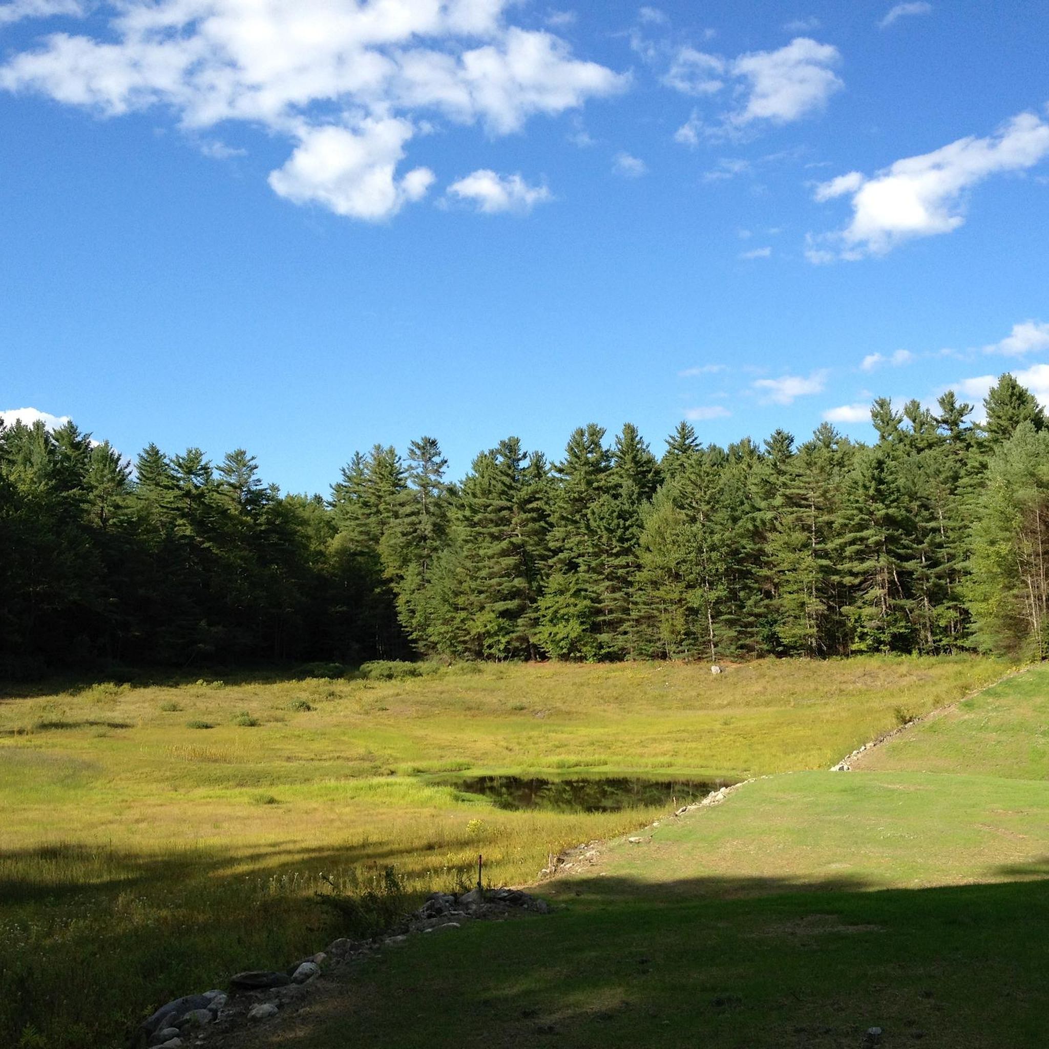
Enjoy 142 acres of protected forest, streams and a reservoir in this beautiful pocket of refuge near Lebanon. The area features a network of well-maintained and clearly marked trails that are perfect for running. The ground can get rocky underfoot, so be mindful of your step.
1
0

Known as Vermont's Grand Canyon, you get a splendid view of the gorge from the road bridge. You can also park up your bike and take the hiking path to explore it further and go for a swim in the summer.
0
0

Dewey Pond is on the northern end of Quechee State Park and is a fantastic place to hike around and look for birds and other wildlife. Some notable local birds you might see are: yellow-rumped warblers, black- throated warbler Northern goshawks, bald and golden eagles, red-tailed and red-shouldered hawks, ospreys, blue jays, and mourning doves. Deweys Pond was named for A.G. Dewey, who owned a wool mill that operated in the area 1869 until the 1960s and used the water from this pond to operate. You can actually see the remains of the old mill on the main trail.
0
0
On the southern end of the Quechee Gorge Trail is a great viewpoint where you can look back up the canyon and the river flowing over rock shelves, creating little waterfalls. This is a great spot to snap some photos and admire the Ottaquechee river as you hike. You can also swim in the river, which is a great way to cool off on hot and humid summer days.
0
0
The Quechee Gorge Bridge overlooks the Quechee Gorge, which is also known as "Vermont's little Grand Canyon." This deep, mile-long chasm was formed during the Ice Age, by the melting waters of a receding glacier about 13,000 years ago. This bridge offers a great view over one of the state's most stunning natural wonders; you can gaze down at the Ottaquechee River flowing through the gorge from over 168 feet in the air! This bridge is a great place to begin or end your walk in the Quechee State Park.
0
0

Frequently Asked Questions
How many hiking trails are available in Hurricane Forest Wildlife Refuge?
There are over 20 hiking trails in Hurricane Forest Wildlife Refuge. The majority of these, 22 out of 24, are rated as easy, making the area accessible for various skill levels.
What kind of terrain can I expect on the trails in Hurricane Forest Wildlife Refuge?
The terrain in Hurricane Forest Wildlife Refuge is characterized by forested areas, river gorges, and conservation lands. You'll find paths along scenic overlooks and through state parks, with a mix of gentle gradients and some moderate elevation changes.
Are there family-friendly hiking options in Hurricane Forest Wildlife Refuge?
Yes, Hurricane Forest Wildlife Refuge offers many family-friendly hiking options. Most trails are rated as easy, providing suitable paths for all ages. For example, the Quechee Gorge Trail – Quechee State Park is an easy 2.7-mile route with scenic views that families often enjoy.
Can I bring my dog on the hiking trails?
Many trails in Hurricane Forest Wildlife Refuge are dog-friendly, but it's always best to check specific trail regulations before you go. Generally, dogs are welcome on leash, allowing you to explore the natural beauty with your canine companion.
Are there any circular hiking routes in the refuge?
Yes, there are several circular routes available. A popular option is the South Quechee Gorge Overlook loop from Quechee Gorge Bridge, an easy 1.4-mile path offering accessible views. Another is the Deweys Pond – Quechee Gorge Bridge loop from Quechee, which is 2.1 miles long and leads through varied natural scenery.
What natural features or landmarks can I see while hiking?
Hikers can enjoy scenic gorges, forested paths, and tranquil ponds. The most prominent feature is the deep Quechee Gorge, which can be viewed from trails like the Quechee Gorge Trail and from overlooks such as the South Quechee Gorge Overlook.
Is there parking available at the trailheads?
Parking is generally available at popular trailheads and access points within Hurricane Forest Wildlife Refuge, especially near state parks and main attractions like Quechee Gorge. It's advisable to check specific route details for parking information before your visit.
What do other hikers enjoy most about Hurricane Forest Wildlife Refuge?
The area is highly rated by the komoot community, with an average score of 4.1 stars from over 80 reviews. Reviewers often praise the scenic gorges, the well-maintained paths, and the variety of easy routes that make the natural beauty accessible to many.
Are there any challenging hikes for experienced hikers?
While the majority of trails in Hurricane Forest Wildlife Refuge are rated as easy, there are a couple of moderate routes for those seeking a bit more challenge. For example, the Burnt Mountain loop — Boston Lot Conservation Area offers more significant elevation gain over its 3.8 miles.
What is the best time of year to go hiking in Hurricane Forest Wildlife Refuge?
The best time to hike in Hurricane Forest Wildlife Refuge typically depends on your preference. Spring and fall offer pleasant temperatures and beautiful foliage, while summer provides lush greenery. Winter hiking is also possible, but conditions may vary, so check local weather and trail reports.
Are there any cafes or places to eat near the hiking trails?
While specific cafes directly on the trails are limited, the towns surrounding Hurricane Forest Wildlife Refuge, such as Quechee, offer various dining options and amenities where you can refuel before or after your hike.
Most popular routes in Hurricane Forest Wildlife Refuge

Get inspired with the komoot mobile app


Explore more
Browse the best Hikes in other regions.
