The best walks and hikes in Reserva Forestal Los Santos
4.8
(122)
783
hikers
12
hikes
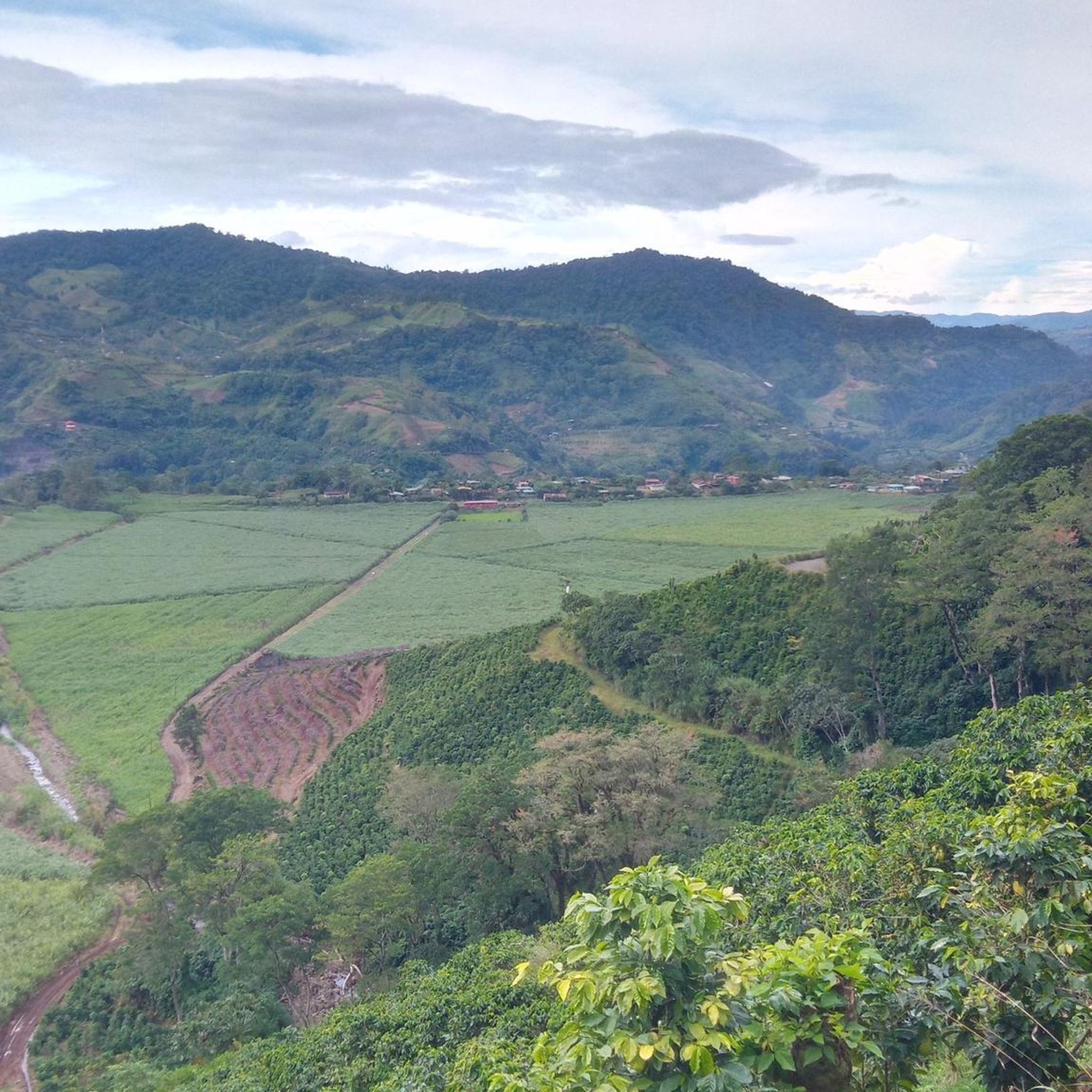
Hiking trails in Reserva Forestal Los Santos traverse diverse landscapes within the Talamanca Mountains, an expansive area characterized by humid tropical forests, including cloud forests. The region is crucial for the conservation of the Naranjo and Savegre River watersheds, featuring notable waterfalls. Hikers can explore varied terrain, from river valleys to higher elevations, with Cerro Buenavista being the most prominent peak at 3,491 meters (11,453 ft).
Best hiking trails in Reserva Forestal Los Santos
- The most popular hiking route is…
Last updated: July 1, 2026
4.8
(62)
303
hikers
10.5km
03:59
470m
470m
Moderate hike. Good fitness required. Mostly accessible paths. Sure-footedness required.
4.8
(21)
163
hikers
5.00km
01:52
240m
240m
Moderate hike. Great for any fitness level. Mostly accessible paths. Sure-footedness required.

Sign up for free
4.6
(16)
74
hikers
5.10km
01:31
140m
140m
Moderate hike. Great for any fitness level. Mostly accessible paths. Sure-footedness required.
5.0
(7)
46
hikers
3.08km
01:04
100m
110m
Moderate hike. Great for any fitness level. Mostly accessible paths. Sure-footedness required.
5.0
(2)
51
hikers
4.07km
01:45
240m
240m
Moderate hike. Great for any fitness level. Mostly accessible paths. Sure-footedness required.
Get access to more routes and recommendations from other explorers.
Sign up for free
Already have an account?
Our route recommendations are based on thousands of hikes, rides, and runs completed by other people on komoot.
Start today with a free account
Your next adventure awaits.
Login or Signup
Popular around Reserva Forestal Los Santos

Tips from the Community

Toilets with panoramic views of the forest!
0
0

Hikes cloud forest hotel Savegre
0
0

Nice Hike, we did it as a family. The trail is starting to get a little bit abandoned, the waterfall is no longer visible (as of June 29, 2024) due to a collapse. Anyways, we enjoyed the beautiful forest.
0
0

Very difficult path, but worth it! Lots of dilapidated bridges and stairs. Sturdy shoes are definitely recommended. The path runs downstream on the right side (unlike what is shown on the Komoot map). Shortly before the waterfall there is another wild suspension bridge.
0
0
Beautiful waterfall in the Rio Savegre. Access via two dilapidated bridges is a bit adventurous.
0
0


Rustic but cozy wooden bungalows with different occupancy options. Since the lodge is at an altitude of 2000m, it gets a bit chilly in the accommodations at night. Breakfast and dinner are made from regional products and are highly recommended.
1
0

Good footwear is a basic requirement for this tour, since the planks are metal grids and transitions are very damp and slippery.
1
1
Frequently Asked Questions
How many hiking trails are available in Reserva Forestal Los Santos?
Reserva Forestal Los Santos offers a selection of 12 hiking trails. These range from easy walks to more challenging moderate routes, ensuring options for various fitness levels.
Are there easy hiking trails suitable for beginners or families in Reserva Forestal Los Santos?
Yes, there is at least one easy hiking trail. The Savegre River – Waterfall on the Río Savegre loop from San Gerardo is a 3.9-mile (6.2 km) path that leads through river valleys to a prominent waterfall, making it a great option for those seeking a less strenuous experience.
What kind of natural features can I expect to see along the trails?
The reserve is characterized by diverse humid tropical forests, including lush cloud forests, and is crucial for the conservation of the Naranjo and Savegre River watersheds. You can expect to encounter beautiful waterfalls, such as the San Gerardo de Dota Waterfall and the Waterfall in Reserva Forestal Los Santos, as well as the scenic Savegre River. Many trails also offer panoramic views of the forests and mountains.
Are there any circular hiking routes in Reserva Forestal Los Santos?
Yes, many trails in Reserva Forestal Los Santos are designed as loops. For example, the popular La Quebrada Cloud Forest Trail – Mirador SIWÕ' loop from Zapotal offers a moderate 3.2-mile (5.1 km) circular path with views of the cloud forest.
What is the best time of year to go hiking in Reserva Forestal Los Santos?
The reserve is characterized by humid tropical forests, meaning it's often lush and misty, especially in its cloud forests. While hiking is possible year-round, consider the dry season (typically December to April) for potentially clearer skies and less rain, though the misty cloud forest experience is a highlight in itself. Always be prepared for varying weather conditions.
What wildlife might I encounter while hiking in the reserve?
Reserva Forestal Los Santos is a biodiversity hotspot. Birdwatchers will be thrilled by species like the resplendent quetzal, black guan, and various doves. Beyond birds, hikers might spot tapirs, coatis, peccaries, armadillos, and even various felids like jaguars, margays, and jaguarundis, though these are more elusive. The plant life is equally rich, with oak trees, magnolias, and numerous fern species.
Are dogs allowed on the hiking trails in Reserva Forestal Los Santos?
The provided information does not specify regulations regarding dogs on trails within Reserva Forestal Los Santos. It is always recommended to check with local park authorities or specific trail operators for the most current rules on pet access before planning your hike.
What do other hikers enjoy most about hiking in Reserva Forestal Los Santos?
The trails in Reserva Forestal Los Santos are highly rated by the komoot community, with an average score of 4.9 stars from over 100 reviews. Hikers often praise the immersive experience of the cloud forests, the stunning waterfalls, and the rich biodiversity, making it an ideal destination for nature enthusiasts.
Are there any specific viewpoints or scenic spots I should look out for?
Yes, many trails lead to stunning panoramic views of the forests and mountains. The La Quebrada Cloud Forest Trail – Mirador SIWÕ' loop from Zapotal, for instance, offers specific views from Mirador SIWÕ' of the surrounding cloud forest.
Is there parking available near the trailheads?
While specific parking details for each trailhead are not provided, many lodges and eco-tourism operators in the region, such as Cedrela Eco Lodge, often offer parking facilities for their guests or visitors accessing nearby trails. It's advisable to inquire locally or with your accommodation provider about parking options.
Are there any permits required for hiking in Reserva Forestal Los Santos?
The provided information does not explicitly state whether permits are required for general hiking access within Reserva Forestal Los Santos. It is recommended to check with local park management or visitor centers for any necessary permits or entrance fees before your visit.
Most popular routes in Reserva Forestal Los Santos
Most popular attractions in Reserva Forestal Los Santos

Get inspired with the komoot mobile app


Explore more
Browse the best Hikes in other regions.
