The best walks and hikes in Mount Fernie Provincial Park
4.6
(22)
437
hikers
24
hikes
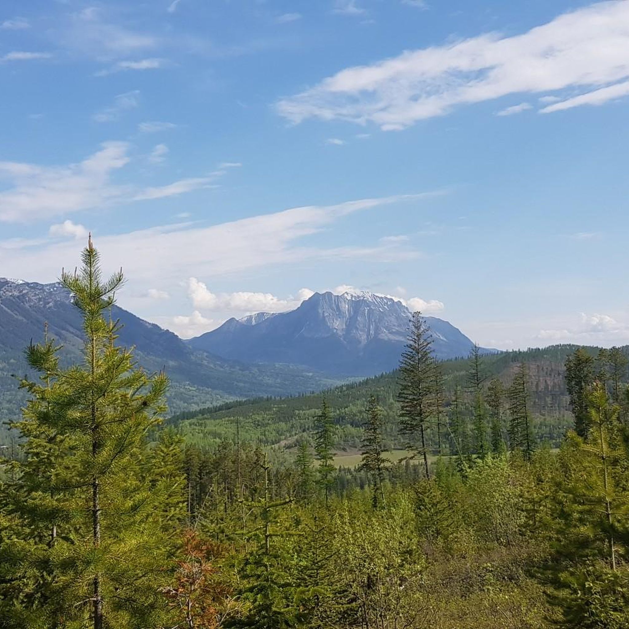
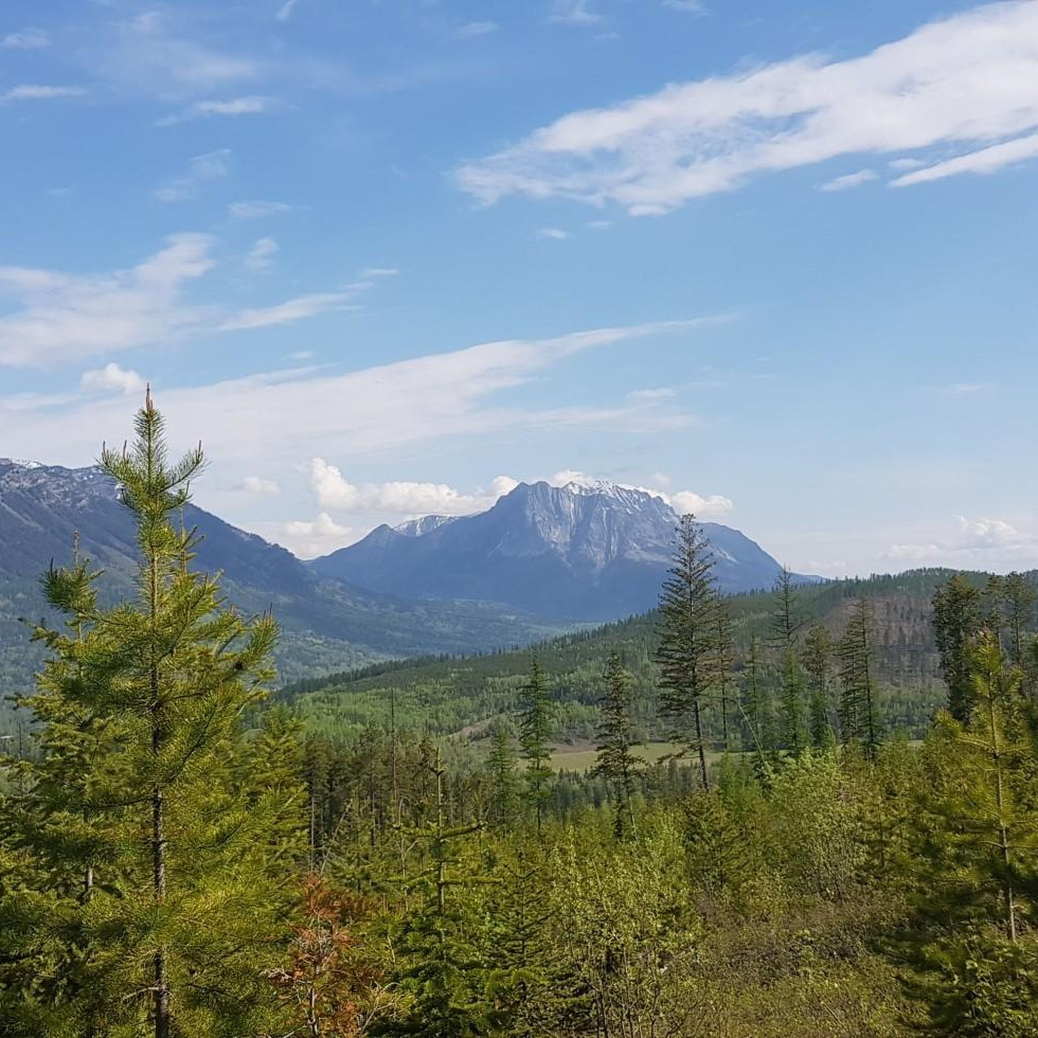
Hiking in Mount Fernie Provincial Park offers diverse landscapes within the southern Kootenay Range, encompassing mountainous terrain and extensive forested areas. The park protects the drainage of Lizard Creek, which features a waterfall before joining the Elk River. Hikers can explore varied forests, including old-growth sections, wetlands, and alpine meadows, providing a range of natural features.
Best hiking trails in Mount Fernie Provincial Park
- The most popular hiking route is Lizard Lake Trail, a 4.2 miles (6.8 km) trail that takes 2 hours 45 minutes to complete. This moderate route features an ascent through subalpine terrain.
- Another top favourite among local hikers is Iconic Photo Spot 4 – Iconic Photo Spot 2 loop from Mount Fernie Provincial Park, a moderate 8.7 miles (14.0 km) path. This route winds through diverse forest landscapes, offering varied scenery.
- Local hikers also love the Bridge Over Fairy Creek loop from Mount Fernie Provincial Park, a 2.0 miles (3.2 km) trail leading through forested areas to a waterfall, often completed in about 52 minutes.
- Hiking in Mount Fernie Provincial Park is defined by mountainous landscapes, forested areas, and the Lizard Creek drainage. The network offers options for different ability levels, from easy walks to more challenging ascents.
- The routes in Mount Fernie Provincial Park are highly rated by the komoot community with an average score of 4.7 stars from over 20 reviews. More than 350 hikers have used komoot to explore Mount Fernie Provincial Park's varied terrain.
Last updated: August 24, 2026
4.0
(1)
16
hikers
6.77km
02:45
530m
530m
Moderate hike. Good fitness required. Easily-accessible paths. Suitable for all skill levels.
3
hikers
6.94km
01:52
80m
80m
Easy hike. Great for any fitness level. Easily-accessible paths. Suitable for all skill levels.

Sign up for free
5.0
(2)
20
hikers
Moderate hike. Good fitness required. Easily-accessible paths. Suitable for all skill levels.
17
hikers
3.18km
00:52
50m
50m
Easy hike. Great for any fitness level. Easily-accessible paths. Suitable for all skill levels.
7.75km
02:09
140m
140m
Moderate hike. Good fitness required. Easily-accessible paths. Suitable for all skill levels.
Get access to more routes and recommendations from other explorers.
Sign up for free
Already have an account?
Our route recommendations are based on thousands of hikes, rides, and runs completed by other people on komoot.
Start today with a free account
Your next adventure awaits.
Login or Signup
Popular around Mount Fernie Provincial Park

Tips from the Community

This trailhead is the main parking area for access to the Fernie Rail Trail and Lizard Creek Trail. There is signage with trail information, a small parking area, a pit toilet, and a picnic table, making it an easy place to begin exploring the Elk Valley.
0
0
Fernie Rail Trail is a beautiful path that follows a former railway corridor through lush forest, colourful wildflower meadows, and peaceful wetlands. The trail is mostly singletrack and meanders alongside creeks and through open clearings, with the surrounding mountain peaks providing a breathtaking backdrop. The trail ends at Mount Fernie Park Road with an option to continue on Old Growth Trail, or turn around and retrace your steps and take in the views from another perspective back to the trailhead.
0
0
This spot is where Fernie Rail Trail ends, and Old Growth Trail begins. There is a pit toilet and a small parking area here, but no water, so plan your trip accordingly. If you’re looking to extend your journey from Fernie Rail Trail, the Old Growth Trail leads deeper into Fernie Nature Park to Island Lake, with towering western red cedars and lush forest, creating a beautiful change of scenery.
0
0

Coal Creek flows down from the mountains outside of Fernie before emptying into the Elk River. There's a ghost-town of the same name along its stretch that was abandoned after the local mine closed in the 1950s.
0
0
The Montane Nordic Trails are a collection of multi-use trails on the outskirts of Fernie that are popular for hiking and mountain biking in summer, and XC skiing in winter. Located so near to Fernie means access is usually easy though heavy snow in winter may create temporary difficulties.
0
0
This viewpoint is located near the high point of the Montane Nordic trail and rewards your efforts with amazing views across the valley and surrounding mountains. The trail is open year-round so it's worth visiting at different times of year. The Warming Hut is maintained by the Fernie Trails and Ski Touring Club and is open to members of the public.
0
0

Lizard Lake Trail is a 7-kilometer route that crosses Lizard Creek and winds through old-growth forest to a subalpine meadow, ending at a small lake with a spectacular backdrop of the Lizard Range.
0
0
Lizard Lake is a small subalpine lake nestled in a meadow beneath the headwall of the Lizard Range.
0
0
Frequently Asked Questions
How many hiking trails are available in Mount Fernie Provincial Park?
Mount Fernie Provincial Park offers over 20 hiking routes, catering to various skill levels. You'll find a mix of easy walks, moderate ascents, and some more challenging trails.
Are there family-friendly hiking options in Mount Fernie Provincial Park?
Yes, the park features several gentle trails suitable for families. The Bridge Over Fairy Creek loop from Mount Fernie Provincial Park is an easy 2.0-mile (3.2 km) route that leads through forested areas to a waterfall, often completed in under an hour. Other easy options include the Mount Fernie Provincial Park Interpretive Trail and the Fernie Rail Trail.
What kind of terrain can I expect on the trails in Mount Fernie Provincial Park?
The park's terrain is diverse, ranging from mountainous landscapes to extensive forested areas. You'll encounter varied forests with western larch, Douglas fir, and old-growth sections, as well as wetlands and alpine meadows. Trails can vary from relatively flat paths to challenging ascents through subalpine terrain.
Are there any trails with waterfalls in Mount Fernie Provincial Park?
Yes, Lizard Creek flows through the park and forms a beautiful waterfall before joining the Elk River. The Bridge Over Fairy Creek loop from Mount Fernie Provincial Park is a popular easy trail that leads directly to a waterfall.
What are some prominent viewpoints or natural features to look out for?
Hikers can enjoy views of the impressive 2,133-meter Mount Fernie, which shadows the park. The diverse forests, including old-growth sections, and the Lizard Creek waterfall are significant natural features. For broader vistas, some trails connect to the wider networks of Island Lake Lodge and Fernie Alpine Resort, offering stunning views across the valley.
What is the best time of year to go hiking in Mount Fernie Provincial Park?
The park is accessible year-round. Hiking and mountain biking are best enjoyed from late April to late October. For winter walks and snowshoeing, the period from November to early April is ideal, with a warming hut available on the Montane Nordic trail.
Is there public transport available to Mount Fernie Provincial Park?
While the park is close to the town of Fernie, direct public transport options specifically to the park entrance are limited. Most visitors access the park by car. For general information on services in Fernie, you can check City of Fernie Leisure Services.
Are there any loop trails in Mount Fernie Provincial Park?
Yes, the park offers several loop trails. A notable moderate option is the Iconic Photo Spot 4 – Iconic Photo Spot 2 loop from Mount Fernie Provincial Park, which is 8.7 miles (14.0 km) and winds through diverse forest landscapes. The Bridge Over Fairy Creek loop is another popular, shorter loop.
What do other hikers enjoy most about hiking in Mount Fernie Provincial Park?
The area is highly rated by the komoot community, with an average score of 4.7 stars from over 20 reviews. Hikers often praise the diverse landscapes, the extensive trail network, and the opportunity to explore varied forests, including old-growth sections, and the beautiful Lizard Creek waterfall.
Can I camp in Mount Fernie Provincial Park?
Yes, Mount Fernie Provincial Park provides seasonal camping and RVing facilities. Campsites are nestled among the trees, offering privacy for visitors looking to extend their stay in the natural environment.
What kind of wildlife might I encounter while hiking?
While not guaranteed, the park is home to various wildlife. Hikers may occasionally spot black bears, deer, moose, and a variety of bird species, adding to the natural experience of the area.
Are there any challenging hikes for experienced hikers?
Yes, for those seeking more strenuous activity, trails like the Lizard Lake Trail offer a challenging ascent through subalpine terrain. This moderate 4.2-mile (6.8 km) route involves significant elevation gain. The park's network also connects to broader systems with more difficult options.
Most popular routes in Mount Fernie Provincial Park

Get inspired with the komoot mobile app


Explore more
Browse the best Hikes in other regions.
