The best walks and hikes in Sic Fiume Marta (Alto Corso)
4.3
(132)
757
hikers
64
hikes
Hiking in Sic Fiume Marta (Alto Corso) explores the upper course of the Marta River, a natural park located in the Viterbo region. The area is characterized by riverine landscapes, gentle hills, and surrounding woodlands, offering a mix of natural beauty and historical elements. Trails often follow the riverbanks, providing views of the water and the local flora.
Best hiking trails in Sic Fiume Marta (Alto Corso)
- The most popular hiking route is Marta Town Hall – Marta loop from…
Last updated: July 9, 2026
4.2
(18)
63
hikers
15.1km
03:55
80m
80m
Moderate hike. Good fitness required. Easily-accessible paths. Suitable for all skill levels.
3.8
(4)
30
hikers
8.66km
02:14
40m
40m
Moderate hike. Good fitness required. Easily-accessible paths. Suitable for all skill levels.

Sign up for free
3.5
(2)
11
hikers
Moderate hike. Good fitness required. Easily-accessible paths. Suitable for all skill levels.
3.0
(1)
11
hikers
Easy hike. Great for any fitness level. Easily-accessible paths. Suitable for all skill levels.
5.0
(1)
3
hikers
13.3km
03:36
170m
170m
Moderate hike. Good fitness required. Easily-accessible paths. Suitable for all skill levels.
Get access to more routes and recommendations from other explorers.
Sign up for free
Already have an account?
Our route recommendations are based on thousands of hikes, rides, and runs completed by other people on komoot.
Start today with a free account
Your next adventure awaits.
Login or Signup

Tips from the Community

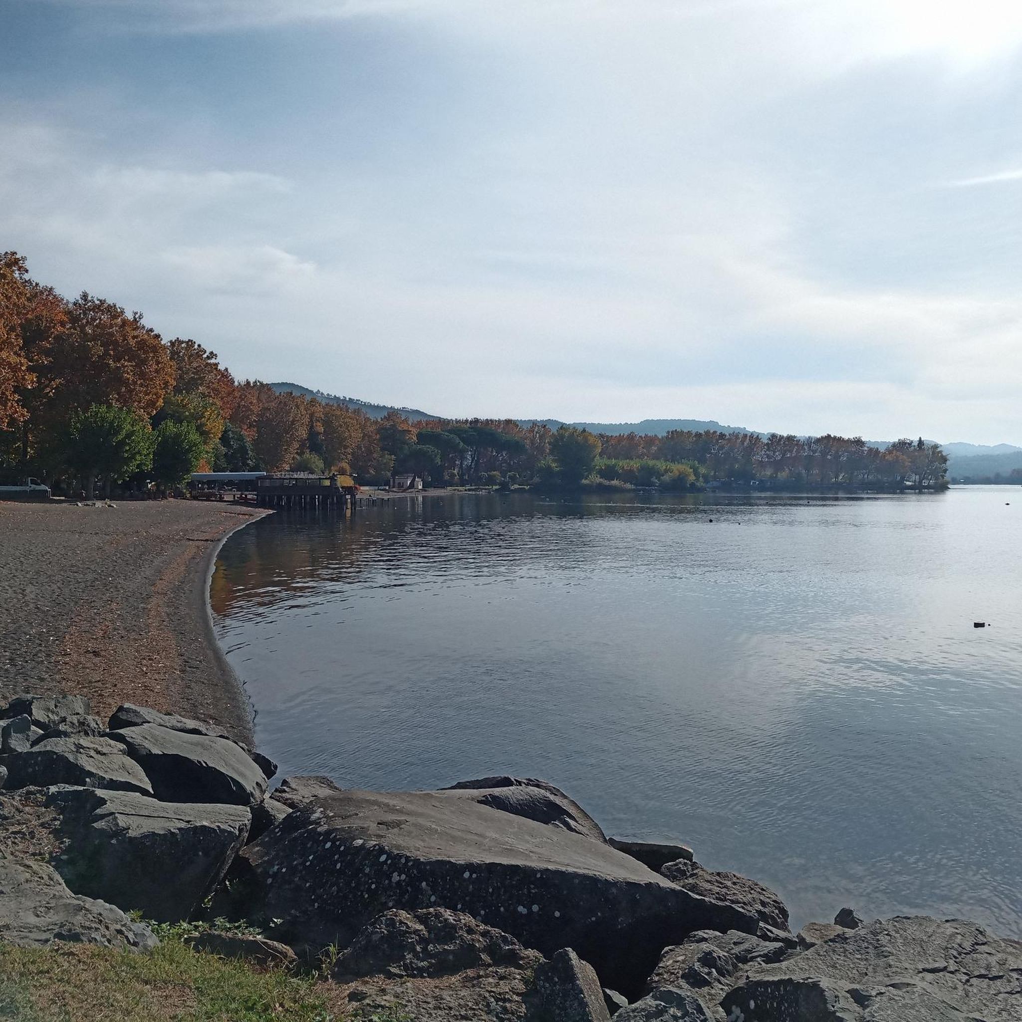
Marta is a charming town on the southern shore of Lake Bolsena in the province of Viterbo, Lazio, Italy. It is known for its picturesque location, fishing port, and relaxed atmosphere. Here is some information about Marta on Lake Bolsena: * Location: Marta is located directly on Lake Bolsena, opposite Isola Martana, from which it takes its name. * Fishing Village: Marta is a traditional fishing village, and you can still see fishing boats in the harbor. Fishing, especially eels and other freshwater fish, plays an important role in the local cuisine. * Lakeside Promenade: The town has a pleasant lakeside promenade, ideal for strolling and enjoying the views of the lake and its islands. * Sights: * Torre dell'Orologio (Clock Tower): A striking tower in the historic center that can offer panoramic views. * Harbor: A lively spot where you can watch fishing boats and take ferries to the islands of Lake Bolsena. * Activities: * Water sports: The lake offers opportunities for swimming, boating, and fishing. * Local cuisine: Be sure to try the local seafood dishes in the town's restaurants. * Festivals: Marta is known for its traditional festivals, such as the "Barabbata" festival, which takes place in May and celebrates local culture and history. * Starting point: Marta is a good base for exploring other towns on Lake Bolsena and in the surrounding Tuscia region, including Bolsena, Capodimonte, and historic sites such as Civita di Bagnoregio. Marta offers an authentic Italian atmosphere and is an ideal place for a peaceful and relaxing stay on Lake Bolsena.
0
0
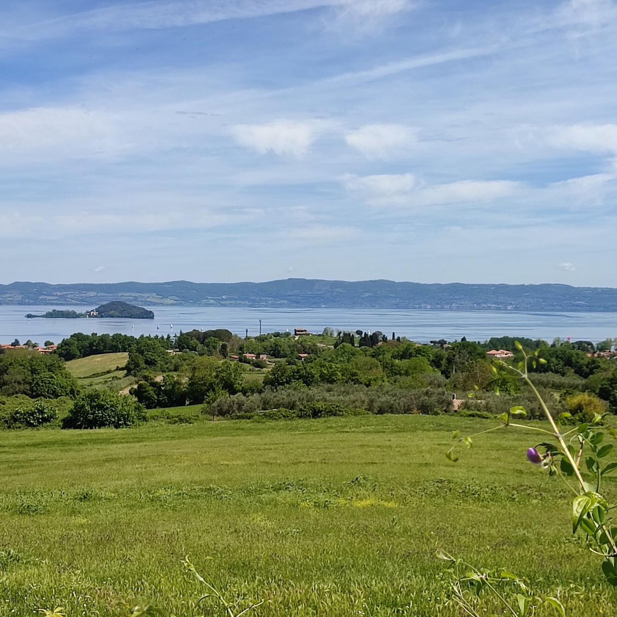
Isola Martana is the smaller of the two islands in Lake Bolsena and lies directly in front of the town of Marta, which gives the island its name. Features and History * Size and Location: It is the smaller of the two volcanic islands in the lake and has an area of approximately 10.3 hectares. It is clearly visible from the town of Marta. * Volcanic Origin: Like the lake itself and its larger sister island (Isola Bisentina), Isola Martana was formed by underground volcanic eruptions. Its crescent-shaped shape and steep, north-facing cliffs are testament to its volcanic past. * Historical Significance: Isola Martana holds a rich and often dark history: * Saint Christina: According to legend, the relics of Saint Christina were hidden here around 410 AD to protect them from barbarian invasions before eventually being returned to Bolsena. * Queen Amalasuntha: The island is most famous for the tragic assassination of Amalasuntha, Queen of the Ostrogoths and daughter of Theodoric the Great, in 535 AD. She was reportedly imprisoned and then murdered here on the orders of her cousin and husband, Theodahad. This event served as a pretext for the Byzantine Emperor Justinian to launch the Gothic War to reconquer Italy. * Monastic past: The island once housed a monastery, which was later abandoned. * Private property: Today, Isola Martana is privately owned and not open to the public.
0
0
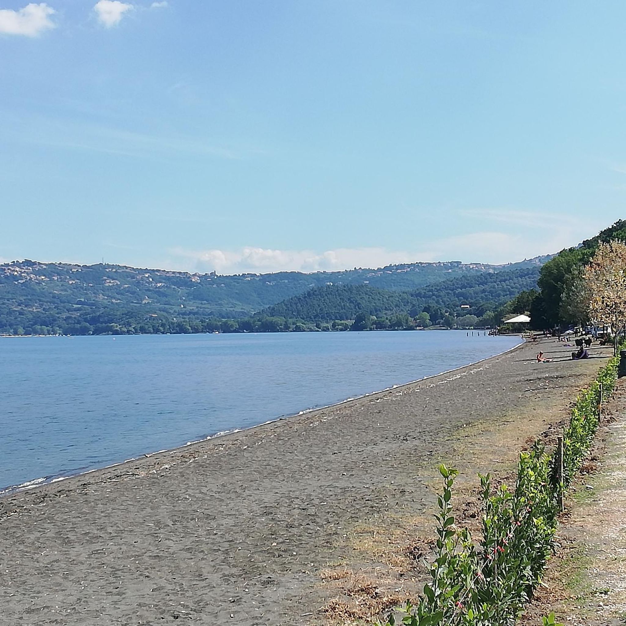
Lake Bolsena is a large volcanic lake in central Italy, about 90 km north of Rome in the province of Viterbo, Lazio. It is a popular tourist destination, known for its natural beauty, clear waters, and relaxed atmosphere. The lake was formed by the collapse of a caldera of the Vulsini volcano. This geological history contributes to its black volcanic beaches, some of which are black in color. Lake Bolsena is known for its clean, spring-fed waters, which are excellent for swimming. The shores often slope gently, making it suitable for families with children. The lake has two islands, Bisentina and Martana, formed by underwater eruptions. Public access to the islands may be limited, but boat tours often offer views of them.
0
0
Piazza Matteotti is a central square in Capodimonte and an important meeting place for the community. The square is a junction where the Corso della Repubblica and the Via Cassia meet. The square also houses the former Church of San Francesco.
0
0
The tower was built around 1780. It is constructed of hewn tuff blocks. The mechanical clock in the tower struck the hours with the ringing of two bells. The Torre dell'Orologio is a historic landmark in Capodimonte.
0
0
Parish and Collegiate Church of Santa Maria Assunta in Cielo. Construction period: Built in the 15th century. Commissioner: Erected by Ranuccio III Farnese. Restoration: Restored in the 16th century under the direction of Vignola.
0
0

The current Palazzo del Comune of Tuscania overlooks Piazza Basile, between the Church of San Lorenzo and the former Church of Santa Croce, currently home to the Historical Archives and the Municipal Library. Previously, the administrators of the municipality resided in the ancient Palazzo del Rivellino, on the hill of the same name; the structure was so called because it was similar to a fortress. Subsequently, the podestà was transferred first to the palace that today is home to the Teatro Comunale, and then to the current one. The latter is accessed via a beautiful external staircase, which features a bronze plaque in memory of the restoration, in 1912, of the ancient name of the city that had been changed by Boniface VIII to Toscanella. (c) https://www.italiavirtualtour.it/dettaglio_member.php?id=96308
0
0
The church and the convent belonged to the Augustinian order. The buildings date back to the end of the 13th century and were completely rebuilt in the 18th century. Of the original church, only the single-nave plan remains, with no internal divisions and a rectilinear apse. The façade, which dates back to the 18th century, has a window on the outside. The interior is characterized by Baroque-style altars. In the apse, behind the 18th-century stucco altar, 15th-century frescoes were found. To the right of the entrance, a Renaissance stone arch gives access to the stone Chapel of San Giobbe, with beautiful reliefs. It is also known as the Ludovisi Chapel, named after the client who had it built in 1486. In the apse of the chapel, there is a fresco from the Viterbo school with a carved stone frame that was painted in 1492 and which represents the Ludovisi family in prayer at the sides of a Crucifixion. Next to the church is the building of the former convent of Sant'Agostino characterized by a beautiful cloister, numerous rooms and, on the upper floor, the monks' cells. It is located within the city walls right in the middle of the town. In 1818 it became the seat of the bishop's seminary, then during the Second World War it was used as accommodation for displaced people. Restored together with the church after the 1971 earthquake, it was finally abandoned around 1980. (c) https://www.cassiciaco.it/navigazione/monachesimo/chiese/italia/lazio/tuscania.html
0
0
Frequently Asked Questions
How many hiking trails are available in Sic Fiume Marta (Alto Corso)?
There are over 50 hiking trails in Sic Fiume Marta (Alto Corso), offering a diverse range of options for exploring the region's riverine landscapes and woodlands.
What types of hiking trails can I expect in Sic Fiume Marta (Alto Corso)?
The trails in Sic Fiume Marta (Alto Corso) cater to various skill levels. You'll find a good mix of easy and moderate routes, with 27 easy trails and 24 moderate trails. There are also a couple of more challenging options for experienced hikers.
What do other hikers say about the trails in Sic Fiume Marta (Alto Corso)?
The trails in Sic Fiume Marta (Alto Corso) are highly regarded by the komoot community, holding an average rating of 4.3 stars from over 100 reviews. Hikers often praise the scenic river paths, views of Lake Bolsena, and the charming routes through local towns.
Are there any easy, family-friendly hikes in Sic Fiume Marta (Alto Corso)?
Yes, there are several easy routes suitable for families. A good option is the Marta Town Hall – View of Marta loop from Marta, which is just 2.6 miles (4.2 km) long and offers pleasant views. Another gentle choice is the Marta Town and Lakeside Promenade – Marta loop from Marta, a 2-mile (3.2 km) path perfect for a leisurely stroll.
Are there any circular walks in Sic Fiume Marta (Alto Corso)?
Many of the trails in Sic Fiume Marta (Alto Corso) are circular, allowing you to start and end in the same location. For example, the Marta Town Hall – Marta loop from Marta is a popular moderate circular route that takes you through the town and along the river.
What is the best time of year to hike in Sic Fiume Marta (Alto Corso)?
The region is generally pleasant for hiking from spring through autumn. Spring brings blooming flora, while autumn offers comfortable temperatures and beautiful fall colors. Summers can be warm, so early morning or late afternoon hikes are recommended during this season. Winter hiking is possible, but some paths might be muddy after rain.
Are there any viewpoints or scenic spots along the trails?
Absolutely. The trails often follow the Marta River, providing continuous views of the water and surrounding natural beauty. Many routes also offer glimpses of Lake Bolsena, especially those near the town of Marta. The View of Marta – Historic Center of Marta loop from Marta is specifically designed to showcase scenic vistas of the town and its surroundings.
Can I bring my dog on the hiking trails in Sic Fiume Marta (Alto Corso)?
Yes, dogs are generally welcome on the trails in Sic Fiume Marta (Alto Corso). It's always recommended to keep your dog on a leash, especially in areas with wildlife or near other hikers, and to carry waste bags to maintain the natural environment.
Are there opportunities for wild swimming in Sic Fiume Marta (Alto Corso)?
While the Marta River flows through the area, it's primarily known for its scenic beauty rather than designated swimming spots. For swimming, the nearby Lake Bolsena offers numerous beaches and lidos, which are a short drive from the hiking trails.
What kind of wildlife and flora can I expect to see?
The riverine environment and woodlands of Sic Fiume Marta (Alto Corso) support diverse flora and fauna. You might spot various bird species, small mammals, and a rich array of Mediterranean vegetation, including reeds along the riverbanks and typical forest trees in the surrounding areas.
Are there places to eat or drink near the hiking trails?
The town of Marta, which serves as a common starting point for many trails, offers several cafes, restaurants, and shops where you can find refreshments and meals before or after your hike. You'll find options ranging from traditional Italian cuisine to casual eateries.
Is public transport available to reach the trailheads?
Public transport options to the specific trailheads within Sic Fiume Marta (Alto Corso) can be limited. The town of Marta is generally accessible by local bus services from larger towns like Viterbo. However, for direct access to many trail starting points, driving is often the most convenient option.
Where can I park my car when hiking in Sic Fiume Marta (Alto Corso)?
Parking is typically available in or near the main towns and villages that serve as trailheads, such as Marta. Look for designated parking areas within the town centers or near popular access points. It's advisable to check local signage for any parking restrictions.
Most popular routes in Sic Fiume Marta (Alto Corso)

Get inspired with the komoot mobile app


Explore more
Browse the best Hikes in other regions.
