Trinkwasserschutzgebiet Lechauwald
Trinkwasserschutzgebiet Lechauwald
The best running trails in Trinkwasserschutzgebiet Lechauwald
4.4
(597)
13,489
runners
747
runs
Jogging in Trinkwasserschutzgebiet Lechauwald offers diverse natural landscapes and well-maintained paths. The region is characterized by extensive riparian forests, primarily composed of grey alders and pine trees, creating shaded environments. The eastern boundary is defined by the Lech river, featuring a dynamic flow and gravel banks. Additionally, dry grasslands contribute to varied running experiences, making the area suitable for different fitness levels.
Best jogging routes in Trinkwasserschutzgebiet Lechauwald
- The most popular jogging route is Auensee near Unterbergen – Lech Dam…
Last updated: July 10, 2026
5.0
(2)
20
runners
Moderate run. Good fitness required. Mostly paved surfaces. Suitable for all skill levels.
5.0
(1)
15
runners
Moderate run. Good fitness required. Mostly paved surfaces. Suitable for all skill levels.

Sign up for free
5.0
(1)
17
runners
Moderate run. Good fitness required. Mostly paved surfaces. Suitable for all skill levels.
10
runners
Moderate run. Good fitness required. Mostly paved surfaces. Suitable for all skill levels.
5
runners
Moderate run. Good fitness required. Mostly paved surfaces. Suitable for all skill levels.
Get access to more routes and recommendations from other explorers.
Sign up for free
Already have an account?
Our route recommendations are based on thousands of hikes, rides, and runs completed by other people on komoot.
Start today with a free account
Your next adventure awaits.
Login or Signup

Tips from the Community

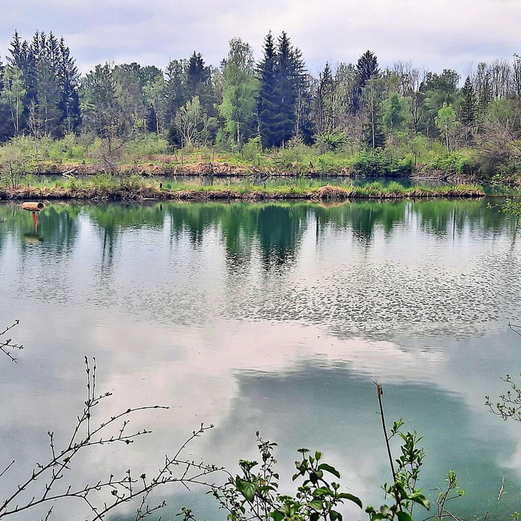
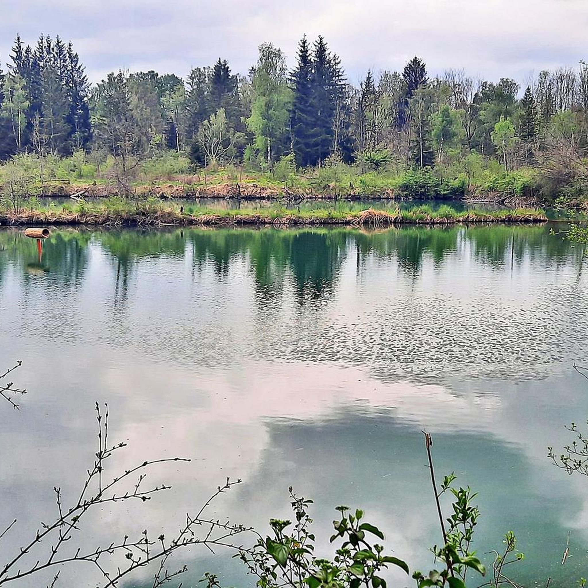
On this section, the Lochbach shows its most beautiful side.
0
0

Here comes a section where you can let it run quite easily
1
0

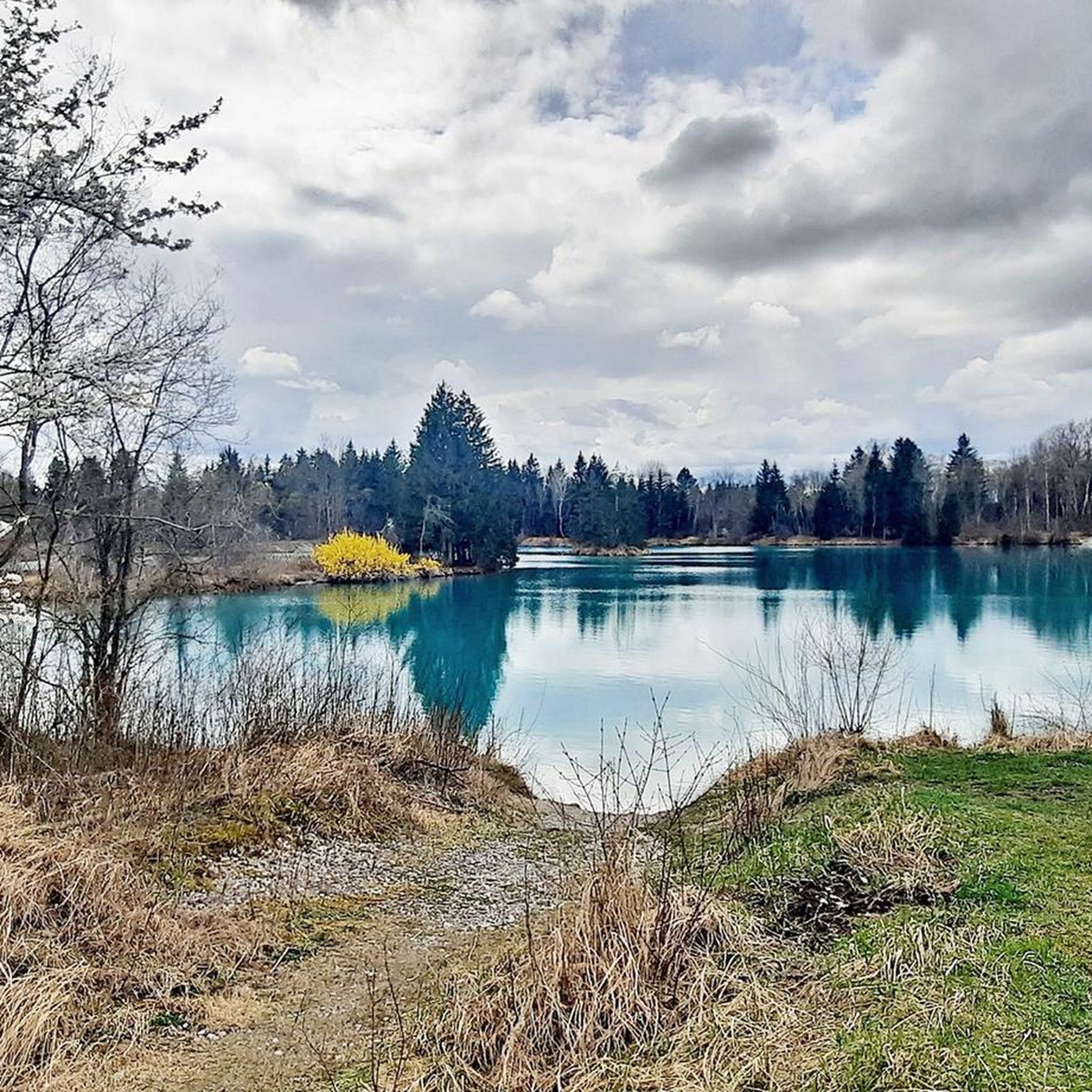
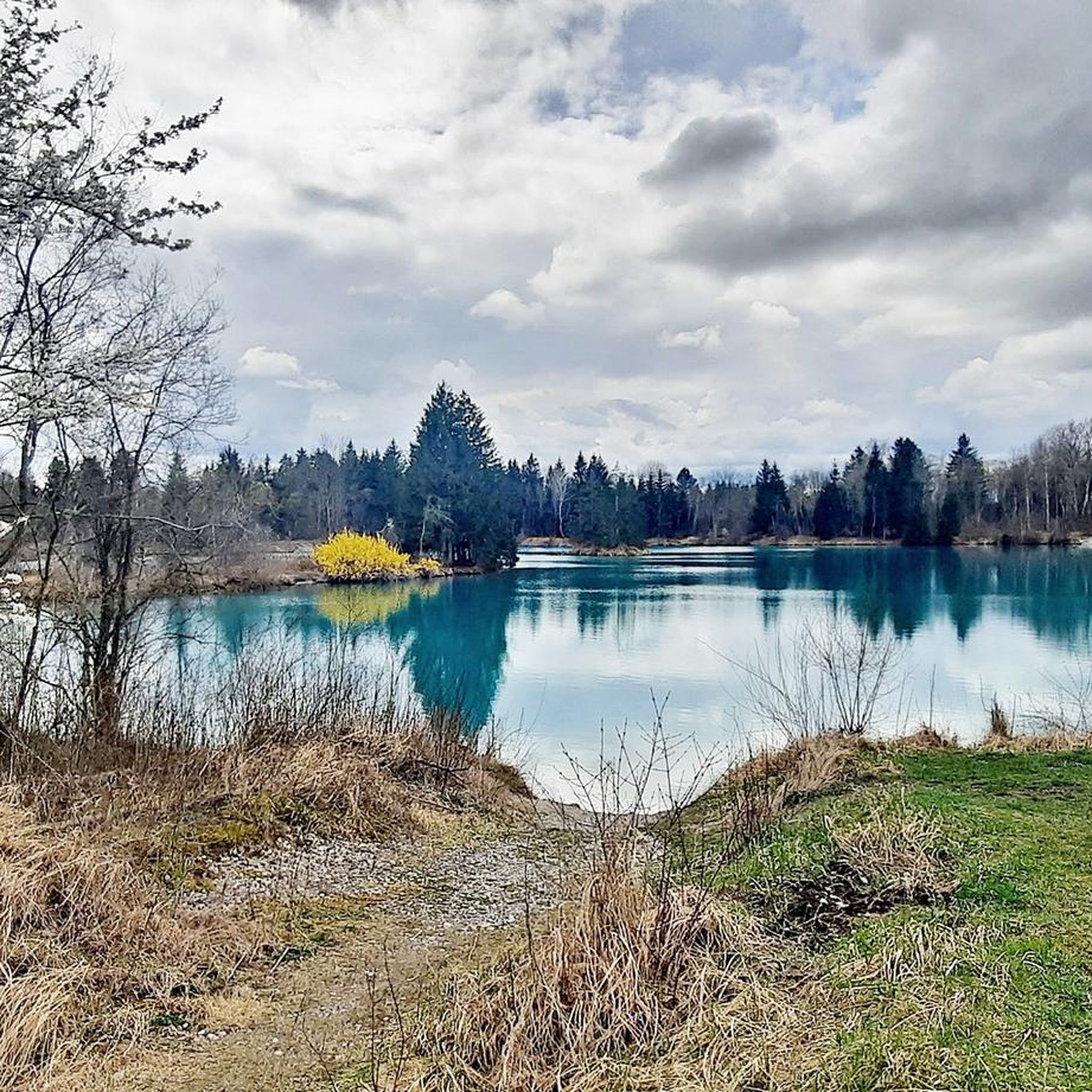
The Auensee near Unterbergen, south of Augsburg, is an idyllic bathing lake characterized by clear, refreshing water and picturesque surroundings. The lake is nestled in the Lechau forest and offers a small island that enriches the landscape. Leisure activities: • Swimming: The Auensee is a popular place for swimming and sunbathing. The lawns invite you to relax. Please note that there are no official sanitary facilities or catering facilities. • Nudist area: An area for nudists has been established on the northwest shore. • Hiking and cycling: The area around the lake offers well-developed paths that are ideal for walks and bike rides. A popular route leads from Unterbergen along the Lech and the Auensee.
1
0
Lake Mandicho is not only a popular local recreation area, but also plays an important role in flood protection and ecology on the Lech. Dam 23 regulates the water level, protects the surrounding areas from flooding and secures the electricity supply through hydropower. Special features and activities • Nature conservation and biodiversity: The area around Lake Mandicho provides a habitat for numerous animal and plant species. The fish ladder and the bypass waterway created in 2016 are ecological improvements that allow migratory fish to bypass the dam and migrate back through the Lech. This contributes significantly to the restoration of natural fish migration routes. • Diverse leisure activities: The lake not only attracts bathers and water sports enthusiasts, but is also a hotspot for bird watchers. Many birds use the shore areas as a resting and breeding ground, which makes the lake attractive for ornithologists and nature lovers. • Events: Occasionally, events and competitions take place around the lake, such as water sports events or nature tours. Especially in summer, Lake Mandicho also attracts many families for picnics and shared activities. • Cultural significance: The name “Lake Mandicho” honors the legendary Bavarian prince Mandicho, which indicates the historical significance of the region. Lake Mandicho combines modern technical functions with nature conservation and leisure activities and is a
4
0


A beautiful stage along the dam
1
0

Bathing lake, but not specially created: very clean water
1
0

Great reservoir for water sports or to cycle or run around it. Small kiosk on the north bank.
3
0
Frequently Asked Questions
How many running routes are available in Trinkwasserschutzgebiet Lechauwald, and what are their difficulty levels?
Trinkwasserschutzgebiet Lechauwald offers a wide selection of over 760 running routes. These cater to various fitness levels, with approximately 110 easy routes, over 560 moderate trails, and around 80 more challenging options for experienced runners.
What kind of scenery can I expect while jogging in Trinkwasserschutzgebiet Lechauwald?
Jogging in Trinkwasserschutzgebiet Lechauwald provides a diverse natural experience. You'll run through extensive riparian forests, primarily grey alders and pine trees, offering shaded paths. The eastern boundary features the dynamic Lech river with its gravel banks, and you'll also encounter open dry grasslands. The area is known for its rich biodiversity, and you might even spot signs of beaver activity.
Are there many circular running paths in Trinkwasserschutzgebiet Lechauwald?
Yes, many of the running routes in Trinkwasserschutzgebiet Lechauwald are circular, offering convenient loop options. For example, the popular View of the Lech Islands – Lech Wetlands loop from Lechauwald bei Unterbergen is a moderate 5.0-mile (8.1 km) path that brings you back to your starting point.
Are there family-friendly running trails in Trinkwasserschutzgebiet Lechauwald?
Absolutely. The Lechauwald features many paths that are described as 'leicht begehbar' (easily walkable), making them suitable for families. There are over 110 easy routes available, providing gentle terrain for a pleasant family run. The diverse landscapes also offer plenty to see for younger runners.
What are some interesting natural attractions or landmarks I can see along the running routes?
While jogging, you can discover several natural highlights. The idyllic Auensee Lechtal-Nord is a beautiful bathing lake within the area. You might also encounter sections of the Lochbach at Mandichosee or the Lochbach between Lake Mandicho and the Lech barrage 22, which are notable river features. The area's unique riparian forests and the wild Lech river itself are major attractions.
What do other runners enjoy most about jogging in Trinkwasserschutzgebiet Lechauwald?
The running routes in Trinkwasserschutzgebiet Lechauwald are highly rated by the komoot community, with an average score of 4.4 stars from over 500 reviews. Runners frequently praise the diverse natural landscapes, particularly the shaded riparian forests and the picturesque views along the Lech river. The well-maintained paths and the variety of difficulty levels also contribute to its popularity.
Are there any running routes that offer views of the Lech river or its islands?
Yes, several routes provide stunning views of the Lech river and its unique islands. A popular choice is the View of the Lech Islands – Lech Wetlands loop from Lechauwald bei Unterbergen, which specifically highlights these scenic features. The eastern boundary of the protection area is defined by the Lech, ensuring many riverside running opportunities.
Are there any specific routes that pass by lakes or water bodies?
Indeed. The Auensee near Unterbergen – Lech Dam 22 – Unterbergen loop from Lechauwald bei Unterbergen offers views of the idyllic Auensee. Another route, the Rapids of the Lochbach – Lake Mandicho loop from Lechauwald bei Unterbergen, takes you through areas near Lake Mandicho, providing pleasant waterside running experiences.
What is the best time of year for running in Trinkwasserschutzgebiet Lechauwald?
The Lechauwald is suitable for running year-round. The riparian forests provide natural shade, making it pleasant even on warmer days. In autumn, the changing foliage offers beautiful scenery, while spring brings fresh greenery. Even in winter, the paths can be enjoyed, though some sections along the river might be 'wurzelige Wege' (rooty paths) which can be more challenging in wet or icy conditions.
Where can I find parking for the running trails in Trinkwasserschutzgebiet Lechauwald?
While specific parking locations are not detailed in the route descriptions, the area is well-known for its accessibility. It's advisable to check local maps or komoot route details for designated parking areas near common starting points like Unterbergen, which is a frequent starting location for many routes in the Lechauwald.
Are there any easy running routes suitable for beginners in the Lechauwald?
Yes, Trinkwasserschutzgebiet Lechauwald has over 110 easy running routes, perfect for beginners or those looking for a relaxed jog. These paths are generally 'leicht begehbar' (easily walkable), offering gentle terrain through the beautiful natural surroundings. An example of an easy route is the Lochbach Winter View – Rapids of the Lochbach loop from Unterbergen, a 2.5-mile (4.1 km) trail.
What kind of terrain will I encounter on the running paths?
The terrain in Lechauwald is varied. You'll find generally 'leicht begehbar' (easily walkable) paths through the forests and along the river. However, some sections, particularly closer to the Lech river, can be 'wurzelige Wege' (rooty paths), adding a natural, trail-like element to your run. The combination of flat riverside paths and varied forest terrain ensures a dynamic running experience.
Most popular routes in Trinkwasserschutzgebiet Lechauwald
Most popular attractions in Trinkwasserschutzgebiet Lechauwald

Get inspired with the komoot mobile app


Explore more
Browse the best Running Trails & Routes in other regions.
