The best walks and hikes in Norra Vätterns Skärgård
4.2
(97)
330
hikers
17
hikes
Hiking in Norra Vätterns Skärgård offers a distinctive experience within a freshwater archipelago, characterized by around fifty islands, many of which are uninhabited. The landscape features granite bedrock supporting rocky pine forests, alongside more fertile moraine and clay soils on larger islands where spruce, aspen, and birch thrive. The region's geological history is evident in polished boulders and rocks sculpted by centuries of water and ice, with the clear waters of Lake Vättern adding to the natural environment.
Best hiking…
Last updated: July 13, 2026
4.8
(24)
78
hikers
2.31km
00:43
10m
10m
Easy hike. Great for any fitness level. Easily-accessible paths. Suitable for all skill levels.
3.0
(2)
5
hikers
Easy hike. Great for any fitness level. Easily-accessible paths. Suitable for all skill levels.

Sign up for free
5.0
(1)
4
hikers
15.6km
04:05
120m
120m
Moderate hike. Good fitness required. Easily-accessible paths. Suitable for all skill levels.
4.8
(13)
24
hikers
8.27km
02:08
40m
40m
Moderate hike. Good fitness required. Easily-accessible paths. Suitable for all skill levels.
3
hikers
6.67km
01:43
30m
30m
Easy hike. Great for any fitness level. Easily-accessible paths. Suitable for all skill levels.
Get access to more routes and recommendations from other explorers.
Sign up for free
Already have an account?
Our route recommendations are based on thousands of hikes, rides, and runs completed by other people on komoot.
Start today with a free account
Your next adventure awaits.
Login or Signup
Tips from the Community

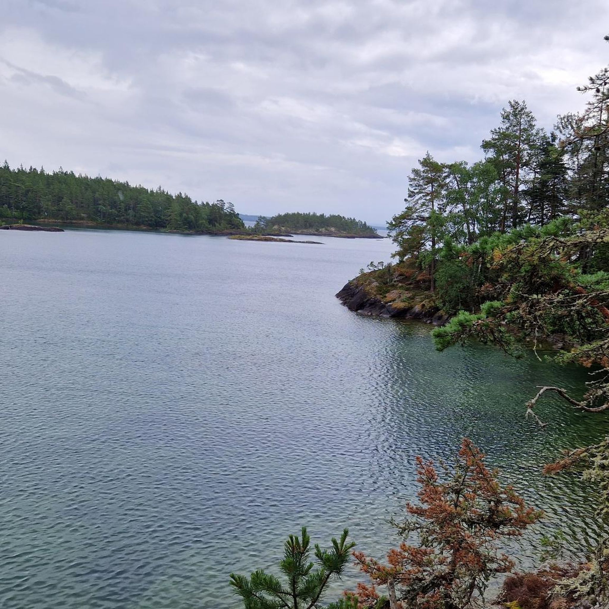
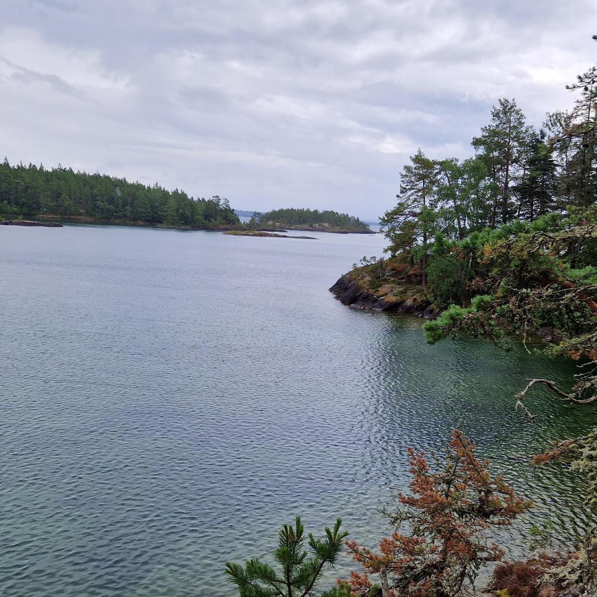
From the path along Harge Uddar, Lake Vättern extends into the distance, its calm waters meeting the sky. The rocky cliffs slope down to the shoreline, where waves break gently against the stone. Pine trees grow along the edge, and the open lake gives a clear view toward the horizon.
2
0
Frequently Asked Questions
How many hiking trails are available in Norra Vätterns Skärgård?
Norra Vätterns Skärgård offers a diverse selection of over 15 hiking routes. These trails cater to various preferences, from easy strolls to more moderate excursions, allowing visitors to explore the unique freshwater archipelago.
What do other hikers enjoy most about the trails in Norra Vätterns Skärgård?
The komoot community rates the trails in Norra Vätterns Skärgård highly, with an average score of 4.2 stars from over 80 reviews. More than 300 hikers have explored the varied terrain, often praising the distinctive freshwater archipelago, the untouched wilderness, and the well-maintained paths that immerse them in the pristine environment.
Are there easy hiking trails suitable for beginners or families in Norra Vätterns Skärgård?
Yes, the region is well-suited for beginners and families, with 12 out of 17 routes classified as easy. An excellent option is the Harge Uddar Trail, a 1.4-mile (2.3 km) path that explores the Harge Uddar Nature Reserve, offering scenic views and unique coastal features. Another easy choice is the Small Scenic Marina – Olshammar's Bathing Area loop from Olshammar, perfect for a short, relaxing walk.
Are there any longer or more challenging hikes in the area?
While most trails are easy, there are 5 moderate routes for those seeking a longer exploration. The Olshammar Church – Olshammar loop from Olshammar is a moderate 9.7-mile (15.6 km) trail that leads through varied terrain, typically completed in about 4 hours. Another moderate option is the Harge Uddar Nature Reserve loop from Sänna, covering 8.3 km.
What kind of natural features and landscapes can I expect to see while hiking?
Norra Vätterns Skärgård boasts a striking diversity of landscapes. You'll encounter rocky pine forests adorned with heather and reindeer lichen, especially on granite bedrock areas. Larger islands feature more fertile moraine and clay soils, supporting spruce, aspen, and birch, alongside rich grove vegetation. The clear, drinkable waters of Lake Vättern are a constant presence, with polished boulders and rocks showcasing the region's geological history.
Are there any circular hiking routes in Norra Vätterns Skärgård?
Yes, many of the trails in Norra Vätterns Skärgård are designed as loops, offering convenient circular routes. Examples include the Small Scenic Marina – Olshammar's Bathing Area loop from Olshammar, the Olshammar Church – Olshammar loop from Olshammar, and the Harge Uddar Nature Reserve loop from Sänna. These loops allow you to start and end at the same point, making planning easier.
Is Norra Vätterns Skärgård suitable for dog-friendly hiking?
Yes, Norra Vätterns Skärgård is generally dog-friendly, offering many trails where dogs are welcome. However, it's always important to keep your dog on a leash, especially within nature reserves, to protect wildlife and ensure a pleasant experience for all visitors. Always clean up after your pet.
What is the best time of year to go hiking in Norra Vätterns Skärgård?
The best time for hiking in Norra Vätterns Skärgård is typically during the warmer months, from spring to early autumn (May to September), when the weather is mild and the trails are clear. Summer offers lush greenery and opportunities for swimming, while autumn brings beautiful fall colors. Winter hiking is also possible, with the area transforming into an ice-skating paradise, but trails may be snow-covered or icy.
Are there guided hiking tours available in the region?
Yes, guided hiking tours are available for those who wish for a more in-depth exploration of Norra Vätterns Skärgård. These tours can provide valuable insights into the region's unique ecology and history. You can find more information about nature guides and guided experiences through local tourism resources, such as Visit Askersund.
Are there any specific regulations or permits needed for hiking in Norra Vätterns Skärgård?
Norra Vätterns Skärgård is largely a nature reserve, meaning specific regulations apply to protect its unique environment. Generally, you can hike freely on marked trails. However, it's crucial to respect the 'Right of Public Access' (Allemansrätten) and adhere to local rules, especially regarding camping, fires, and waste. No specific hiking permits are typically required for day hikes on established trails.
Where can I find information about public transport or parking for trailheads?
Information regarding public transport to Norra Vätterns Skärgård can be limited, as many trailheads are best accessed by car. Parking is generally available near popular starting points, such as those for the Harge Uddar trails or routes around Olshammar. For detailed information on specific trailheads and their accessibility, it's advisable to check local municipality websites or tourist information centers like Visit Askersund.
Can I find accommodation or places to eat near the hiking trails?
The Norra Vätterns Skärgård area, particularly around towns like Askersund and Olshammar, offers various amenities. You can find accommodation options ranging from hotels to guesthouses and designated camping areas on several islands (e.g., Kungsholmen, Björkholmen, Stora Krokholmen for up to two nights). Cafes and restaurants are available in nearby communities, providing places to refuel after your hike.
Most popular routes in Norra Vätterns Skärgård

Get inspired with the komoot mobile app


Explore more
Browse the best Hikes in other regions.
