The best walks and hikes in Korung National Park
4.8
(174)
1,176
hikers
56
hikes
Hiking trails in Korung National Park are situated approximately 16 miles (26 km) southeast of Perth, Western Australia, offering a diverse landscape for outdoor enthusiasts. The park is characterized by extensive Jarrah and Marri forests, with an understory of banksias, grass trees, and zamia palms. Portions of the park are located on the Darling Scarp, providing expansive views over the Perth Coastal Plain. Rugged granite outcrops and significant water bodies like Victoria Dam and Bickley Brook Reservoir further define the…
Last updated: October 14, 2026
4.7
(10)
43
hikers
6.24km
01:45
120m
120m
Easy hike. Great for any fitness level. Easily-accessible paths. Suitable for all skill levels.
4.9
(8)
12
hikers
13.2km
03:43
270m
270m
Moderate hike. Good fitness required. Easily-accessible paths. Suitable for all skill levels.

5.0
(6)
15
hikers
10.1km
02:46
140m
140m
Moderate hike. Good fitness required. Easily-accessible paths. Suitable for all skill levels.
5.0
(11)
9
hikers
10.9km
03:07
260m
260m
Moderate hike. Good fitness required. Easily-accessible paths. Suitable for all skill levels.
1
hikers
3.05km
00:50
50m
50m
Easy hike. Great for any fitness level. Easily-accessible paths. Suitable for all skill levels.
Get access to more routes and recommendations from other explorers.
Already have an account?
Our route recommendations are based on thousands of hikes, rides, and runs completed by other people on komoot.
Start today with a free account
Your next adventure awaits.

Tips from the Community

The western section of the Munday Brook Walk is easy to follow, along a wide, dirt path. Here you'll get some very nice open views towards Canning Mills. The southern end of this section intersects with Canning Road, but there is no parking on the roadside there.
0
0
The Karragullen Oval is a community recreation reserve mostly used as a cricket field. It is a popular spot for parking and accessing the Monday Brook Walk, which passes alongside the oval.
0
0
This northern section of the Munday Brook Walk is about the halfway point for those doing a full walk. There is a small creek crossing with a collapsed bridge here, and a little further along there is a fallen tree along the path as well, so it can be easy to get turned around. Be prepared for this section of the walk and check the komoot map to keep yourself on-route.
0
0

Korung National Park spans more than 6,000 hectares of beautiful jarrah forest on the eastern edge of Perth in the Darling Scarp. The park is home to abundant native wildlife and includes a network of walking and mountain biking trails, with plenty of lookouts that offer expansive views across the Swan Coastal Plain. It’s a popular destination for bushwalking, birdwatching, and escaping into nature, just 45 minutes from the city.
0
0
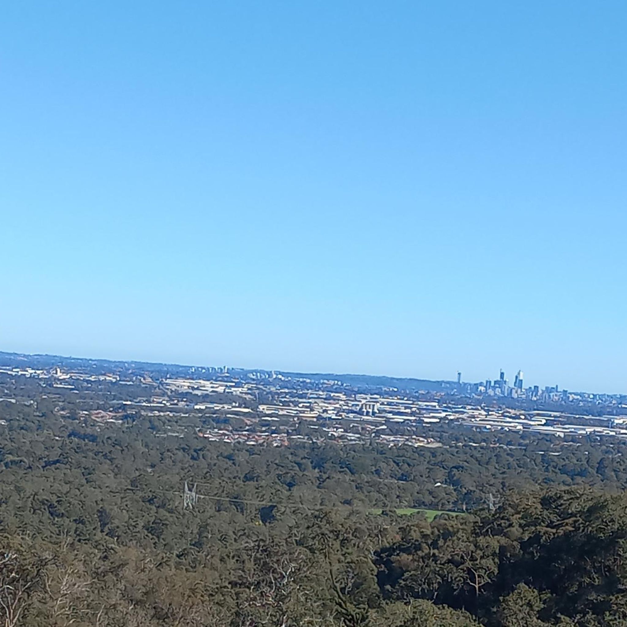
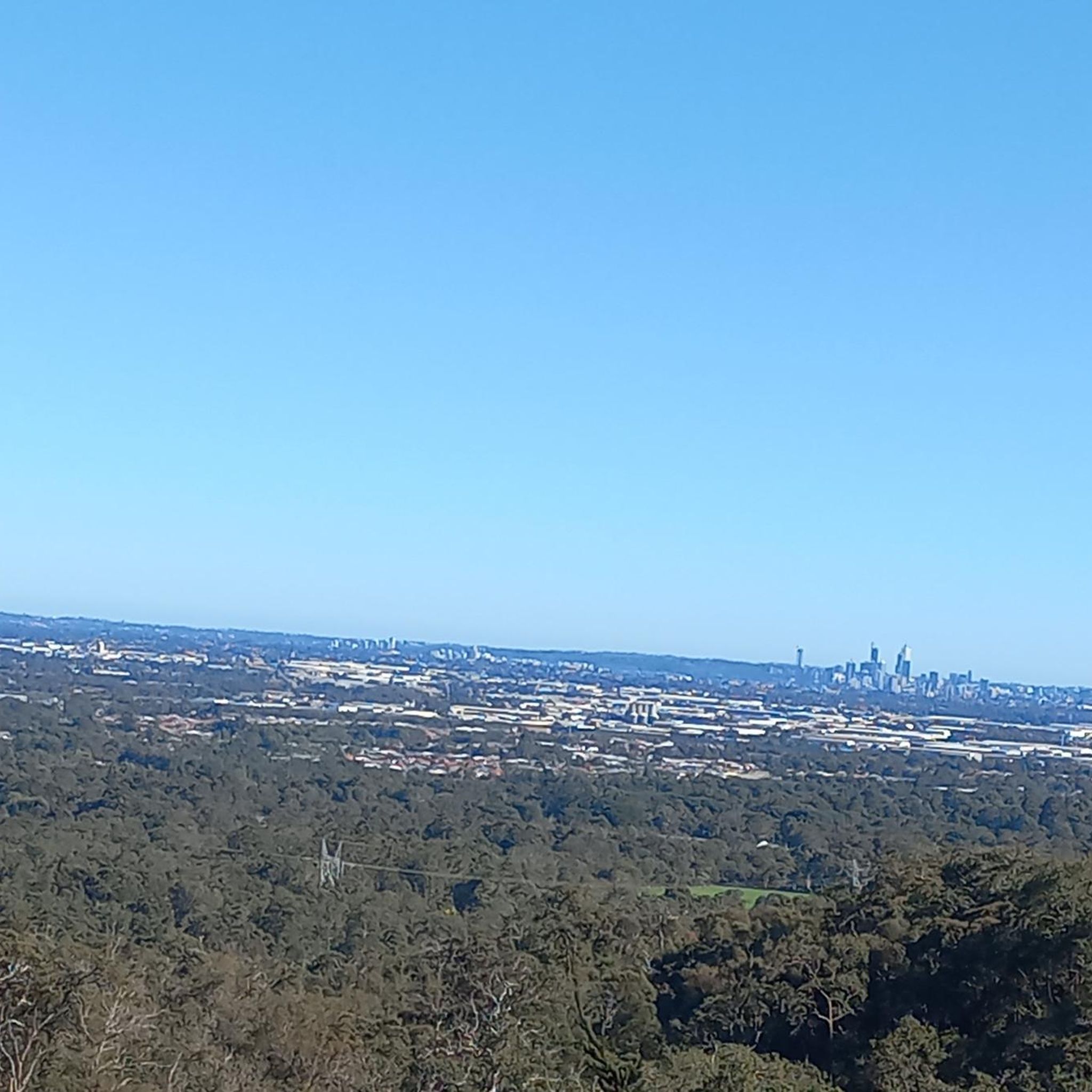
From this vantage point, you can see west across the jarrah-covered Perth Hills to the Swan Coastal Plain and the Perth skyline in the distance. On a clear day, you can see the city rise above the surrounding suburbs, creating a beautiful contrast between the urban landscape and the native bush.
0
0
This track is a moderately challenging route that takes you through jarrah and marri woodland in Banyowla Regional Park. This route follows a mix of unmarked bush tracks and management trails, with a few steep climbs, rocky sections, and occasional views across the Perth Hills. With limited way markings and multiple track junctions, it’s best to carry your komoot offline GPS route to stay on course while exploring this peaceful area.
0
0

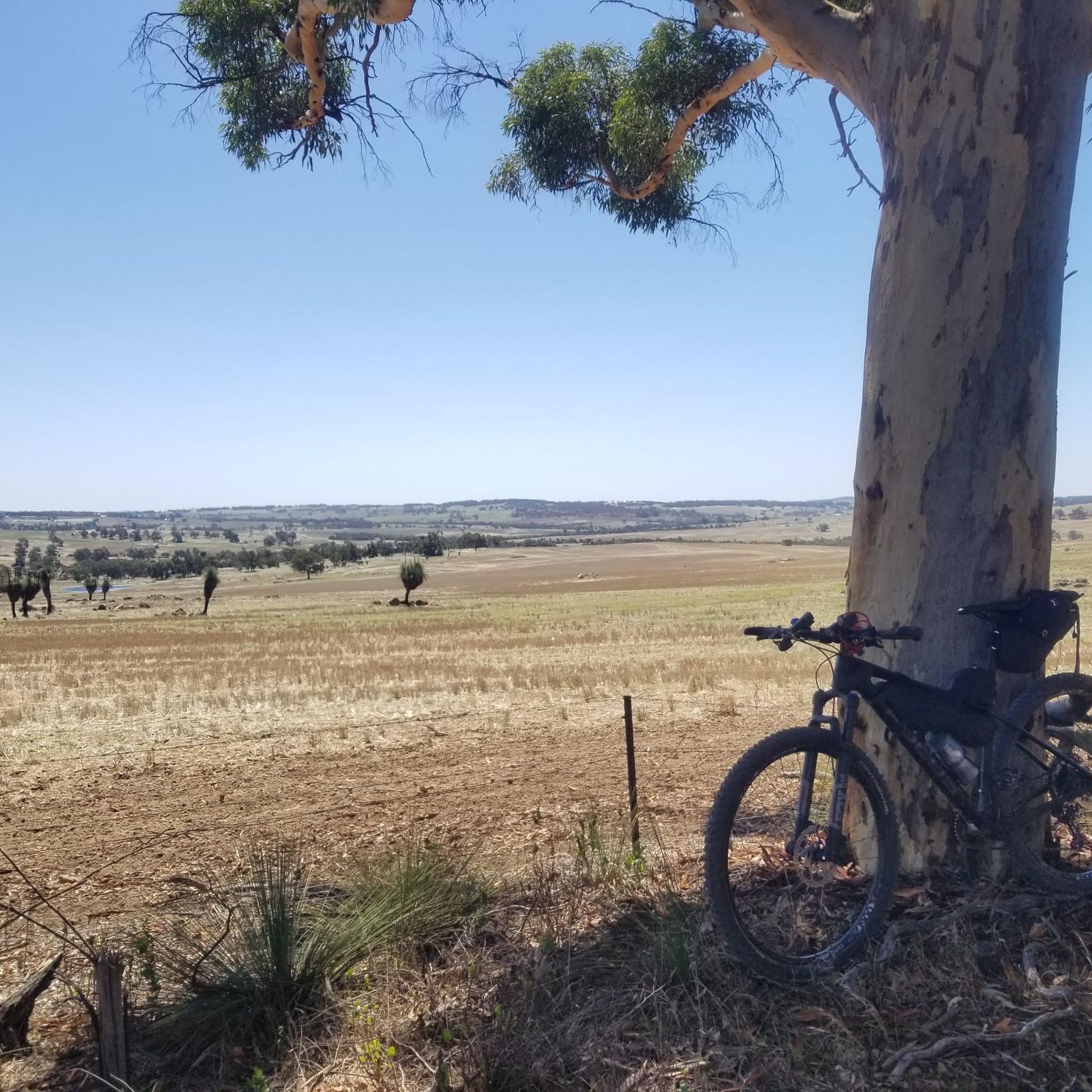
This path forms an easy circuit through Korung National Park's jarrah and marri forests. It's a relatively flat track with plenty of shade, which makes it a great option for those looking for a nice outing that isn't too strenuous. There are a lot of other trails in this part of the park and it's easy to end up on another route, so make sure to have your komoot app handy. Also, mountain biking is popular here as well so keep an eye out for those enjoying the trails on two wheels.
0
0
Known for its jarrah forests, Korung National Park sits just an hour outside of Perth. The park is popular with hikers and mountain bikers, but be aware that there are limited facilities, so it's best to come prepared to be self- sufficient.
0
0
Frequently Asked Questions
What is the best time of year to hike in Korung National Park?
The park is particularly stunning in springtime (September to November) when it transforms into a "wonderland of wildflowers." You'll find vibrant yellow wattles, delicate orchids, and other local flora creating a spectacular display of color. The cooler months are also ideal for hiking, avoiding the peak heat of summer.
Are there any easy hiking trails suitable for beginners or families in Korung National Park?
Yes, Korung National Park offers several easy trails. For a gentle introduction, consider the Victoria Dam – Victoria Dam loop from Carmel, which is 4.2 miles (6.8 km) and takes less than two hours to complete, circling the historic Victoria Dam. Another good option is the Bickley Brook Reservoir loop from Silverdale Road Reserve, an easy 4.8 km route.
What kind of natural features and landscapes can I expect to see while hiking?
Korung National Park is characterized by lush Jarrah and Marri forests, with an understory of banksias, grass trees, and zamia palms. You'll also encounter significant water bodies like Victoria Dam and Bickley Brook Reservoir, and rugged granite outcrops. Portions of the park, particularly around Lions Lookout, offer expansive views over the Perth Coastal Plain.
Are there any circular hiking routes in Korung National Park?
Many of the trails in Korung National Park are designed as loops, offering varied scenery without retracing your steps. A popular moderate option is the Victoria Dam – Victoria Dam loop from Victoria Dam, an 8.1 miles (13.0 km) trail leading through Jarrah and Marri forests. For a longer moderate loop, try the Victoria Dam – Victoria Dam loop from Orange Grove, which is nearly 15 km.
What do other hikers enjoy most about Korung National Park?
The area is highly rated by the komoot community, with an average score of 4.7 stars from over 160 reviews. Hikers often praise the diverse terrain, the beauty of the Jarrah and Marri forests, and the scenic routes around the reservoirs. The vibrant wildflower displays in spring are also a frequently mentioned highlight.
Are dogs allowed on the hiking trails in Korung National Park?
Generally, dogs are not permitted in Western Australian national parks to protect native wildlife. It's always best to check the latest regulations with the Department of Biodiversity, Conservation and Attractions (DBCA) before planning your visit with a pet.
How many hiking trails are available in Korung National Park?
Korung National Park offers a comprehensive network of over 60 hiking trails. These range in difficulty from easy to difficult, ensuring options for various fitness levels and preferences.
Are there any viewpoints or lookouts with scenic vistas in the park?
Yes, portions of Korung National Park lie on the edge of the Darling Scarp, providing excellent viewpoints. The Lions Lookout Walk Trail is particularly noted for offering sweeping vistas across the Perth Coastal Plain and the Bickley Brook valley. The Kattamorda Heritage Trail also provides incredible city views.
Is there parking available at the trailheads in Korung National Park?
While specific visitor facilities are limited, parking is generally available at various access points and trailheads throughout the park. It's advisable to check the starting points of your chosen route for designated parking areas.
Can I reach Korung National Park using public transport?
Korung National Park is situated approximately 26 kilometers southeast of Perth, making it primarily accessible by car. Public transport options directly to trailheads within the park are limited, so driving is generally the most convenient way to access the hiking routes.
Are there any longer, more challenging hikes in Korung National Park?
For those seeking a more challenging experience, the park does offer routes with steeper ascents and descents. The Bickley Brook Reservoir loop from Basildon Reserve is a moderate 5.8 miles (9.3 km) path that includes some steep climbs and descents, offering views of the reservoir and surrounding valley.
What kind of trees and plants will I see in Korung National Park?
The park is dominated by majestic Jarrah and Marri trees, forming dense forests. Below the canopy, you'll find an understory rich with native Australian flora, including banksias, distinctive grass trees (balgas), and zamia palms. In spring, the ground comes alive with a vibrant display of wildflowers.
Most popular routes in Korung National Park

Get inspired with the komoot mobile app


Explore more
Browse the best Hikes in other regions.
