The best cycling routes in Santo Antônio Do Pinhal
4.0
(2)
382
riders
10
rides
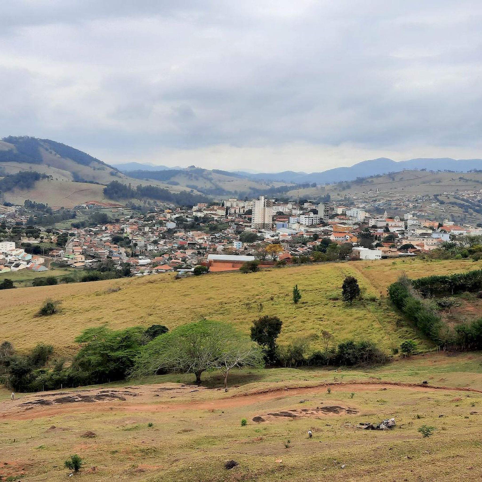
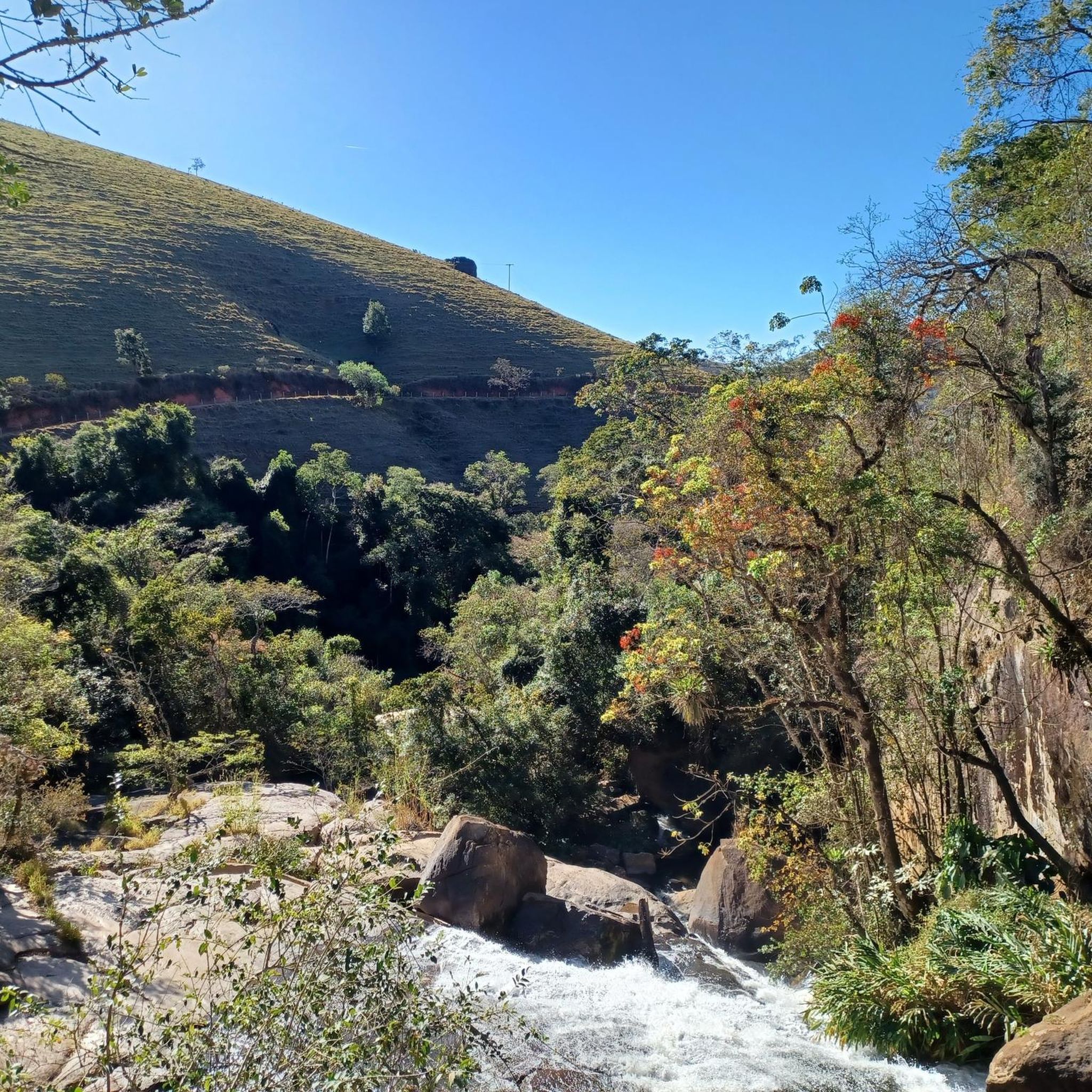
Touring cycling routes in Santo Antônio Do Pinhal are characterized by the mountainous terrain of the Serra da Mantiqueira. The region features significant elevation changes, offering challenging climbs and descents through diverse landscapes. Cyclists can expect routes that traverse forested areas, provide panoramic views of the surrounding valleys, and pass by natural features such as waterfalls. The presence of araucaria trees is common, contributing to the natural environment.
Best touring cycling routes in Santo Antônio Do Pinhal
- The most popular touring cycling route is Vista de Mellos – Fountain of Friendship loop from Eugênio Lefévre, a 54.4 miles (87.5 km) trail that takes 6 hours 18 minutes to complete. This difficult route features substantial elevation gain through the mountainous landscape.
- Another top favourite among local touring cyclists is Vista de Mellos – Fountain of Friendship loop from Peixe na Pista, a difficult 51.7 miles (83.2 km) path. This route offers extensive views of the Serra da Mantiqueira and challenging ascents.
- Local touring cyclists also love the Fountain of Friendship – Start of Zig Zag Trail loop from Eugênio Lefévre, a 54.0 miles (87.0 km) trail leading through varied terrain with significant climbs, often completed in about 6 hours 44 minutes.
- Touring cycling in Santo Antônio Do Pinhal is defined by mountainous terrain, panoramic viewpoints, and forested paths. The network offers options for different ability levels, though many routes feature challenging ascents.
- The routes in Santo Antônio Do Pinhal are highly rated by the komoot community with an average score of 4.0 stars from 2 reviews. More than 300 touring cyclists have used komoot to explore Santo Antônio Do Pinhal's varied terrain.
Last updated: July 10, 2026
107
riders
87.5km
06:19
1,770m
1,760m
Hard bike ride. Very good fitness required. Mostly paved surfaces. Suitable for all skill levels.
50
riders
83.2km
06:15
1,840m
1,840m
Hard bike ride. Very good fitness required. Mostly paved surfaces. Suitable for all skill levels.

Sign up for free
31
riders
87.0km
06:45
2,110m
2,110m
Hard bike ride. Very good fitness required. Mostly paved surfaces. Suitable for all skill levels.
15
riders
42.8km
03:12
1,000m
1,000m
Hard bike ride. Very good fitness required. Mostly paved surfaces. Suitable for all skill levels.
10
riders
49.2km
03:36
1,080m
1,080m
Hard bike ride. Very good fitness required. Mostly paved surfaces. Suitable for all skill levels.
Get access to more routes and recommendations from other explorers.
Sign up for free
Already have an account?
Our route recommendations are based on thousands of hikes, rides, and runs completed by other people on komoot.
Start today with a free account
Your next adventure awaits.
Login or Signup
Popular around Santo Antônio Do Pinhal
Tips from the Community

Just ride to cycle. Without making the effort.
0
0
It is in the Capivari region. One of the busiest places.
1
0
The trail is hardly difficult to access, however, it is worth using the GPS.
0
0
The trail requires care, however, there is a risk of falling. It's a really cool track.
0
0
Spectacular place to take pictures. Excellent place to relax your legs and is on the post side.
0
0
Place to relax your legs or meet your cycling friends. It has free parking.
0
0
Very beautiful and interesting place. German style. It's worth visiting.
0
0
Frequently Asked Questions
How many touring cycling routes are available in Santo Antônio do Pinhal?
Santo Antônio do Pinhal offers around a dozen touring cycling routes. These routes are primarily characterized by the mountainous terrain of the Serra da Mantiqueira, providing diverse landscapes for exploration.
What are the typical difficulty levels for touring cycling routes in this region?
The touring cycling routes in Santo Antônio do Pinhal are generally challenging. While there are 2 moderate routes, the majority (10 out of 12) are classified as difficult, featuring significant elevation changes and demanding climbs through the mountainous landscape.
What kind of terrain can I expect on touring cycling routes in Santo Antônio do Pinhal?
Cyclists can expect mountainous terrain with significant elevation changes, including challenging climbs and descents. Routes often traverse forested areas, offer panoramic views of surrounding valleys, and pass by natural features like waterfalls. The presence of araucaria trees is common, contributing to the natural environment.
Are there any scenic viewpoints or natural landmarks to see along the cycling routes?
Yes, the region is rich in scenic spots. Many routes offer breathtaking views of the Serra da Mantiqueira. Notable landmarks include Pico Agudo, which provides a spectacular 360-degree vista, and the Nossa Senhora Auxiliadora Viewpoint, offering panoramic views of the Serra and the city. You might also encounter the Lajeado Waterfall and other ecological trails leading to beautiful waterfalls.
What is the best time of year for touring cycling in Santo Antônio do Pinhal?
Santo Antônio do Pinhal generally enjoys a mild climate, making it suitable for cycling throughout much of the year. However, for the most comfortable experience, consider visiting during the drier, cooler months to avoid heavy rains and enjoy clearer views.
Are there any particularly challenging routes for experienced touring cyclists?
Absolutely. The region is known for its demanding climbs. For instance, the Vista de Mellos – Fountain of Friendship loop from Eugênio Lefévre is a difficult 87.5 km route with substantial elevation gain. Another challenging option is the Vista de Mellos – Fountain of Friendship loop from Peixe na Pista, an 83.2 km path offering extensive views and challenging ascents.
Are there any circular touring cycling routes available?
Yes, many of the touring cycling routes in Santo Antônio do Pinhal are designed as loops. For example, the Fountain of Friendship – Start of Zig Zag Trail loop from Eugênio Lefévre is a 87.0 km circular trail leading through varied terrain with significant climbs.
What do other touring cyclists enjoy the most about cycling in Santo Antônio do Pinhal?
The area is highly rated by the komoot community, with an average score of 4.0 stars. Cyclists often praise the challenging mountainous terrain, the panoramic viewpoints, and the forested paths that provide a truly immersive natural experience.
Are there any shorter or more moderate touring cycling options?
While most routes are difficult, there are a couple of moderate options available. For a challenging but slightly shorter loop, consider the Start of Zig Zag Trail – Fountain of Friendship loop from Santo Antônio do Pinhal, which covers 42.8 km with over 1000m of elevation gain.
What facilities are available for cyclists in Santo Antônio do Pinhal?
Santo Antônio do Pinhal is increasingly cyclist-friendly, offering planned bike paths and ecological trails. The city supports cyclists with features like repair stations, bike rentals, and dedicated rest areas, making it convenient for touring cyclists.
Can I find routes that connect to other towns or regions?
Yes, for adventurous cyclists, there are challenging routes that connect to nearby areas. An example is the 'Estrada Velha' (Old Road) between Santo Antônio do Pinhal and Campos do Jordão, a 34-36 km route known for its breathtaking natural landscapes. There's also an off-road connection between Monteiro Lobato and Santo Antônio do Pinhal for those seeking wilder, less-trafficked paths.
Are there any routes that pass by the Eugênio Lefévre Station?
Yes, the historic Eugênio Lefévre Station serves as a starting point for several routes, adding a cultural dimension to your ride. For example, the Vista de Mellos – Fountain of Friendship loop from Eugênio Lefévre begins near this station.
Most popular routes in Santo Antônio Do Pinhal

Get inspired with the komoot mobile app


Explore more
Browse the best Cycling routes in other regions.
