The 7 Most Amazing Peaks around Schwirzheim
Best mountain peaks around Schwirzheim are characterized by the Eifel region's rolling hills, forested terrain, and scenic viewpoints. The area offers excellent hiking opportunities, leading to elevated areas that provide expansive vistas of the surrounding countryside. While not featuring towering alpine peaks, these locations offer rewarding experiences for visitors seeking panoramic views and natural beauty. The region is well-regarded for its diverse hiking trails, which cater to various fitness levels.
Best mountain peaks around Schwirzheim
- The most popular mountain peaks…
Last updated: June 29, 2026
View of Gerolstein from the Munterley
Highlight • Viewpoint
Translated by Google •
Tip by

Dietzenley Observation Tower
Highlight • Viewpoint
Translated by Google •
Tip by

Sign up now to discover places like this
Get recommendations on the best single tracks, peaks, & plenty of other exciting outdoor places.
Sign up for free
Basilica of St. Salvator, Prüm
Highlight • Religious Site
Translated by Google •
Tip by

Schwarzer Mann (Ski and Recreation Area)
Highlight • Rest Area
Translated by Google •
Tip by
Langer Stein and Seimersberg
Highlight • Summit
Translated by Google •
Tip by

Sign up for free to discover even more peaks around Schwirzheim.
Sign up for free
Already have an account?
Start today with a free account
Your next adventure awaits.
Login or Signup

Tips from the Community

"To the west of the Langer Stein (640m) and Seimersberg (662m) we move to the Prümer Kopf. The gradients have so far proven to be very moderate, as they are today. In the surrounding spruce forest we repeatedly discover up to two meter high anthills ( https://www.das-tierlexikon.de/ameise/) and these are often surprisingly close together. We also encounter an unusually large number of hard-working dung beetles; we often have to be very careful not to step on them. (https://www .biologie-schule.de/mistkaefer-steckbrief.php)" https://www.komoot.de/tour/778942841
0
0

"The Black Man is 697.3 meters high. And of course it has nothing to do with the children's song - oh what! The Internet knows: The Black Man is the highest peak in the Schneifel and the third highest mountain in the Eifel (after the Hohe Acht and the Erresberg) and is considered an Eldorado for winter sports enthusiasts and hikers seven kilometers north-west of Prüm not far from the Belgian border in the Hohes Venn nature park located, but which covers a larger area, but comes from the word "Schneise" and designates the mountain range to which the black man also belongs." https://susanne-wingels.de/tag/forstmeisterjansenstein
0
0
"With an area of approx. 102 hectares, the area around the Gerolsteiner Dolomites has been a nature reserve since 1990. + occurring animal species: bat + occurring plant species: juniper, orchids, character plants calcareous grassland, grove rush-beech forest, woodruff-beech forest, orchid-limestone-beech forest Around 380 million years ago there was a warm, subtropical shallow sea here, in which mighty reefs of stromatopores - relatives of sponges - and corals formed. After the dolomitization, sinking and folding of the rocks, the Devonian deposits were lifted out again. Today's Gerolsteiner Dolomites were formed, which rise steeply above the Kylltal north of the center of Gerolstein. The rocks "Hustley", "Munterley", "Drohende Ley", "Große Kanzel" and "Auberg" characterize the cityscape from afar and form the landmark of Gerolstein. The most famous summit of the Gerolsteiner Dolomites is the "Munterley" - with a height of 482 meters - and offers a breathtaking view over Gerolstein, the Kylltal and far into the Vulkaneifel. Stone Age people, who settled here 30,000 years ago, obviously enjoyed this view, as evidenced by stone tools and bones found at the nearby Buchenloch Cave. Visiting the Gerolsteiner Dolomites can be perfectly combined with hiking the Felsenpfad - the northern part of the "Gerolsteiner Dolomiten Acht". The almost eight-kilometer round tour offers many magical places and geological traces." https://www.eifel.info/a-gerolsteiner-dolomites
10
0

Here, skiers and snowboarders are transported to the starting point with two tow lifts. From there, two blue-marked descents lead back down. The Schwarzer Mann ski area offers a total of 1.5 km of slopes for beginners, families and advanced skiers. www.skigebiete-test.de
3
0

In addition to Hellenthal-Udenbreth, one of the most famous winter sports areas in the Eifel. The Schwarzer Mann ski area is about 14 km northwest of Prüm in the Eifel. On the Schwarzen Mann ridge (697 meters peak) it offers an easy and a medium-difficulty downhill slope for relaxed skiing and snowboarding. An alternative to skiing is the natural toboggan run with its own toboggan lift. For children, the Schwarzer Mann winter sports center not only offers the two ski slopes, but also its own mini children's toboggan run. For cross-country skiers there are around ten kilometers of groomed cross-country trails. And hikers can look forward to around five kilometers of signposted winter hiking trails in the Schwarzen Mann winter sports area. To stop off, the Blockhaus Schwarzer Mann offers Eifel specialties, home-style cooking, coffee and cake and more. Source: https://www.skiresort.de/skigebiet/schwarzer-mann-pruem/
4
0

A mighty, beautiful building in the middle of the Eifel, including the building of the adjoining grammar school.
8
1

The Basilica of St. Salvator stands in Prüm, a town in the West Eifel region. In 721, the Frankish noblewoman Bertrada founded a monastery on her estate on the Prüm River with monks from Echternach. A second foundation was established in 752 by King Pippin, who had married a granddaughter of the first founder, with monks from Meaux near Paris, who lived according to the Rule of St. Benedict. In 1222, the monastery became the center of an independent principality, which was annexed by the Elector of Trier in 1576. The Elector and Archbishop of Trier then served as the abbot's administrator. Reconstruction of the abbey buildings began in 1721. As part of the Napoleonic secularization, the abbey was finally dissolved in 1802. Prüm, which initially belonged to the original parish of Rommersheim, was under the pastoral care of the Marienstift (St. Mary's Collegiate Church) from the mid-15th century. The Marienstift had been founded in 1016 by Abbot Urold of Prüm. The collegiate church became the parish church. In 1802, the monastery church became the parish church, and the collegiate church was demolished in 1826.
9
0
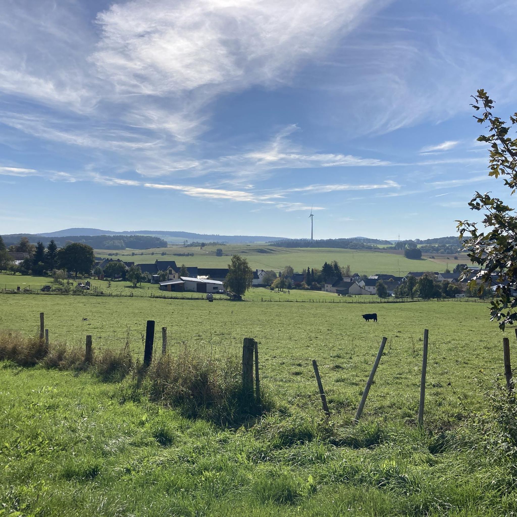
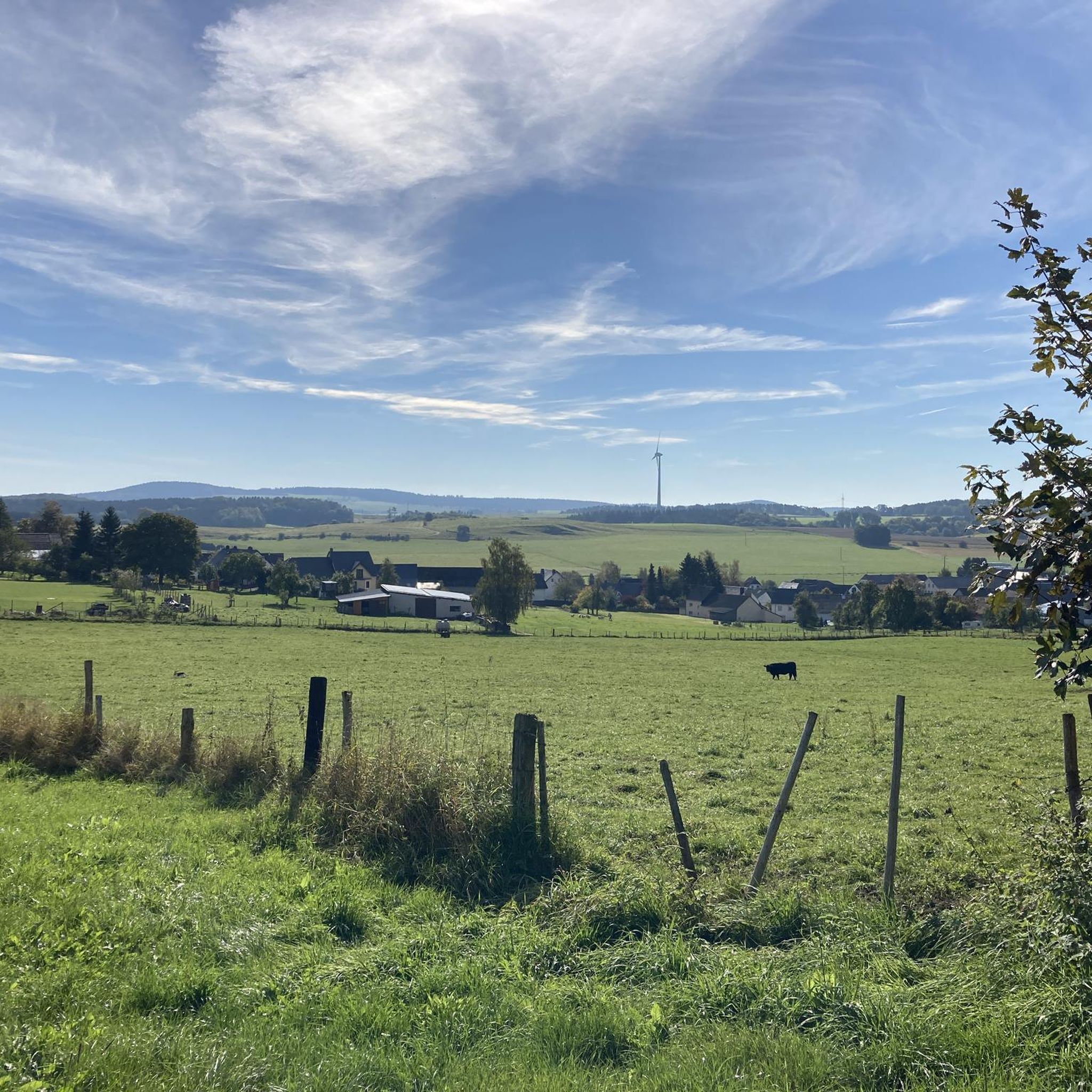
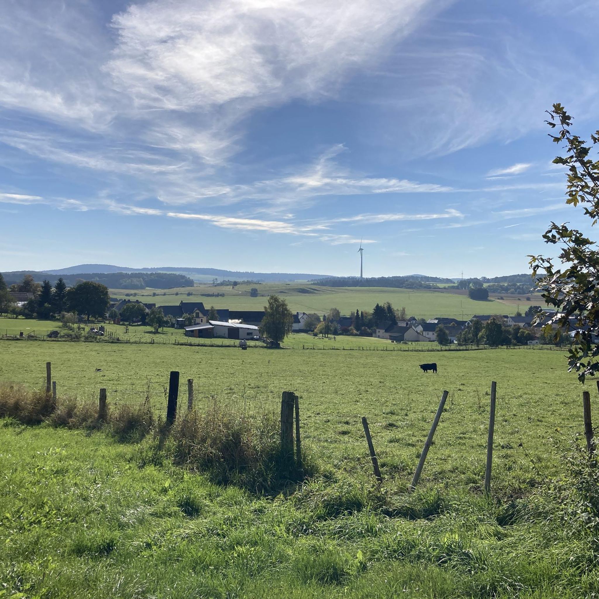
The observation tower on the Dietzenley offers an impressive view of the landscape of the Vulkaneifel. About 2500 years ago there was a Celtic housing estate on the Dietzenley with pasture areas, which were protected against attacks by ramparts up to 9 m high and 4 m wide.
13
0
Frequently Asked Questions
What are some notable elevated areas or viewpoints near Schwirzheim?
The Eifel region around Schwirzheim features picturesque rolling hills and scenic viewpoints rather than towering peaks. Notable spots include the Dietzenley Observation Tower, which offers impressive panoramic views of the Vulkaneifel landscape. Another popular location is the View of Gerolstein from the Munterley, providing a fantastic vista over Gerolstein and the Kylltal.
What kind of views can I expect from the elevated areas around Schwirzheim?
From the elevated areas and viewpoints near Schwirzheim, you can expect stunning panoramic views of the Eifel landscape. Locations like View of Auberg and Munterley offer beautiful perspectives of the Auberg and Gerolstein, showcasing lush forests, rolling hills, and unique geological formations like the dolomite rock formations of the Gerolstein Dolomites.
Are there any historical or cultural sites associated with the elevated areas near Schwirzheim?
Yes, some elevated areas near Schwirzheim have historical significance. For instance, the Dietzenley Observation Tower stands on a site that was once a Celtic housing estate about 2500 years ago. Additionally, hiking routes in the wider Eifel region often incorporate points of interest such as ancient castle ruins, adding a historical dimension to your outdoor experience.
What do visitors particularly enjoy about the mountain peaks and viewpoints in the Schwirzheim region?
Visitors highly appreciate the tranquil atmosphere and the grandiose all-round views from spots like the Dietzenley Observation Tower. The unique geological history, such as standing on a Devonian reef formed 380 million years ago at the View of Gerolstein from the Munterley, also fascinates many. The region's natural beauty, diverse hiking trails, and the opportunity for photography are also frequently mentioned highlights.
Are there family-friendly options for exploring the elevated areas around Schwirzheim?
Yes, the Eifel region around Schwirzheim offers many family-friendly options. Many trails leading to viewpoints are well-maintained and suitable for various fitness levels, including those with 'easily-accessible paths'. The View of Auberg and Munterley, for example, is part of routes that can be enjoyed by families, offering panoramic views and interesting rock formations.
What is the best time of year to visit the mountain peaks and viewpoints near Schwirzheim?
The Eifel region is beautiful throughout the year, but spring, summer, and autumn are particularly popular for hiking and enjoying the viewpoints. Spring brings lush greenery and blooming wildflowers, while autumn offers vibrant foliage. Even in winter, areas like Schwarzer Mann (Ski and Recreation Area) provide opportunities for winter sports and scenic winter hiking trails.
Are there hiking trails near these elevated areas, and what are their difficulty levels?
Yes, the region is well-regarded for its diverse hiking trails. You'll find routes catering to various fitness levels, from leisurely walks to more challenging routes. For example, the nearby Hiking around Schwirzheim guide features trails like the 'Heilert Eifel Viewpoint – Duppach Drees Mineral Spring loop from Duppach' which is rated easy, and the 'Hartelstein Castle Ruins – Vlierbachtal Valley loop from Schwirzheim' which is moderate.
Can I find parking and trailheads for the mountain peaks around Schwirzheim?
Yes, many popular elevated areas and viewpoints in the Schwirzheim region are easily accessible and feature designated parking areas and trailheads. For instance, the elevated area near Duppach, known as Auf Heilert, offers convenient parking and a resting place, making it a popular starting point for exploring the panoramic views.
Are there dog-friendly trails around the mountain peaks near Schwirzheim?
The Eifel region generally welcomes dogs on its hiking trails, making it a great area for exploring with your canine companion. While specific rules may vary by location, many of the natural trails leading to viewpoints and through forests are suitable for dogs, provided they are kept on a leash and owners clean up after them. Always check local signage for any specific regulations.
What other outdoor activities can I do near the mountain peaks around Schwirzheim?
Beyond hiking to viewpoints, the Schwirzheim area offers a variety of outdoor activities. You can explore numerous running trails, with options like the 'On Roth loop from Fleringen' found in the Running Trails around Schwirzheim guide. Road cycling is also popular, with routes such as the 'Kyll Cycle Path near Lissingen – Birresborn Linden Spring loop from Büdesheim' detailed in the Road Cycling Routes around Schwirzheim guide. In winter, the Schwarzer Mann (Ski and Recreation Area) offers skiing, snowboarding, and tobogganing.
Where can I find an observation tower with panoramic views in the region?
For an impressive panoramic view of the Vulkaneifel landscape, head to the Dietzenley Observation Tower. This location was once a Celtic housing estate and provides a grandiose all-round view, allowing you to see far across the region, including Gerolstein and Büscheich on a clear day.
What is unique about the 'View of Gerolstein from the Munterley'?
The View of Gerolstein from the Munterley is unique because you are standing on a Devonian reef formed 380 million years ago. This ancient reef, composed of dolomite rock, offers a fantastic view over Gerolstein and the beautiful Kylltal. It's a place where geological history meets stunning natural scenery.
Is there a place near Schwirzheim that offers winter sports opportunities?
Yes, the Schwarzer Mann (Ski and Recreation Area) is a well-known winter sports destination near Schwirzheim. It offers downhill slopes for skiing and snowboarding, a natural toboggan run with its own lift, a mini children's toboggan run, and groomed cross-country trails. There are also signposted winter hiking trails for those who prefer to explore on foot.
Most popular routes around Schwirzheim
Most popular attractions around Schwirzheim

Get inspired with the komoot mobile app


Explore more
See even more amazing summits around Schwirzheim with these guides:
