The best running trails in Mecapaca
4.3
(7)
82
runners
7
runs
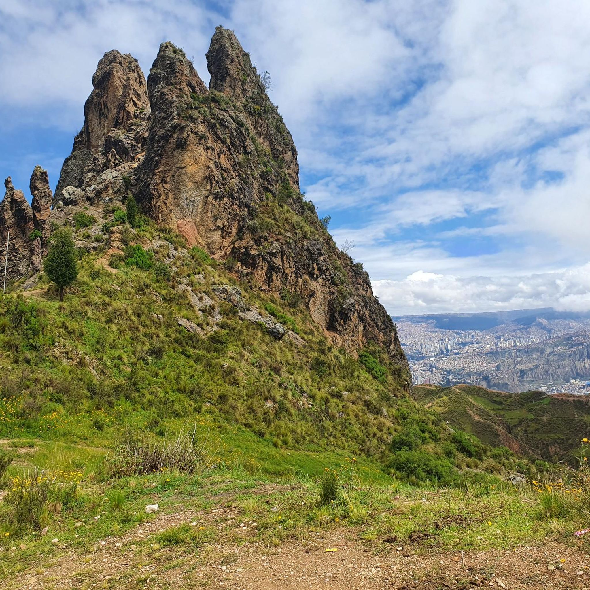
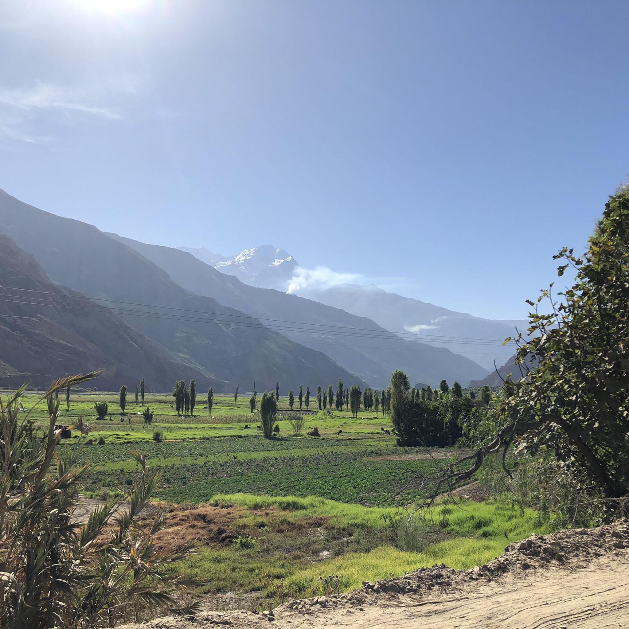
Jogging in Mecapaca offers diverse landscapes within the Andes mountains near La Paz, Bolivia. The region features rolling hills, lush valleys, and mountain vistas, with terrain transitioning from arid highlands to fertile farmland. Joggers can explore riverine paths along waterways like the Río Huañajahuira and Río Jilusaya, as well as mountain trails. Situated at an altitude of approximately 10,500 feet (3,200 meters) above sea level, Mecapaca provides varied elevations for running.
Best jogging routes in Mecapaca
- The most popular jogging…
Last updated: July 10, 2026
5.0
(1)
20
runners
11.1km
01:12
170m
170m
Moderate run. Good fitness required. Mostly paved surfaces. Suitable for all skill levels.
3.0
(1)
10
runners
13.4km
01:31
360m
360m
Hard run. Very good fitness required. Mostly paved surfaces. Suitable for all skill levels.

Sign up for free
8
runners
18.9km
02:04
420m
420m
Hard run. Very good fitness required. Mostly paved surfaces. Suitable for all skill levels.
7
runners
11.1km
01:20
270m
270m
Hard run. Good fitness required. Sure-footedness, sturdy shoes and alpine experience required.
5.0
(1)
10
runners
17.7km
02:00
430m
430m
Hard run. Very good fitness required. Mostly paved surfaces. Suitable for all skill levels.
Get access to more routes and recommendations from other explorers.
Sign up for free
Already have an account?
Our route recommendations are based on thousands of hikes, rides, and runs completed by other people on komoot.
Start today with a free account
Your next adventure awaits.
Login or Signup
Popular around Mecapaca
Frequently Asked Questions
What kind of terrain can I expect when running in Mecapaca?
Mecapaca offers a diverse landscape for runners, featuring rolling hills, lush valleys, and impressive mountain vistas. The terrain transitions from arid highlands to fertile farmland, providing a mix of surfaces. You'll find riverine paths along waterways like the Río Huañajahuira and Río Jilusaya, as well as mountain trails. Be prepared for varied elevations, as the region is situated at an altitude of approximately 3,200 meters (10,500 feet) above sea level.
Are there any easy or beginner-friendly running routes in Mecapaca?
While many routes in Mecapaca involve significant elevation changes, there are moderate options suitable for those looking for a less strenuous run. For example, the Río Huañajahuira – Bosquecillo Colegio La Salle loop from Agencia Boliviana Espacial is a moderate 10.8 km (6.7 miles) route that offers a good balance of challenge and accessibility.
Can I find circular running routes in Mecapaca?
Yes, many of the running paths in Mecapaca are designed as loops, allowing you to start and finish at the same point. An example is the Beyu loop from Estadio Rafael Mendoza Castellón, a challenging 17.5 km (10.9 miles) route that takes you through varied landscapes.
What are some notable natural attractions or landmarks I might see while jogging in the area?
Beyond the stunning Andean scenery, you might encounter unique geological formations. While not directly within Mecapaca, the famous 'Valley of the Moon' (Valle de la Luna) is nearby and offers lunar-like landscapes for exploration. Another striking landmark is 'La Muela del Diablo', a rock formation resembling a devil's molar tooth, which provides breathtaking vistas over the surrounding areas. For more information on the Valley of the Moon, you can visit visitsouthamerica.co.
Are there any running routes with particularly good views?
Given Mecapaca's mountainous setting, many routes offer spectacular views. Trails ascending peaks like Cerro Pucara or Cerro Pichincha, though challenging, reward runners with panoramic vistas. Even lower elevation routes often provide scenic outlooks over valleys and rivers. The Bajadita Alley – Beyu loop from Agencia Boliviana Espacial, a difficult 20.3 km (12.6 miles) route, is known for its expansive views.
What should I consider regarding the altitude when running in Mecapaca?
Mecapaca is situated at approximately 3,200 meters (10,500 feet) above sea level. Runners should be mindful of the high altitude and allow for gradual acclimatization, especially if coming from lower elevations. It's advisable to start with shorter, easier runs and stay well-hydrated.
Are there family-friendly running paths in Mecapaca?
While many routes are moderate to difficult, families looking for outdoor activity can find suitable paths. The region's diverse ecosystems are ideal for nature walks, which can be adapted for light jogging. Look for routes described as 'moderate' and consider their length and elevation gain to ensure they are appropriate for all family members.
What do other runners say about the trails in Mecapaca?
The running routes in Mecapaca are highly rated by the komoot community, with an average score of 4.25 stars from over 5 reviews. Runners often praise the varied terrain, the beautiful riverine paths, and the challenging mountain trails that offer a rewarding experience.
Are there any dog-friendly running trails in Mecapaca?
Mecapaca's extensive trail networks generally welcome dogs, making it a great place to run with your canine companion. However, it's always recommended to keep dogs on a leash, especially in areas with wildlife or near local communities, and to carry waste bags. Always check local regulations for specific trails.
Is there public transport or parking available near the running routes?
While specific details on public transport to every trailhead are not readily available, Mecapaca is a municipality near La Paz, suggesting some accessibility. Many routes, such as the Bosquecillo La Florida – Bosquecillo Colegio La Salle loop from Calacoto, start from points like 'Agencia Boliviana Espacial' or 'Apostolic nunciature', which may have nearby parking or be accessible by local transport from La Paz. It's best to research specific starting points for parking options.
What is the best time of year to go running in Mecapaca?
Mecapaca's climate varies with elevation. Generally, the dry season (May to October) offers clearer skies and more stable weather conditions, making it ideal for outdoor activities like running. However, runners should always be prepared for varied conditions due to the altitude and mountainous environment.
Most popular routes in Mecapaca

Get inspired with the komoot mobile app


Explore more
Browse the best Running Trails & Routes in other regions.
