The best cycling routes in Tianguismanalco
4.5
(4)
79
riders
5
rides
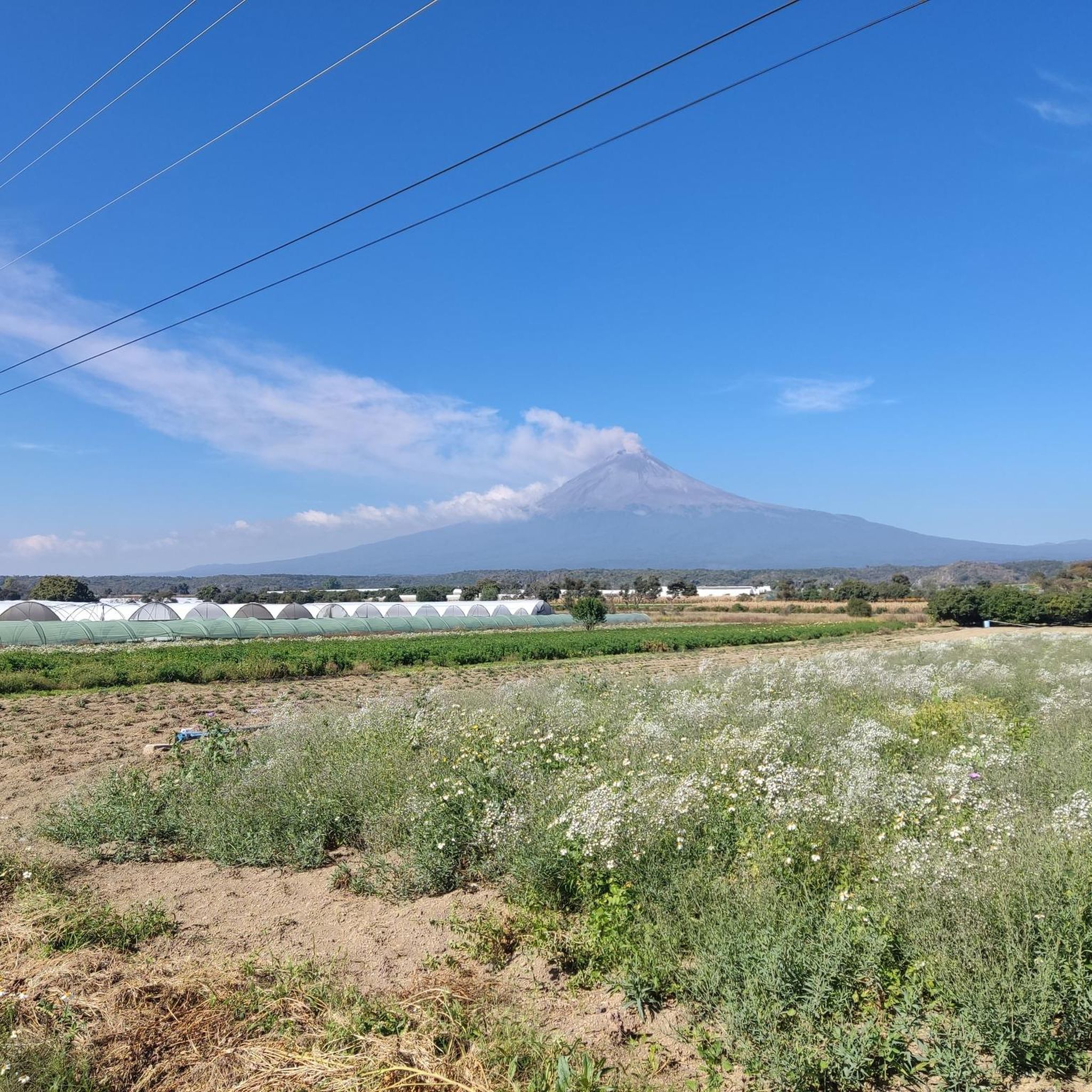
Touring cycling in Tianguismanalco offers routes through diverse landscapes in the Puebla region. The area features varied terrain, including barrancas (ravines) and views towards significant geological formations. Routes often traverse agricultural lands and connect historical towns. The elevation changes provide a challenging experience for cyclists.
Best touring cycling routes in Tianguismanalco
- The most popular touring cycling route is View Near Puebla – Great Pyramid of Cholula loop from Cholula, a 32.9 miles (53 km) trail that takes 3 hours…
Last updated: July 1, 2026
4.0
(3)
43
riders
52.4km
03:16
490m
490m
Hard bike ride. Very good fitness required. Mostly paved surfaces. Suitable for all skill levels.
19
riders
Hard bike ride. Very good fitness required. Mostly paved surfaces. Suitable for all skill levels.

Sign up for free
2
riders
45.1km
02:46
380m
380m
Moderate bike ride. Good fitness required. Mostly paved surfaces. Suitable for all skill levels.
8
riders
65.4km
04:06
590m
590m
Hard bike ride. Very good fitness required. Mostly paved surfaces. Suitable for all skill levels.
3
riders
10.4km
01:07
230m
230m
Moderate bike ride. Good fitness required. Mostly paved surfaces. Suitable for all skill levels.
5.0
(1)
4
riders
58.1km
03:45
710m
710m
Hard bike ride. Very good fitness required. Mostly paved surfaces. Suitable for all skill levels.
Our route recommendations are based on thousands of hikes, rides, and runs completed by other people on komoot.
Start today with a free account
Your next adventure awaits.
Login or Signup
Popular around Tianguismanalco

Tips from the Community

The road is somewhat sandy in sections during the dry season.
0
0
It is a good place to start the ride towards the Popobike route, as it has parking and clean bathrooms, and they also have a restaurant. Good food and reasonable prices.
0
0

This street is full of beautifully painted houses. The restaurant at the intersection is a very nice photo opportunity
1
0


The air is getting quite thin once you get closer to the top. Allow yourself enough time to get up there. We had to take a lot of breaks and needed around 4 to 5 hours to get there!
1
0

Starting point for hikes on the volcanoes. Located at 3,600 meters, the air is much thinner.
2
0
Frequently Asked Questions
What kind of terrain can I expect on touring cycling routes in Tianguismanalco?
Touring cycling routes in Tianguismanalco feature diverse landscapes, including barrancas (ravines), agricultural lands, and views towards significant geological formations like Popocatépetl. The terrain often involves varied elevations, providing a challenging experience.
Are there any easy or beginner-friendly touring cycling routes in Tianguismanalco?
The touring cycling routes in Tianguismanalco are generally considered challenging due to varied elevations and terrain. While most routes are rated 'difficult', there is one 'moderate' option: the Summit of Popocatépetl – Paso de Cortés loop from Paso de Cortés, which is 10.4 km long and takes about 1 hour 7 minutes.
What are the typical distances and durations for touring cycling routes in Tianguismanalco?
The touring cycling routes in Tianguismanalco vary significantly in length and duration. You can find routes ranging from approximately 10 km, taking just over an hour, up to 74 km, which can take over 4 hours to complete. For example, the Barranca Amesaque – Aclacomul loop from Atlixco is 73.9 km long.
Are there any circular touring cycling routes available in Tianguismanalco?
Yes, all the touring cycling routes listed for Tianguismanalco are designed as loops, allowing you to start and finish at the same point. Examples include the View Near Puebla – Great Pyramid of Cholula loop from Cholula and the Barranca Xumetitla – Atotonilco loop from San Pedro Cholula.
What kind of views or landmarks can I expect to see along the touring cycling routes?
Many routes offer scenic views and pass by notable landmarks. For instance, the View Near Puebla – Great Pyramid of Cholula loop from Cholula provides views of the Great Pyramid of Cholula. Other routes offer glimpses of the majestic Popocatépetl volcano and explore rural areas and barrancas.
What do other touring cyclists say about the routes in Tianguismanalco?
The touring cycling routes in Tianguismanalco are highly rated by the komoot community, with an average score of 5.0 stars from over 4 reviews. Cyclists often praise the challenging terrain and the diverse landscapes, including barrancas and views of regional landmarks.
Are there any routes that explore the barrancas (ravines) in the area?
Yes, several routes delve into the unique barranca landscapes of the region. The Barranca Xumetitla – Atotonilco loop from San Pedro Cholula specifically explores barrancas and rural areas around San Pedro Cholula. Another option is the Aclacomul – Barranca Atlaco loop from Atlixco.
What is the best time of year for touring cycling in Tianguismanalco?
Tianguismanalco generally experiences a dry season from November to April and a rainy season from May to October. For touring cycling, the dry season typically offers more stable weather conditions with less chance of rain, making it ideal for exploring the varied terrain and elevations.
What should I bring for a touring cycling trip in Tianguismanalco, given the challenging routes?
Given the challenging nature and varied elevations of the routes, it's advisable to bring appropriate gear. This includes a well-maintained touring bicycle, plenty of water, snacks, sun protection, a repair kit, and layers of clothing to adapt to changing temperatures, especially when gaining elevation. A GPS device or a loaded komoot tour is also recommended for navigation.
Are there any routes that pass through historical towns or agricultural lands?
Yes, many routes in Tianguismanalco traverse agricultural lands and connect historical towns, offering a glimpse into the local culture and scenery. The routes often start or pass near towns like Cholula, San Pedro Cholula, and Atlixco, allowing for exploration of these areas.
How many touring cycling routes are available in the Tianguismanalco area?
There are 5 touring cycling routes available in the Tianguismanalco area, offering a range of challenging experiences through diverse landscapes.
Is it possible to see the Popocatépetl volcano from any of the cycling routes?
Yes, some routes offer views towards significant geological formations, including the Popocatépetl volcano. The Summit of Popocatépetl – Paso de Cortés loop from Paso de Cortés specifically takes you into the mountainous terrain near the volcano.
Most popular routes in Tianguismanalco

Get inspired with the komoot mobile app


Explore more
Browse the best Cycling routes in other regions.
