The best walks and hikes in Forêt Communale De Saint-Dié-Des-Vosges
4.5
(1093)
5,110
hikers
11
hikes
Hiking in Forêt Communale De Saint-Dié-Des-Vosges offers a network of trails within a significant communal forest. The region is characterized by dense woodlands and varied terrain, typical of the Vosges mountains. Hikers can expect paths that wind through forested landscapes, with moderate elevation changes. This area provides opportunities for exploring nature within a well-established forest environment.
Best hiking trails in Forêt Communale De Saint-Dié-Des-Vosges
- The most popular hiking route is The Source of Solitude – The King's Chair loop from La Bolle - Village vacances CAP France, a 4.8 miles (7.7 km) moderate trail that takes 2 hours 23 minutes to complete, featuring forest paths and notable viewpoints.
- Another top favourite among local hikers is The Source of Solitude loop from La Bolle - Village vacances CAP France, a moderate 7.4 miles (11.9 km) path through dense forest, offering a longer exploration of the area.
- Local hikers also love the Roche d'Anozel – La Pierre Percée loop from La Bolle - Village vacances CAP France, an 8.2 miles (13.2 km) trail leading through varied forest terrain, often completed in about 4 hours 17 minutes.
- Hiking in Forêt Communale De Saint-Dié-Des-Vosges is defined by dense woodlands, varied forest paths, and moderate elevation changes. The network offers options for different ability levels, with all 11 available routes rated as moderate.
- The routes in Forêt Communale De Saint-Dié-Des-Vosges are highly rated by the komoot community with an average score of 4.5 stars from over 800 reviews. More than 4000 hikers have used komoot to explore Forêt Communale De Saint-Dié-Des-Vosges's varied terrain.
Last updated: August 26, 2026
5.0
(5)
22
hikers
13.2km
04:18
430m
430m
Moderate hike. Good fitness required. Mostly accessible paths. Sure-footedness required.
4.4
(9)
44
hikers
7.68km
02:24
290m
290m
Moderate hike. Good fitness required. Easily-accessible paths. Suitable for all skill levels.

Sign up for free
4.1
(10)
43
hikers
11.9km
03:37
400m
400m
Moderate hike. Good fitness required. Easily-accessible paths. Suitable for all skill levels.
5.0
(1)
18
hikers
12.4km
03:52
480m
480m
Moderate hike. Good fitness required. Easily-accessible paths. Suitable for all skill levels.
5.0
(2)
10
hikers
6.40km
02:01
270m
270m
Moderate hike. Good fitness required. Easily-accessible paths. Suitable for all skill levels.
Get access to more routes and recommendations from other explorers.
Sign up for free
Already have an account?
Our route recommendations are based on thousands of hikes, rides, and runs completed by other people on komoot.
Start today with a free account
Your next adventure awaits.
Login or Signup
Popular around Forêt Communale De Saint-Dié-Des-Vosges
Tips from the Community

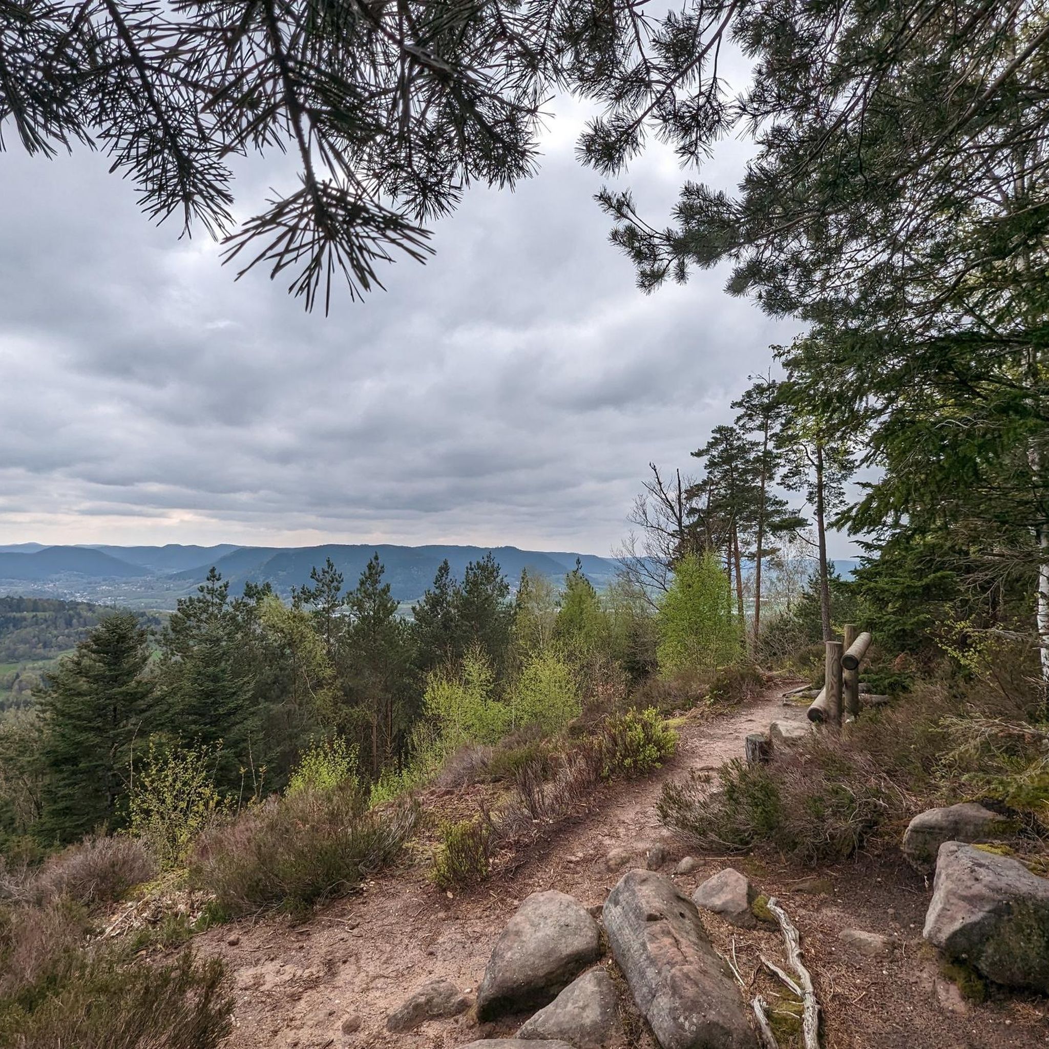
The Roche d’Anozel is located in the Kemberg massif near Saulcy-sur-Meurthe, not far from Saint-Dié-des-Vosges. The striking Vosges sandstone rock is about 740 m high and approximately 15 m high and 20 m wide. An enigmatic inscription on the rock is dated to the year 1402. Particularly interesting is the view over the Meurthe valley and the surrounding Vosges mountains. The Roche is part of a network of well-marked hiking trails.
0
0

Nice, but not really any panorama...
0
0

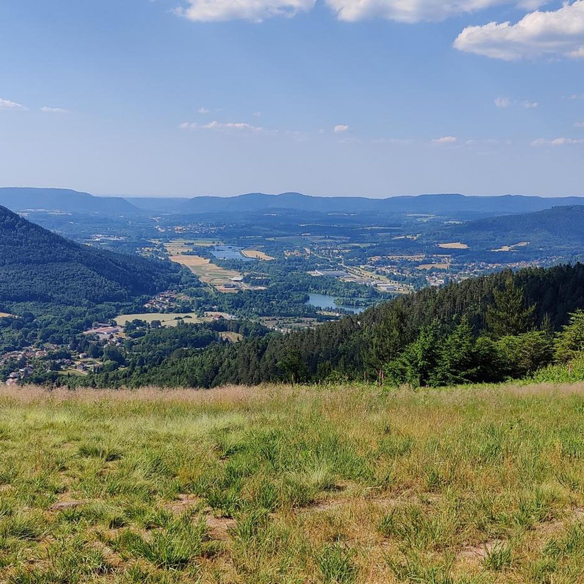
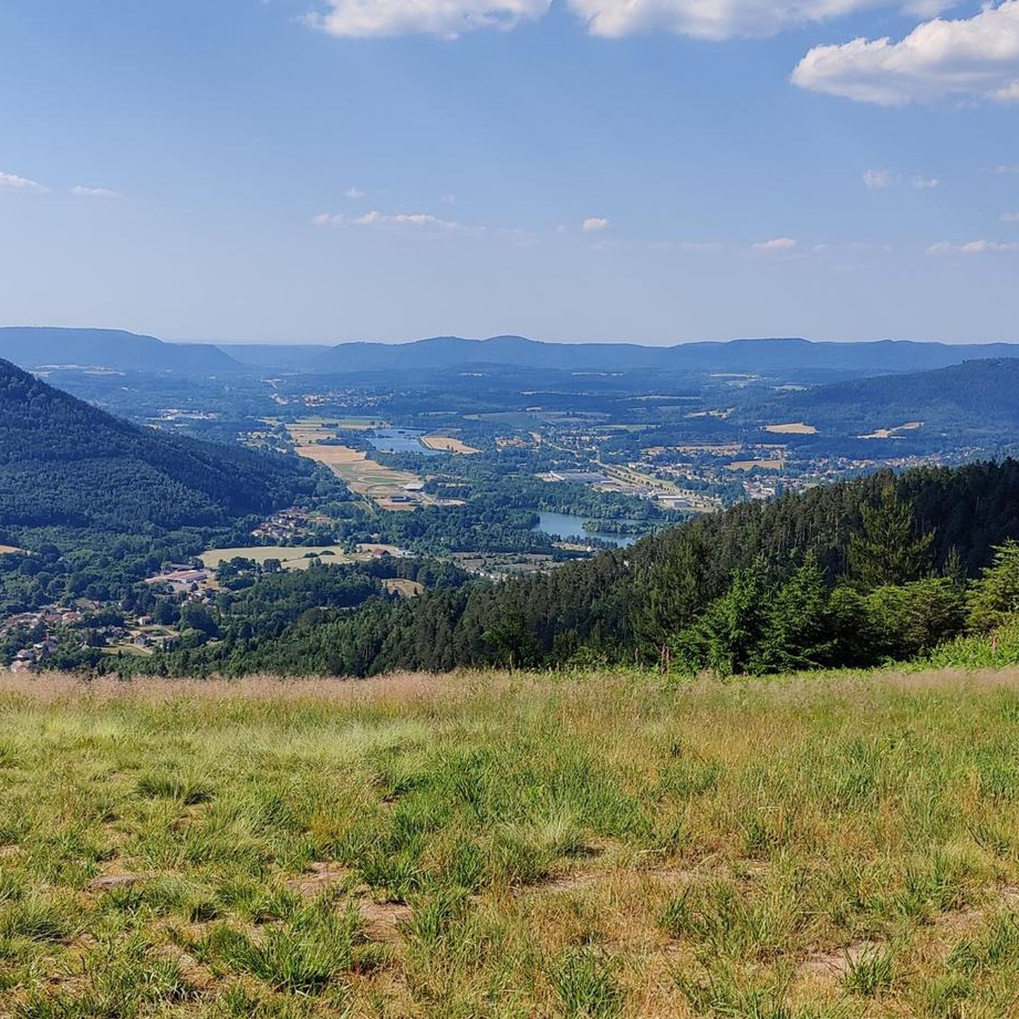
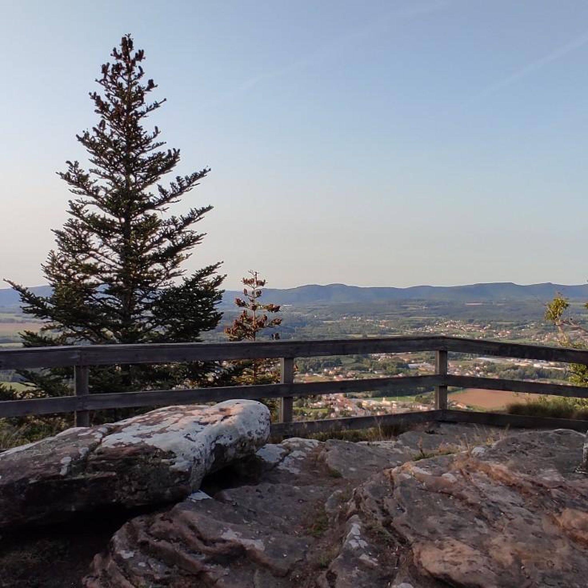
The King's Chair is a wooded rocky promontory overlooking the town of Saint-Dié-des-Vosges. This natural site offers a beautiful view of the Taintroué valley and owes its name to a local legend that tells of Charlemagne's passage.
1
0


Great view of Saint-Dié-des-Vosges
1
0

Emblematic rock of the Kemberg massif, from which the view of the Vosges is clear.
1
0

Large steep rock with south-facing viewing platform.
2
0
Frequently Asked Questions
How many hiking trails are available in Forêt Communale De Saint-Dié-Des-Vosges?
There are 11 hiking routes available in Forêt Communale De Saint-Dié-Des-Vosges. All of these trails are rated as moderate, offering a consistent level of challenge for hikers.
What kind of terrain can I expect when hiking in Forêt Communale De Saint-Dié-Des-Vosges?
The Forêt Communale De Saint-Dié-Des-Vosges is characterized by dense woodlands and varied forest paths. You can expect moderate elevation changes, typical of the Vosges mountains, with trails winding through established forest environments.
Are there any easy hiking trails in Forêt Communale De Saint-Dié-Des-Vosges?
All 11 hiking routes in Forêt Communale De Saint-Dié-Des-Vosges are classified as moderate. While there are no trails specifically rated as 'easy', many of the moderate routes are accessible to those with a reasonable level of fitness, especially the shorter ones.
What are the typical lengths of hikes in Forêt Communale De Saint-Dié-Des-Vosges?
Hikes in this forest vary in length. For example, the The King's Chair loop from La Bolle - Village vacances CAP France is about 4 miles (6.4 km), while the Roche d'Anozel – La Pierre Percée loop from La Bolle - Village vacances CAP France extends to 8.2 miles (13.2 km).
Are there family-friendly hiking options in Forêt Communale De Saint-Dié-Des-Vosges?
Given that all trails are moderate, many can be suitable for families with older children or those accustomed to hiking. Shorter routes like The Source of Solitude – The King's Chair loop from La Bolle - Village vacances CAP France, at 4.8 miles (7.7 km), offer a good balance of length and exploration without being overly strenuous.
Can I bring my dog on the hiking trails in Forêt Communale De Saint-Dié-Des-Vosges?
Generally, dogs are welcome on trails in French communal forests, provided they are kept under control, especially to protect local wildlife. It's always a good idea to keep your dog on a leash and clean up after them.
Are there any circular walks available in Forêt Communale De Saint-Dié-Des-Vosges?
Yes, all the listed routes in Forêt Communale De Saint-Dié-Des-Vosges are circular walks, meaning you'll end up back at your starting point. This includes popular options like The Source of Solitude loop from La Bolle - Village vacances CAP France.
Where can I find good viewpoints along the trails?
Many trails in the region offer scenic spots. The The Source of Solitude – The King's Chair loop from La Bolle - Village vacances CAP France is specifically noted for featuring notable viewpoints, allowing you to enjoy vistas over the forested landscape.
Is there parking available near the trailheads?
Yes, trailheads in communal forests like this typically have designated parking areas. For many routes starting from La Bolle - Village vacances CAP France, parking facilities are usually available on-site or nearby.
What do other hikers say about the trails in Forêt Communale De Saint-Dié-Des-Vosges?
The trails in Forêt Communale De Saint-Dié-Des-Vosges are highly regarded by the komoot community, with an average rating of 4.5 stars from over 800 reviews. Hikers often praise the well-maintained forest paths and the immersive experience within the dense woodlands.
What is the best time of year to hike in Forêt Communale De Saint-Dié-Des-Vosges?
The best time to hike is typically from spring through autumn (April to October) when the weather is mild and the forest is vibrant. Summer offers lush greenery, while autumn brings beautiful fall foliage. Winter hiking is possible, but trails may be snowy or icy, requiring appropriate gear.
Are there any cafes or places to eat near the hiking trails?
While the forest itself is primarily natural, you'll find amenities in nearby Saint-Dié-des-Vosges. Additionally, starting points like La Bolle - Village vacances CAP France may offer facilities or be close to options for refreshments before or after your hike.
What should I wear for hiking in Forêt Communale De Saint-Dié-Des-Vosges?
Given the varied terrain and potential for moderate elevation, wear comfortable, sturdy hiking shoes with good grip. Layered clothing is recommended to adapt to changing weather conditions, and a waterproof jacket is advisable, especially in the Vosges region.
Most popular routes in Forêt Communale De Saint-Dié-Des-Vosges

Get inspired with the komoot mobile app


Explore more
Browse the best Hikes in other regions.
