The best walks and hikes in Twin Peaks Wilderness
4.9
(199)
4,292
hikers
162
hikes
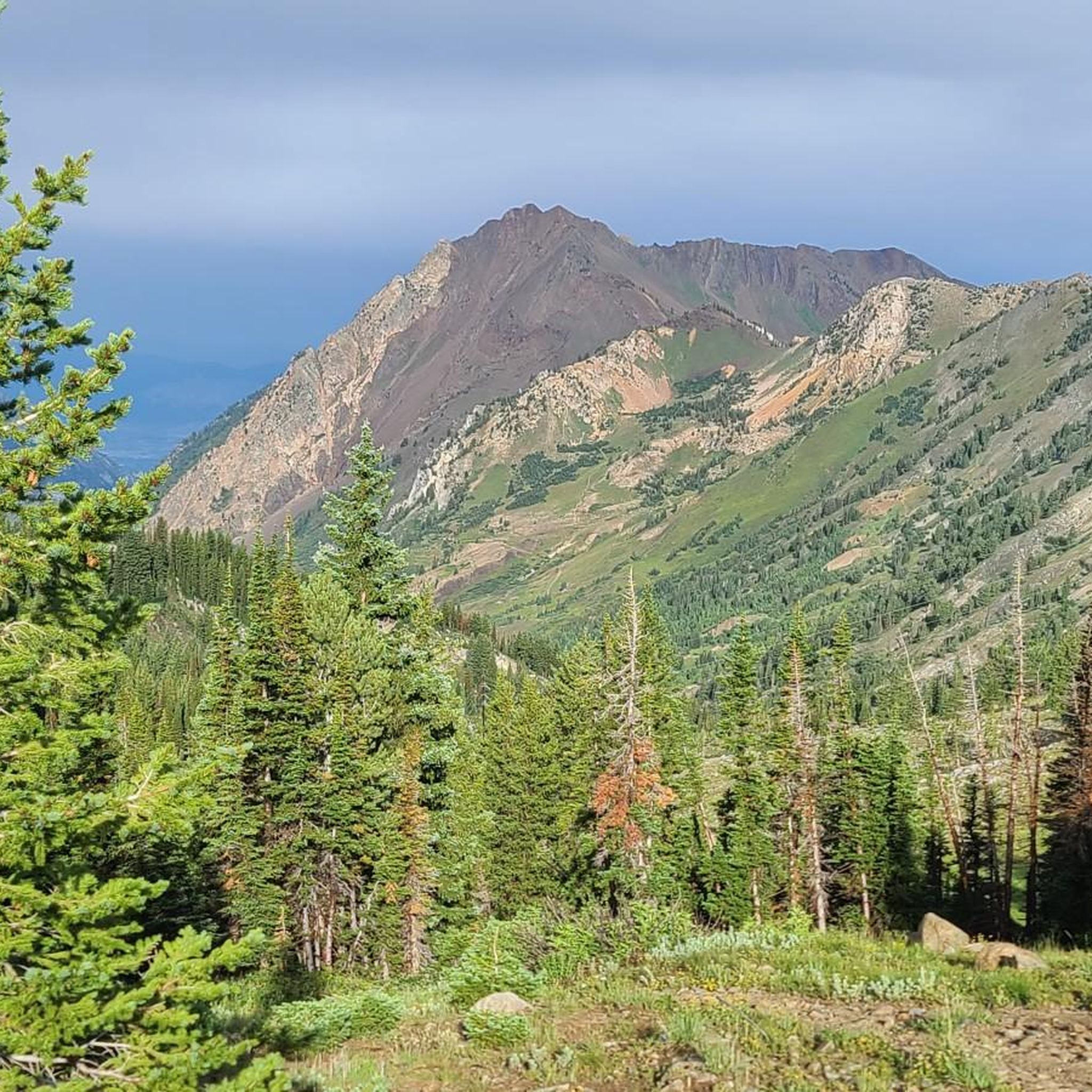
Hikes in Twin Peaks Wilderness Utah are characterized by a rugged and varied landscape within the Uinta-Wasatch-Cache National Forest. The terrain features steep, narrow canyons, high ridges, and glacially-carved cirque basins. Elevations rise significantly from the canyon floors, leading to a number of alpine lakes and prominent peaks.
Best hiking trails in Twin Peaks Wilderness
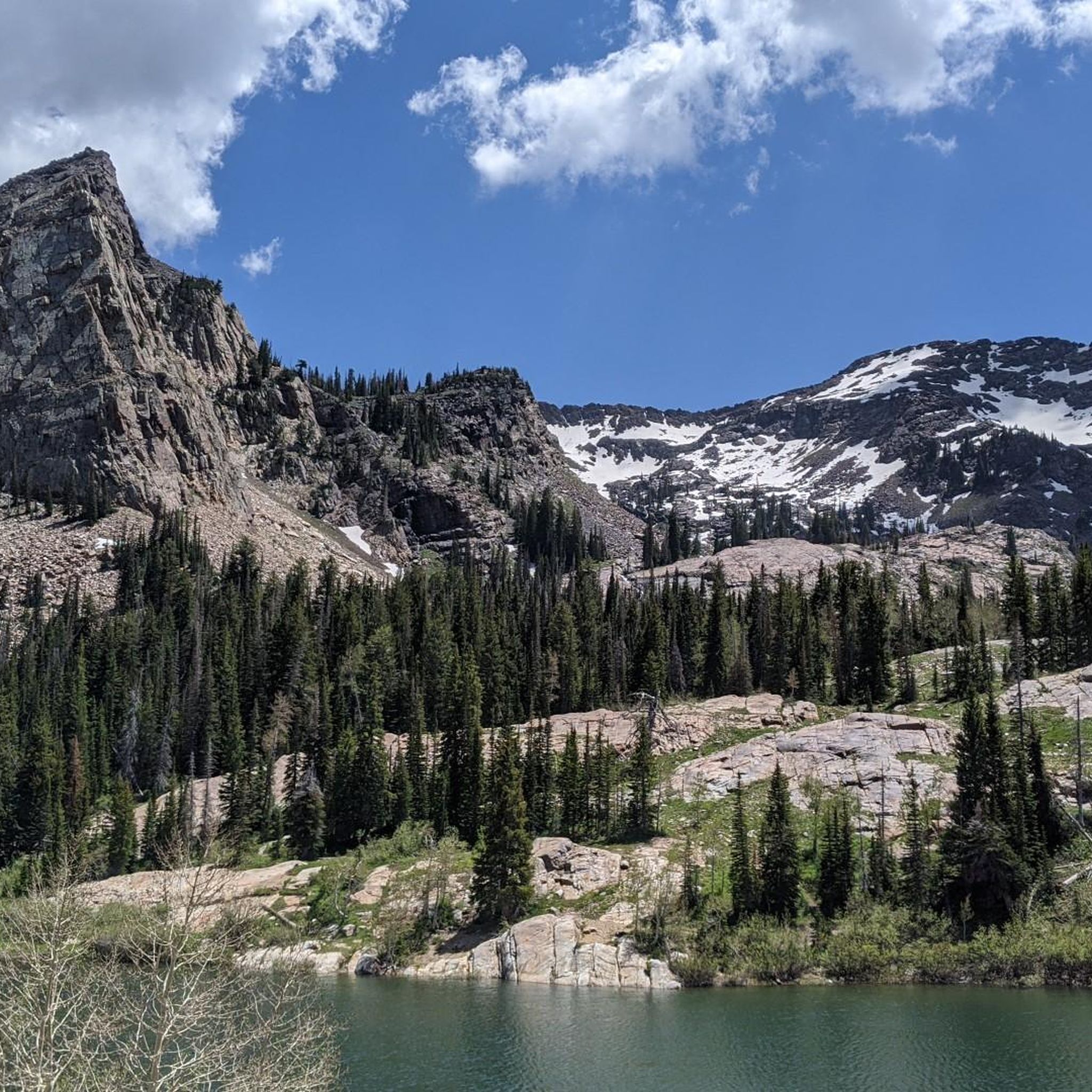
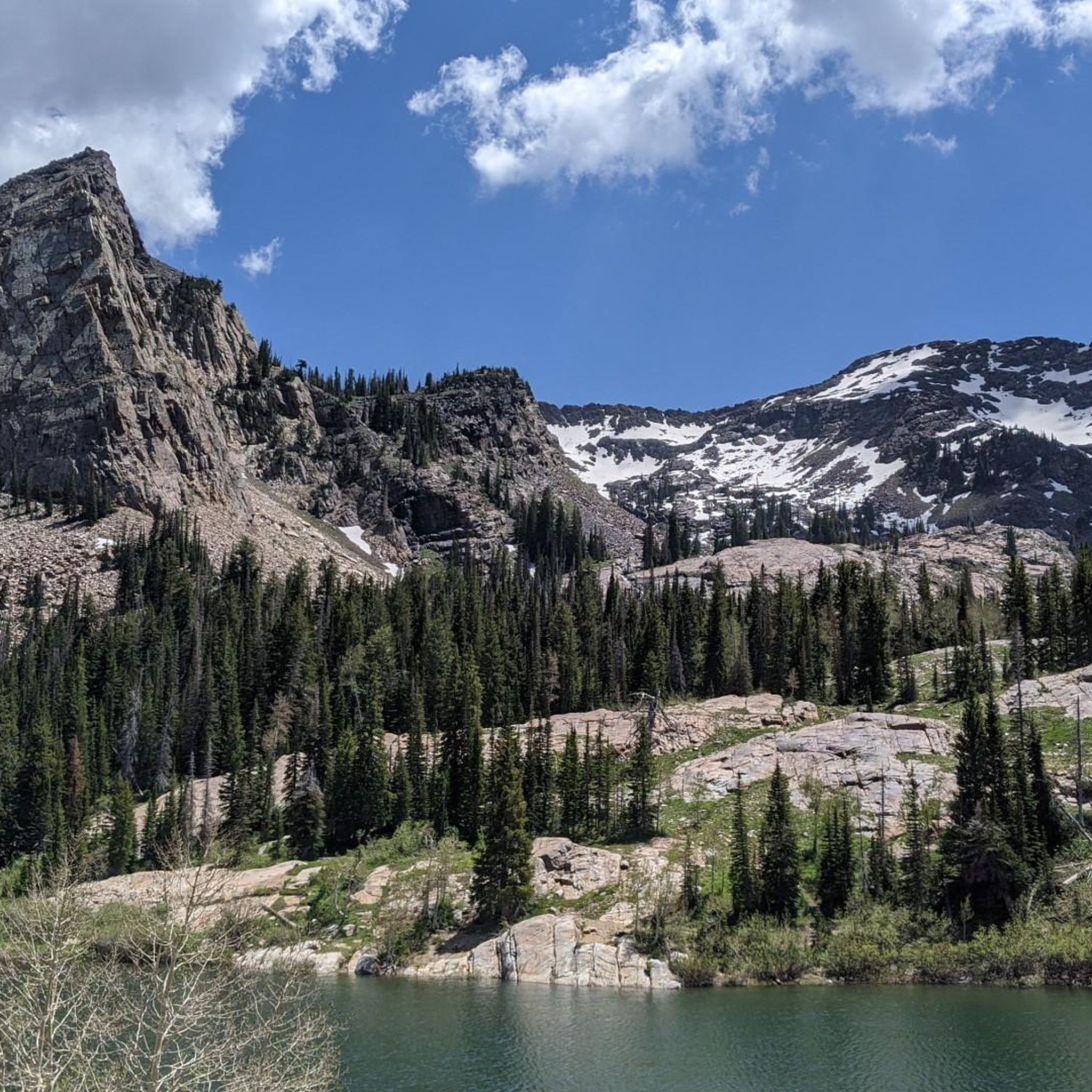
- The most popular hiking route is Lake Blanche — Big Cottonwood Canyon, a 7.0 mile (11.3 km) trail that takes about 5 hours 20 minutes to complete. This difficult hike involves a significant ascent to the alpine Lake Blanche.
- Another top favourite among local hiking enthusiasts is Red Pine Trail — Uinta-Wasatch-Cache National Forest, a moderate 7.7 mile (12.4 km) path. The route follows a steady climb through forest to reach Red Pine Lake.
- Local hiking enthusiasts also love the White Pine Trail — Uinta-Wasatch-Cache National Forest, a 10.3 mile (16.6 km) trail leading through forested canyon terrain, often completed in about 6 hours 40 minutes.
- Hiking in Twin Peaks Wilderness is defined by its high-altitude alpine environment, rocky ridges, and numerous cirque basins. The trail network offers a mix of moderate and difficult routes, with most hikes involving sustained elevation gain.
- The routes in Twin Peaks Wilderness are highly rated by the komoot community with an average score of 4.9 stars from more than 180 reviews. More than 4,000 hikers have used komoot to explore Twin Peaks Wilderness's varied terrain.
Last updated: July 7, 2026
5.0
(1)
30
hikers
10.5km
03:07
310m
370m
Embark on the Little Cottonwood Creek Trail for a moderate 6.5-mile (10.5 km) hike that gains 1011 feet (308 metres) in elevation, usually taking about 3 hours and 6 minutes to complete. As you follow the route, you will enjoy the soothing sounds of the creek, winding through dense forests of pine and aspen. The terrain shifts between smooth dirt paths and rocky sections, offering a varied experience as you continuously gain elevation. Look out for impressive, massive granite boulders, some still showing chisel marks from pioneer mining activities, and enjoy the vibrant waterfalls and cascades, especially during the spring snowmelt.
When planning your visit, be aware that this is a popular multi-use trail. Parking is available at the trailhead, but remember that dogs are not permitted on this route. The canyon is a critical protected watershed area for Salt Lake Valley, so these restrictions help preserve its natural state. While the trail is generally accessible, you might encounter streamlets crossing the path, particularly during warmer months when snowmelt is higher.
This trail offers a rewarding experience through a picturesque canyon within the Uinta-Wasatch-Cache National Forest. The presence of granite boulders with historical chisel marks provides a unique glimpse into the area's past, connecting you to early pioneer activities. The dynamic landscape, shaped by the creek and its cascades, makes this route a notable choice for those seeking both natural beauty and a touch of local history.
5.0
(5)
18
hikers
5.08km
01:36
210m
230m
Embark on an easy hike along the Little Cottonwood Creek Trail, a 3.2-mile (5.1 km) route that winds through the Uinta-Wasatch-Cache National Forest. You will gain 705 feet (215 metres) in elevation, with an estimated duration of 1 hour and 36 minutes. The path follows the soothing sounds of the creek, leading you through dense forests of pine and aspen, where you can spot vibrant wildflowers in late spring and massive granite boulders. It offers a straightforward outdoor adventure with plenty of shade.
When planning your visit, remember that dogs are not permitted on the Little Cottonwood Creek Trail, as the area is a protected watershed. Good hiking boots are recommended, especially during spring when parts of the trail can be wet from snowmelt. Parking is generally available near the trailheads, making access convenient for your outing.
This trail is notable for its unique geological features, including granite boulders that still bear chisel marks from early pioneers. Keep an eye out for small waterfalls and cascades, particularly when the snow is melting in spring, adding to the scenic beauty of the route. The trail provides a peaceful escape into nature, showcasing the natural history of the region.

Sign up for free
7
hikers
2.02km
00:48
240m
20m
Embark on the Mill B North Fork Trail to Overlook, an easy hiking route spanning 1.3 miles (2.0 km) with an elevation gain of 783 feet (239 metres). You can expect to complete this journey in about 48 minutes. The trail begins with stairs and switchbacks, leading you through shaded areas filled with pines and aspens. A short distance in, you will discover Hidden Falls, a beautiful waterfall, before the path opens up to offer glimpses of the canyon and the wider Salt Lake Valley.
This trail is accessible year-round from the S-curve in Big Cottonwood Canyon, making it a convenient option for a quick outdoor escape. While the path is generally well-maintained, be aware that winter conditions can bring slush and deeper snow. If you plan to visit during colder months, consider bringing snowshoes or microspikes to navigate the terrain safely.
The Mill B North Fork Trail is nestled within the Uinta-Wasatch-Cache National Forest, offering a rewarding experience for its relatively short length. The highlight is the Mill B Overlook, which provides panoramic vistas down into Big Cottonwood Canyon. This route is a great way to experience the natural beauty of the area and enjoy impressive views without committing to a full-day excursion.
1
hikers
3.30km
01:28
480m
0m
Hike the moderate Ferguson Canyon Trail for 2.1 miles (3.3 km) to gain 1585 feet (483 metres) and enjoy panoramic Salt Lake Valley views.
10.2km
04:56
1,150m
150m
Hike the difficult 6.3-mile Gad Valley to American Fork Twin Peaks trail, gaining 3782 feet to Salt Lake County's highest point.
Get access to more routes and recommendations from other explorers.
Sign up for free
Already have an account?
Our route recommendations are based on thousands of hikes, rides, and runs completed by other people on komoot.
Start today with a free account
Your next adventure awaits.
Login or Signup
Tips from the Community

This overlook is a short detour off the main Mill B Trail but worth the stop. It provides breathtaking views of Big Cottonwood Canyon, beautiful trees and a big sky!
0
0
Hidden Falls is an easily accessible waterfall in Big Cottonwood Canyon. It’s a beautiful and relaxing spot and an easy hike you can do with the whole family.
0
0
Frequently Asked Questions
Are dogs allowed in the Twin Peaks Wilderness?
No, dogs are generally not permitted on the trails within the Twin Peaks Wilderness. Much of the area is part of the protected Salt Lake City Watershed, which has strict regulations to protect water quality. This includes prohibiting domestic animals like dogs and horses in many of the main canyons, such as Big and Little Cottonwood Canyons where popular trailheads are located.
What is the best time of year to hike in the Twin Peaks Wilderness?
The prime hiking season is from July to September. During these summer months, the trails are typically free of snow, the weather is warmer, and the alpine wildflowers are in bloom. Early summer can still have significant snowpack at higher elevations, while fall offers cooler temperatures and beautiful foliage. Winter is reserved for experienced individuals with proper gear for snowshoeing or backcountry skiing.
Are there any easy, family-friendly hikes in the area?
While the Twin Peaks Wilderness is known for its steep and strenuous trails, there are some more manageable options suitable for families or those seeking a less demanding walk. The Mill B North Trail to Mill B Overlook is a great choice, offering rewarding views without a major ascent. It's a shorter route that provides a good taste of the region's scenery.
How many hiking trails are available in the Twin Peaks Wilderness?
There are over 120 hiking routes to explore throughout the Twin Peaks Wilderness. These range from short, accessible walks to strenuous, multi-hour climbs to alpine lakes and peaks, offering a wide variety of options for different skill levels.
What do other hikers enjoy most about the Twin Peaks Wilderness?
The area is highly rated by the komoot community. Reviewers frequently praise the dramatic alpine scenery, the challenging but rewarding climbs, and the stunning views of picturesque lakes like Lake Blanche, Lake Florence, and Lake Lillian. The sense of rugged wilderness so close to Salt Lake City is a major highlight.
Are there any hikes that lead to alpine lakes?
Yes, hiking to alpine lakes is one of the signature experiences in this wilderness. The Maybird Gulch and Maybird Lakes trail is a challenging but beautiful route that leads you into a classic glacial cirque containing several pristine lakes.
What should I know about parking at the trailheads?
Parking can be very limited, especially on weekends and holidays at popular trailheads like those for Lake Blanche and in Little Cottonwood Canyon. It is highly recommended to arrive early in the morning to secure a spot. Carpooling is also a great option to reduce congestion.
Can I go backpacking in the Twin Peaks Wilderness?
Yes, backpacking is a popular activity for experienced hikers. The rugged terrain offers opportunities for multi-day trips, but there are few established loop trails. Most backpackers create out-and-back or point-to-point routes. Be sure to practice Leave No Trace principles and be prepared for steep ascents and variable mountain weather.
What kind of wildlife might I see?
The wilderness supports a variety of wildlife. While sightings are not guaranteed due to the proximity to urban areas, you may encounter mule deer, pikas, and marmots. Mountain goats are often seen on the high, rocky ridges. Less commonly, you might spot moose, black bears, or mountain lions, so it's important to be aware and store food properly.
Are there opportunities for winter hiking?
Winter transforms the Twin Peaks Wilderness into a destination for snowshoeing and backcountry skiing. Many of the summer hiking trails become popular winter routes. However, this requires proper avalanche safety knowledge, training, and equipment, as the steep canyon terrain is prone to avalanches. Always check the Utah Avalanche Center forecast before heading out.
What is the terrain like on a typical hike?
Most hikes in the Twin Peaks Wilderness involve significant and sustained elevation gain. Trails are often steep, rocky, and strenuous. You'll typically start in forested canyons with oak and maple trees, ascending through fir and aspen groves before reaching the exposed, alpine terrain of the high peaks and cirque basins.
Most popular routes in Twin Peaks Wilderness

Get inspired with the komoot mobile app


Explore more
Browse the best Hikes in other regions.
