The best cycling routes around Collegeville
4.7
(55)
883
riders
36
rides
Touring cycling routes around Collegeville, Pennsylvania, are defined by an extensive network of multi-use trails, including the Perkiomen Trail and its connection to the Schuylkill River Trail. The landscape features a mix of wooded areas, open fields, and riverside paths along the Perkiomen Creek. The region includes various parks and natural areas, offering diverse terrain from relatively flat rail trails to routes with moderate elevation changes.
Best touring cycling routes around Collegeville
- The most popular touring cycling route is Steep Climb on Perkiomen Trail loop from Collegeville, a 14.1 miles (22.6 km) trail that takes 1 hour 37 minutes to complete. This route leads through wooded sections and alongside the Perkiomen Creek.
- Another top favourite among local touring cyclists is Perkiomen Trail – Lower Perkiomen Valley Park loop from Collegeville, an easy 10.0 miles (16.1 km) path. This route offers scenic views along the Perkiomen Trail, passing through Lower Perkiomen Valley Park.
- Local touring cyclists also love the View from Sullivan's Bridge – Schuylkill River Trail loop from Audubon, a 31.2 miles (50.3 km) trail leading through riverside paths and varied park landscapes, often completed in about 2 hours 57 minutes.
- Touring cycling around Collegeville is defined by multi-use rail trails, riverside paths along the Perkiomen Creek, and varied park landscapes. The network offers options for different ability levels, from easy, flat sections to routes with more significant climbs.
- The routes in Collegeville are highly rated by the komoot community with an average score of 4.7 stars from over 40 reviews. More than 800 touring cyclists have used komoot to explore Collegeville's varied terrain.
Last updated: June 29, 2026
4.8
(8)
132
riders
50.3km
02:58
150m
150m
Moderate bike ride. Good fitness required. Mostly paved surfaces. Suitable for all skill levels.
5.0
(2)
55
riders
41.7km
03:10
200m
200m
Moderate bike ride. Good fitness required. Mostly paved surfaces. Suitable for all skill levels.

Sign up for free
5.0
(2)
53
riders
25.0km
01:44
180m
180m
Moderate bike ride. Good fitness required. Mostly paved surfaces. Suitable for all skill levels.
4.5
(2)
32
riders
26.4km
01:43
210m
210m
Moderate bike ride. Good fitness required. Mostly paved surfaces. Suitable for all skill levels.
4.5
(2)
19
riders
53.0km
03:47
420m
420m
Moderate bike ride. Good fitness required. Mostly paved surfaces. Suitable for all skill levels.
Get access to more routes and recommendations from other explorers.
Sign up for free
Already have an account?
Our route recommendations are based on thousands of hikes, rides, and runs completed by other people on komoot.
Start today with a free account
Your next adventure awaits.
Login or Signup



Tips from the Community

The Schuylkill Center for Environmental Education is a 365-acre park with over three miles of trails. The space is known for its environmentally-focused art installations and ecological restoration efforts.
0
0

The Schuylkill River Trail, a multi-use path extending from Frackville in Schuylkill County through Montgomery, Chester, and Berks counties to Philadelphia, traverses the historically rich southeastern Pennsylvania region. The trail winds through rural, agricultural, suburban, urban, and industrial areas. It is a rail trail with over 75 miles of the trail being paved or surfaced with crushed stone and open to the public. Managed and developed by the Schuylkill River Trail Partners, there are ongoing plans to extend the trail.
0
0

The Lower Perkiomen Valley Park is a 107 acre park in Upper Providence Township. From the park, there is access to the Perkiomen Trail, great views of the Perkiomen Creek and several nature trails.
0
0
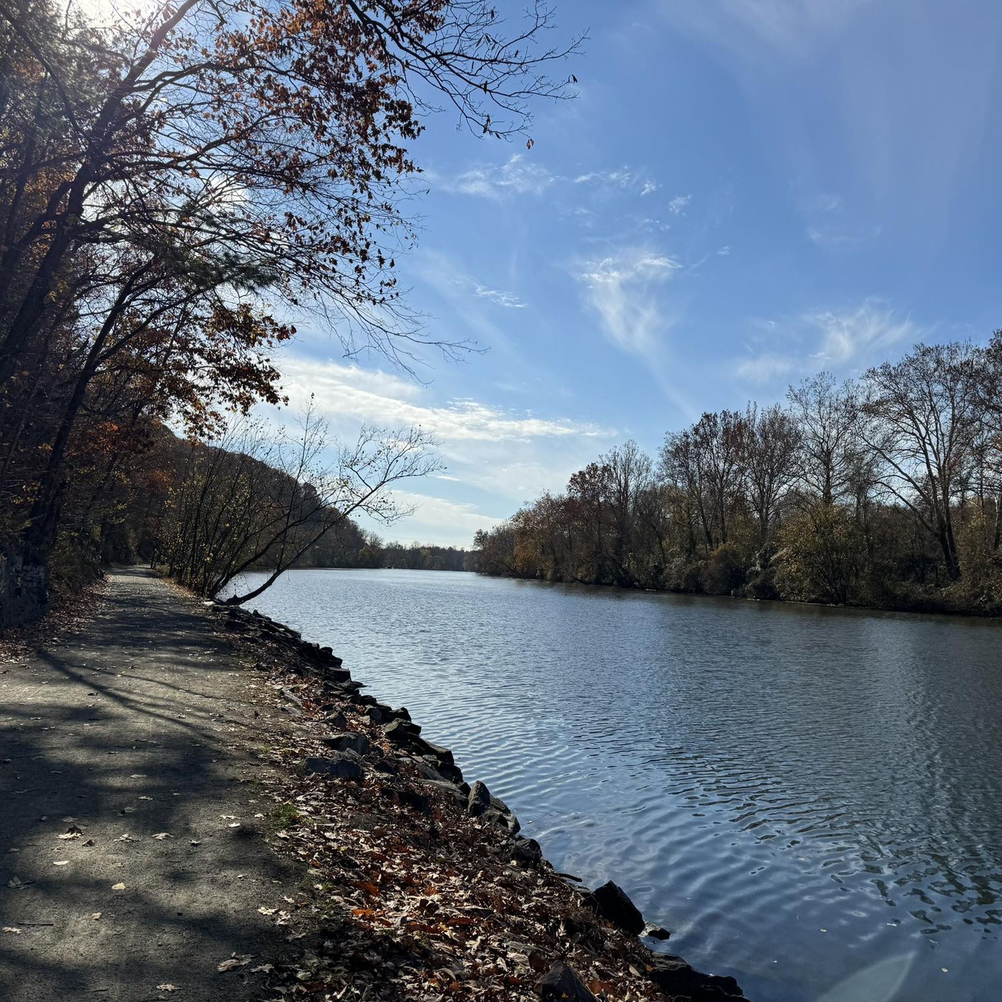
The Perkiomen Trail is a 20-mile-long trail that follows the Perkiomen Creek. It is popular with cyclists, hikers and runners. The surface is mostly crushed stone, but there are some paved sections.
0
0

Red Trail follows along the northern edge of the reservoir and is a gem for novice riders.
0
0

Knight Road dissects the Green Lane Reservoir and Perkiomen Creek. With water on either side of the road, it is a beautiful section to ride, with a lot to see.
0
0

Knight Lake is an extension of Deep Creek Lake, east of the Deep Creek Dam. There are day use areas, picnic tables and other amenities around the lake, making it a nice spot for a rest and family activities.
0
0

Perkiomen Creek has a meandering flow, forming different coves in the Green Lane Reservoir, such as Snowflake Cove. The Cove sits along the Blue Trail, forming a little beach surrounded by forest. It can be very scenic during autumn with the golden colors contrasting with the emerald green water.
0
0
Frequently Asked Questions
How many touring cycling routes are available in Collegeville?
There are over 35 touring cycling routes around Collegeville, offering a variety of experiences for different skill levels. These routes are highly rated by the komoot community, with an average score of 4.8 stars.
What kind of terrain can I expect on touring cycling routes around Collegeville?
The terrain primarily features multi-use rail trails and riverside paths, notably the Perkiomen Trail and Schuylkill River Trail. You'll find a mix of crushed gravel and paved sections, traversing wooded areas, open fields, and scenic bends along the Perkiomen Creek. While many routes are relatively flat, some, like the Steep Climb on Perkiomen Trail loop from Perkiomen Township, incorporate more significant elevation changes.
Are there any easy touring cycling routes suitable for beginners or families?
Yes, Collegeville offers several easy routes perfect for beginners or family outings. The Lower Perkiomen Valley Park – Perkiomen Trail loop from Cromby is an easy 16.3-mile path offering scenic views along the Perkiomen Trail. Another great option is the Steep Climb on Perkiomen Trail loop from Collegeville, which is 14.1 miles and leads through wooded sections and alongside the Perkiomen Creek.
Can I connect to longer trail systems from Collegeville?
Absolutely. A significant advantage for touring cyclists in Collegeville is the Perkiomen Trail's seamless connection to the Schuylkill River Trail in Oaks. This junction opens up vast possibilities for longer rides, allowing you to explore destinations like the historic Valley Forge National Historical Park and other areas along the extensive 82-mile Schuylkill River Trail.
What natural features or scenic views can I expect along the cycling routes?
Cycling routes in Collegeville offer diverse natural beauty. You'll frequently ride alongside the picturesque Perkiomen Creek, enjoying pleasant riverside views. The trails pass through wooded areas, open fields, and parks such as Lower Perkiomen Valley Park and Central Perkiomen Valley Park. The Skippack Creek loop from Collegeville provides views of the Skippack Creek, which has sculpted ridges and valleys.
Are there any historical landmarks or attractions accessible from the cycling routes?
Yes, the area around Collegeville is rich in history and natural attractions. The connection to the Schuylkill River Trail allows access to the historic Valley Forge National Historical Park. Along the trails, you can find points of interest such as the National Memorial Arch, various Ruins, and the Site of General Muhlenberg's Brigade. The John James Audubon Center at Mill Grove, known for its birdlife, is also easily reachable via a connector from the Schuylkill River Trail.
Are the touring cycling routes around Collegeville suitable for dogs?
Many multi-use trails in the Collegeville area, including sections of the Perkiomen Trail and Schuylkill River Trail, are generally dog-friendly. However, it's always recommended to keep dogs on a leash and ensure you clean up after them. Specific park regulations may vary, so check local signage for any restrictions.
What is the best time of year to go touring cycling in Collegeville?
Collegeville offers enjoyable touring cycling experiences throughout much of the year. Spring and fall provide pleasant temperatures and beautiful scenery, with changing foliage in autumn. Summer is also popular, though it can be warmer, making shaded sections of trails along the Perkiomen Creek particularly appealing. Winter cycling is possible, but be mindful of potential ice or snow on trails.
Are there any circular touring cycling routes in the Collegeville area?
Yes, many of the popular touring cycling routes around Collegeville are designed as loops. For instance, the Steep Climb on Perkiomen Trail loop from Perkiomen Township and the Fitzwater Station – Rapps Dam Covered Bridge loop from Collegeville are excellent circular options, allowing you to start and end at the same point.
Where can I park when visiting the touring cycling trails in Collegeville?
Access points to the Perkiomen Trail and Schuylkill River Trail often have designated parking areas. Lower Perkiomen Valley Park, where the two trails meet, is a popular and convenient access point with parking. Various trailheads along the Perkiomen Trail also offer parking facilities. It's advisable to check specific trail maps or park websites for detailed parking information.
Are there any routes that offer a more challenging touring cycling experience?
While many routes are relatively easy, Collegeville does offer options for more challenging touring. The Fitzwater Station – Rapps Dam Covered Bridge loop from Collegeville is classified as a difficult route, covering over 46 miles with significant elevation gain, providing a robust challenge for experienced cyclists.
What are the main differences between the Perkiomen Trail and the Schuylkill River Trail near Collegeville?
The Perkiomen Trail, often called 'The Perky,' is a 20-mile multi-use rail trail running directly through Collegeville, following the Perkiomen Creek. It offers a mix of crushed gravel and paved sections with a relatively easy journey. The Schuylkill River Trail (SRT), which connects to the Perkiomen Trail in Oaks, is a much longer, impressive multi-use path stretching over 82 miles through southeastern Pennsylvania, offering diverse landscapes from rural to urban settings, largely built upon former railroad lines. Both are excellent for touring, with the SRT providing options for significantly longer journeys.
Most popular attractions around Collegeville

Get inspired with the komoot mobile app


Explore more
Browse the best Cycling routes in other regions.
