The best walks and hikes around Collegeville
4.7
(23)
387
hikers
37
hikes
Hiking trails around Collegeville offer a mix of creek-side paths, rolling hills, and woodland routes. The region is characterized by the Perkiomen and Skippack Creeks, which have shaped the local landscape into gentle valleys and low ridges. Many routes follow former railroad lines, providing level gravel or paved surfaces, while others explore the forests and meadows of nearby state and local parks. The area features wooded views, open fields, and mature woodlands, providing diverse environments for exploration.
Best hiking trails around Collegeville
- The most popular hiking route is Skippack Creek Loop Trail, a 5.4 miles (8.8 km) trail that takes about 2 hours 20 minutes to complete. This route offers varied landscapes and opportunities for wildlife sightings within Evansburg State Park.
- Another top favourite among local hikers is Zacharias Creek Trail, a moderate 5.0 miles (8.1 km) path. This trail provides scenic views along the creek within Heebner Park.
- Local hikers also love the Grand Parade Trails, a 3.3 miles (5.3 km) trail leading through wooded sections and open fields, often completed in about 1 hour 24 minutes.
- Hiking around Collegeville is defined by riverside paths along the Perkiomen and Skippack Creeks, forested sections in state parks, and level multi-use trails. The network provides options for both easy family-friendly hikes and more moderate routes with some elevation.
- The routes in Collegeville are highly rated by the komoot community with an average score of 4.7 stars from over 20 reviews. More than 400 hikers have used komoot to explore Collegeville's varied terrain.
Last updated: June 28, 2026
4.5
(4)
45
hikers
8.78km
02:19
70m
90m
Embark on the Skippack Creek Loop Trail for a refreshing hike through Evansburg State Park. This moderate route spans 5.5 miles (8.8 km) and involves a gentle elevation gain of 243 feet (74 metres), typically taking about 2 hours and 18 minutes to complete. As you follow the path, you will wind alongside the picturesque Skippack Creek, moving through pleasant pine forests and encountering varied terrain that includes single-track sections and gravel roads. Keep an eye out for wooden bridges and the tranquil water views that define much of this journey.
When planning your visit, be aware that the trail can become muddy, especially after rainfall or during the spring season. You might also encounter a stream crossing that could be more challenging in wetter conditions. Parking is generally available within Evansburg State Park, making access straightforward. Remember that certain parts of the route require walking on public roads, so exercise caution and stay alert to active traffic in those areas.
Beyond the natural beauty, the Skippack Creek Loop Trail offers glimpses into the area's past. As you hike along the creek, you may spot old ruins, hinting at the historical layers embedded within Evansburg State Park. This loop design allows you to experience a diverse range of scenery and features without retracing your steps, providing a comprehensive exploration of the park's unique blend of nature and history.
8
hikers
2.25km
00:34
10m
0m
The Limerick Community Park Loop offers a wonderfully accessible and easy experience, perfect for a casual stroll or a family outing. You'll follow a wide, paved path that winds through the park, passing by various sports fields and offering views of the local ecosystem. With a distance of just 1.4 miles (2.2 km) and a mere 22 feet (7 metres) of elevation gain, this hike takes about 34 minutes, making it ideal for strollers and young children.
Planning your visit is straightforward, as the park provides convenient parking right at the trailhead. You'll also find restrooms, sports courts, and picnic pavilions on site, adding to the park's appeal. Keep in mind that some parts of the loop are unshaded, so bringing sun protection is a good idea, especially if you're visiting during warmer months.
This loop is part of the larger 70-acre Limerick Community Park, which boasts amenities like the popular Manderach Memorial Playground, featuring a large tower with two gigantic tube slides. The park is also actively working to connect existing segments into an 8-mile community trail system, highlighting its commitment to outdoor recreation in Montgomery County.

Sign up for free
5
hikers
5.31km
01:24
40m
50m
The Grand Parade Trails offer an easy 3.3-mile (5.3 km) loop that takes you through a truly unique desert landscape, perfect for beginners or a relaxing family outing. With only 136 feet (41 metres) of elevation gain, you can comfortably complete this hike in about 1 hour and 23 minutes, exploring wide, sandy paths that wind past junipers and pinyon pines. The highlight is undoubtedly the chance to see several of Kodachrome Basin's distinctive "sedimentary pipes" and explore two fascinating box canyons, making for a memorable experience.
Planning your visit to the Grand Parade Trails means heading into Kodachrome Basin State Park. While specific trailhead parking isn't detailed, you'll find ample parking within the state park. To make the most of your hike, especially in the desert, consider going during the cooler parts of the day or year, like early mornings or the shoulder seasons, and always bring plenty of water.
What truly sets this trail apart are its geological wonders, including the mysterious 67 "sedimentary pipes" that dot the landscape, some rising dramatically from the canyon floor. You'll also encounter a free-standing 50-70 foot rock geyser and walk alongside impressive red-rock cliffs of Entrada sandstone. It's a fantastic opportunity to witness the unique natural history of the region up close.
4
hikers
8.13km
02:06
30m
60m
The Zacharias Creek Trail offers a moderate hike spanning 5.1 miles (8.1 km), with a gentle elevation gain of 89 feet (27 metres). You can expect to complete it in about 2 hours and 5 minutes. As you hike, the path winds through riparian woods and open green fields, following Zacharias Creek. You will encounter varied terrain, including paved sections, boardwalks, and crushed stone paths. Keep an eye out for glimpses of a stately mansion and a Veterans' Memorial as you pass through woods and scrublands near Heebner Park.
Planning your visit to the Zacharias Creek Trail is straightforward. You will find convenient parking available at both the Green Hill Road entrance and within Heebner Park itself. Heebner Park also provides useful amenities, such as restrooms, picnic tables, and a playground, making it a good starting point for your adventure. Consider beginning your hike here to take advantage of these facilities.
This trail is notable for its very scenic experience, offering an accessible route for hikers of varying skill levels. The path's diverse surfaces, from paved sections to boardwalks, add to the engaging nature of the walk. It provides a pleasant escape into nature within Heebner Park, allowing you to enjoy both natural beauty and historical markers.
2
hikers
1.14km
00:18
10m
20m
Step back in time on the Washington's Headquarters Loop, an easy 0.7-mile (1.1 km) hiking trail that winds through the historic grounds of Valley Forge National Historical Park. With only 42 feet (13 metres) of elevation gain, this route offers a gentle stroll across grassy paths and gravel walkways, providing a tangible connection to the past amidst meadows and woodlands. It's a perfect, quick outing for families and history enthusiasts, taking roughly 18 minutes to complete.
To make the most of your visit, plan to go between March and November when the Washington's Headquarters building is typically open for tours. The trail is easily accessible within Valley Forge National Historical Park, and it's a dog-friendly option, provided your canine companion stays on a leash. This makes it an excellent choice for a relaxed historical walk with minimal planning required.
The primary point of interest is, of course, Washington's Headquarters itself, where George and Martha Washington resided during the harsh winter encampment of 1777-1778. Beyond the headquarters, you can explore the surrounding grounds and envision the lives of Continental Army soldiers, with reconstructed huts nearby. This loop is a key part of the larger Valley Forge Encampment Tour, offering a concise yet impactful historical experience.
Get access to more routes and recommendations from other explorers.
Sign up for free
Already have an account?
Our route recommendations are based on thousands of hikes, rides, and runs completed by other people on komoot.
Start today with a free account
Your next adventure awaits.
Login or Signup



Tips from the Community

George Washington's headquarters during the encampment at Valley Forge.
0
0

Varnum's Quarters is a two-story stone house on the property. The Stephens family owned the house, but General Varnum and six of his staff quartered in the house during part of the war.
0
0
Varnum's Quarters is a two-story stone house on the property. The Stephens family owned the house, but General Varnum and six of his staff quartered in the house during part of the war.
0
0

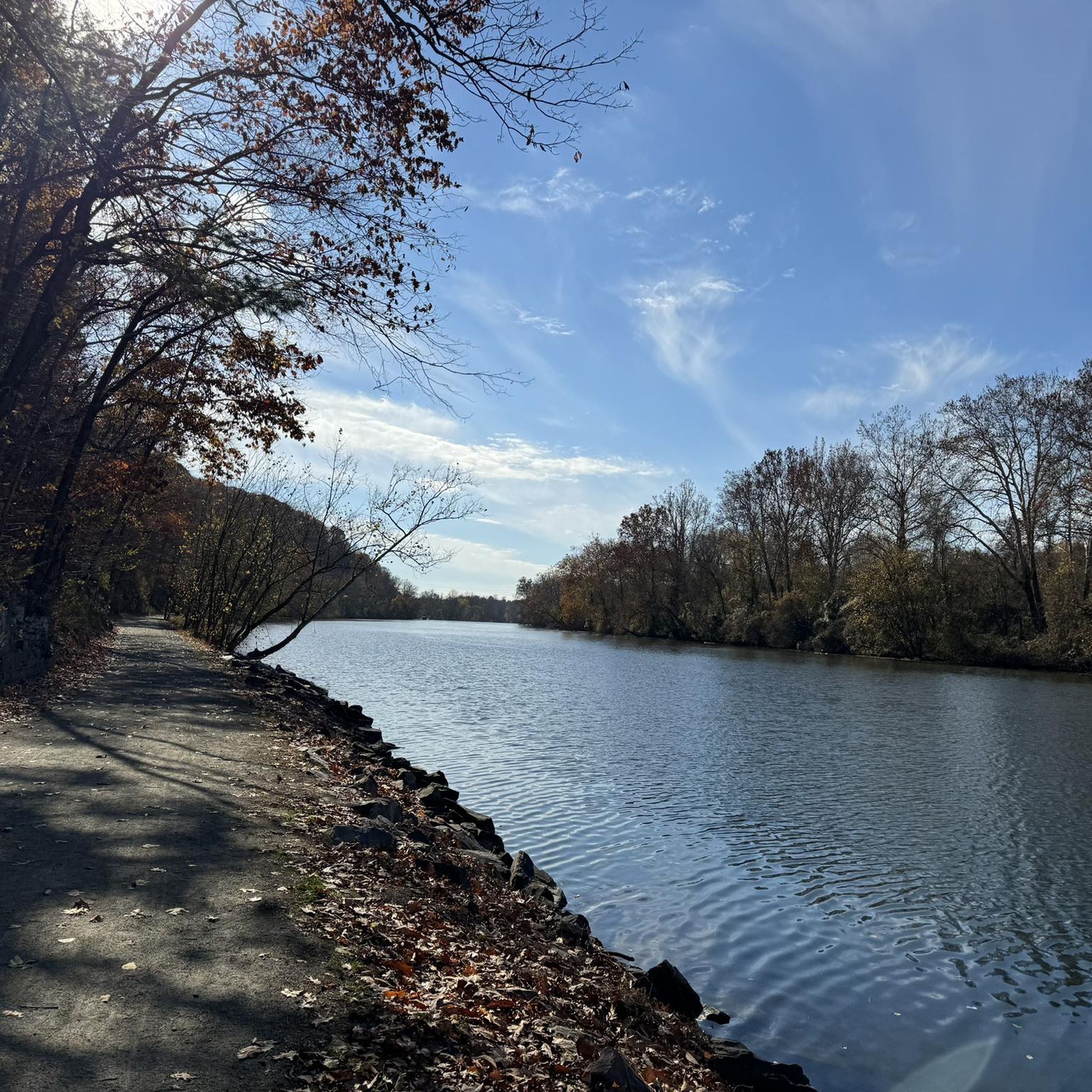
Best section of this loop hike was along the eastern side of Skippack Creek. The trail was littered with fallen leaves and being elevated above the creek, it allowed for better views.
1
0
Frequently Asked Questions
Are the hiking trails around Collegeville suitable for dogs?
Yes, many trails in the Collegeville area are dog-friendly, but policies can vary. Evansburg State Park and Norristown Farm Park are popular with dog walkers, though you must keep your dog on a leash. Always check the specific regulations for the park you plan to visit before you go.
What are some good, easy hikes for families with children?
The region has many options for family outings. The River Trail loop from Valley Forge is a great choice, offering a mostly flat path along the water that's manageable for little legs. The Perkiomen Trail is also excellent for families due to its level surface and numerous access points.
Where can I find a good circular walk near Collegeville?
For a scenic loop, consider the General von Steuben Statue – Varnum's Quarters loop from Valley Forge. This route offers a mix of historical sights and natural landscapes within Valley Forge National Historical Park, creating a varied and engaging walk without needing to backtrack.
How difficult are the trails in Evansburg State Park?
Evansburg State Park offers more rugged terrain compared to the flat Perkiomen Trail. The trails here, shaped by Skippack Creek, feature more ridges, valleys, and elevation changes. While many routes are still considered moderate, they provide a more challenging and traditional hiking experience with varied woodland and meadow paths.
What is the Perkiomen Trail like?
The Perkiomen Trail is a 19-mile multi-use path that follows a former railroad line, making it mostly flat with a gravel or paved surface. It runs along the scenic Perkiomen Creek, connecting several parks and towns. It's ideal for walking, jogging, and cycling, offering easy access and picturesque views.
Is it possible to hike in the Collegeville area during winter?
Yes, winter hiking is popular in the area. The flatter, wider paths like the Perkiomen Trail are often accessible and provide beautiful, stark scenery. Trails in parks like Evansburg State Park remain open, but can be icy or muddy. It's always best to wear appropriate footwear with good traction.
Are there any hikes with waterfalls near Collegeville?
The geology of the Collegeville area is characterized by gentle creeks and rolling hills rather than dramatic drops in elevation, so large waterfalls are not a common feature on local trails. Hikes here focus more on serene creek-side scenery, woodlands, and meadows.
Where is the best place to park for hiking?
Parking is available at numerous trailheads and parks. For the Perkiomen Trail, the Graterford Trailhead is a well-regarded access point. Evansburg State Park has several parking areas, such as the one off Mayhall Road, which provides access to the Skippack Creek Loop. Valley Forge National Historical Park also has multiple large lots near its main visitor center and key trailheads.
What do other hikers enjoy about the trails around Collegeville?
The trails around Collegeville are highly rated by the komoot community. Reviewers often praise the well-maintained paths, especially the mix of paved multi-use trails and more natural woodland routes. The scenic views along the Perkiomen and Skippack Creeks are frequently mentioned as a highlight.
Are the trails free to access?
Yes, the vast majority of hiking trails in and around Collegeville, including the Perkiomen Trail, Evansburg State Park, and Valley Forge National Historical Park, are free to access for hiking and walking. There are no entrance fees for these parks.
How many hiking trails are there in the Collegeville area?
There are over 15 designated hiking routes around Collegeville on komoot, ranging from easy walks to more moderate treks. This network includes paths in local parks, state parks, and the extensive Perkiomen Trail, offering plenty of options to explore.
Most popular attractions around Collegeville

Get inspired with the komoot mobile app


Explore more
Browse the best Hikes in other regions.
