The best walks and hikes around Andrews Afb
9
hikers
7
hikes
Hikes around Andrews Afb explore a landscape of woodlands, wetlands, and river valleys. The region is characterized by numerous parks with hiking trails, offering routes that follow creek beds and wind through forested areas. Most trails feature gentle elevation changes, making them accessible for various fitness levels.
Best hiking trails around Andrews Afb
- The most popular hiking route is Henson Creek Trail — Henson Creek Park, an 11.7 mile (18.8 km) trail that takes about 4 hours 45 minutes to complete. This moderate route follows the creek through Henson Creek Park.
- Another top favourite among local hiking enthusiasts is Fort Dupont Park to Fort Mahan Park loop — Washington, D.C, a moderate 7.1 mile (11.5 km) path. The route connects two historic parks through a wooded landscape.
- Local hiking enthusiasts also love the Green & Blue Trail loop — LP Cosca Regional Park, a 3.1 mile (5.0 km) trail leading through LP Cosca Regional Park, often completed in about 1 hour 15 minutes.
- Hiking around Andrews Afb is defined by forested parklands, riverside paths, and wetland loops. The network of trails provides options for both short, easy walks and longer, more moderate hikes.
- The guide includes highly-rated routes that showcase the best of the region's landscape. More than 15 hikers have used komoot to explore the varied terrain around Andrews Afb.
Last updated: August 8, 2026
1.67km
00:26
10m
0m
The Blue Trail offers an easy hiking experience through the peaceful forested areas of Cosca Regional Park. You can expect a gentle path that makes for a pleasant walk, perfect for a quick escape into nature. This route covers 1.0 miles (1.7 km) with a minimal elevation gain of 34 feet (10 metres), and you can comfortably complete it in about 25 minutes.
When planning your visit, remember that the Blue Trail is located within Cosca Regional Park in Clinton, Maryland. Parking is generally available in the park's designated areas, making access straightforward for your hike. Before heading out, it's always a good idea to check local park signs for any specific regulations or temporary closures that might be in effect.
This particular Blue Trail is known for its accessibility and serves as a great option for anyone looking for a short, easy outdoor activity. While some trails with
3
hikers
4.98km
01:18
30m
30m
The Cosca Regional Park Green Loop offers a delightful immersion into Maryland's natural woodlands, feeling surprisingly remote despite its urban proximity. You'll follow a singletrack path through extensive forests, with occasional views of rural scenery and the park's lake, which is particularly vibrant when the autumn colors arrive. It's a peaceful, leafy journey perfect for unwinding.
This easy 3.1-mile (5.0 km) loop involves a modest 108 feet (33 metres) of elevation gain, making it accessible for nearly everyone and typically taking about 1 hour and 17 minutes. The trail is part of the larger Cosca Regional Park, which means you'll find amenities like picnic areas and playgrounds. It's also a popular choice for families and dog owners, just remember to keep your furry friends on a leash.
What makes this route stand out is its ability to deliver a genuine nature experience within a regional park setting. It's one of five main trails in the 690-acre park, all interconnected, offering flexibility to extend your adventure if you're feeling ambitious. Beyond hiking, the trail is multi-use, shared by mountain bikers and trail runners, adding to its dynamic atmosphere.

Sign up for free
4
hikers
4.70km
01:14
40m
40m
The Orange and Purple Trail Loop in LP Cosca Regional Park offers a delightful journey through varied green spaces, perfect for a quick nature escape. You'll wander through well-maintained single tracks, including sections that pass through an old-growth forest, providing welcome shade. Keep an eye out for the charming Bridge over Butler Branch, a notable landmark along the way, and enjoy the gentle undulations of the terrain, with some rocky sections designed to prevent muddiness.
This easy 2.9-mile (4.7 km) hiking route is ideal for beginners and families, taking approximately 1 hour and 13 minutes to complete with a modest 121 feet (37 metres) of elevation gain. Parking is readily available at LP Cosca Regional Park, and you'll find bathrooms conveniently located at the start of the Yellow Trail, which integrates into this loop. It's a great option for a relaxed outing, even on warmer or lightly rainy days.
This loop provides an accessible outdoor adventure within the natural surroundings of LP Cosca Regional Park, making it a popular choice for those seeking a peaceful walk without a strenuous climb. The combination of the Orange and Purple Trails, along with the connecting Yellow Trail, ensures a diverse and engaging experience, showcasing the park's varied ecosystems and offering a refreshing break from urban life.
1
hikers
11.5km
03:06
150m
150m
Embark on the Fort Dupont Park to Fort Mahan Park loop, a moderate hike that offers a refreshing escape into nature right within Washington, D.C. This 7.1-mile (11.5 km) route features a mix of paved, dirt, and gravel sections, guiding you through urban green spaces and historical sites. You will gain 504 feet (154 metres) in elevation over an estimated 3 hours and 6 minutes, enjoying shaded paths and a peaceful ambiance. Look for opportunities for bird watching and keep an eye out for glimpses of the Capitol Dome from certain viewpoints as you explore.
Before you head out, be aware that trail conditions can change; you might encounter muddy sections after rain or overgrown areas during the summer. Some asphalted parts of the trail can be wavy, which could be challenging if you are using a stroller. The route also crosses several busy roads and weaves through residential neighborhoods, so stay alert and be mindful of traffic. Plan your visit during drier periods for the most comfortable experience.
This route largely follows the Fort Circle Park Hiker-Biker Trail, a greenbelt that connects several Civil War-era forts. It offers a unique blend of natural beauty and historical significance, allowing you to walk through a heavily forested area that once played a role in the city's defense. The trail provides a chance to experience a different side of Washington, D.C., away from the usual tourist spots, while still offering glimpses of iconic landmarks.
1.90km
00:29
0m
0m
Embark on an easy 1.2-mile (1.9 km) hike along the Piscataway Park Service Road, a gentle route that takes about 28 minutes to complete with only 10 feet (3 metres) of elevation gain. This accessible path winds through tranquil woodlands and meadows, offering serene views of the Potomac River and the chance to spot wildlife like bald eagles near the tidal wetlands. It’s a perfect option for a quick, scenic outing.
Planning your visit is straightforward, as the park offers parking facilities. While the trail is generally flat and easy, be aware that some unpaved sections can become muddy after rain. Spring and autumn are particularly pleasant seasons for hiking here, providing comfortable temperatures and vibrant natural scenery for wildlife observation.
Piscataway Park holds significant historical value, established to preserve the natural view from Mount Vernon across the Potomac. Many trails, including this service road, meander around the National Colonial Farm, an outdoor museum showcasing 18th-century agriculture. This blend of natural beauty, rich wildlife, and historical context makes the area a distinctive destination.
Get access to more routes and recommendations from other explorers.
Sign up for free
Already have an account?
Our route recommendations are based on thousands of hikes, rides, and runs completed by other people on komoot.
Start today with a free account
Your next adventure awaits.
Login or Signup
Popular around Andrews Afb


Tips from the Community

Piscataway Creek Park is a picturesque nature preserve, home to bald eagles, ospreys, deer, foxes, beavers, and many other wildlife species. If you want to extend your hike here, this service road continues as a loop, ending back onto Commo Road, where you can return to the Cheltenham Wetlands parking area.
0
0
This beautiful hidden gem is surrounded by rolling grass and young forest, with a long boardwalk running through the wetlands. It is home to a variety of songbirds and mourning doves and is a lovely, tranquil spot, perfect for a short, peaceful hike where you can enjoy some solitude with nature.
0
0
This trail is an excellent single track popular with hikers and mountain bikers through an old-growth forest, making it perfect for hot days or light rainy days. It is well-maintained, with rock in some sections laid down to prevent it from getting muddy. There are bathrooms at the start of the trail and a lovely stream nearby, with a variety of terrain, including small hills. The trail connects to the Orange and Purple Trails, which are well-marked, for several options to extend your hike through this beautiful natural scenery.
0
0
This footbridge is a scenic spot before entering the park's wooded area. It's ideal for spotting some waterfowl, perfect for a memorable photo before continuing on the trail.
0
0
This portion of Cosca Park is well-equipped with fantastic sports facilities, including illuminated basketball courts, two baseball and two softball diamonds, and a tennis bubble. There is plenty of parking available for easy access to the park's Yellow, Orange, and Purple multiuse trails to explore the expansive and beautiful natural areas of the grounds.
0
0
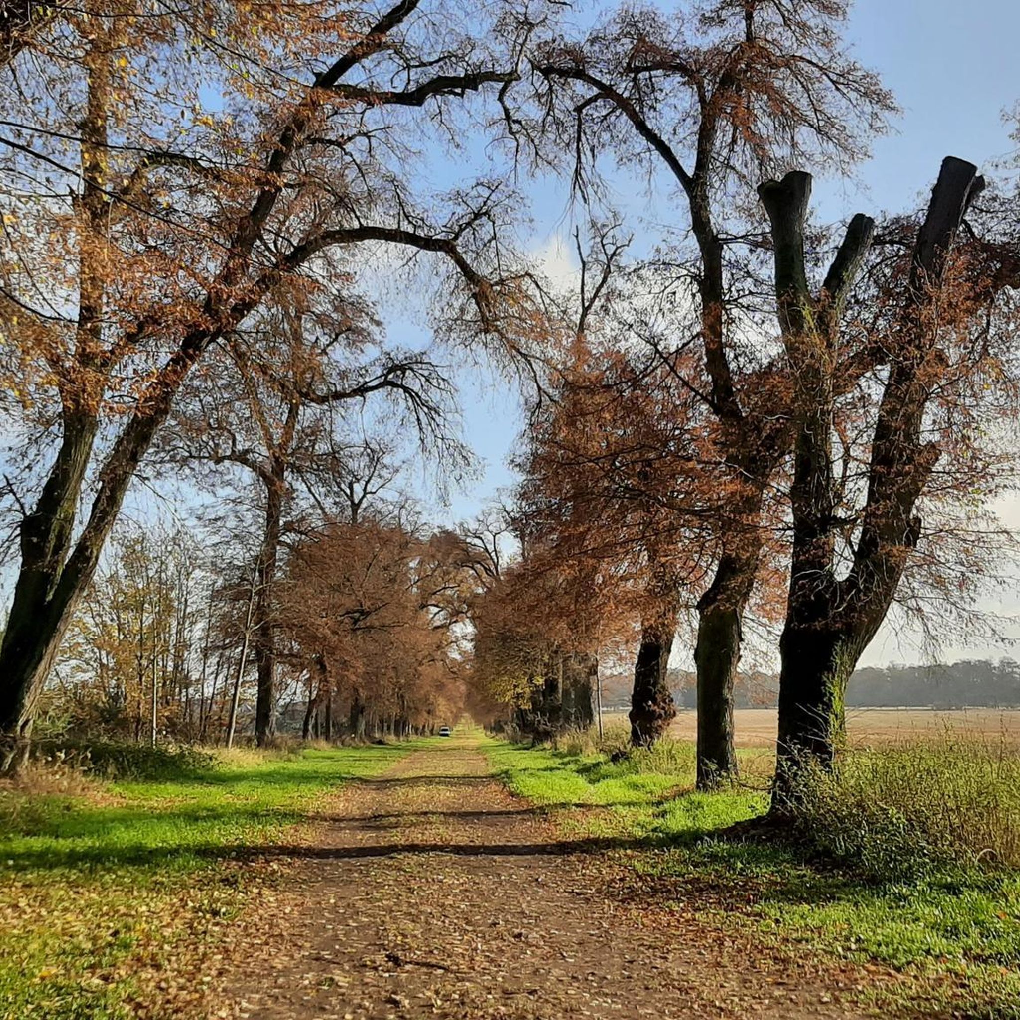
This is a fantastic trail, especially in autumn, when you can enjoy the beautiful trees changing color. It is one of the five main trails in the park, each ranging from 1 to 2 miles. All the trails are interconnected, with several options to extend your hike. The path is well-marked, making it easy to navigate your way through this beautiful, peaceful, hilly terrain.
0
0
This scenic route winds around the lake, where you can take in the beauty of nature. The trail, a mix of paved, dirt, and gravel, offers a peaceful and leisurely stroll with some nice benches along the way. Keep an eye out for an abundance of turtles, cormorants, frogs, and fascinating mushrooms along the way.
0
0
This 690-acre park offers a variety of outdoor activities, including a beautiful lake surrounded by a nice trail, picnic tables and restrooms, great hiking trails through the expansive wooded area, paddle boats, campsites, and picnic shelters. The park also features a playground and a nature center where you can see wild birds of prey, including a bald eagle. Additionally, there's a tennis bubble, skate ramp, baseball fields, playgrounds, and cookout sites. It's a favorite spot for dog owners, with dog-friendly facilities and pleasant trails to walk your pets.
0
0
Frequently Asked Questions
Are there any easy, beginner-friendly hikes near Andrews AFB?
Yes, the area has several easy trails perfect for beginners or a relaxed walk. A great option is the Cheltenham Wetlands loop — Piscataway Creek Park, which is a short, flat walk of about 1.2 miles (1.9 km). Another good choice is the Cosca Yellow Trail loop — LP Cosca Regional Park, a gentle 2.9-mile (4.7 km) route.
Can I bring my dog on the hiking trails?
Many parks in the region are dog-friendly, but policies can vary. For instance, Rosaryville State Park is a popular spot for dog walkers, but pets must be leashed at all times. It's always best to check the specific park's regulations before you go. You can find more information on their official website: Rosaryville State Park.
What are some good family-friendly hikes in the area?
LP Cosca Regional Park is an excellent choice for families. It offers several easy trails and has other amenities like a lake and playgrounds. Piscataway Park is another great option, with easy trails like the Bluebird Trail and the chance to see farm animals at the National Colonial Farm, which can be a fun addition to a family hike.
Are there any paved trails suitable for strollers or wheelchairs?
Yes, the Anacostia Riverwalk Trail is a fantastic option. It features over 15 miles of paved paths that are ideal for strollers, wheelchairs, and casual walking. The trail runs alongside the river and connects several parks, offering plenty of benches and picnic areas along the way.
Where can I find more challenging hikes near Andrews AFB?
For a more strenuous hike, consider visiting the Chesapeake & Ohio Canal National Historical Park, particularly the Great Falls area. It offers rugged trails with dramatic scenery, such as the Billy Goat Trail, which involves some rock scrambling and provides a significant challenge compared to the gentler park loops closer to the base.
Are there any hikes with waterfalls nearby?
The most dramatic waterfalls in the region are located at the Great Falls section of the C&O Canal National Historical Park. The park has several viewpoints and trails that offer stunning views of the falls where the Potomac River cascades over a series of steep, jagged rocks.
What kind of scenery can I expect on trails in Rosaryville State Park?
Rosaryville State Park offers a classic Maryland landscape. The trails, like the popular Perimeter Trail, wind through dense woodlands and open fields. You'll also pass by historic farm buildings, including old barns and silos, which are part of the park's Agriculture Heritage Trail. It's a great place for birdwatching, especially during migration seasons.
Where can I find scenic views or overlooks on a hike?
Piscataway Park offers some of the most unique scenic views in the area. From its trails along the Potomac River, you can get a clear and beautiful view of George Washington's Mount Vernon estate directly across the water. The park's mix of wetlands and woodlands also provides excellent opportunities for spotting wildlife like bald eagles and herons.
What is the best time of year to hike around Andrews AFB?
Spring and autumn are generally the best times for hiking in this region. The weather is mild, and the humidity is lower than in the summer. Spring offers blooming wildflowers, while autumn provides beautiful fall foliage. Summer can be hot and humid, so early morning hikes are recommended. Winter is also possible, but be prepared for colder temperatures and potentially muddy or icy trails.
Are the hiking trails near the base free to access?
Many local and regional parks, like LP Cosca Regional Park and Piscataway Park, offer free access to their trails. However, some state parks, such as Rosaryville State Park, may have a day-use service charge per vehicle. It's a good practice to check the park's official website for the most current fee information before your visit.
What do other hikers enjoy about the trails near Andrews AFB?
The komoot community has explored several routes in the area. Hikers often praise the accessibility of the parks and the variety of environments, from the peaceful riverside paths along the Anacostia River to the dense forests of Rosaryville State Park. The well-maintained and clearly marked trail systems in parks like LP Cosca are also frequently mentioned as a major plus.
Most popular routes around Andrews Afb
Most popular attractions around Andrews Afb

Get inspired with the komoot mobile app


Explore more
Browse the best Hikes in other regions.
