The best road cycling routes around East Alton
4.9
(16)
54
riders
7
rides
Road cycling routes around East Alton are characterized by the confluence of the Mississippi and Missouri Rivers, offering unique river perspectives. The terrain features dramatic limestone bluffs and an extensive network of paved trails, including dedicated paths and marked shoulders. This region provides varied landscapes for road cyclists, from river-level routes to gentle climbs along the bluffs.
Best road cycling routes around East Alton
- The most popular road cycling route is Missouri River loop, a 46.1 miles (74.3 km)…
Last updated: October 18, 2026
74.3km
03:04
260m
260m
The Missouri River loop is a 46.1-mile road cycling route in St. Louis County, offering moderate difficulty and scenic river views.
4.8
(6)
19
riders
40.1km
01:33
100m
100m
Easy road ride. Great for any fitness level. Mostly well-paved surfaces and easy to ride.

10
riders
78.7km
03:39
230m
230m
Moderate road ride. Good fitness required. Mostly well-paved surfaces and easy to ride.
6
riders
Moderate road ride. Great for any fitness level. Some segments of this route may be unpaved and difficult to ride.
5
riders
Easy road ride. Great for any fitness level. Mostly well-paved surfaces and easy to ride.
Get access to more routes and recommendations from other explorers.
Already have an account?
Our route recommendations are based on thousands of hikes, rides, and runs completed by other people on komoot.
Start today with a free account
Your next adventure awaits.
Popular around East Alton

Tips from the Community

Great flat trail with access to the towns along the way.
0
0

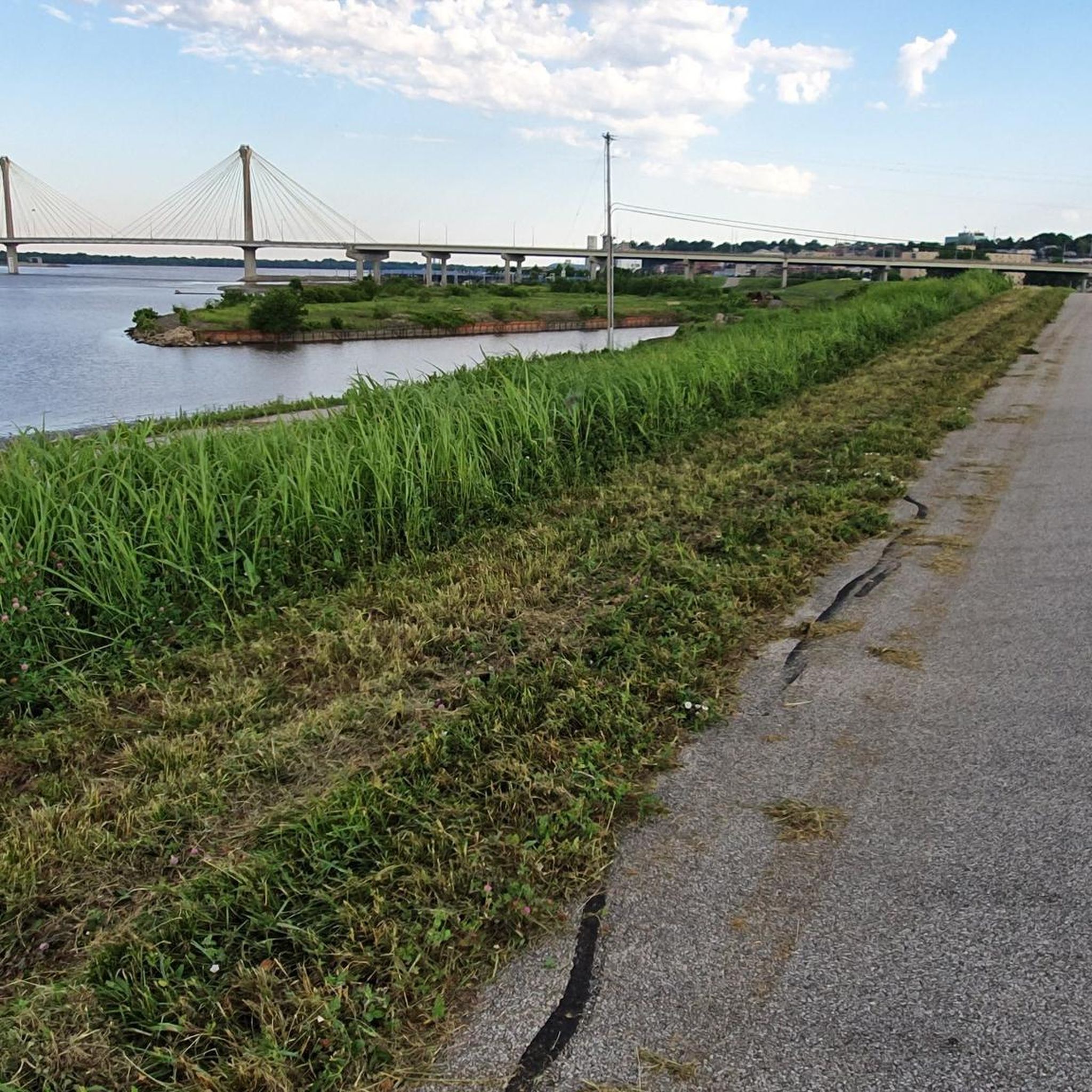
The MCT Confluence Trail is a beautiful 20.5 mile long trail. The trail mostly follows the Mississippi River. The trail is paved and mostly flat, so it is not a challenging trail. This section gives you great views of the river as you enter Alton.
1
0
Riverfront Park is a great park on the banks of the Mississippi River in Alton. There is a paved biking and hiking trail that runs through the park. The park also has a large amphitheater, picnic area and restrooms.
1
0
The Piasa Bird is a creature from Native American mythology that was painted on the cliffside above the Mississippi River. The original depiction of the Piasa Bird no longer exists, so this is a 20th century recreation that sits several hundred yards from where the original image was found.
1
0
The Sam Vadalabene Trail is a 20 mile paved trail from Grafton to Alton. The trail follows along the Mississippi and gives you great views of the river. The trail also connects several parks and you pass through several communities, so you have multiple choice for spots for a break.
1
0
The MCT Goshen Trail is considered the spine of the MCT Trail system. There are 5 other trails that connect into this trail. The path is fully paved and mostly flat. This is a beautiful section of the path. It passes through a mix of woodland, suburbs and open fields.
1
0
Nice biking and pedestrian-only bridge. The MCT Trail has several bridges to cross busy roads, and this is one of the longest.
1
0

Fantastic conditions, smooth riding and very few street crossings
0
0
Frequently Asked Questions
What kind of terrain can I expect on road cycling routes around East Alton?
Road cycling routes in East Alton are primarily characterized by the confluence of the Mississippi and Missouri Rivers, offering unique river perspectives. You'll find an extensive network of paved trails, including dedicated paths like the Confluence Trail and marked shoulders along scenic byways. The terrain generally features dramatic limestone bluffs and varied landscapes, from river-level routes to gentle climbs.
Are there any easy or beginner-friendly road cycling routes in the East Alton area?
Yes, East Alton offers several easy road cycling routes. For instance, the Grafton Ferry Pier loop from Blue Pool is an easy 25.8-mile (41.5 km) path with minimal elevation gain, perfect for beginners. The Confluence Trail – Confluence Trail – east of Alston loop from Alton Museum of History and Art is another easy option, covering 25.2 miles (40.6 km).
What are some notable landmarks or attractions I can see while road cycling near East Alton?
Many routes offer views of significant landmarks. You can cycle past the Confluence Tower and the Lewis & Clark Monument, which marks the meeting point of the Mississippi and Missouri Rivers. The Confluence Trail itself provides scenic views of the Mississippi, including the Melvin Price Locks and Dam. Along the Great River Road, you might also spot the iconic Piasa Bird mural perched on a bluff.
Are there any family-friendly road cycling routes in East Alton?
Yes, the paved and mostly flat nature of trails like the Confluence Trail makes them ideal for families. The Confluence Trail – Confluence Trail – east of Alston loop from Alton Museum of History and Art is an easy 25.2-mile route that is suitable for families looking for a pleasant ride along the river.
Where can I park my car when accessing road cycling routes in East Alton?
Parking is available at various access points for the region's trail network. For routes utilizing the Confluence Trail, you can often find parking at designated Madison County Transit (MCT) Park and Ride lots, such as the one mentioned in the Confluence Trail – east of Alston – Confluence Trail loop from MCT Park and Ride. Specific parking areas are also available for the Sam Vadalabene Great River Road Bike Trail, including near Piasa Park.
What is the best time of year for road cycling in East Alton?
The spring and fall seasons are generally considered the best for road cycling in East Alton. During these times, the weather is typically mild, and the natural scenery, especially the fall foliage along the bluffs, is particularly beautiful. Summer can be warm and humid, while winter can bring cold temperatures and potential snow or ice.
Are there any cafes or places to eat along the road cycling routes?
Yes, the charming river towns along the Great River Road, such as Alton, Elsah, and Grafton, offer various dining options. These towns are often accessible from the main cycling routes like the Sam Vadalabene Great River Road Bike Trail and the Confluence Trail, providing convenient stops for refreshments and meals.
What do other road cyclists enjoy most about cycling in East Alton?
The road cycling routes in East Alton are highly rated by the komoot community, with an average score of 4.9 stars from over 40 reviews. Cyclists often praise the extensive river views, the dramatic limestone bluffs, and the well-maintained, dedicated paved trails that offer a safe and scenic riding experience.
Are there any challenging road cycling routes or significant climbs in the East Alton area?
While many routes are relatively flat, some offer moderate elevation changes. The Missouri River loop, for example, is a moderate 46.1-mile (74.3 km) route with an elevation gain of approximately 855 feet (260 meters), providing a good workout with extensive river views. Routes that venture slightly away from the immediate riverfront and into the bluff areas may also present more varied terrain.
Can I find loop routes for road cycling around East Alton?
Yes, many of the road cycling routes in East Alton are designed as loops, allowing you to start and end at the same point. Examples include the popular Missouri River loop and the Grafton Ferry Pier loop from Alton, which offers a scenic riverfront experience.
What is the longest road cycling route available in the East Alton area?
Among the routes highlighted, the Grafton Ferry Pier loop from Alton is one of the longest, covering approximately 47.5 miles (76.4 km). This moderate route connects Alton to the Grafton Ferry Pier, offering extensive riverfront cycling.
Is public transport available for cyclists in East Alton?
The Madison County Transit (MCT) system operates in the area and includes an extensive network of paved trails, some of which are patrolled. While specific bike rack policies for buses should be checked with MCT directly, the presence of the MCT trail system indicates a commitment to cycling infrastructure and accessibility.
Most popular routes around East Alton
Most popular attractions around East Alton

Get inspired with the komoot mobile app


Explore more
Browse the best Road cycling routes in other regions.
