The best road cycling routes around Lough Fee
4.7
(18)
373
riders
6
rides
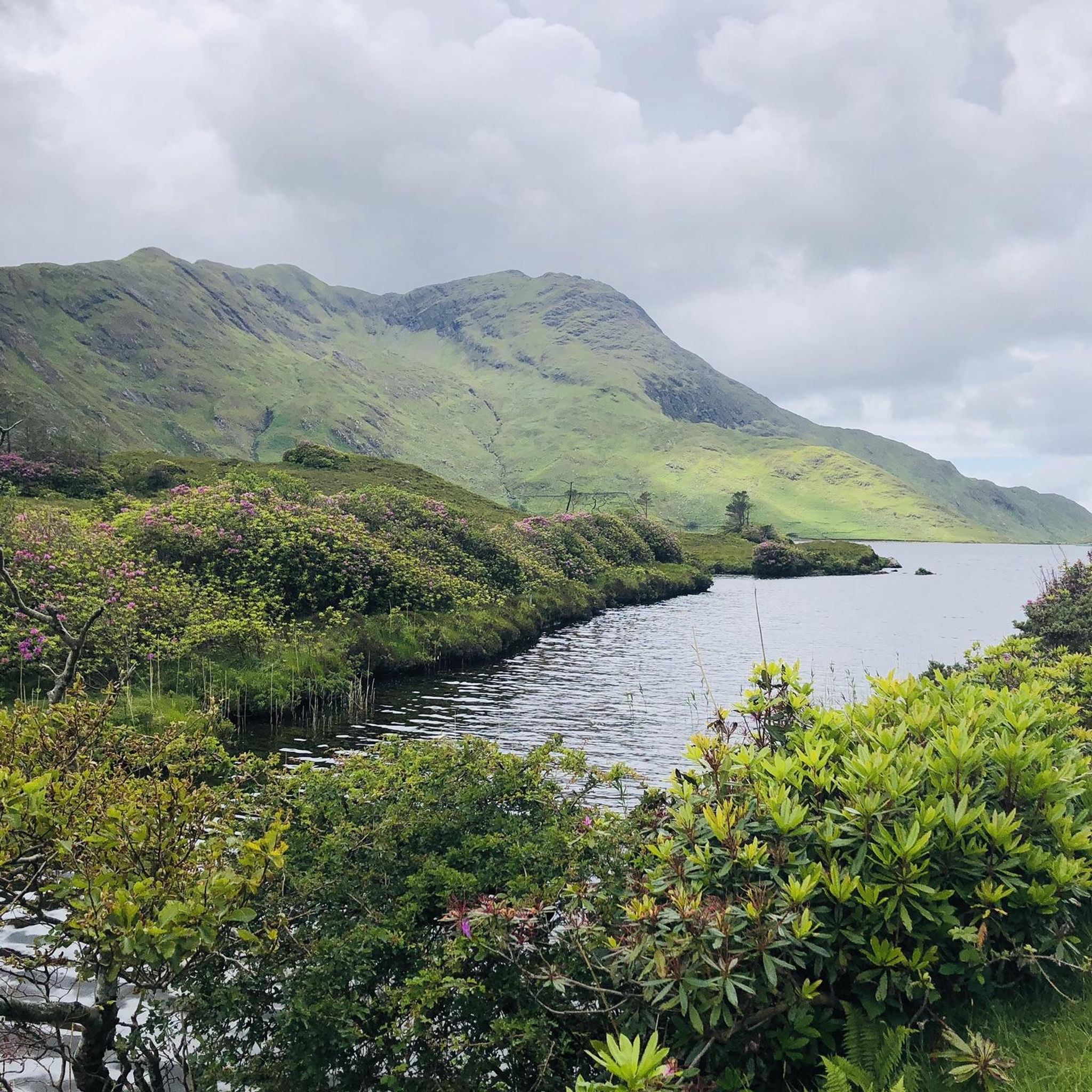
Road cycling routes around Lough Fee are situated in the Connemara area of County Galway, Ireland, characterized by freshwater lakes, surrounding mountains, and green hills. The region offers mostly paved surfaces suitable for road bikes, with routes often tracing the shores of Lough Fee and Kylemore Lough. It is located within the northern parts of Connemara National Park, providing a backdrop of rugged landscapes and a tranquil atmosphere.
Best road cycling routes around Lough Fee
- The most popular road cycling…
Last updated: July 10, 2026
18
riders
19.5km
01:04
170m
170m
Easy road ride. Great for any fitness level. Mostly well-paved surfaces and easy to ride.
5
riders
Moderate road ride. Good fitness required. Mostly well-paved surfaces and easy to ride.

Sign up for free
5.0
(6)
64
riders
Easy road ride. Great for any fitness level. Mostly well-paved surfaces and easy to ride.
17
riders
51.5km
02:18
410m
410m
Moderate road ride. Good fitness required. Some segments of this route may be unpaved and difficult to ride.
11
riders
87.8km
03:57
790m
790m
Moderate road ride. Good fitness required. Mostly well-paved surfaces and easy to ride.
Our route recommendations are based on thousands of hikes, rides, and runs completed by other people on komoot.
Start today with a free account
Your next adventure awaits.
Login or Signup
Popular around Lough Fee
Tips from the Community

Holy pilgrim hill. Initially, the summit was occupied by a Celtic fort, but then there was an early Christian oratory. It is said that Saint Patrick fasted there for 40 days in 441 and then waved a bell to banish all snakes from the land. The chapel that stands there now was consecrated on July 31, 1905.
5
0
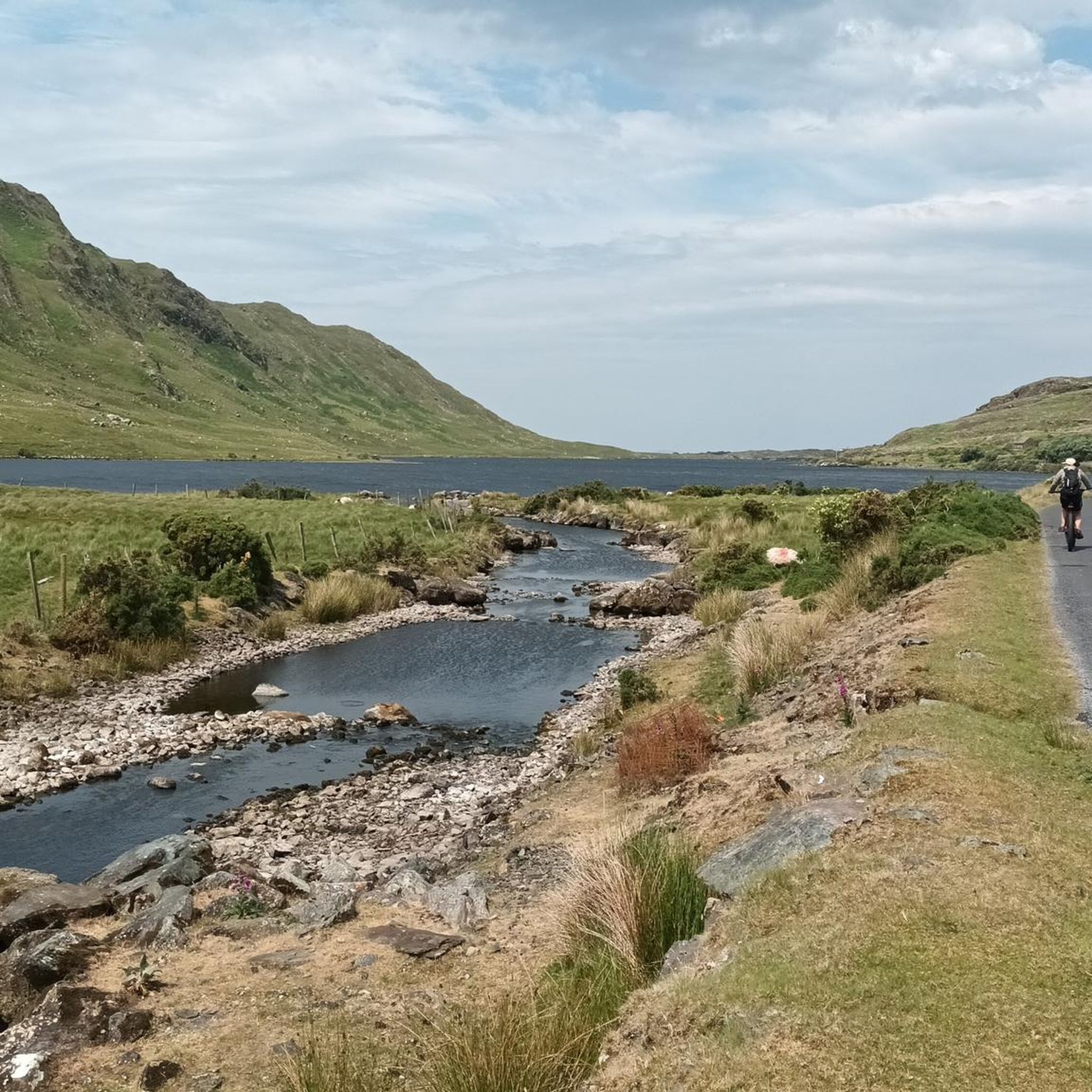
Wild Atlantic Way Discovery Point: The road through Doo Lough Valley is a quiet, narrow route with little traffic, allowing you to fully enjoy the wide views over the dark lake and surrounding mountain slopes. Along the shore are several photogenic spots where water, light, and landscape come together beautifully. This passage logically connects to Delphi Valley, the climb to Doolough Pass, and the understated 1849 memorial, making this stretch one of the most impressive links of the entire route.
4
0
The road through Doo Lough Valley is a quiet, narrow route with little traffic, allowing you to fully enjoy the wide views over the dark lake and the surrounding mountain slopes. Along the shore are several photogenic spots where water, light, and landscape come together beautifully. This passage logically connects to Delphi Valley, the climb to Doolough Pass, and the understated 1849 memorial, making this section one of the most impressive links of the entire route.
6
0
From this spot, you have an open, elevated view over Killary Fjord, with wide sightlines towards the steep flanks of Ben Gorm and Mweelrea. The fjord stretches out below you, clearly showing how the landscape opens up towards the ocean. In clear weather, you get deep contrasts between water and mountains; in fog, a typical Connemara atmosphere is created.
5
0
An absolute must-see on the border of Galway and Mayo. Here the river Erriff thunders over wide rock plateaus into the fjord. Whether you come for the film history of The Field, the chance to see salmon leaping, or simply for the dramatic view of the Connemara mountains: this stop never disappoints. Particularly impressive after a hearty Irish downpour!
6
0
At this spot, the landscape opens up towards Killary Lough, Ireland's only true fjord. From the slight elevation, you see the long, narrow water between the Mweelrea mountains (Mayo) and the Twelve Bens/Maumturks (Galway). The view is broad and clear: a deep, straight fjord valley with steep flanks, tidal water, and often a strikingly silvery light. The road runs here along open peatland and low rocks, causing the fjord to suddenly come fully into view — a classic Connemara moment of space, water, and rugged mountains.
7
0
This is THE postcard moment of your tour through Connemara. From this elevated point along the N59, you have an unobstructed view over the deep blue fjord and the steep walls of the Mweelrea mountain on the other side. It's the perfect spot to get off your bike for a moment, breathe in the salty sea air, and take in the scale of this unique glacial landscape. Don't forget to wave to the dolphins that sometimes swim by in the depths below!
7
0
Killary Fjord (of Killary Harbour) is often called the only true fjord in Ireland, although technically it is one of the three glacial fjords on the island. This deep sea arm cuts 16 kilometres inland, forming the natural border between the counties of Galway and Mayo.
6
0
Frequently Asked Questions
What kind of road cycling routes can I find around Lough Fee?
The Lough Fee area offers a variety of road cycling routes, ranging from easy loops under 20 miles to more challenging rides over 75 kilometers with significant ascents. You'll find mostly paved surfaces, ideal for road bikes, with routes often tracing the shores of Lough Fee and Kylemore Lough, providing stunning views of mountains and lakes.
Are there any easy road cycling routes suitable for beginners around Lough Fee?
Yes, there are several easy routes. For instance, the Lough Fee – Lough Fee loop from Killary Harbour is an easy 19.5 km (12.1 miles) route that offers beautiful views of Gowlaun Hill and the ocean. Another easy option is the Letterfrack, Tully Cross, Croonagh and Owenduff Bridge loop — Connemara National Park, which is 37.4 km (23.2 miles) long.
What are the more challenging road cycling options in the Lough Fee region?
For those seeking a challenge, the region offers moderate routes with greater distances and elevation gains. The Outlandish landscape – Owenglin River Stone Bridge loop from Glassilaun Beach is a moderate 112.4 km (69.9 miles) path featuring expansive views and quiet roads. Another moderate option is the Doolough Valley – Doolough Valley loop from Bundorragha River, spanning 87.2 km (54.2 miles).
What kind of scenery can I expect while road cycling around Lough Fee?
You can expect breathtaking scenery, including freshwater lakes like Lough Fee and Kylemore Lough, surrounded by magnificent mountains and green hills. Many routes offer views of Killary Fjord and the coastline, with a real feeling of remoteness and peace. The area is also part of Connemara National Park, providing a backdrop of rugged, wild landscapes.
Are there any circular road cycling routes around Lough Fee?
Yes, many of the routes around Lough Fee are designed as loops, allowing you to start and finish at the same point. Examples include the easy Lough Fee – Lough Fee loop from Killary Harbour and the moderate Doolough Valley – Doolough Valley loop from Bundorragha River.
What landmarks or points of interest can I see along the road cycling routes?
Cycling routes often provide views of iconic landmarks such as Kylemore Abbey, a Benedictine monastery set amidst mountains. You'll also encounter stunning natural features like Gowlaun Hill, Killary Fjord, and the tranquil waters of Lough Fee and Kylemore Lough. The routes are within the broader Connemara National Park, offering a wealth of natural beauty.
What do other road cyclists say about the routes around Lough Fee?
The road cycling routes around Lough Fee are highly rated by the komoot community, with an average score of 4.7 stars from over 15 reviews. Cyclists often praise the quiet roads, minimal traffic (aside from sheep!), and the spectacular, remote views of the lakes, mountains, and coastline.
Is the Lough Fee area suitable for family-friendly road cycling?
While some routes are longer and more challenging, the area does offer easier, shorter loops that could be suitable for families with some cycling experience. The mostly paved surfaces and quiet roads contribute to a pleasant experience. Always check the route's distance and elevation profile to ensure it matches your family's ability.
What is the best time of year to go road cycling in Lough Fee?
The region's beauty is enhanced in spring when rhododendrons add vibrant color. Generally, the warmer, drier months from late spring to early autumn offer the most pleasant cycling conditions, though the varying shades of the water throughout the day make it picturesque year-round. Be prepared for changeable weather typical of the west of Ireland.
Are there cafes or pubs near the road cycling routes around Lough Fee?
The Lough Fee area is known for its remoteness and tranquility, meaning amenities like cafes and pubs might not be directly on every route. It's advisable to plan your stops in nearby villages or towns such as Letterfrack or Tully Cross, which are often incorporated into longer loops, to find refreshments and accommodation.
What are the road conditions like for cycling around Lough Fee?
The road cycling routes around Lough Fee predominantly feature mostly paved surfaces, making them well-suited for road bikes. The roads are generally quiet with minimal traffic, contributing to a peaceful cycling experience amidst the stunning natural landscape.
How many road cycling routes are available in the Lough Fee area?
There are several dedicated road cycling routes around Lough Fee, offering a range of distances and difficulties to explore the Connemara landscape.

Get inspired with the komoot mobile app


Explore more
Browse the best Road cycling routes in other regions.
