The best cycling routes around Université Pepperdine
4.2
(11)
279
riders
18
rides
Touring cycling around Université Pepperdine offers diverse landscapes, from the coastal bluffs of Malibu to the expansive Santa Monica Mountains. The region is characterized by its Mediterranean ecosystem, featuring challenging canyon roads, winding ridges, and sections of the Pacific Coast Highway. Cyclists encounter varied terrain, including significant elevation changes and scenic routes through natural parklands. The area provides a network of roads and trails suitable for different cycling preferences.
Best touring cycling routes around Université Pepperdine
- The most popular touring…
Last updated: July 10, 2026
17
riders
53.1km
03:51
1,130m
1,130m
Hard bike ride. Very good fitness required. Mostly paved surfaces. Suitable for all skill levels.
4.0
(4)
12
riders
45.0km
03:15
950m
950m
Hard bike ride. Very good fitness required. Mostly paved surfaces. Suitable for all skill levels.

Sign up for free
1
riders
32.4km
02:52
920m
920m
Hard bike ride. Very good fitness required. Mostly paved surfaces. Suitable for all skill levels.
5.0
(1)
89
riders
41.7km
03:07
1,010m
1,010m
Hard bike ride. Very good fitness required. Mostly paved surfaces. Suitable for all skill levels.
4.0
(4)
22
riders
41.3km
03:12
1,120m
1,120m
Hard bike ride. Very good fitness required. Mostly paved surfaces. Suitable for all skill levels.
Get access to more routes and recommendations from other explorers.
Sign up for free
Already have an account?
Our route recommendations are based on thousands of hikes, rides, and runs completed by other people on komoot.
Start today with a free account
Your next adventure awaits.
Login or Signup
Tips from the Community

Malibu Road departs from the Pacific Coast Highway and travels down closer to the water. This is a great way for cyclists to avoid the busy highway while also being able to admire the view with less traffic to worry about.
0
0

While bike paths through Malibu are 'here now" and suddenly gone and you're in traffic, there are few places as pleasant to visit by bicycle as Malibu. Be sure to bike up Malibu Road, but if you're adventurous and in good shape, take the bottom of Mulholland rd (from far north of Malibu) up to the valley side of the canyon. You can then reward yourself with a long downhill ride on curvy Decker. (You'll be on your breaks for miles). This is a great town to lunch, coffee or just watch the waves.
0
0

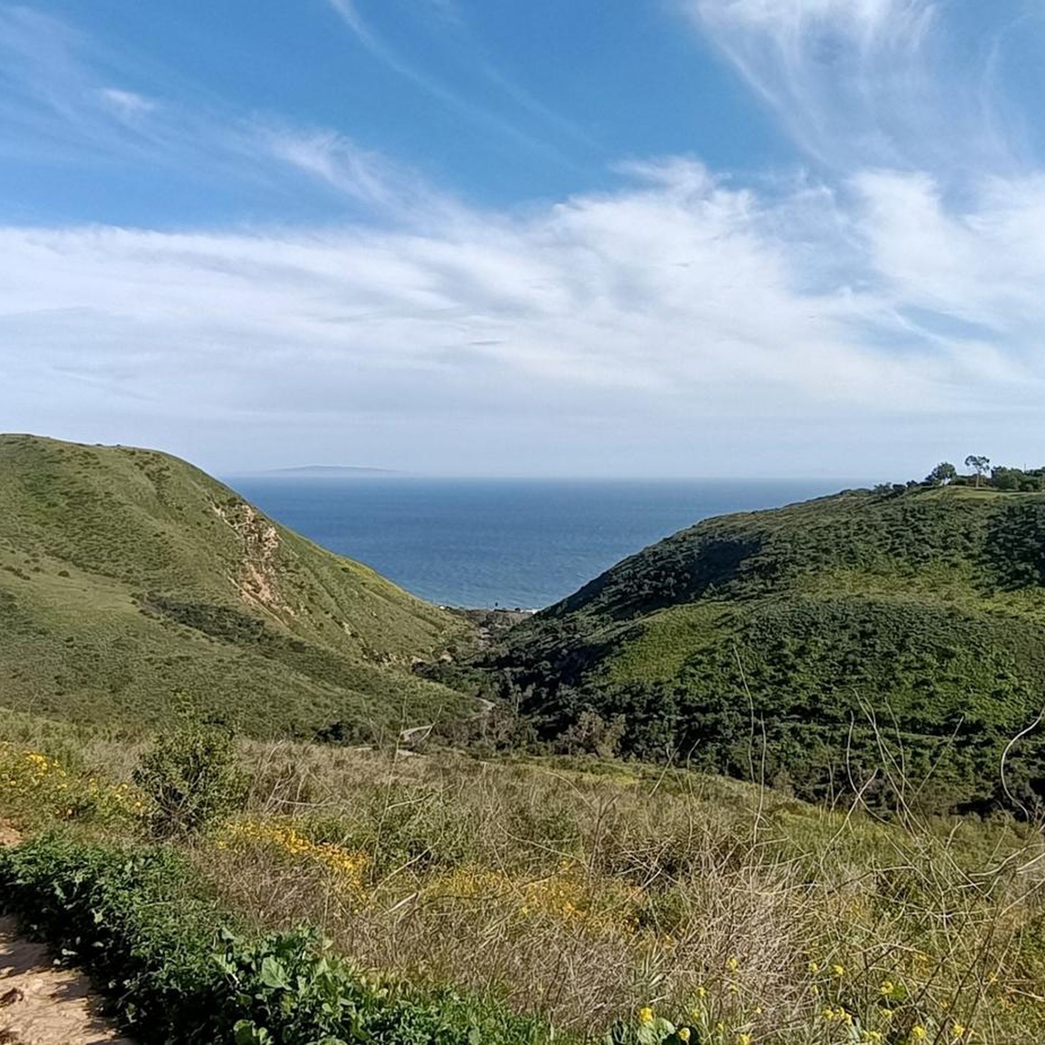
Dan Blocker Beach, a 15.2-acre stretch of bluff and beach with over a mile of ocean frontage, attracts surfers and divers. Visitors also go swimming, fishing, and soak up the sun on this sandy, narrow beach. In 2014, the county added a public viewing area, parking, ADA-compliant restrooms, ocean-facing benches, and picnic tables.
1
0

Topanga is a charming mountain community nestled in the Santa Monica Mountains of Los Angeles County, California. Known for its bohemian atmosphere and artistic vibe, Topanga offers a unique blend of nature and culture. Explore the quaint shops and galleries along Topanga Canyon Boulevard, or venture into Topanga State Park for outdoor adventures.
0
0

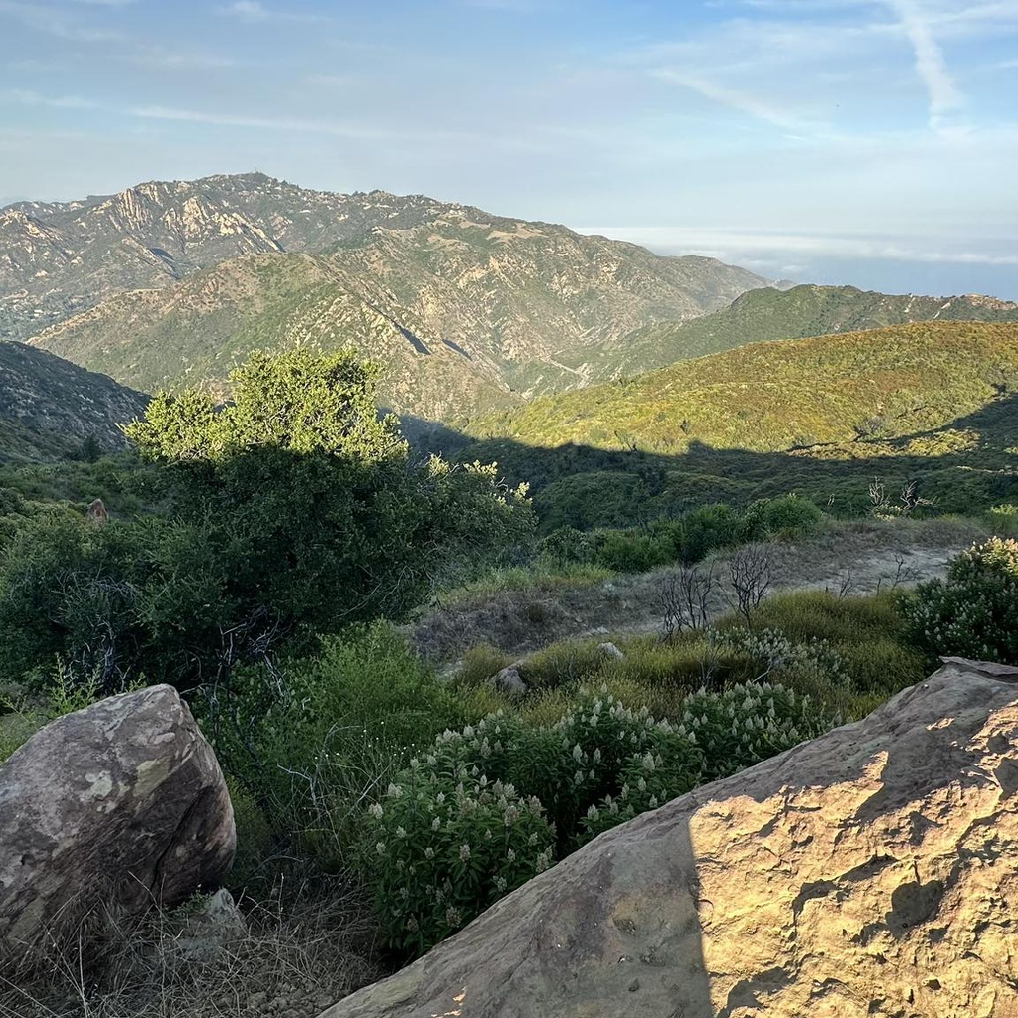
It is our tradition to visit a high mountain on the first day of the new year. The sattle peak view point is 720 m above sea level and provides an outstanding view to the pacific ocean and to the valley. It is great for a short holiday walk.
0
0
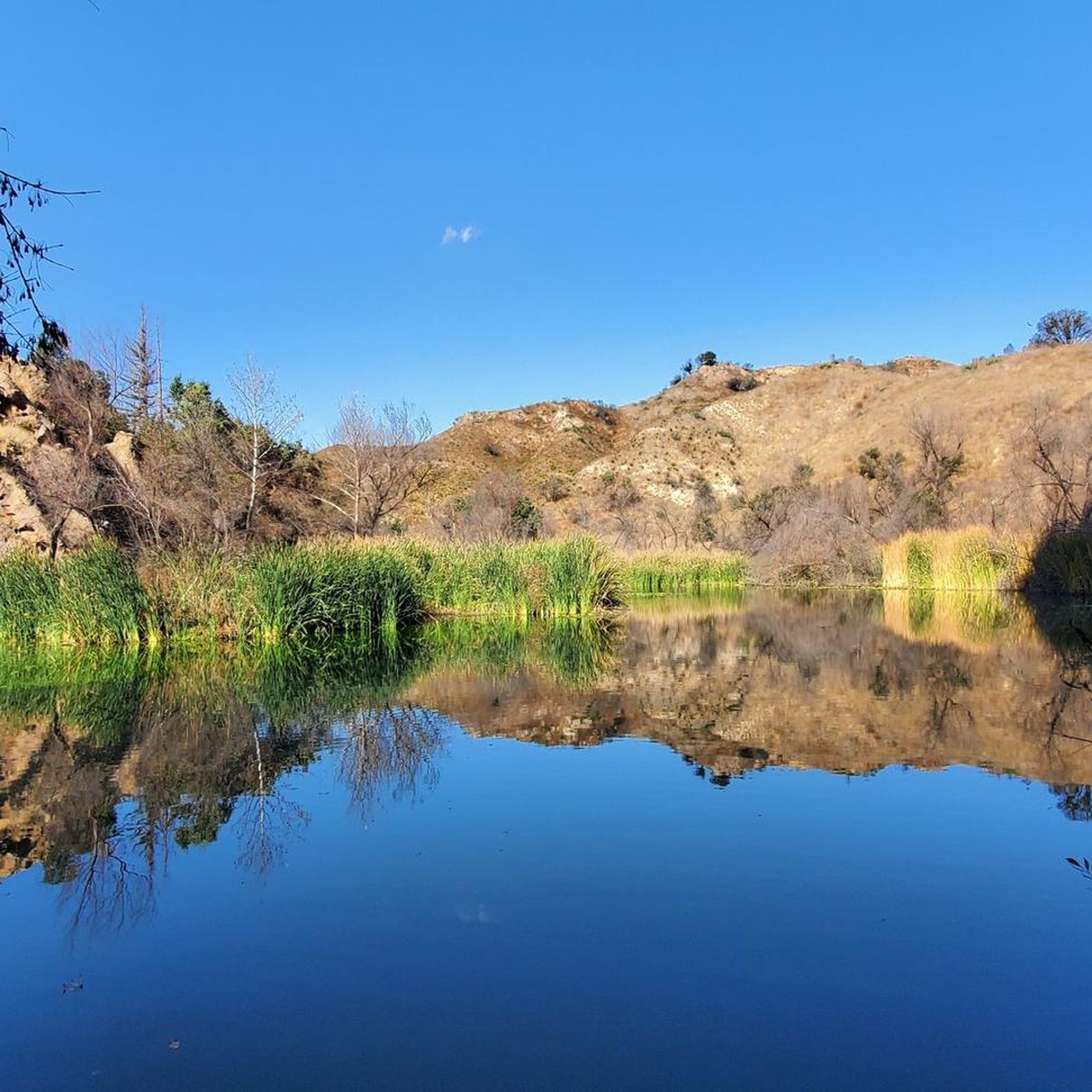
Rocky Oaks Park is a park for bikers, hikers, and horseback riders. Most of the trails are wide with compact, hard dirt. There is a pond in the middle of the park, and the park is right off Mulholland Highway, so it's easy to access.
0
0
La Sierra Preserve is 130 acres in size. This area is made up of willow riparian habitat, oak woodland, mixed riparian woodland, coastal sage scrub, wetlands, grassland, and chaparral.
0
0
Dan Blocker County Beach is 15.2 acres in size and is a bluff and beach property with over one mile of ocean frontage. Dan Blocker Beach has tons of recreational activities for surfers, divers, and scuba divers, including swimming and fishing.
0
0
Frequently Asked Questions
How many touring cycling routes are available around Université Pepperdine?
There are over 25 touring cycling routes around Université Pepperdine, offering a wide range of experiences from coastal rides to challenging mountain climbs. The komoot community has explored these routes extensively, with over 400 touring cyclists using the platform in this region.
What is the general difficulty level of touring cycling routes near Pepperdine?
The touring cycling routes around Université Pepperdine are predominantly challenging, with 20 routes rated as difficult. However, there are also 5 moderate routes available for those seeking a less strenuous ride. There are currently no easy routes listed, indicating the region's terrain often involves significant elevation changes.
When is the best time of year for touring cycling around Université Pepperdine?
The Mediterranean climate of Malibu makes touring cycling enjoyable year-round. However, spring and fall offer particularly pleasant conditions with mild temperatures and clear skies, ideal for tackling the region's varied terrain. Summers can be warm, especially in the canyons, while winters are generally mild but may bring occasional rain.
Are there any circular touring cycling routes in the area?
Yes, many of the touring cycling routes around Université Pepperdine are designed as loops, allowing you to start and end at the same point. Popular circular routes include the challenging Zumas & Trancas Canyon loop from Dan Blocker Beach and the scenic Latigo Canyon Loop, both offering diverse landscapes and elevation changes.
What scenic viewpoints can I expect to see along touring cycling routes?
The Santa Monica Mountains and Malibu coastline offer numerous breathtaking viewpoints. Cyclists can enjoy panoramic vistas of the Pacific Ocean and rugged mountain-scapes. Notable viewpoints include Point Dume Overlook and the Viewpoint at Backbone Trail, providing stunning photo opportunities and rest stops.
Are there any natural features or landmarks to explore while cycling?
Absolutely. The region is rich in natural beauty. You can cycle past coastal bluffs, through canyons, and alongside beautiful beaches. Highlights include the wetlands of Malibu Lagoon State Beach, the serene Malibou Lake, and the unique rock formations at El Matador State Beach. Malibu Creek State Park also features the popular Malibu Creek Rock Pools.
Are there options for easier or beginner-friendly touring cycling routes?
While many routes in the Santa Monica Mountains are challenging, there are moderate options available. For a flatter, more relaxed ride, sections of the Pacific Coast Highway or the Marvin Braude Bike Trail (The Strand) offer scenic oceanfront cycling. Among the komoot routes, the Escondido Beach – Malibu Road loop from Malibu is a moderate option with less elevation gain compared to the mountain routes.
What are some challenging routes for experienced touring cyclists?
Experienced touring cyclists will find plenty of challenging routes with significant elevation gains in the Santa Monica Mountains. The Escondido Beach – Dan Blocker County Beach loop from Malibu is a very difficult option, featuring over 2000 meters of ascent. Other demanding routes include Mulholland Highway, Latigo Canyon, and Decker Canyon Road, known for their steep climbs and thrilling descents.
Where can I find parking for touring cycling routes around Université Pepperdine?
Parking is available at various points along the coast and at trailheads within the Santa Monica Mountains. Many beaches, such as Dan Blocker Beach, offer parking facilities that serve as convenient starting points for coastal and canyon loops. Always check local signage for parking regulations and fees.
Are there family-friendly touring cycling options near Pepperdine?
For family-friendly cycling, consider routes that avoid heavy traffic and steep climbs. The Marvin Braude Bike Trail, also known as The Strand, offers a flat, paved path along the oceanfront, perfect for families. While not directly listed in the touring routes, it provides a safe and scenic option for all ages to enjoy coastal views.
Can I find cafes or places to stop for refreshments along the routes?
Yes, especially along the Pacific Coast Highway and in the Malibu area, you'll find various cafes, restaurants, and convenience stores. Many routes pass through or near small communities where you can refuel. It's always a good idea to carry sufficient water and snacks, especially when venturing into the more remote canyon areas of the Santa Monica Mountains.
What do other touring cyclists say about touring cycling in Université Pepperdine?
The touring cycling routes around Université Pepperdine are highly rated by the komoot community, with an average score of 4.5 stars. Reviewers often praise the stunning coastal and mountain views, the challenging climbs, and the diverse terrain that makes each ride unique. The combination of ocean vistas and rugged canyon roads is a consistent highlight.
Most popular routes around Université Pepperdine
Most popular attractions around Université Pepperdine

Get inspired with the komoot mobile app


Explore more
Browse the best Cycling routes in other regions.
