The 11 Most Amazing Peaks around Muir Beach
Best mountain peaks around Muir Beach offer access to elevated terrain and prominent viewpoints within the Marin Headlands. The region is characterized by its coastal proximity and the presence of significant natural features like Mount Tamalpais. These elevated areas provide diverse landscapes, from forested trails to open ridgelines. The area is largely contained within protected public lands, including state parks and national recreation areas.
Best mountain peaks around Muir Beach
- The most popular mountain peaks is Mount Tamalpais Summits,…
Last updated: July 8, 2026
Mount Tamalpais — East Peak
Highlight • Summit
Tip by

Horse Hill Bike Path
Highlight (Segment) • Cycleway
Tip by
Sign up now to discover places like this
Get recommendations on the best single tracks, peaks, & plenty of other exciting outdoor places.
Sign up for free
Cardiac Hill (Dipsea Trail, Mount Tamalpais State Park)
Highlight • Summit
Tip by
Bare Knoll
Highlight • Summit
Tip by

Railway Grade Fireroad Trailhead at East Ridgecrest Blvd
Highlight • Trail
Tip by
Sign up for free to discover even more peaks around Muir Beach.
Sign up for free
Already have an account?
Start today with a free account
Your next adventure awaits.
Login or Signup

Tips from the Community

One of the best views in the entire Bay Area. No question.
0
0

Mount Tam East Peak offers some of the most majestic views north of the bay. From this vantage point, you can see all of Marin, along with Point Reyes to the north and Oakland and San Francisco to the south. The stunning panoramic vistas make the journey well worth the effort. There are restrooms and picnic tables, ideal for a snack or lunch while you capture some incredible photos.
1
0

Just before the last ascent of East Ridgecrest Blvd toward the East Peak of Mt Tamalpais is the Railway Grade Fireroad Trailhead on the south side, and a few dozen yards furthe south, the Eldridge Grade Fire Road down on the north side.
0
0
Great lookout with a usually closed summit hut at 2571 feet (784 m) elevation. Outstanding views of the Bay, Marin County, San Francisco, and the Pacific Ocean.
0
0

Bare Knoll is a relatively small peak that allows you to see views stretching from Stinson Beach into the Gulf of the Farallones.
1
0

There are, indeed, horses on this hill. Connector path between Mill Valley and Corte Madera, easier than Camino alto. The alto tunnel is still closed, learn more here: https://openaltotunnel.org/
0
0

This trail runs along part of the Dipsea Trail and heads towards Cardiac Hill. The first section is characterised by a wooden stairway, then the path goes into a lush forest.
0
0
Continuous but gradual climb to the summit ridge from the south, thanks to the former rail line.
0
0
Frequently Asked Questions
What are the most popular mountain peaks and elevated viewpoints around Muir Beach?
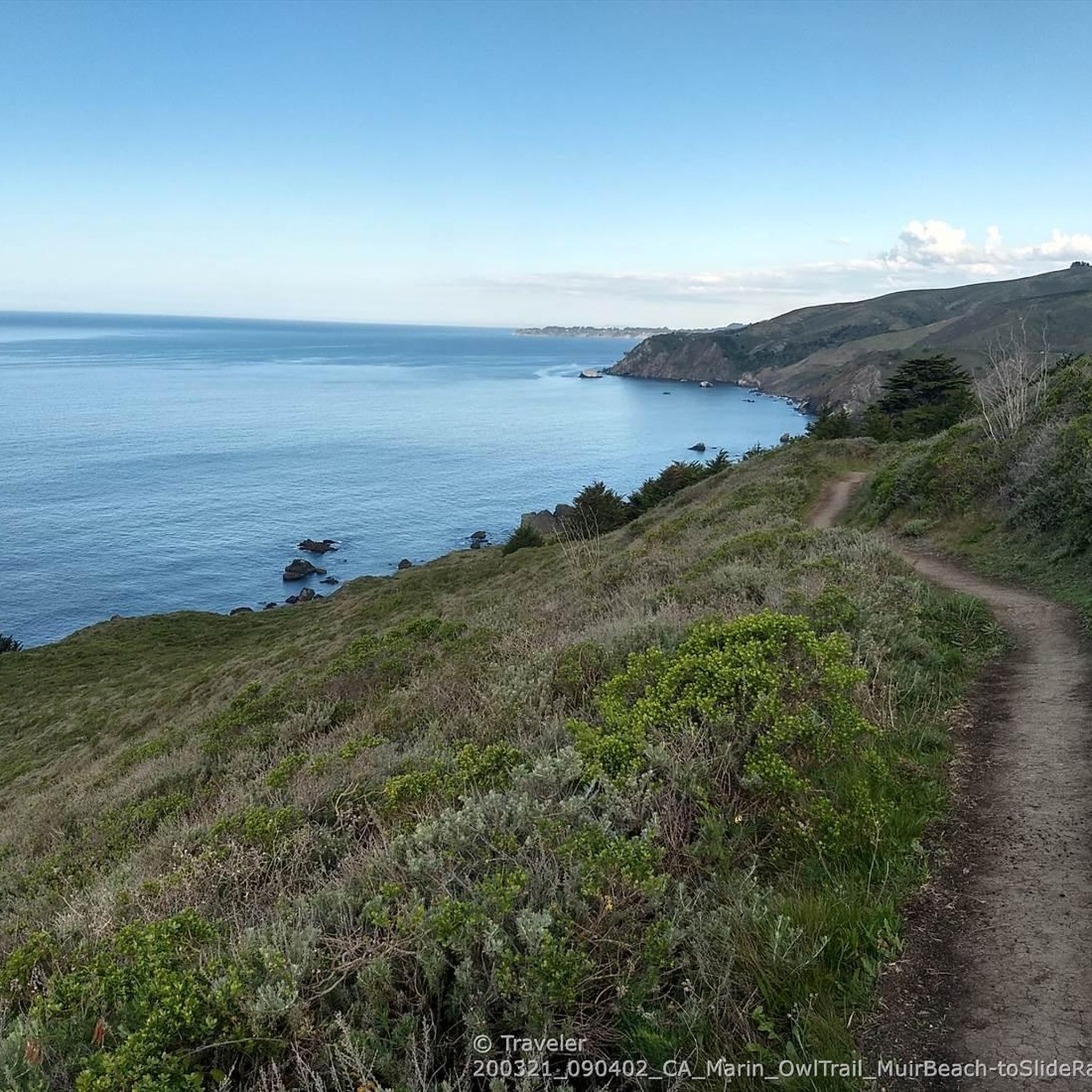
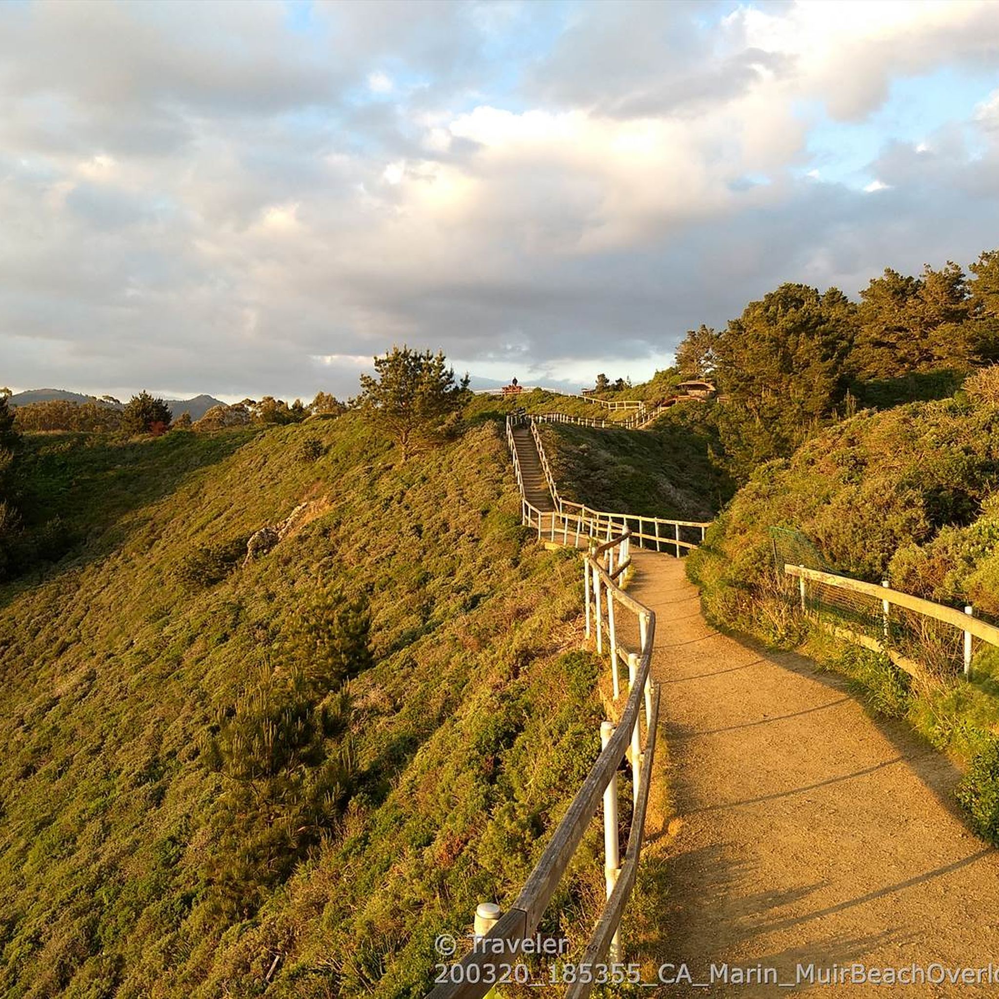
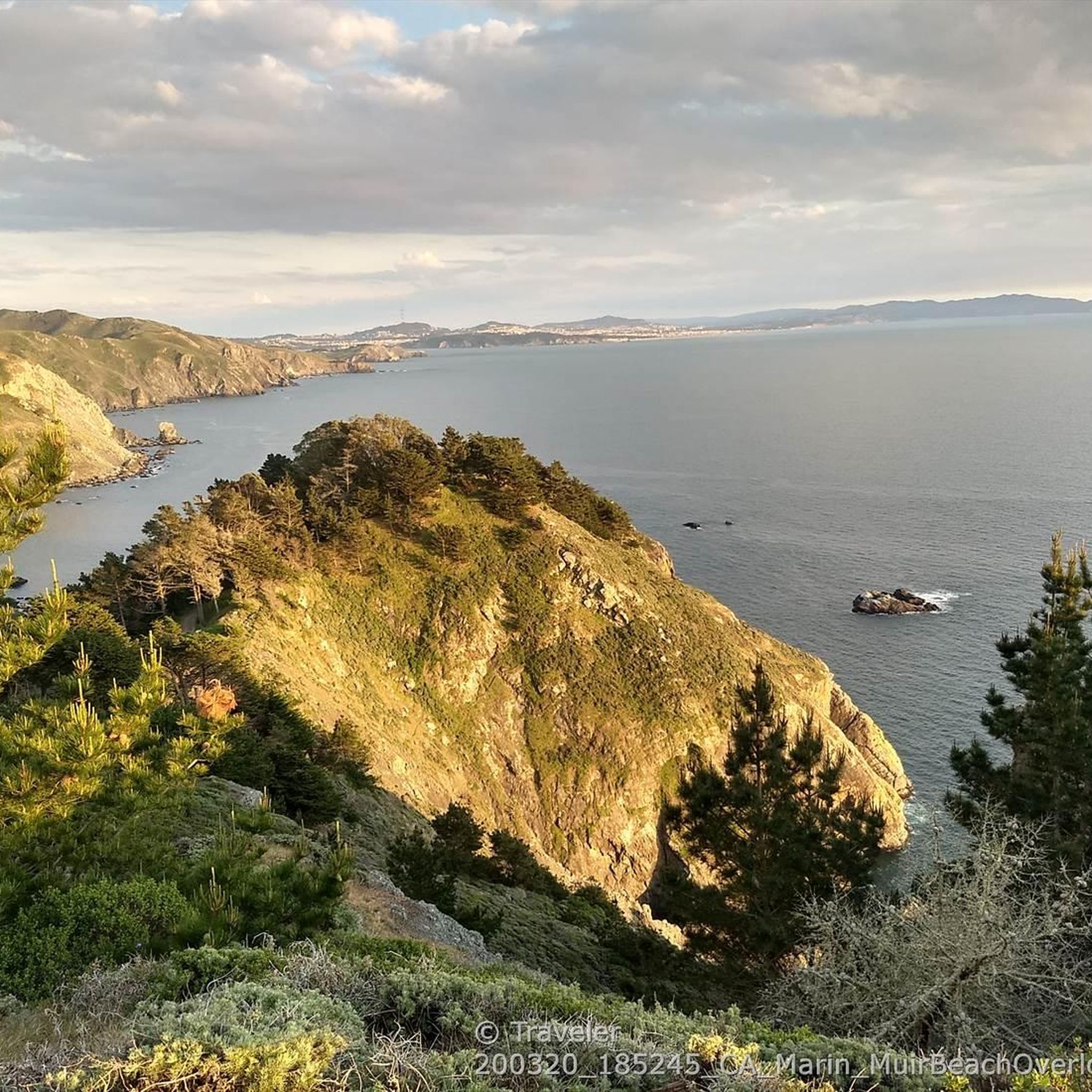
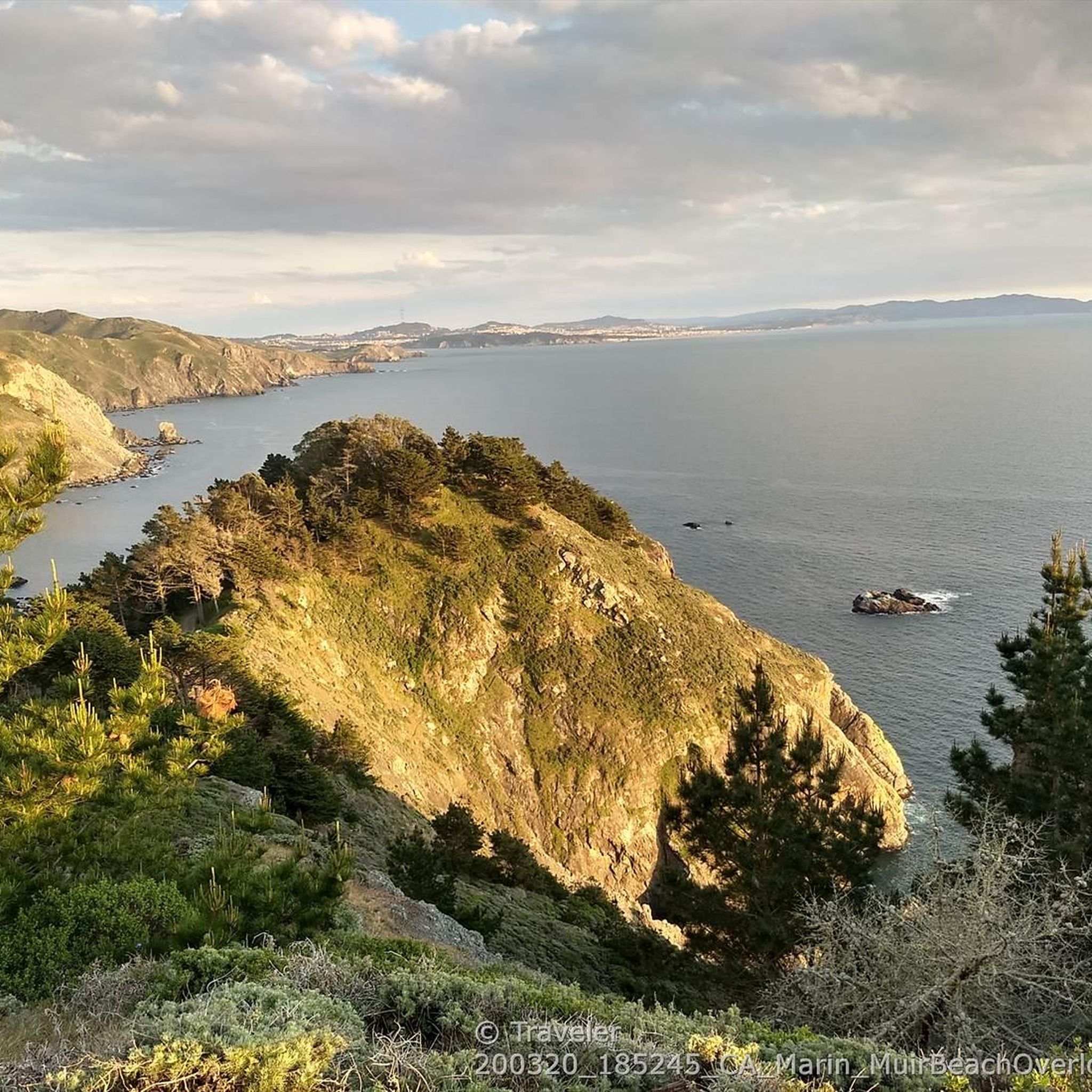
The most popular elevated areas include Mount Tamalpais Summits, which offers panoramic views of the San Francisco Bay Area. Another highly regarded spot is Cardiac Hill (Dipsea Trail, Mount Tamalpais State Park), known for its challenging trail and lush forest. The Muir Beach Overlook is also a distinct elevated point providing expansive views of the Pacific Ocean and coastline.
Are there family-friendly mountain trails or viewpoints near Muir Beach?
While many trails offer varying difficulties, the Muir Beach Overlook is an easily accessible spot for breathtaking ocean views, suitable for families. For easy hikes, consider routes like Pirate's Cove or the Slide Ranch Tidepool South Beach Loop, which can be found in the Easy hikes around Muir Beach guide.
What kind of natural features can I expect to see from the peaks around Muir Beach?
From these elevated points, you can expect stunning natural vistas. Mount Tamalpais Summits provides panoramic views of the San Francisco Bay Area. From Bare Knoll, you can see views stretching from Stinson Beach into the Gulf of the Farallones. The Muir Beach Overlook offers expansive views of the Pacific Coast and the Point Reyes Peninsula.
What outdoor activities can I do near the mountain peaks around Muir Beach?
The area offers a variety of outdoor activities. You can explore numerous hiking trails, including challenging sections like Cardiac Hill. There are also running trails and cycling paths like the Horse Hill Bike Path. For more detailed options, check out the Hiking around Muir Beach and Running Trails around Muir Beach guides.
Are there any historical landmarks or cultural sites on or near these peaks?
Yes, the Muir Beach Overlook features historic base-end stations, which were observation posts used as part of the San Francisco Bay coastal defense system in the 1900s. These provide a glimpse into the region's past military significance.
What is the best time to visit the mountain peaks and viewpoints near Muir Beach?
The Muir Beach Overlook is especially popular for whale watching during their winter migrations, typically between January and March. Generally, the region offers beautiful views year-round, but clear days provide the best panoramic visibility.
Are there any less crowded mountain trails or viewpoints in the Muir Beach area?
While popular spots like Mount Tamalpais can attract many visitors, exploring trails like the Dias Ridge Trail or Coyote Ridge, accessible by going east (uphill) along Dias Ridge, might offer a more serene experience with breathtaking views of the Pacific Ocean and the Marin coastline.
What are some challenging mountain trails near Muir Beach?
For a challenging experience, consider Cardiac Hill (Dipsea Trail, Mount Tamalpais State Park), which features a steep ascent and wooden stairway. Other difficult running routes include the Coast Trail & Bay Area Ridge Trail loop or the Dias Ridge and Coyote Ridge Loop, detailed in the Running Trails around Muir Beach guide.
What should I wear when hiking the peaks around Muir Beach?
Given the coastal proximity and varying elevations, it's advisable to dress in layers. Weather can change quickly, so be prepared for sun, wind, and potential fog. Sturdy hiking shoes are recommended for comfort and safety on uneven terrain.
How accessible are the mountain peaks and viewpoints by public transport?
While direct public transport to all trailheads might be limited, the Golden Gate Transit provides bus service to Muir Beach. From there, some trails and viewpoints are accessible on foot. For specific routes, it's best to check local transit schedules.
Can I bring my dog on trails around Muir Beach's mountain peaks?
Many trails in the Marin Headlands and Mount Tamalpais State Park are dog-friendly, though leash requirements often apply. Always check specific trail regulations before heading out to ensure a pleasant experience for you and your pet.
Where can I find parking for mountain trails near Muir Beach?
Parking is available at various trailheads and viewpoints, including near the Muir Beach Overlook and access points for Mount Tamalpais State Park. It's recommended to arrive early, especially on weekends, as parking can fill up quickly at popular spots.
What do visitors enjoy most about the mountain peaks around Muir Beach?
Visitors frequently appreciate the stunning panoramic views, the diverse hiking opportunities ranging from easy strolls to challenging climbs, and the chance to connect with nature. The area's protected public lands offer a sense of wilderness close to urban areas, making it a popular escape.
Most popular attractions around Muir Beach

Get inspired with the komoot mobile app


Explore more
See even more amazing summits around Muir Beach with these guides:
