The best road cycling routes around Mount Laguna
5.0
(6)
211
riders
7
rides
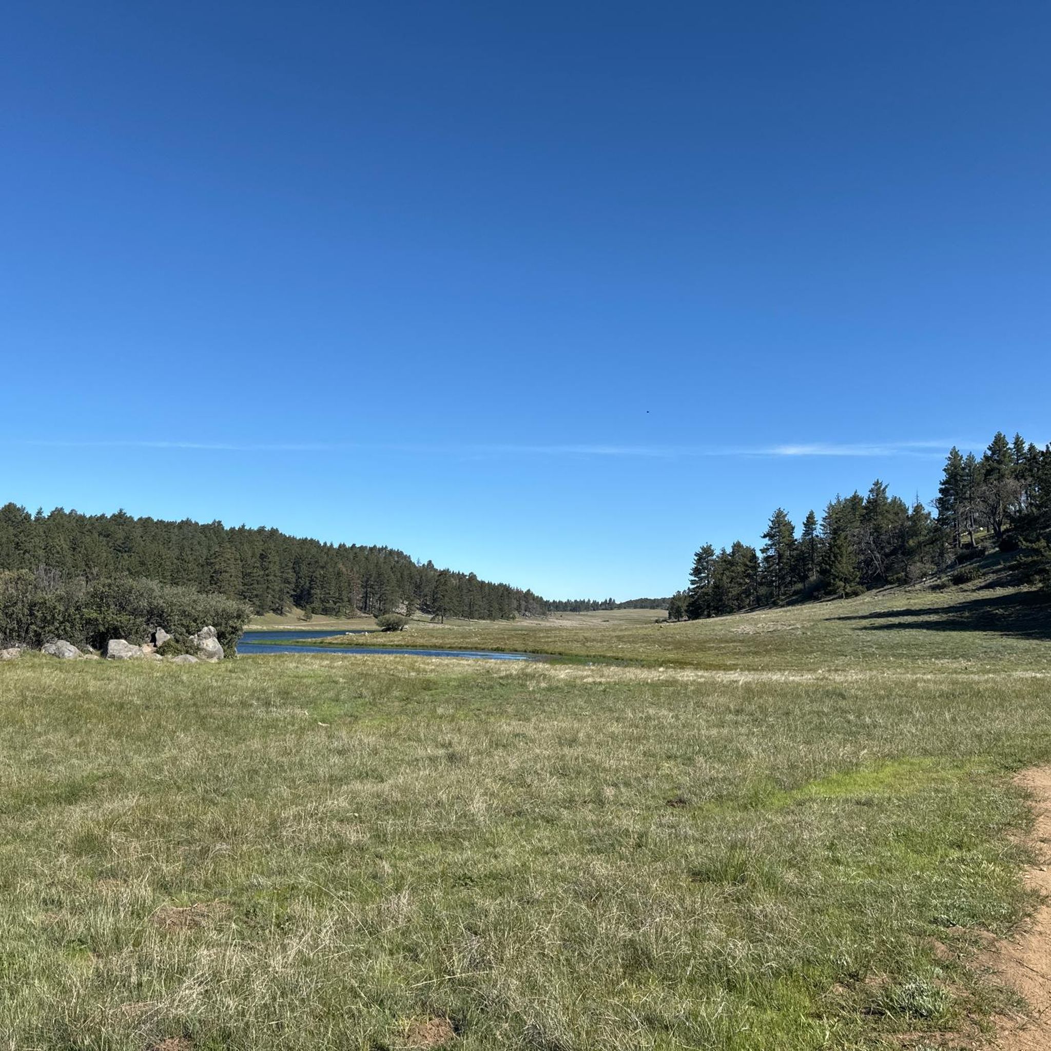
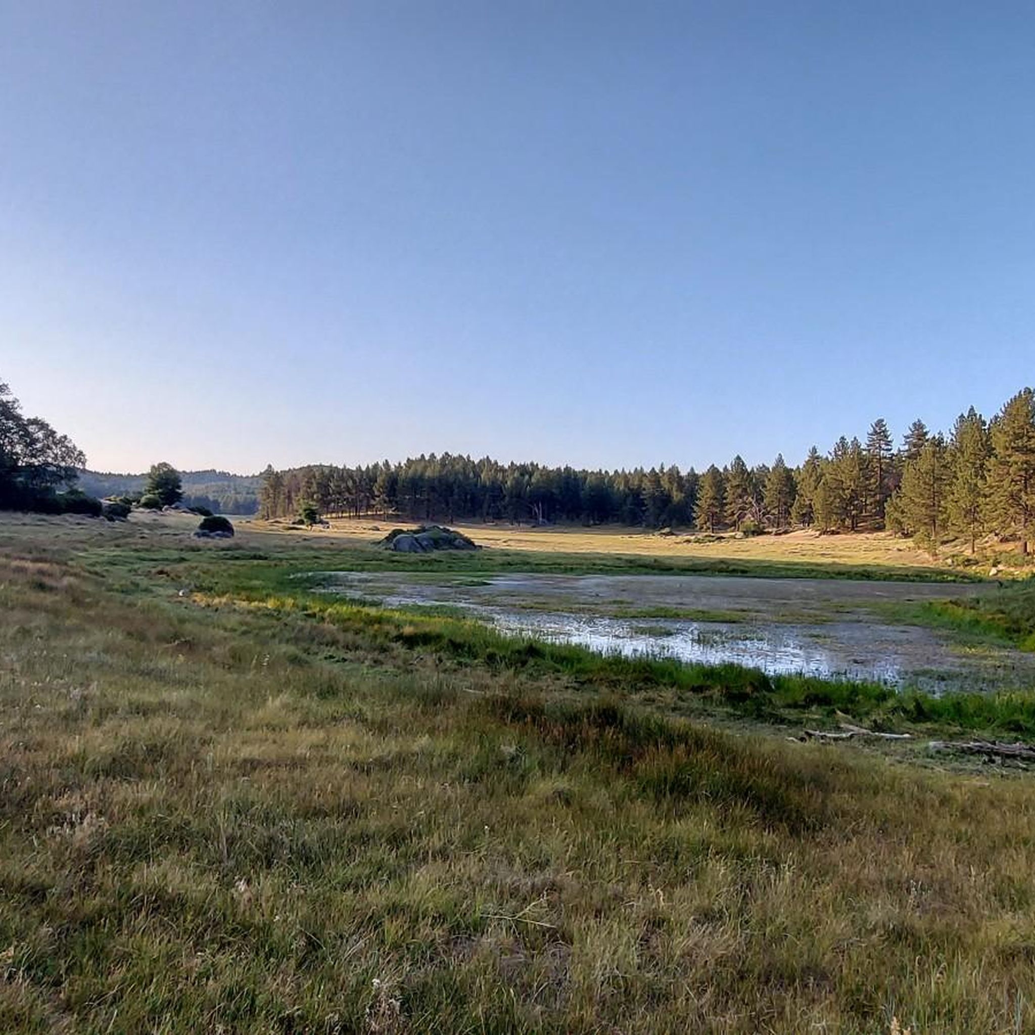
Road cycling routes around Mount Laguna offer diverse landscapes and varied terrain within the Cleveland National Forest. The region rises to 6,000 feet above sea level, featuring elevated wooded areas with pine and oak trees, expansive meadows, and long climbs. Cyclists encounter sweeping vistas of the Anza-Borrego Desert and can experience routes that incorporate the scenic Sunrise Highway. The area provides a range of challenging climbs and picturesque descents, testing endurance over long distances.
Best road cycling routes around Mount Laguna
- The most popular road cycling route is Lake Cuyamaca/Mt. Laguna loop, a 45.6 miles (73.3 km) difficult trail that takes 3 hours 53 minutes to complete. This route features significant elevation gain and diverse scenery, including a mountain lake and pine forests.
- Another top favourite among local road cyclists is Kitchen Creek loop, a difficult 31.8 miles (51.2 km) path. This route includes sections of partially car-free roads, offering a serene riding experience with notable views.
- Local road cyclists also love the Wooded Hill Loop, a 17.0 miles (27.3 km) trail leading through elevated wooded areas and meadows, often completed in about 1 hour 38 minutes.
- Road cycling around Mount Laguna is defined by long climbs, pine forests, and panoramic desert views. The network offers options for different ability levels, with a focus on endurance-testing routes.
- The routes in Mount Laguna are highly rated by the komoot community with an average score of 5.0 stars from over 6 reviews. More than 200 road cyclists have used komoot to explore Mount Laguna's varied terrain.
Last updated: July 7, 2026
5.0
(2)
73
riders
73.3km
03:54
1,250m
1,250m
Prepare for a demanding road cycling adventure on the Lake Cuyamaca/Mt. Laguna loop, a difficult route that challenges you with 45.6 miles (73.3 km) and a significant 4090 feet (1247 metres) of elevation gain. This ride typically takes around 3 hours and 53 minutes to complete. You'll begin near Lake Cuyamaca with expansive views of mountains and valleys, then climb through high mountain meadows before entering thick pine forests as you approach Mount Laguna. The highlight for many riders is the incredible desert overlooks just past Mount Laguna, offering sweeping vistas of the Anza-Borrego Desert below.
While you won't encounter specific permit requirements or seasonal closures for this route, careful planning is crucial for such a challenging ride. You can find convenient amenities like food and water in towns such as Pine Valley and Guatay. Mount Laguna village also provides a general store and the Pine House Cafe, which makes for a good spot to refuel and rest during your journey.
This route stands out for its dramatic transition through diverse Southern California landscapes, from the tranquil lake views to the rugged mountain terrain and the vast desert expanse. It offers a unique opportunity to experience multiple ecosystems within a single, continuous ride. The journey through Cuyamaca Rancho State Park and up to Mount Laguna showcases the region's natural beauty and varied topography, making it a memorable experience for any dedicated road cyclist.
24
riders
51.2km
02:49
1,100m
1,100m
The Kitchen Creek loop presents a difficult road cycling adventure, covering 31.8 miles (51.2 km) with a substantial elevation gain of 3598 feet (1097 metres). You can expect to complete this ride in about 2 hours and 48 minutes, traversing diverse landscapes that shift from lower elevation sage bushes to higher pine and conifer forests. As you climb, you will be rewarded with expansive views from Laguna Summit, where the Anza-Borrego Desert stretches to the east and the Pacific Ocean shimmers to the west.
When planning your ride, be aware that a large part of Kitchen Creek Road is closed to cars beyond a certain gate, ensuring a quieter cycling experience. However, some sections of the road feature unmaintained asphalt, which can be rough with potholes and fallen rocks. It is important to ensure your racebike is suitable for these varied conditions to enjoy the route safely and comfortably.
This route is a notable part of the Mount Laguna scenic viewpoints, offering a truly challenging ride that demands very good fitness. The changing scenery, from desert vistas to forest paths and pleasant views within Kitchen Creek Canyon when the creek is flowing, makes it a distinctive option for experienced cyclists seeking a demanding journey in the region.

Sign up for free
8
riders
27.3km
01:39
690m
690m
Explore the 17.0-mile Wooded Hill Loop, a moderate route through Laguna Mountain's highest wooded point with scenic views and varied terrain
5.0
(2)
45
riders
122km
06:32
2,170m
2,170m
Hard road ride. Very good fitness required. Mostly well-paved surfaces and easy to ride.
5.0
(1)
40
riders
130km
06:52
2,290m
2,290m
Hard road ride. Very good fitness required. Mostly well-paved surfaces and easy to ride.
Get access to more routes and recommendations from other explorers.
Sign up for free
Already have an account?
Our route recommendations are based on thousands of hikes, rides, and runs completed by other people on komoot.
Start today with a free account
Your next adventure awaits.
Login or Signup




Tips from the Community

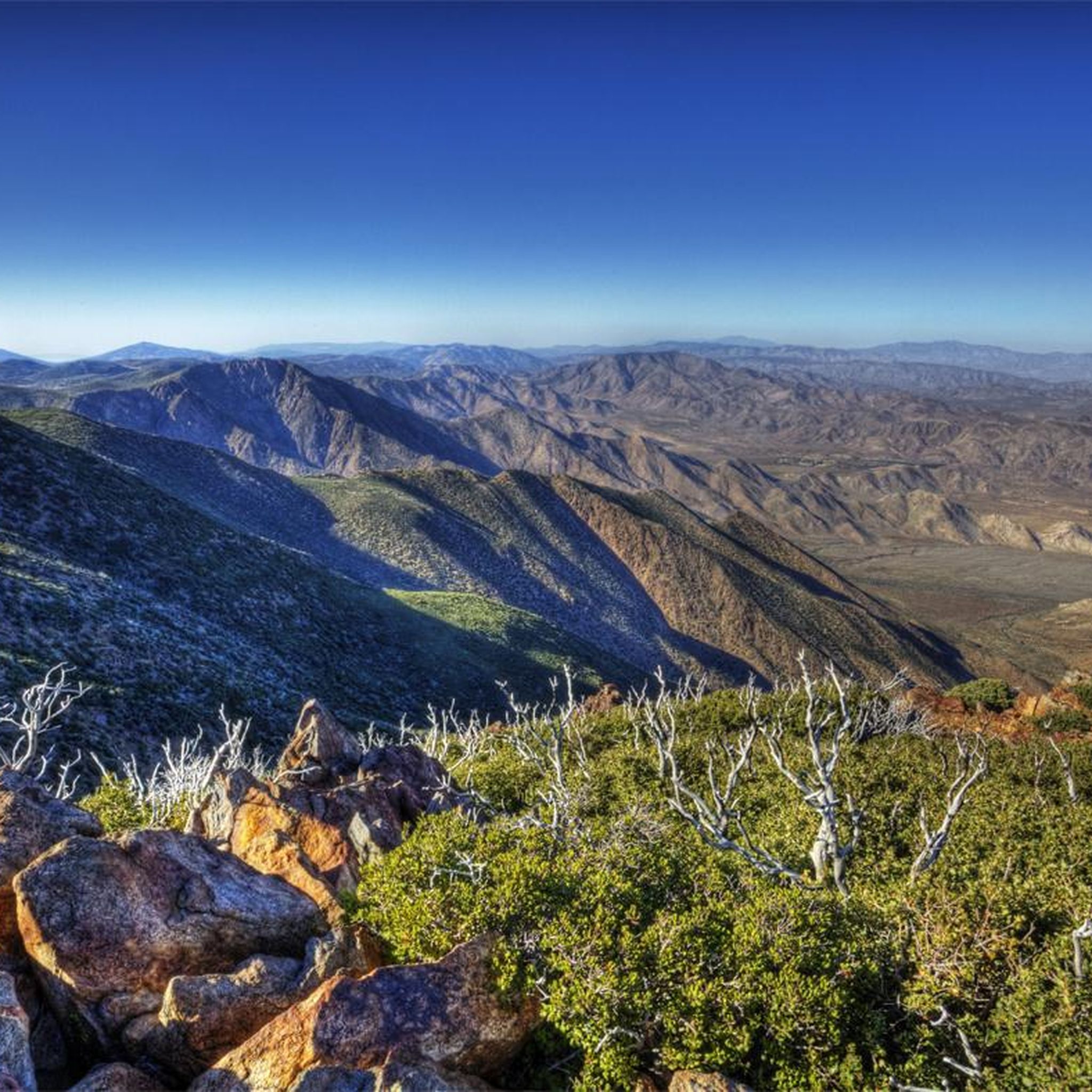
Laguna Summit is a prominent mountain pass along Sunrise Highway (State Route 79). As one of the highest points along this scenic route, it offers panoramic views of the surrounding landscapes, including the Anza-Borrego Desert to the east and the Pacific Ocean to the west.
0
0
Lake Cuyamaca is a picturesque 110-acre reservoir nestled in the Cuyamaca Mountains. Created in the 1880s to supply water to the city of San Diego, it now serves as a recreational haven for fishing, boating, and picnicking.
0
0


The Dyar house was built in 1923, had two-stories, and measured 60' by 35′. There were six bedrooms upstairs and two full baths. The basement contained a wood burning furnace and the heat was pumped into each room through vents. An electric generating plant was built alongside the home as was a two-car garage. After 10 years, the Dyar’s made a deal with the state of California to take over the ranch and open it to the public. From that time forward the state used the home as a small lodge for paying guests. After the 2003 Cedar Fire swept through this area though, all that remains today is a skeletal structure.
0
0

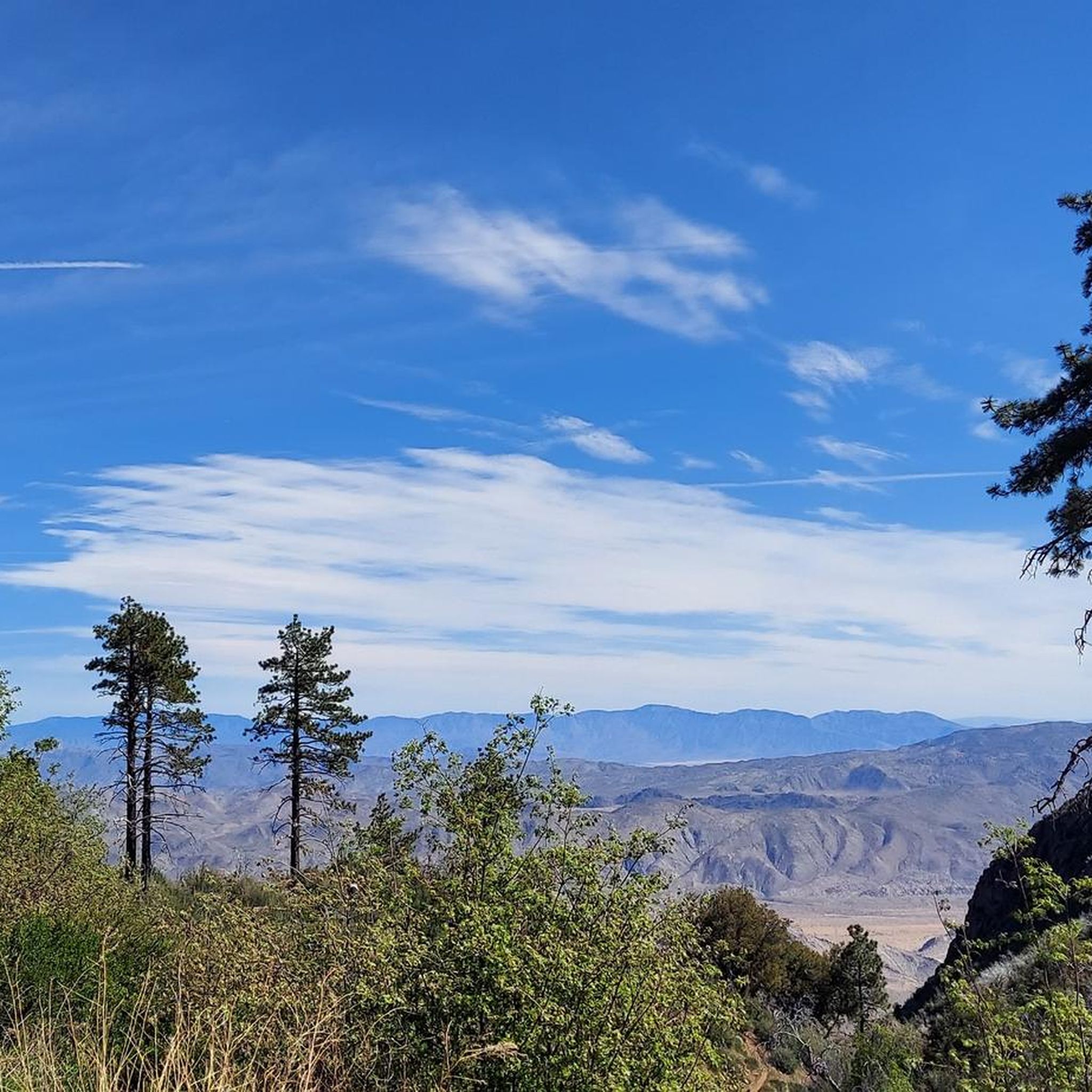
Kwaaymii Point is a spiritual point especially for the indigenous people. On a clear day you can look over the desert including the Sawtooth Range and Cottonwood Canyon.
4
0

Lake Cuyamaca is a reservoir in San Diego County. The reservoir was created in 1888 to provide water for the city of San Diego.Today, the lake is used for fishing and there is a campground on the shore.
2
0

Frequently Asked Questions
What is the general difficulty of road cycling routes around Mount Laguna?
Road cycling routes in Mount Laguna are generally challenging, characterized by long climbs and significant elevation gain. Most routes are rated difficult, testing endurance rather than short bursts of power. For example, the Lake Cuyamaca/Mt. Laguna loop, a popular option, features over 1200 meters of elevation gain.
What kind of terrain and landscapes can I expect on Mount Laguna road cycling routes?
You can expect a diverse range of landscapes, from elevated wooded areas with pine and oak trees to expansive meadows. Many routes offer sweeping vistas of the Anza-Borrego Desert on one side and views towards the Pacific Ocean on the other. A typical ride might take you from a beautiful mountain lake, through valleys, up to thick pine forests, and then down with desert views.
Are there any partially car-free roads for a more serene cycling experience?
Yes, some sections, particularly on roads like Kitchen Creek Road and Pine Creek Road, are partially car-free or single-lane. This offers a more serene and enjoyable riding experience. The Kitchen Creek loop specifically includes sections of this marvelous cycling back road.
What are some notable scenic viewpoints or landmarks along the road cycling routes?
Many routes incorporate the iconic Sunrise Highway (S1), which offers sweeping vistas. You can also find breathtaking panoramic views of the Anza-Borrego Desert from various points, including Storm Canyon Overlook and Kwaaymii Point. The tranquil Big Laguna Lake is another prominent feature in the area.
When is the best time of year for road cycling in Mount Laguna?
Mount Laguna offers a refreshing escape, especially during warmer months, due to its elevation. While specific seasonal closures can occur, particularly in winter due to snow, the area is generally excellent for road cycling from spring through fall. Always check local weather conditions before heading out.
Are there any loop routes available for road cyclists?
Yes, Mount Laguna features several varied loop routes that cater to different skill levels. Examples include the Lake Cuyamaca/Mt. Laguna loop and the Wooded Hill Loop, which takes you through elevated wooded areas and meadows.
What do other road cyclists say about the routes in Mount Laguna?
The road cycling routes in Mount Laguna are highly rated by the komoot community, with an average score of 5.0 stars from over 6 reviews. Cyclists often praise the challenging climbs, picturesque descents, and the diverse scenery that includes mountain lakes, pine forests, and panoramic desert views.
Are there any facilities or places to stop for refreshments near the cycling routes?
Yes, the historic Laguna Mountain General Store, built in the 1930s, serves as a hub for visitors and offers groceries, camping supplies, and gifts. This can be a convenient stop for refreshments or supplies during your ride.
Where can I find parking for road cycling in Mount Laguna?
While specific parking areas vary by route starting point, many cycling loops often start from areas like Pine Valley. You can also find parking at trailheads or designated recreational areas within the Cleveland National Forest. For routes like the Storm Canyon Overlook – Kwaaymii Point loop from Julian, starting points in nearby towns often provide parking options.
Are there any family-friendly road cycling options in Mount Laguna?
Given the challenging nature of most road cycling routes in Mount Laguna, which feature long climbs and significant elevation, truly 'family-friendly' options suitable for young children or beginners are limited. The routes are primarily designed for endurance and experienced cyclists. However, shorter sections of less trafficked roads might be suitable for older, more experienced cycling families.
What kind of wildlife might I encounter while cycling in Mount Laguna?
Mount Laguna's unique ecosystem supports a variety of bird species, including Red-tailed Hawks, White-headed Woodpeckers, and Acorn Woodpeckers. You might also spot the elusive Mountain Quail. Keep an eye out, especially in the forested and meadow areas.
Are there accommodations available for cyclists in Mount Laguna?
Yes, for those looking to stay overnight, the Laguna Mountain Lodge offers rustic accommodations with cabins and motel units. Additionally, various campgrounds are available, such as Laguna El Prado Campground, which is noted for its generous sites.
Most popular attractions around Mount Laguna

Get inspired with the komoot mobile app


Explore more
Browse the best Road cycling routes in other regions.
