The best walks and hikes around Veitastondsvatnet
4.4
(443)
1,844
hikers
22
hikes
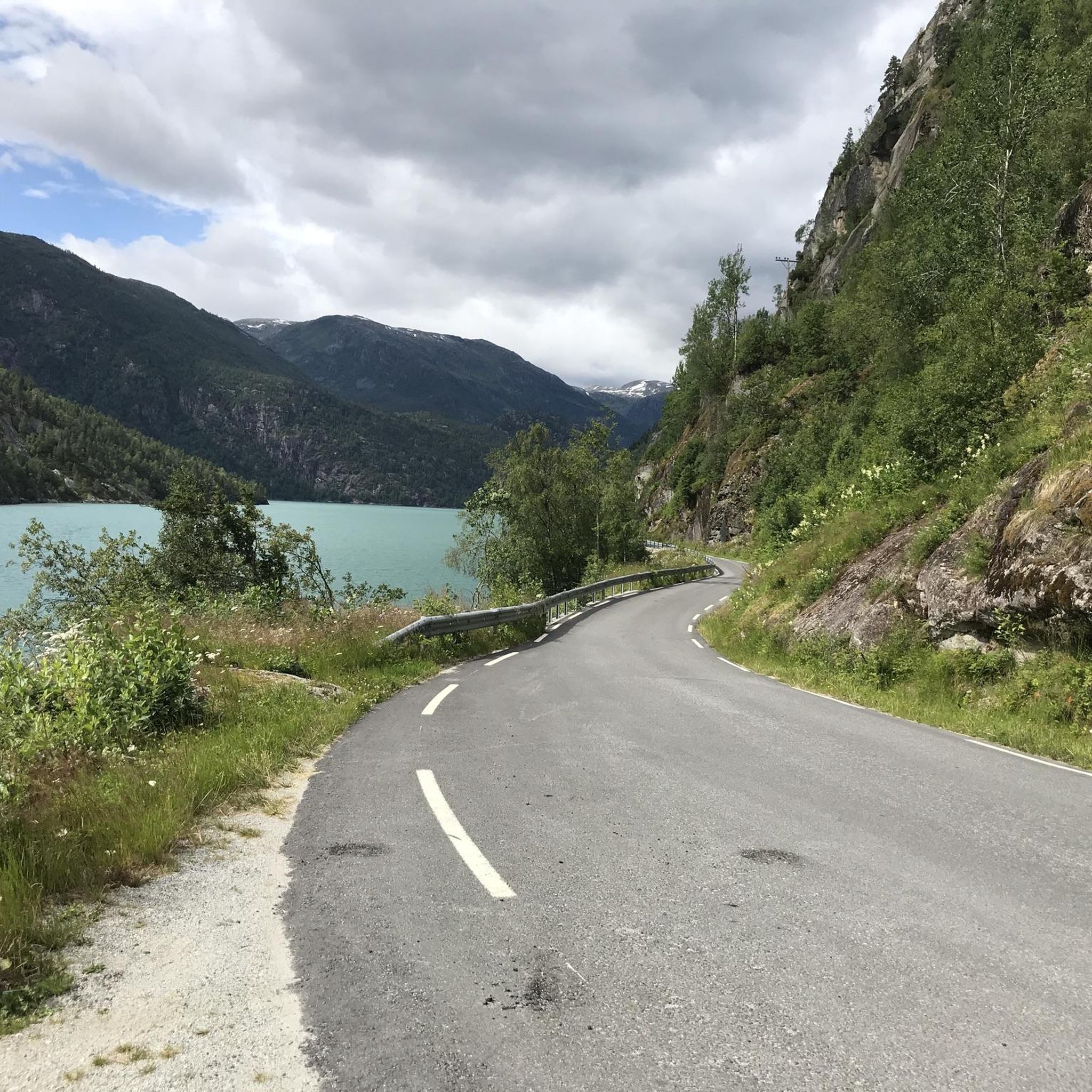
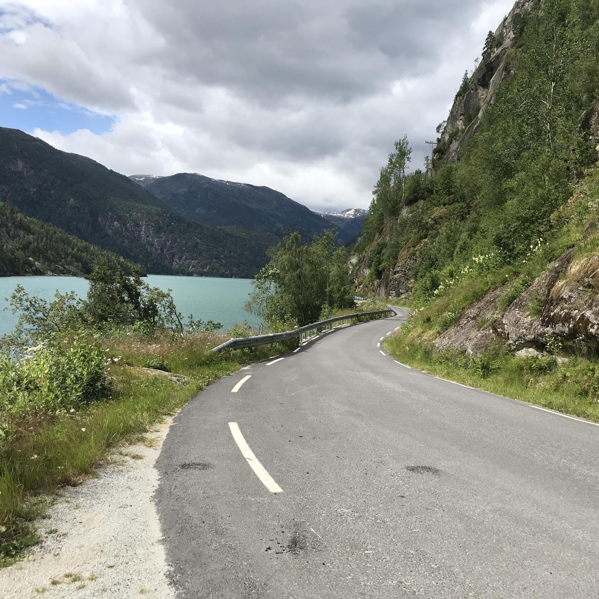
Hiking around Veitastondsvatnet, located in Norway's Sogn and Fjordane region, offers a diverse range of outdoor experiences. The area is characterized by its natural features, including the lake itself, surrounded by varied terrain. Hikers can expect paths that range from gentle lakeside walks to routes with more significant elevation changes, providing access to viewpoints and scenic landscapes. The region's broader geography includes fjords, mountains, and waterfalls, contributing to the varied hiking terrain around Veitastondsvatnet.
Best hiking trails around Veitastondsvatnet
- The…
Last updated: October 13, 2026
4.5
(2)
4
hikers
4.23km
01:29
290m
130m
Easy hike. Great for any fitness level. Easily-accessible paths. Suitable for all skill levels.
1
hikers
3.54km
01:03
110m
110m
Easy hike. Great for any fitness level. Easily-accessible paths. Suitable for all skill levels.

4.4
(5)
18
hikers
13.6km
04:23
600m
600m
Moderate hike. Good fitness required. Easily-accessible paths. Suitable for all skill levels.
3.82km
01:49
410m
410m
Moderate hike. Good fitness required. Easily-accessible paths. Suitable for all skill levels.
4.0
(4)
24
hikers
Easy hike. Great for any fitness level. Easily-accessible paths. Suitable for all skill levels.
Get access to more routes and recommendations from other explorers.
Already have an account?
Our route recommendations are based on thousands of hikes, rides, and runs completed by other people on komoot.
Start today with a free account
Your next adventure awaits.
Popular around Veitastondsvatnet
Tips from the Community

Grøssete is a remote mountain hut in Vestland, situated at an elevation of 850 metres. Surrounded by pristine wilderness, it offers a peaceful refuge for hikers and outdoor enthusiasts exploring the Norwegian mountains.
0
0
From this point you get a great view of the waterfall Fessene. Stop and enjoy it!
0
0
While ascending on the trail you get better and better views over the lake. Keep going!
0
0

On the old Kongevegen between Sogndal and Hafslo lies a spring around which a story is told: Saint Olav is said to have drunk here. Since then, the water has been considered healing.
0
0

Stalheim Viewpoint offers one of the country's most iconic and dramatic panoramas, overlooking the Nærøydalen valley, a UNESCO World Heritage site. From this high vantage point, you look down into the steep gorge, with clear views of the valley floor and the twin cascades of Stalheimsfossen and Sivlefossen plunging down the mountainsides.
0
0
Helvetesfossen (meaning "Hell's Waterfall") is a picturesque waterfall. It is situated along the historic Kongevegen (King's Road), offering a scenic spot often viewed alongside the nearby Futespranget waterfall. It forms part of a popular walking route that follows the old road, allowing visitors to appreciate the falls and the surrounding cultural history of the Sognefjord area.
1
0

Frequently Asked Questions
How many hiking trails are available around Veitastondsvatnet?
There are over 20 hiking routes documented around Veitastondsvatnet, offering a variety of experiences for different skill levels. This includes 11 easy trails, 7 moderate routes, and 2 more challenging options.
What kind of terrain can I expect on hikes around Veitastondsvatnet?
The terrain around Veitastondsvatnet is quite varied. You'll find paths ranging from gentle lakeside walks to routes with more significant elevation changes. The broader Sogn and Fjordane region is known for its dramatic natural features, including fjords, mountains, and waterfalls, which contribute to the diverse hiking landscape.
Are there any family-friendly hiking options in the area?
Yes, Veitastondsvatnet is known for its accessibility and offers several easy hikes suitable for families. These paths allow visitors to connect with nature without requiring strenuous effort. Many routes are short and relatively flat, perfect for outings with children.
Can I bring my dog on the hiking trails around Veitastondsvatnet?
While specific dog policies can vary by trail, generally, dogs are welcome on many hiking trails in Norway, provided they are kept on a leash, especially during certain seasons to protect wildlife. Always check local signage for any specific restrictions on individual paths.
Are there any circular hiking routes available?
Yes, there are several circular routes. For example, the moderate View of Lake with Cabins – Köllsetevatnet loop from Hodlekve kryss is a popular choice, offering views of the lake and cabins. Another easy option is the View of the Village and Lake – Panoramic View of the Lake loop from Hafslo.
What are the best times of year to go hiking in Veitastondsvatnet?
The best time to hike around Veitastondsvatnet is typically during the warmer months, from late spring to early autumn (May to September), when the weather is milder and trails are clear of snow. This allows for the most comfortable hiking experience and access to all routes.
What kind of views can I expect on the trails?
Hikers can expect stunning lake views, varied forest paths, and routes that lead to panoramic vistas. The region's broader geography includes majestic fjords and mountains, offering a picturesque backdrop to your outdoor adventures.
Are there any easy hikes with good viewpoints?
Absolutely. The Stalheimskleiva Trail is an easy route featuring a steady ascent with rewarding views of the surrounding landscape. Another easy option is the View of Sognefjord loop from Hafslo kyrkje, which offers beautiful fjord views.
What do other hikers say about the trails in Veitastondsvatnet?
The trails in Veitastondsvatnet are highly rated by the komoot community, with an average score of 4.5 stars from over 340 reviews. Hikers often praise the beautiful lake views, varied forest paths, and the accessibility of routes for different ability levels.
Are there any longer, more challenging hikes for experienced hikers?
Yes, for those seeking a greater challenge, there are 2 difficult routes available. While specific details on these are not provided, they offer more significant elevation changes and longer distances for experienced hikers to explore the rugged beauty of the region.
Is there public transport access to the hiking areas around Veitastondsvatnet?
Information on specific public transport routes directly to trailheads around Veitastondsvatnet is limited. It is advisable to check local bus schedules or consider driving, as many trailheads in rural Norwegian areas are best accessed by car.
Where can I find parking for the hiking trails?
While specific parking facilities for each trailhead are not detailed, generally, in areas like Veitastondsvatnet, you can often find designated parking areas near popular trail starting points or in nearby villages. It's recommended to check local maps or tour descriptions for specific parking information before your hike.

Get inspired with the komoot mobile app


Explore more
Browse the best Hikes in other regions.
