Routes

Planner

Features

Updates

App

Login or Signup

Get the App

Login or Signup

Routes
Cycling routes
Canada
British Columbia

Cowichan Valley F

The best cycling routes around Cowichan Valley F

4.5

(54)

465

riders

11

rides

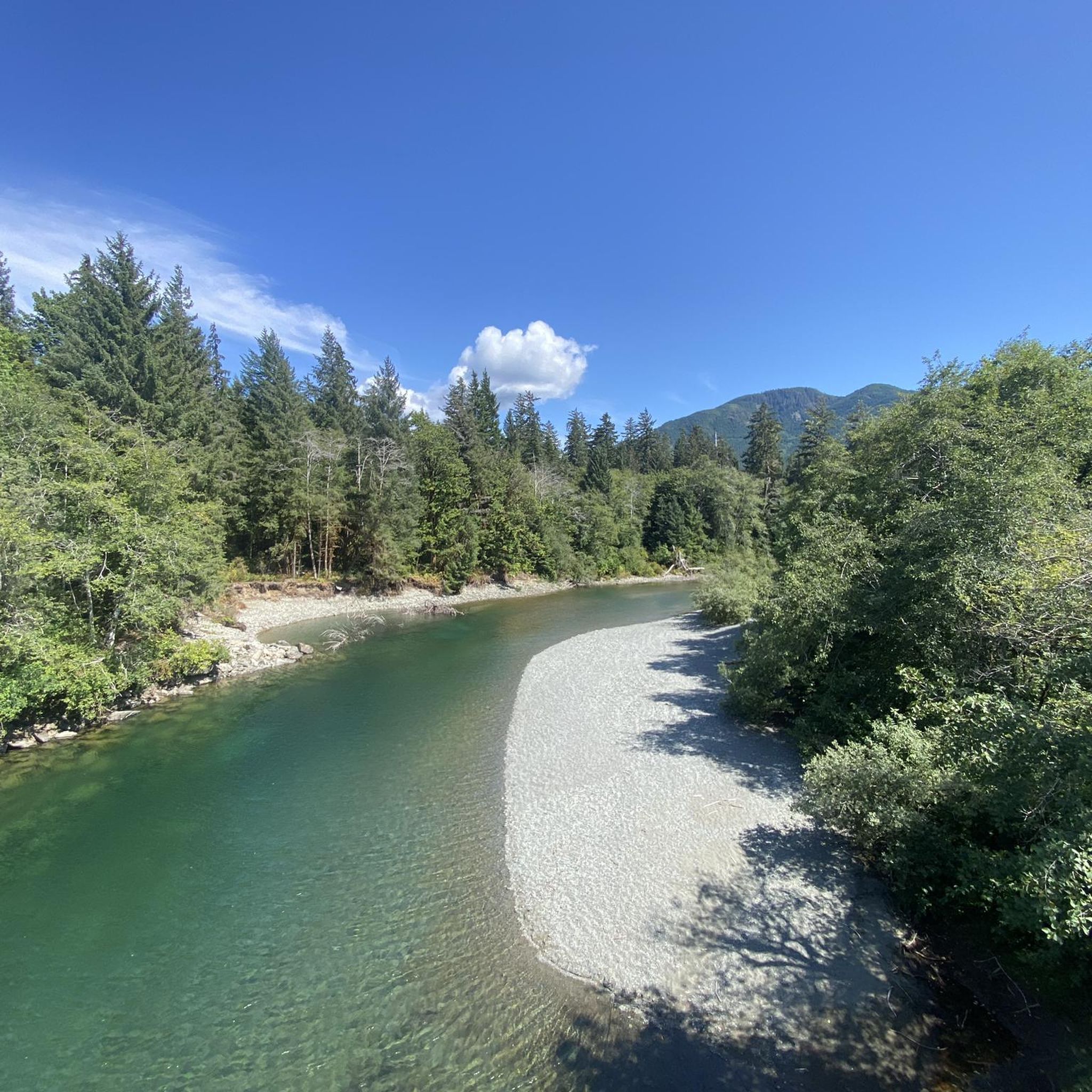
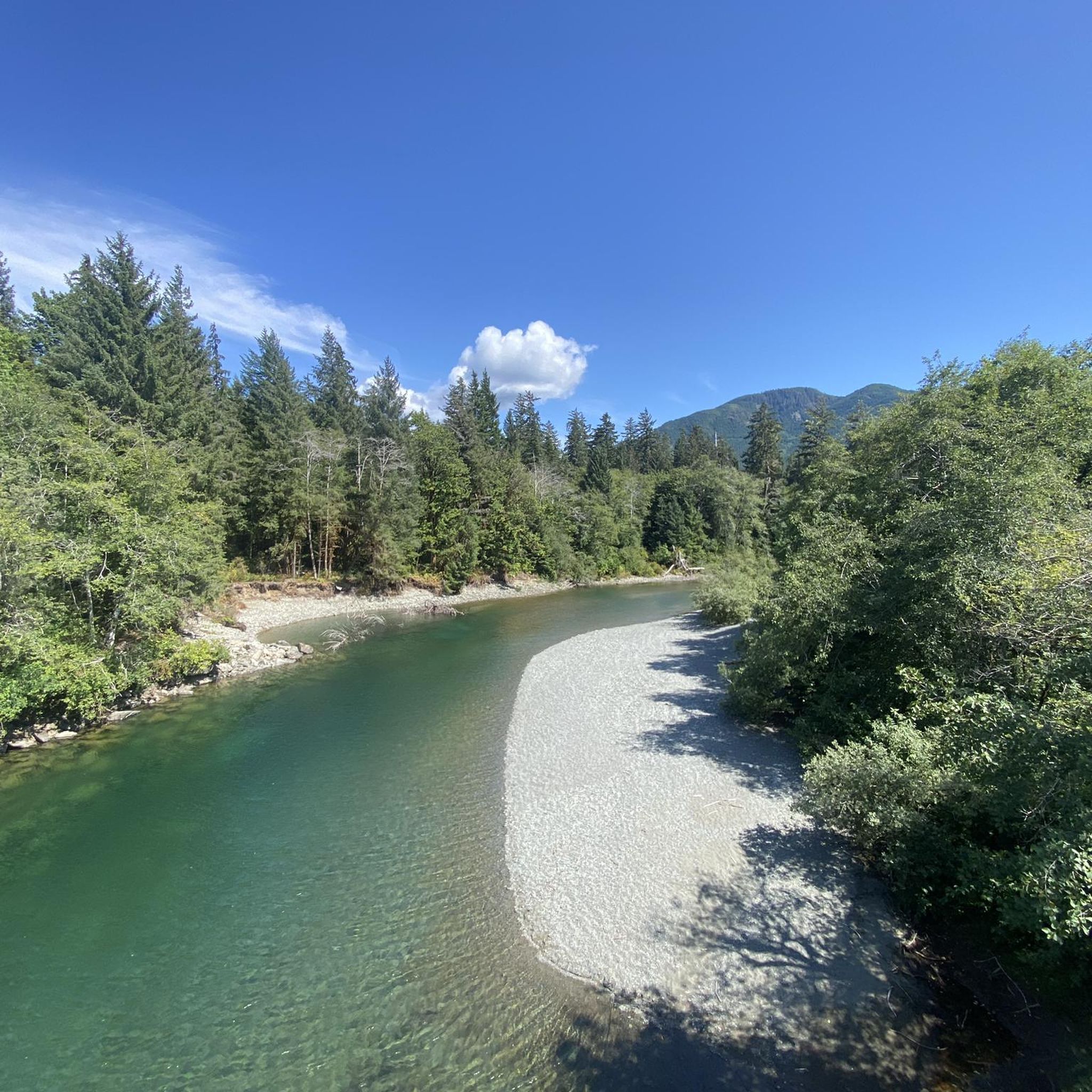
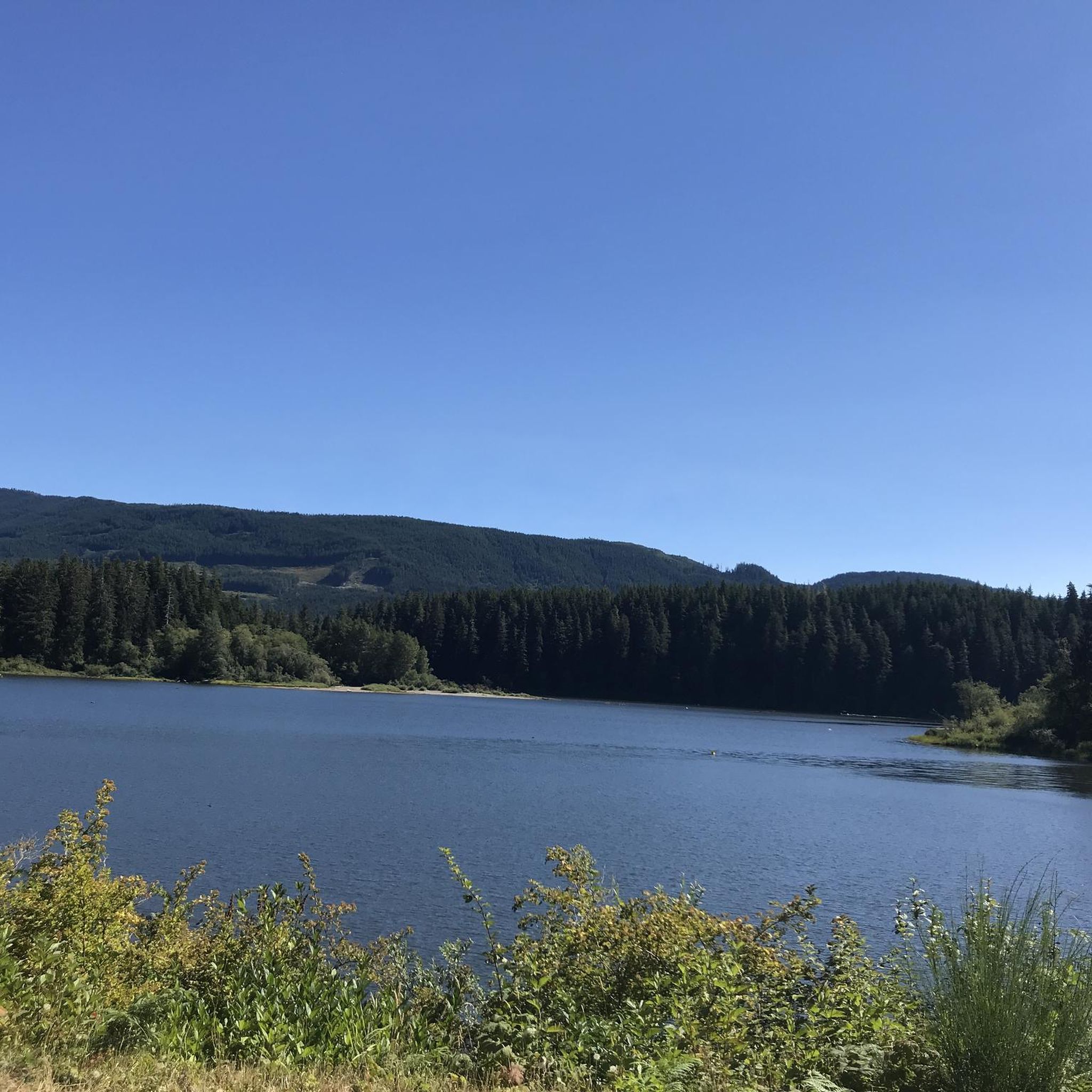
Touring cycling around Cowichan Valley F offers routes through a varied topography, encompassing lush river valleys, forested hills, and coastal areas. The region is characterized by features such as the Cowichan River and Cowichan Lake, with elevations ranging from sea level to hills under 200 meters. Glacial activity has shaped the distinctive valleys and mountains, providing diverse terrain for cyclists.

Best touring cycling routes around Cowichan Valley F

  • The most popular touring cycling route is Lake Cowichan – Fairy Lake loop from Lake Cowichan, a 67.9 miles (109.2 km) trail that takes 6 hours 53 minutes to complete. This challenging route explores extensive forested areas and offers significant elevation changes.
  • Another top favourite among local touring cyclists is Mayo Lake – J&V's Burgers & Pizza loop from Cowichan Lake at Kapoor (WB), a moderate 24.2 miles (38.9 km) path. This route passes through varied terrain, including sections near Mayo Lake.
  • Local touring cyclists also love the Lake Cowichan Bridge – Mayo Lake loop from Lake Cowichan, a 13.5 miles (21.8 km) trail leading through river valleys and past Mayo Lake, often completed in about 1 hour 41 minutes.
  • Touring cycling around Cowichan Valley F is defined by its river valleys, forested hills, and lake shores. The network offers options for different ability levels, from easy loops to more challenging routes with significant climbs.
  • The routes in Cowichan Valley F are highly rated by the komoot community with an average score of 4.6 stars from more than 40 reviews. More than 400 touring cyclists have used komoot to explore Cowichan Valley F's varied terrain.

Last updated: July 5, 2026

4.5

(4)

21

riders

#1.

Mayo Lake – J&V's Burgers & Pizza loop from Cowichan Lake at Kapoor (WB)

38.9km

02:48

280m

280m

Moderate bike ride. Good fitness required. Mostly paved surfaces. Suitable for all skill levels.

Navigate with device

Send to Phone

Save

Moderate

Easy bike ride. Great for any fitness level. Mostly paved surfaces. Suitable for all skill levels.

Easy
guide_signup
Let us show you the way with the komoot mobile app
With a free komoot account, you can easily find, customize, and navigate endless outdoor adventures.

Sign up for free

Easy bike ride. Great for any fitness level. Mostly paved surfaces. Suitable for all skill levels.

Easy

Hard bike ride. Very good fitness required. Mostly paved surfaces. Suitable for all skill levels.

Hard

Moderate bike ride. Good fitness required. Mostly paved surfaces. Suitable for all skill levels.

Moderate
Sign up for free to see 7 more rides around Cowichan Valley F.

Get access to more routes and recommendations from other explorers.

Sign up for free

Already have an account?

Our route recommendations are based on thousands of hikes, rides, and runs completed by other people on komoot.

Start today with a free account

Your next adventure awaits.

Login or Signup
Popular around Cowichan Valley F

West Coast Trail — Seven days on the Graveyard of the Pacific

Hiking around Cowichan Valley F

Gravel biking around Cowichan Valley F

Road Cycling Routes around Cowichan Valley F

Running Trails around Cowichan Valley F

Other adventures around Cowichan Valley F

West Coast Trail — Seven days on the Graveyard of the Pacific

Hiking Collection by

Sue

Tips from the Community

Alex
November 15, 2025, Fairy Lake Recreation Site

Fairy Lake Recreation Site has 36 campsites for both tents and small RVs, with premium waterfront spots. Facilities include pit toilets, fire pits, and picnic tables at each site. The lake features a sandy beach for swimming, a non-motorized boat launch, and excellent fishing for cutthroat trout and Dolly Varden.

0

0

Alex
November 15, 2025, Fairy Lake

Fairy Lake, just off Pacific Marine Road, sits tucked into dense Vancouver Island rainforest along the San Juan River and has a small, unique attraction. There is a famous tiny Douglas fir growing from a partly-submerged log, known as the “Fairy Lake bonsai tree.”

0

0

Great for swimming and with the option of wild camping. Directly above the water between bushes and trees. Good privacy and very quiet after 7 p.m. It is also tolerated. There are no no camping signs either.

Translated by Google

0

0

Dank
July 21, 2024, Hidden River Pool

Place to take a dip and fill up water if you need. Right after the bridge heading towards port renfrew there’s a little path from the pullout. Enjoy

0

0

Glorious burgers and milkshakes at this retro diner. Great service, awesome food. Not open on Sundays!

0

0

Nice little town - you can cycle the whole way around on gravel logging roads.

0

0

Be sure to take enough food and water with you. No shops to Lake Cowichan. Wild camping possible on the shores of Lake Cowichan. Attention: Bear rules!

Translated by Google

2

0

On a former railway line through dense jungle. Pure nature and totally lonely.

Translated by Google

1

0

Frequently Asked Questions

What types of terrain can I expect on touring cycling routes in the Cowichan Valley?

The Cowichan Valley offers a diverse range of terrain for touring cyclists. You'll find routes winding through lush river valleys, forested hills, and scenic coastal areas. The region's landscape, shaped by glacial activity, provides varied experiences from relatively flat sections to routes with significant elevation changes, particularly in areas near mountains like Mount Tzouhalem and Mount Prevost.

Are there any family-friendly touring cycling routes in the Cowichan Valley?

Yes, the Cowichan Valley offers several routes suitable for families. The Lake Cowichan Bridge – Mayo Lake loop from Lake Cowichan is an easy 21.8 km trail that takes you through river valleys and past Mayo Lake, often completed in about 1 hour 41 minutes. The Cowichan Valley Trail, part of the Trans Canada Trail, also features mostly wide, flat, and compacted gravel sections, making it accessible for cyclists of all skill levels.

What are some notable landmarks or attractions I can see along the cycling routes?

The Cowichan Valley is rich in natural and historical attractions. A major highlight is the Kinsol Trestle, one of the world's tallest and longest wooden railway trestles, which is part of the Cowichan Valley Trail. You can also explore the Cowichan Valley Trail — Rainforest Section, or visit beautiful lakes like Lake Cowichan and Fairy Lake. Charming towns like Cowichan Bay and Duncan also offer cultural experiences and amenities.

What is the best time of year for touring cycling in the Cowichan Valley?

The Cowichan Valley benefits from a mild, Mediterranean-like climate, making it suitable for touring cycling much of the year. Spring and fall generally offer pleasant temperatures and beautiful scenery. Summers are warm and dry, ideal for long rides, while winters are mild but can bring rain. Always check local weather conditions before heading out.

Are there any challenging routes for experienced touring cyclists?

Yes, for experienced touring cyclists seeking a challenge, the Cowichan Valley offers routes with significant elevation changes. The Lake Cowichan – Fairy Lake loop from Lake Cowichan is a difficult 109.2 km trail that explores extensive forested areas and features substantial climbs, typically taking around 6 hours 53 minutes to complete.

Are there any loop routes available for touring cyclists?

Many touring cycling routes in the Cowichan Valley are designed as loops, allowing you to start and end in the same location. Examples include the moderate Mayo Lake – J&V's Burgers & Pizza loop from Cowichan Lake at Kapoor (WB), which covers 38.9 km, and the easy Mayo Lake – J&V's Burgers & Pizza loop from Cowichan Lake at Mayo (EB), a 22.1 km ride. These loops often pass through varied terrain and scenic spots.

What is the community's overall rating for touring cycling in the Cowichan Valley?

The touring cycling routes in the Cowichan Valley are highly regarded by the komoot community, holding an impressive average rating of 4.6 stars from over 40 reviews. Cyclists frequently praise the varied terrain, scenic beauty, and the well-maintained sections of trails like the Cowichan Valley Trail.

Can I find routes that incorporate historic railway trestles?

Absolutely. The Cowichan Valley is famous for its historic railway trestles, which are integrated into many cycling routes. The Holt Creek Trestle – 66 Mile Trestle loop from Cowichan Lake at Lepage (EB) is a moderate 34.2 km route that allows you to experience these impressive structures firsthand, including the iconic Kinsol Trestle.

Are there options for shorter, easier rides?

Yes, the region caters to all skill levels, including those looking for shorter, easier rides. The Lake Cowichan Bridge – Mayo Lake loop from Lake Cowichan is an easy 21.8 km trail that offers a pleasant ride through river valleys and past Mayo Lake, making it a great option for a relaxed outing.

What kind of surfaces can I expect on the touring cycling routes?

The Cowichan Valley's touring cycling routes feature a mix of surfaces. The extensive Cowichan Valley Trail, a key part of the network, is primarily composed of wide, flat, and compacted gravel, suitable for touring bikes. Other routes may include paved sections, especially when passing through towns or along quieter roads, and some natural, unpaved paths through forested areas.

Are there places to stop for food or drinks along the routes?

Yes, many cycling routes in the Cowichan Valley pass through or near charming towns and rural areas with amenities. You'll find opportunities to stop at local shops, cafes, restaurants, and even wineries and cideries, especially in communities like Cowichan Bay, Duncan, and near Lake Cowichan. For example, the Mayo Lake – J&V's Burgers & Pizza loop from Cowichan Lake at Kapoor (WB) suggests a stop at J&V's Burgers & Pizza.

How many touring cycling routes are available in the Cowichan Valley?

There are over 10 dedicated touring cycling routes available in the Cowichan Valley, offering a variety of experiences. These include 3 easy routes, 6 moderate routes, and 3 difficult routes, ensuring options for cyclists of all skill levels.

Most popular routes around Cowichan Valley F

Easy hikes around Cowichan Valley F

Most popular attractions around Cowichan Valley F

Places to see

Store rating

Get inspired with the komoot mobile app

With a free komoot account, you can easily find, customize, and navigate endless outdoor adventures.

or

Join komoot Now

Store rating

Explore more

Browse the best Cycling routes in other regions.

VancouverCoast MountainsRocky MountainsElectoral Area AStanley Park National Historic SiteVictoriaMonashee MountainsArea C (Pemberton Valley/Mount Currie/D'Arcy)Vancouver IslandSaanichGrouse Mountain Regional ParkVictoria Harbour Migratory Bird SanctuaryCypress Provincial ParkMetro Vancouver Regional ParksIona Beach Regional ParkOkanagan-Similkameen DGaribaldi Provincial ParkCapilano WatershedEast Central Okanagan Electoral AreaBurnabyCentral SaanichArea D (Elaho/Garibaldi)Colony Farm Regional ParkEagle Mountain Recreation SiteWhistler Interpretive ForestRichmondOkanagan LakeArea E (Naramata/Greyback)Selkirk MountainsNorth SaanichShowh Lakes-Ancient Cedars Trail Recreation SiteDeas Island Regional ParkBurnaby Lake Regional ParkBrohm Lake Day Use Recreation SiteBuntzen Lake Recreation AreaAlice Lake Provincial ParkMaple RidgeSurrey Bend Regional ParkTantalus Provincial ParkLangleyBrackendale Eagles Provincial ParkPitt MeadowsCapilano River Regional ParkSurreyBlackcomb Glacier Provincial ParkGowlland Tod Provincial ParkBrohm Lake Interpretive Forest TrailsMinnekhada Regional ParkOak Bay Islands Ecological ReserveArea D (Trinity/West Creighton)Ƚáu,Welṉew̱/John Dean Provincial ParkNorth Okanagan BCapital GCodd Wetland Ecological Conservancy AreaKalamalka Lake Provincial ParkDeltaNorth CowichanCentral Okanagan JArea B (Shawnigan Lake)Fraser River Delta -- RamsarSatellite Channel Ecological ReserveBurns Bog Ecological Conservancy AreaPinecone Burke Provincial ParkCowichan Valley GSea To Sea Regional ParkPacific Spirit Regional ParkPurcell MountainsSalt Spring Island Electoral AreaBoundary Bay Regional ParkSooke Hills Wilderness Regional ParkNanaimoKanaka Creek Regional ParkMount Tuam Ecological ReserveCoquitlam WatershedTynehead Regional ParkMount Maxwell Ecological ReserveComox Valley B (Lazo North)Ayum Creek Regional Park ReserveFraser Islands Regional Park ReserveArea E (Chilliwack River Valley)Burnaby Mountain Conservation AreaBear Creek Provincial ParkMount Seymour Provincial ParkAbbotsfordNanaimo GTəmtəmíxʷtən/Belcarra Regional ParkSooke Mountain Provincial ParkArea P (Rivers and the Peaks)K'Ómoks Royston LandsUpper Trent River WoodlandsArea C (Inkaneep/Willowbrook)Okanagan Mountain Provincial ParkNanaimo ECrown Land ReserveArea A (Upper Flathead/Elk Valley)Skaha Bluffs Provincial ParkLower Seymour Conservation ReserveArea C (Moyie/Bull River)Koksilah River Provincial ParkMount Maxwell Provincial ParkArea G (Deroche/Dewdney/Sumas Mountain)Blaney Bog Regional Park ReserveUbc Malcolm Knapp Research ForestBurgoyne Bay Provincial ParkRathtrevor Beach Provincial ParkNorth Cowichan Municipal Forest ReserveArea B (Discovery Islands/Mainland Inlets)Cultus Lake Provincial ParkCougar Canyon Ecological ReservePitt LakeGoldstream Provincial ParkMyra-Bellevue Provincial ParkLynn Headwaters Regional ParkSeal Bay Regional Nature ParkArea A (Baynes Sound)Area F (Alberni Highway)Area D (Oyster Bay/Buttle Lake)Seymour WatershedAlaksen National Wildlife AreaSumas Mountain Regional ParkArea L (Grasslands)Vedder Mountain Interpretative ForestArea C (Puntledge/Black Creek)Stephens Coyote Ridge Regional ParkArea F (Trout Creek Valley)Sunshine Coast Regional DistrictHillkeep Regional ParkGeorge C. Reifel Migratory Bird SanctuaryArea J (Copper Desert Country)Area A (Kicking Horse/Kinbasket Lake)Tsable Lakes WoodlandsGlen Valley Regional ParkRobert'S Lake Regional ParkStawamus Chief Provincial ParkArea C (Arrowsmith-Benson)Mount Fernie Provincial ParkFraser River Ecological ReserveCowichan River Provincial ParkArea F (Columbia Lake/Windermere Lake)Area G (Upper Similkameen/Hedley)Mount Gardner Recreation SiteMill Farm Regional Park ReserveEllison Provincial ParkArea B (Lake Koocanusa)Woodley Range Ecological ReserveArea G (Forster Creek/Mount Assiniboine)Brandywine Falls Provincial ParkUpper Puntledge River WoodlandsCrippen Regional ParkGolden Ears Provincial ParkRuckle Provincial ParkFraser Valley DSouth Star Recreation TrailArea E (Saint Mary/Skookumchuck)Beaver Lodge Forest LandsCowichan LakeArea I (Youbou / Meade Creek)Area A (Osoyoos Lake)Alberni-ClayoquotArea H (Lighthouse Country)Columbia National Wildlife AreaArea F (Willow River/Upper Fraser)Helliwell Provincial ParkPacific Rim National Park Reserve - Long Beach UnitWidgeon Marsh Regional Park ReserveKootenay National ParkArea C (Sasquatch Country)Read Island Provincial ParkArea A (Kyuquot/Nootka/Sayward)Area E (Balfour/Cottonwood Lake)Windermere Lake Provincial ParkSpallumcheenBoyle Point Provincial ParkMount Geoffrey Escarpment Provincial ParkHarrison LakeArea C (Chilako River/Nechako)Area D (Tabor Lake/Stone Creek)Area F (McConnell Creek/Hatzic Prairie)Area B (Cawston/Lower Similkameen)Beaufort East WoodlandsWest Arm Provincial ParkKootenay Boundary EBodega Ridge Provincial ParkSilver Star Provincial ParkLiumchen Ecological ReserveElk Falls Provincial ParkArea B (Shelter Bay/Mica Creek)Mt. Macpherson Cross-Country Trails Recreation SiteMount Revelstoke National ParkMount Revelstoke National ParkArea G (Salmo Valley)Area J (Lower Arrow/Columbia)Campbell Valley Regional ParkArea H (The Slocan Valley)Mount Richardson Provincial ParkTrinity Ricardo Trail Recreation SiteArea B (Lower Columbia/Old Glory)Denman Island Provincial ParkNairn Falls Provincial ParkBlue Mountain Recreation SiteArea A (Malaspina/Toba)Area C (Lois Lake/Saltery Bay)Area B (Paradise Valley)Upper Little Qualicum River WoodlandsMt Begbie Area Recreation SiteMount Begbie Recreation SiteYoho National ParkHazelton MountainsSkeena MountainsArea A (Hudson Bay Mountain)Area B (Cayoosh/Pavilion)

Nearby adventure guides

Things to Do in Upper Ashburnham Creek Watershed

background

Get ready to conquer new peaks

Sign up for Free

Explore
RoutesRoute plannerFeaturesHikesMTB TrailsRoad cycling routesBikepackingSitemap
Download the app
Follow Us on Socials

© komoot GmbH

Privacy Policy