The best walks and hikes around Hurwenensche Kil
4.4
(2131)
11,185
hikers
447
hikes
Hiking trails around Hurwenensche Kil are primarily characterized by flat terrain along the Waal River and its floodplains. The region features a network of paths through open landscapes, offering views of the river and surrounding nature. Elevation changes are minimal, making the area suitable for accessible walks. The landscape is shaped by the river's course, including side channels and islands within the floodplains.
Best hiking trails around Hurwenensche Kil
- The most popular hiking route is Waal River at Hurwenen –…
Last updated: July 8, 2026
4.4
(14)
84
hikers
Easy hike. Great for any fitness level. Easily-accessible paths. Suitable for all skill levels.
3.1
(7)
26
hikers
Easy hike. Great for any fitness level. Easily-accessible paths. Suitable for all skill levels.

Sign up for free
4.5
(2)
10
hikers
Easy hike. Great for any fitness level. Easily-accessible paths. Suitable for all skill levels.
4.8
(4)
14
hikers
4.71km
01:11
10m
10m
Easy hike. Great for any fitness level. Easily-accessible paths. Suitable for all skill levels.
4.7
(80)
310
hikers
Moderate hike. Good fitness required. Easily-accessible paths. Suitable for all skill levels.
Get access to more routes and recommendations from other explorers.
Sign up for free
Already have an account?
Our route recommendations are based on thousands of hikes, rides, and runs completed by other people on komoot.
Start today with a free account
Your next adventure awaits.
Login or Signup

Tips from the Community

With 4 legs, the sofa still can't swim.
0
0

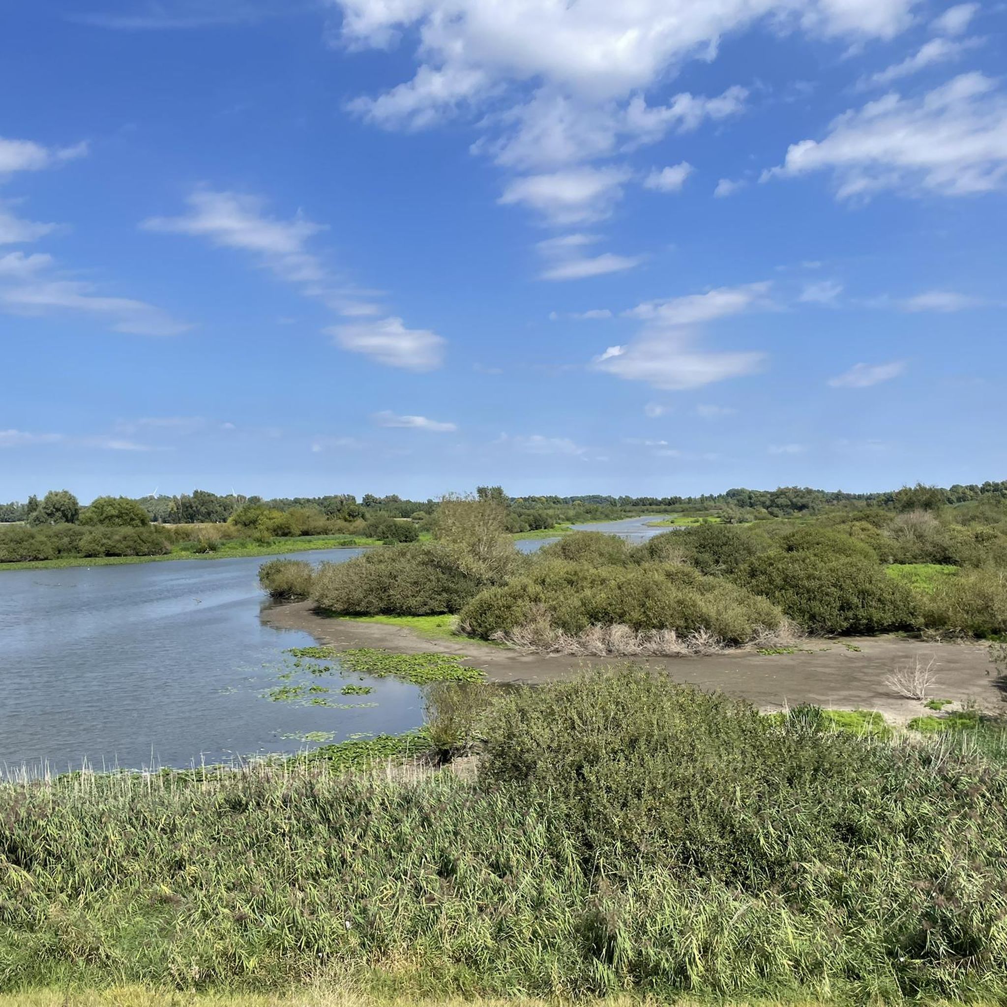
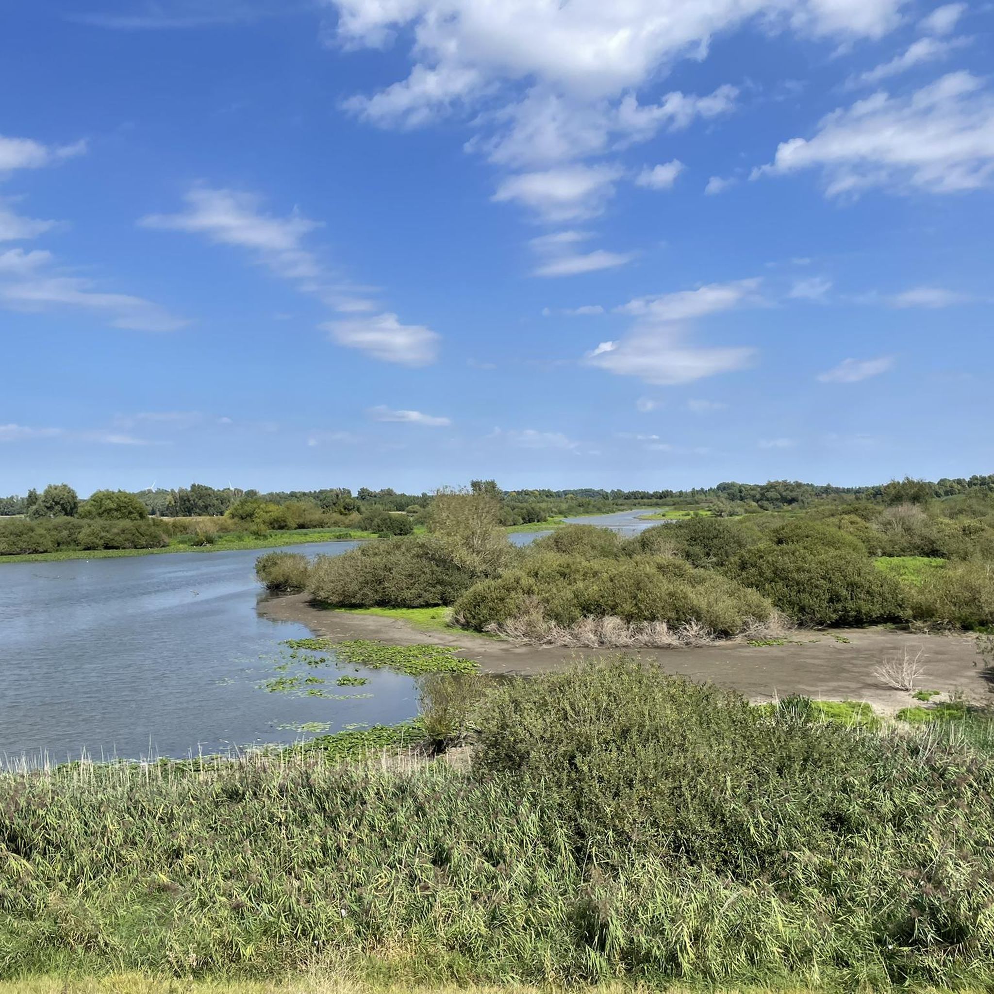
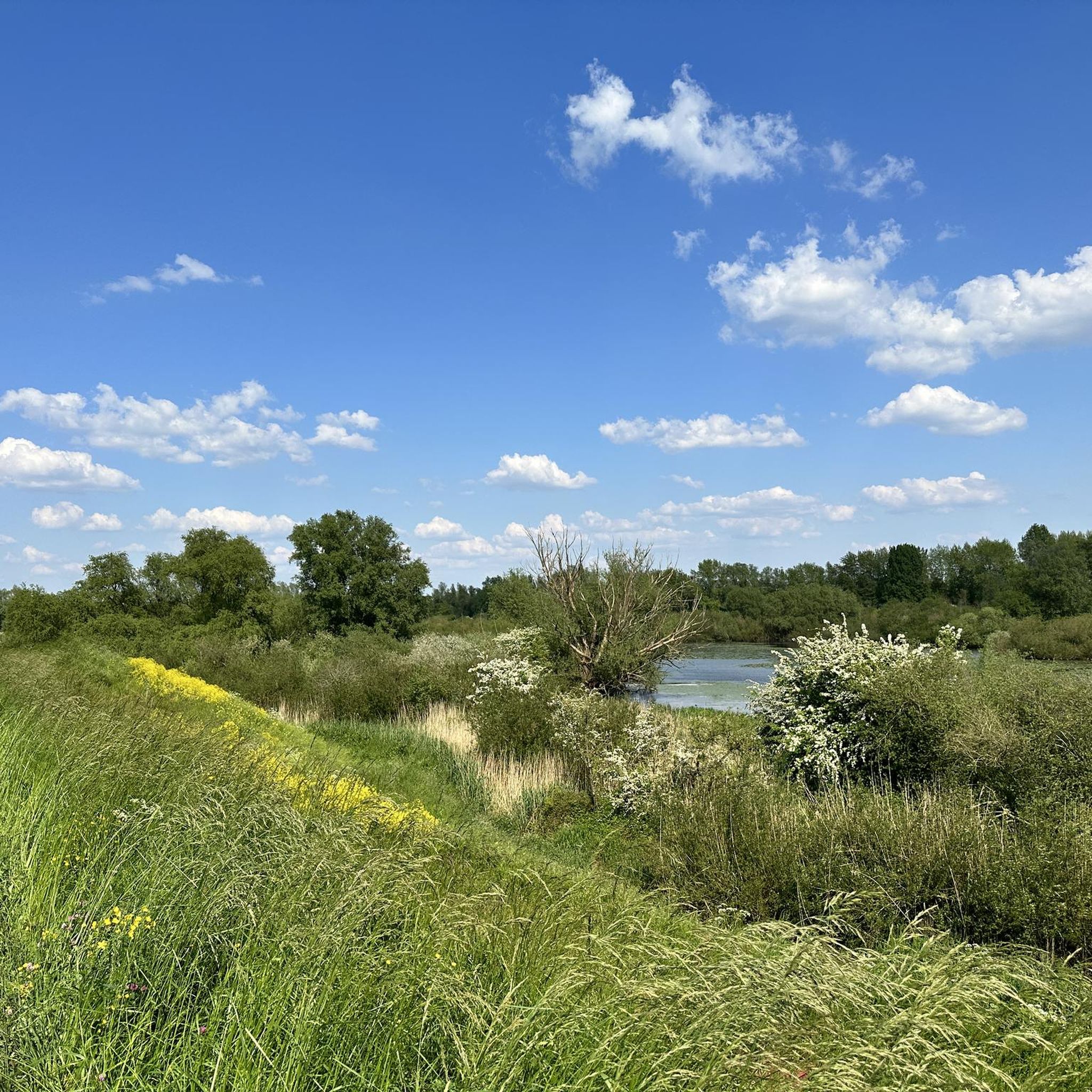
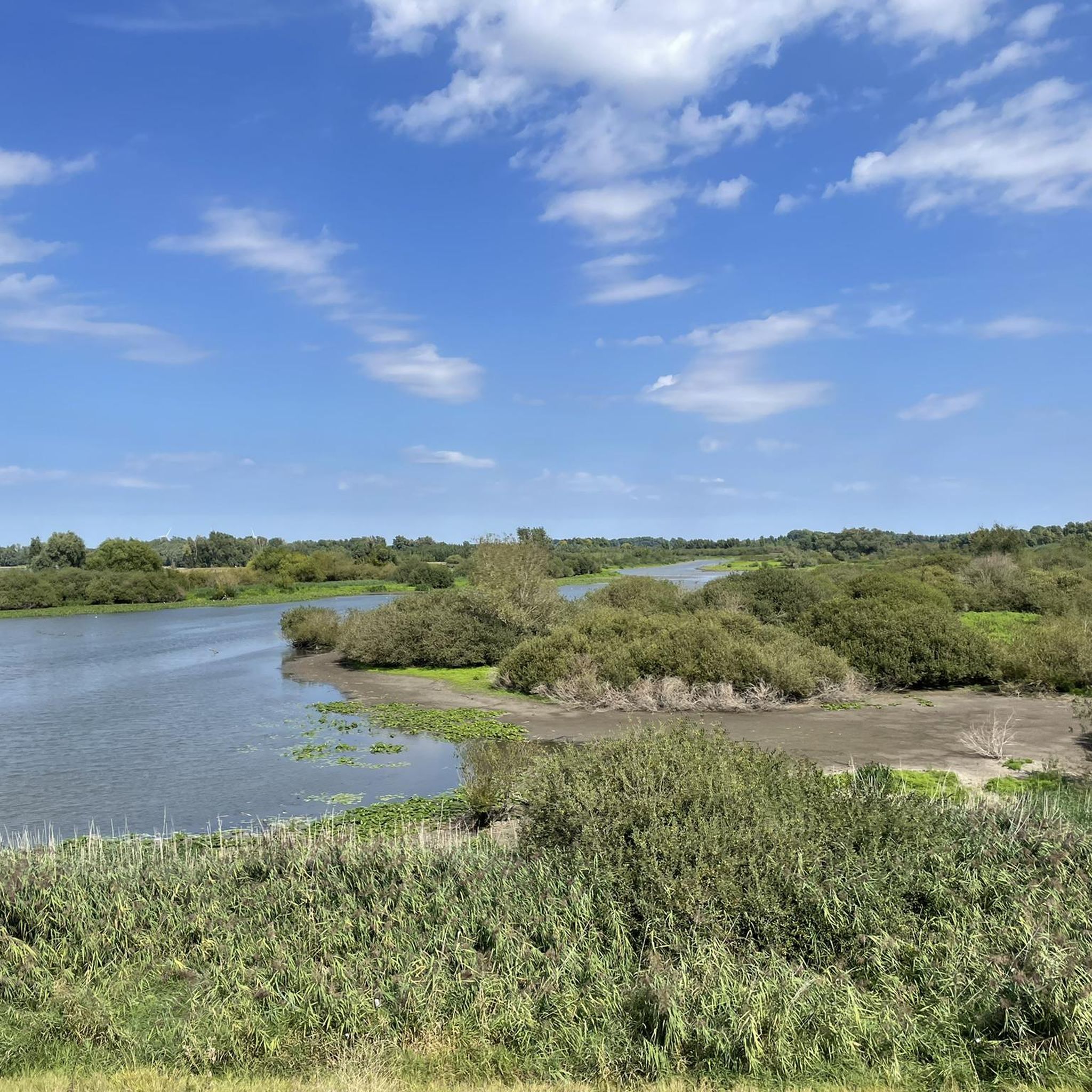
The Kil van Hurwenen (also: Hurwenensche Uiterwaarden) is a nature reserve in the floodplain of the Waal River near Hurwenen in the Dutch municipality of Maasdriel. Before the municipal reorganization of 1999, the area was partly part of the municipality of Zaltbommel, but due to a border adjustment, it now belongs entirely to the municipality of Maasdriel. The area covers 146 hectares and is owned by the Dutch Forestry Commission (Staatsbosbeheer). The area was created in 1639 when a former meander of the Waal River, whose course is still clearly visible in the landscape, was cut off from the river by human intervention. During high water, the area is still flooded by water from the river. Several sand pits, a remnant of clay extraction for the brick industry, are still located in the immediate vicinity. To improve the natural and water quality, the area was redesigned between 2010 and 2015. Source and more information: Wikipedia
1
0
You'll often find a bench in the nature reserve, but a bench for swimmers...? Please leave it there!
2
0


Architecturally very striking church that doesn't quite fit in with the rest of the town, but is very attractive.
2
0
The castle itself is not open to the public. It's hard to find a good view when the trees are in leaf. It's barely visible from the gate, and even from the dike, it's only partially visible.
2
0
In order to improve the quality of nature and water, the area was redesigned between 2010 and 2015. This has led to improved living conditions for various plant and animal species. For example, a co-flowing secondary channel was constructed in the north of the Hurwenen floodplain. The secondary channel provides a better living environment, particularly for current-loving fish species. The construction of the secondary channel took place within the Water Framework Directive and also contributes to the ecological objectives of the European Natura 2000 programme. Many bird species use the area to forage during their migration to and from their wintering areas. The Kil van Hurwenen, or De Kil, as the locals call this area, is now open to the public. Source and more information: Wikipedia
2
0

Visit the Anne Frank tree in Neerijnen and park easily at the Stroomhuis, where you can also go for a cup of coffee or a cultural activity. A beautiful combination of nature and culture!
0
0
Frequently Asked Questions
What is the general terrain like for hiking in Hurwenensche Kil?
The terrain in Hurwenensche Kil is predominantly flat, characterized by paths along the Waal River and its extensive floodplains. You'll find open landscapes with minimal elevation changes, making it suitable for accessible walks. The landscape is shaped by the river's course, including side channels and islands.
Are there many hiking routes available in Hurwenensche Kil?
Yes, Hurwenensche Kil offers a wide variety of hiking options. There are over 450 routes available, catering to different preferences and skill levels.
What kind of difficulty can I expect from the hiking trails?
Most of the trails in Hurwenensche Kil are considered easy, with nearly 300 routes falling into this category. There are also over 120 moderate routes and a smaller selection of more challenging trails for experienced hikers.
Are there any good circular walks in the area?
Yes, many routes in Hurwenensche Kil are circular, allowing you to start and end at the same point. For example, the Kil van Hurwenen – Waal River at Hurwenen loop from Uiterwaarden Waal is an easy 3.2-mile (5.2 km) circular path that explores the Kil van Hurwenen and the adjacent Waal River area.
Can I bring my dog on the hiking trails in Hurwenensche Kil?
Many trails in the Hurwenensche Kil area are dog-friendly, allowing you to enjoy the natural surroundings with your pet. However, it's always advisable to keep dogs on a leash, especially in nature reserve areas or near livestock, and to check specific route details for any restrictions.
Are there family-friendly hiking options in Hurwenensche Kil?
Absolutely. Given the predominantly flat terrain and numerous easy routes, Hurwenensche Kil is very suitable for family outings. Trails like the Island and side channel – Hurwenen Floodplains loop from Hurwenen, a 2.9-mile (4.7 km) easy trail, are perfect for families with children.
What are some notable landmarks or viewpoints along the trails?
The region offers views of the Waal River and its floodplains, which are natural landmarks themselves. You might also encounter historical structures like Waardenburg Castle and the Waardenburg Corn Mill on routes such as the Waardenburg Castle – Waardenburg Corn Mill loop from Uiterwaarden Waal.
Is there parking available for hikers in Hurwenensche Kil?
Yes, parking is generally available at common starting points for trails, particularly near the Uiterwaarden Waal area. Specific parking information can often be found in the details of individual komoot tours.
What is the best time of year to go hiking in Hurwenensche Kil?
Hurwenensche Kil can be enjoyed year-round. Spring brings blooming nature, summer offers warm weather for longer walks, and autumn provides beautiful colors. Winter hiking is also possible, though paths might be muddy or icy depending on conditions. Always check local weather forecasts before heading out.
What do other hikers enjoy most about the trails in Hurwenensche Kil?
The area is highly rated by the komoot community, with an average score of 4.4 stars from over 1,700 reviews. Reviewers often praise the peaceful, open landscapes, the scenic views of the Waal River, and the well-maintained paths that make for enjoyable and accessible walks.
Are there any cafes or places to eat near the hiking routes?
While the immediate floodplains are natural areas, you can find cafes and restaurants in nearby villages such as Hurwenen and Zaltbommel. These towns offer options for refreshments and meals before or after your hike.
How long do hikes in Hurwenensche Kil typically take?
Hikes vary in length and duration. Many popular routes, like the Waal River at Hurwenen – Hurwenen Floodplains loop from Uiterwaarden Waal, are around 4.7 miles (7.5 km) and can be completed in under two hours. Shorter options are also available for quicker excursions.
Most popular routes around Hurwenensche Kil

Get inspired with the komoot mobile app


Explore more
Browse the best Hikes in other regions.
