The best running trails in Custer County
19
runners
11
runs
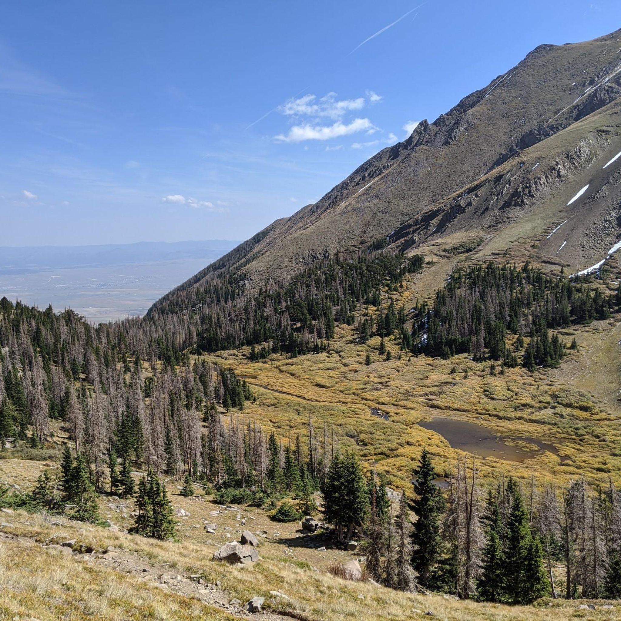
Jogging routes in Custer County traverse a rugged, mountainous landscape, characterized by high-alpine trails and significant elevation changes. The region is dominated by the Sangre de Cristo Mountains, offering challenging terrain for experienced runners. Expect routes that lead through alpine forests, past high mountain lakes, and towards prominent peaks. This environment provides a demanding yet rewarding experience for those seeking strenuous running adventures.
Best jogging routes in Custer County
- The most popular jogging route is Venable-Comanche Trail loop, a…
Last updated: October 10, 2026
8
runners
19.6km
02:42
1,160m
1,160m
Hard run. Very good fitness required. Sure-footedness, sturdy shoes and alpine experience required.
5
runners
37.3km
05:05
1,880m
1,880m
Hard run. Very good fitness required. Mostly paved surfaces. Suitable for all skill levels.

3
runners
17.8km
03:10
1,190m
1,190m
Hard run. Very good fitness required. Sure-footedness, sturdy shoes and alpine experience required.
1
runners
16.4km
02:24
740m
740m
Hard run. Very good fitness required. Mostly paved surfaces. Suitable for all skill levels.
1
runners
21.7km
02:42
910m
910m
Hard run. Very good fitness required. Mostly paved surfaces. Suitable for all skill levels.
1
runners
19.2km
02:56
940m
940m
Hard run. Very good fitness required. Sure-footedness, sturdy shoes and alpine experience required.
10.2km
01:06
180m
180m
Moderate run. Good fitness required. Mostly paved surfaces. Suitable for all skill levels.
14.2km
02:09
710m
710m
Hard run. Very good fitness required. Mostly paved surfaces. Suitable for all skill levels.
7.50km
00:59
410m
410m
Hard run. Very good fitness required. Mostly paved surfaces. Suitable for all skill levels.
16.3km
02:51
830m
830m
Hard run. Very good fitness required. Sure-footedness, sturdy shoes and alpine experience required.
Our route recommendations are based on thousands of hikes, rides, and runs completed by other people on komoot.
Start today with a free account
Your next adventure awaits.
Popular around Custer County
Tips from the Community

From the top of Hermit Pass you get incredible views of both the east and west sides of the Sangre de Cristos. The Hermit Pass Road which leads up here from the east is a nontechnical climb on a semi-rocky road past an alpine lake and mountain peaks. The trail down the west side is a beautiful singletrack.
0
0
There is a gravel lot at the top of North Taylor Road. From here you can run south along the Rainbow Trail (doubletrack forest road) all the way down the foothills of the Sangre de Cristos or head up into the Mountains. You can run up to Lakes of the Clouds by going north, or head south along forest roads to reach the Hermit Pass ascent.
0
0
The Rainbow Trail is a nontechnical doubletrack trail which passes by a couple creek waterfalls, with views out from the Sangre de Cristos. The trail is half exposed, half in the trees on the slope of Beck Mountain.
0
0

South Colony Lakes are at the base of Crestone Needle, giving you a privileged view of the peak, with green clear water surrounded by grass and a creek that flows from the lakes. This can be a good spot to camp before reaching the needle.
0
0
Horn Lake is a small lake formed by the melting of glaciers on Little Baldy Mountain and Mount Adams. The trail goes up following Horn Creek. It is not so well-maintained, but still worth it.
0
0
Close to Venable Trail, there's a short steadily steep trail to Venable Lakes, a group of small alpine lakes with fantastic views of Rio Grande National Forest.
0
0
Horn Lake is a small lake formed by the melting of glaciers on Little Baldy Mountain and Mount Adams. The trail goes up following Horn Creek, it is not so well-maintained, but still worth it.
0
0
Comanche Lake is a beautiful alpine lake in San Isabel National Forest. The trail to the lake is short, but can be rocky and steep; hiking poles are recommended to get down from the lake. Coming from Venable trail, you need to cross Phantom Terrace, a small ledge that connects the Comanche trail to Venable trail, this part seems to be more sketchy than it really is, you just need to have caution. The trail is better experienced between May and October due to snow and muddy conditions.
0
0
Frequently Asked Questions
How many running routes are available in Custer County?
Komoot features 11 dedicated running routes in Custer County. These routes primarily cater to experienced runners, offering challenging terrain and significant elevation changes through the mountainous landscape.
What kind of terrain can I expect on jogging trails in Custer County?
Jogging routes in Custer County are characterized by rugged, mountainous terrain, high-alpine trails, and substantial elevation changes. You'll find paths leading through alpine forests, past high mountain lakes, and towards prominent peaks. For a different experience, the George S. Mickelson Trail offers a 109-mile rail-to-trail path through the Black Hills with varied scenery, while Custer State Park provides options from granite peaks to rolling plains.
Are there any easy or beginner-friendly running paths in Custer County?
While most komoot routes in Custer County are rated as difficult, the region does offer some easier options. For instance, the Sylvan Lake loop in Custer State Park is just over a mile long and ideal for accessible trail running. The Creekside Trail, also in Custer State Park, is a moderate 3.5-mile route with mostly paved surfaces suitable for various fitness levels.
What are some scenic viewpoints or natural features I can see while running?
Custer County is rich in natural beauty. Along the routes, you might encounter stunning features like Venable Falls, the summit of Humboldt Peak, and the serene Horn Lake. The region also boasts granite spires around Sylvan Lake, the iconic Needles, and panoramic views from trails like the Lover's Leap Trail in Custer State Park.
Are there any long-distance running trails for experienced athletes?
Absolutely. Custer County is ideal for long-distance runners seeking a challenge. The Rito Alto four pass loop is a difficult 23.1-mile path with extensive views and significant climbing. The George S. Mickelson Trail, a 109-mile rail-to-trail, also provides an excellent option for extended runs, with an annual half and full marathon hosted there.
Can I find circular running routes in the area?
Yes, several circular routes are available. A popular choice is the Venable-Comanche Trail loop, a challenging 12.2-mile trail. Another option is the Lake of the Clouds Loop, which covers 10.2 miles with notable elevation gain.
What is the best time of year for trail running in Custer County?
The Black Hills region, including Custer County, offers year-round opportunities for outdoor activities. While specific trail conditions vary, the George S. Mickelson Trail is noted as a year-round option. For high-alpine routes, summer and early fall generally provide the most favorable conditions before winter snows make trails more challenging or inaccessible.
Are there opportunities to see wildlife while jogging in Custer County?
Yes, Custer County is known for its abundant wildlife. The Wildlife Loop State Scenic Byway in Custer State Park is famous for its nearly 1,300 bison, as well as pronghorn antelope, deer, burros, elk, bighorn sheep, and prairie dogs. Early morning or late evening runs can increase your chances of spotting these animals, especially in areas like Wind Cave National Park's Highland Creek Trail.
Where can I park for jogging trails in Custer County?
Many trails in Custer County have designated parking areas. For example, the Gibson Creek Trailhead is a known parking spot. The George S. Mickelson Trail has 15 trailheads, many with amenities, which typically include parking. Always check specific route details for the most convenient access points.
What are some challenging running routes with significant elevation gain?
Custer County is characterized by its challenging, high-elevation routes. The Crestone Needle via South Colony Lakes is an 11.1-mile trail with over 3,800 feet of elevation gain. Another demanding option is the Humboldt Peak Trail, a 6.2-mile route with over 2,500 feet of ascent.
What do other runners enjoy most about jogging in Custer County?
Komoot users who have explored Custer County's trails often praise the challenging high-alpine environments, the stunning mountain passes, and the rewarding peak ascents. The region offers a demanding yet immersive experience for those seeking strenuous running adventures amidst breathtaking natural beauty.
Most popular routes in Custer County
Most popular attractions in Custer County

Get inspired with the komoot mobile app


Explore more
Browse the best Running Trails & Routes in other regions.
