The best running trails around St. Juliot
4.4
(14)
806
runners
68
runs
Jogging around St. Juliot offers access to a diverse landscape, characterized by its dramatic coastline and picturesque valleys. The region features extensive trail options, including sections of the South West Coast Path, providing varied terrain for runners. Joggers can experience imposing cliffs, wooded valleys carved by rivers, and paths that range from easily accessible to more challenging.
Best jogging routes around St. Juliot
- The most popular jogging route is Ladies' Window Arch – Bossiney Cove loop from River Valency,…
Last updated: August 20, 2026
5.0
(1)
62
runners
14.1km
01:39
280m
280m
Moderate run. Good fitness required. Mostly paved surfaces. Suitable for all skill levels.
25
runners
19.6km
02:45
730m
730m
Hard run. Very good fitness required. Mostly paved surfaces. Suitable for all skill levels.

Sign up for free
18
runners
36.7km
04:34
960m
960m
Hard run. Very good fitness required. Mostly paved surfaces. Suitable for all skill levels.
18
runners
Hard run. Very good fitness required. Mostly paved surfaces. Suitable for all skill levels.
17
runners
Moderate run. Good fitness required. Mostly paved surfaces. Suitable for all skill levels.
Get access to more routes and recommendations from other explorers.
Sign up for free
Already have an account?
Our route recommendations are based on thousands of hikes, rides, and runs completed by other people on komoot.
Start today with a free account
Your next adventure awaits.
Login or Signup
Popular around St. Juliot
Tips from the Community

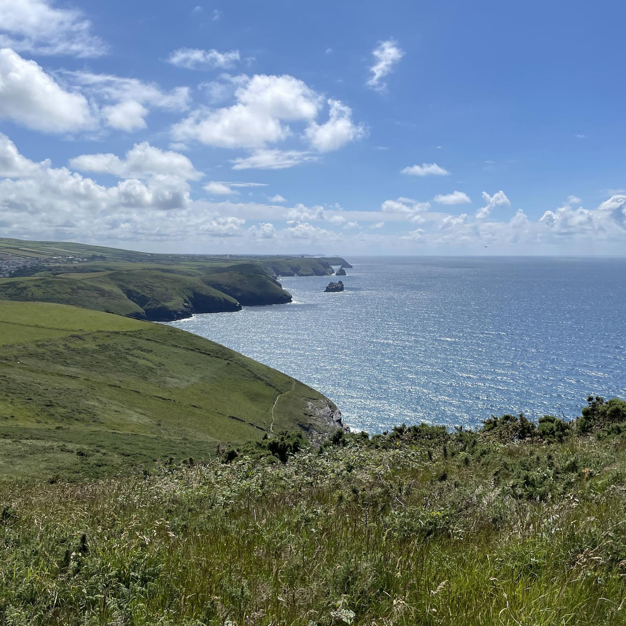
The view of Bossiney Bay, a stunning bay near Tintagel on the north coast of Cornwall, offers a dramatic and unforgettable panorama of the Atlantic Ocean. From the high-lying cliff paths, you look down on the steep rock faces and the golden sandy beach that emerges at low tide. The turquoise waters of the bay form a beautiful contrast with the dark granite cliffs and the deep green of the surrounding grasslands. One of the most striking elements in the view is Elephant Rock, an imposing rock formation at sea that has taken the shape of an elephant through natural erosion. Walking along the coastal path, you will enjoy the rugged, untamed beauty of the landscape and the constant dynamics of the crashing waves below in the bay.
0
0
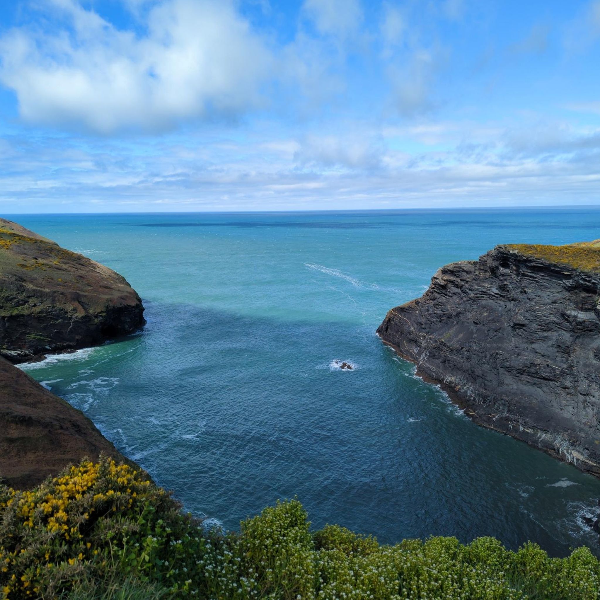
The Ladies Window arch is a spectacular, natural rock arch in granite along the rugged north coast of Cornwall, located near the village of Trevalga and a stone's throw from Tintagel. From the iconic South West Coast Path, you have a beautiful view down onto this remarkable geological formation. Through the continuous erosion of the powerful Atlantic Ocean, an opening has been worn into the steep cliffs that acts as a natural window. Through this rock arch, you get an idyllic glimpse of the crashing waves and the clear seawater below in the cove. According to local legend, the rock arch owes its charming name to ladies from Victorian times. They would walk in their long dresses to this specific spot on the cliffs to enjoy the spectacular sea view, sheltered from the harsh wind. Today, it remains one of the most photogenic resting points along the hiking route between Boscastle and Tintagel.
0
0

hard to imagine that in 2004 almost everything was destroyed by the floods
0
0
great opportunities for swimming
0
0
You can have a great picnic here. If you're lucky, you might meet ponies
0
0


The harbour was built in 1587 by Sir Richard Grenville and was used until the 19th century for the transport of slate from the nearby quarries. The natural stone harbour walls also protect the place from storm surges. On the morning of 16 August 2004, a severe storm raged over Southern England, causing the water level of the rivers flowing through Boscastle to rise by two metres within an hour. Around 11 am local time, a four-metre high tidal wave surged through the narrow valley, sweeping over 50 cars and six buildings into the Atlantic. Another 20 houses were so badly damaged that they later had to be demolished. Just under 30 minutes later, one of the largest air rescue operations in British history began. Seven SAR helicopters from the Royal Air Force and Royal Navy rescued over 150 people from the roofs of their houses. British media later spoke of the miracle of Boscastle, as the devastating flood claimed no lives. Source: Wikipedia
0
0
Frequently Asked Questions
How many running routes are available around St. Juliot?
There are over 70 dedicated running routes around St. Juliot, offering a wide variety of options for joggers of all levels. These include 7 easy routes, 44 moderate routes, and 20 difficult routes, ensuring there's a trail to match your fitness and desired challenge.
What are the general difficulty levels of running trails in St. Juliot?
The running trails in St. Juliot offer a mix of difficulty levels. You'll find 7 easy routes perfect for a relaxed jog, 44 moderate routes for a good workout, and 20 difficult routes for those seeking a more challenging run with significant elevation changes, particularly along the coastal paths.
Are there any circular running routes in St. Juliot?
Yes, the majority of running routes around St. Juliot are circular, allowing you to start and finish at the same point. For example, the Pentargon Cliff and Waterfall – Bridge over the River Valency loop from River Valency is a challenging 11.2 km circular path that offers stunning coastal views.
Can I find running routes with waterfalls in St. Juliot?
Absolutely! The region is known for its natural beauty, including waterfalls. The High Cliff – Pentargon Cliff and Waterfall loop from River Valency is a difficult 19.5 km route that features dramatic cliff formations and views of the Pentargon Waterfall. St Nectan's Glen, with its 60-foot waterfall, is also a significant natural attraction nearby.
What do other runners say about the trails in St. Juliot?
The running routes in St. Juliot are highly rated by the komoot community, with an average score of 4.3 stars from over 9 reviews. More than 800 runners have used komoot to explore the varied terrain, often praising the dramatic coastal scenery and the diverse trail options.
Are there family-friendly running routes in St. Juliot?
While many routes in St. Juliot feature challenging coastal terrain, there are 7 easy routes that could be suitable for families looking for a less strenuous run or walk. These paths typically offer more accessible surfaces and gentler gradients, though specific suitability depends on the family's fitness level.
Are the running trails in St. Juliot dog-friendly?
Many of the coastal paths and inland trails around St. Juliot are dog-friendly, offering a great opportunity to run with your canine companion. However, it's always recommended to keep dogs on a lead, especially near cliff edges, livestock, or in nature conservation areas. Check local signage for specific restrictions.
What kind of landscapes can I expect to see while running in St. Juliot?
St. Juliot offers a diverse landscape for runners. You'll experience dramatic coastal paths with imposing cliffs and spectacular sea views, such as those found on the Bridge over the River Valency – Pentargon Cliff and Waterfall loop from River Valency. You'll also find tranquil wooded valleys carved by rivers, and varied terrain ranging from easily accessible paths to more challenging sections.
Are there any viewpoints or landmarks along the running routes?
Yes, the routes are rich with stunning viewpoints and natural landmarks. You can enjoy breathtaking vistas from areas like Willapark Lookout and Rocky Valley (Willapark Lookout and Rocky Valley) or experience the dramatic Pentargon Cliff. High Cliff, Cornwall's tallest cliff, also provides a formidable backdrop for your run. Many routes also pass by historical sites like Tintagel Castle Bridge (Tintagel Castle Bridge).
What is the longest running route available in St. Juliot?
One of the longest and most challenging running routes is the Ladies' Window Arch – Barras Nose loop from St. Juliot. This difficult trail spans 31.6 km (19.6 miles) and leads through extensive coastal paths and cliff-top vistas, typically taking over 4 hours to complete.
Are there any running routes that explore the South West Coast Path?
Yes, many of the running routes around St. Juliot incorporate sections of the South West Coast Path, Britain's longest National Trail. This provides extensive opportunities for trail running with spectacular sea views and challenging elevations, allowing you to experience the region's dramatic coastline.
What kind of terrain can I expect on the running trails?
The running trails in St. Juliot offer a mix of surfaces and gradients. You'll encounter rugged coastal paths, sometimes with steep ascents and descents, as well as riverside paths through wooded valleys. The variety allows you to choose routes that match your ability and desired workout intensity, from easily accessible sections to more challenging, technical terrain.
Most popular attractions around St. Juliot

Get inspired with the komoot mobile app


Explore more
Browse the best Running Trails & Routes in other regions.
