The best MTB trails around Zalamea La Real
4.4
(45)
791
riders
96
rides
Mountain bike trails around Zalamea La Real traverse a landscape shaped by its unique mining history and natural features. The region is characterized by the striking reddish waters of the Río Tinto, vast open-pit mines, and reservoirs like Gossán. Beyond these distinctive areas, routes lead through pine and eucalyptus forests, as well as traditional *dehesas* of oak and cork oak. This sinuous topography provides varied terrain for mountain biking.
Best mountain bike trails around Zalamea La Real
- The most popular…
Last updated: October 13, 2026
3
riders
30.4km
03:03
680m
680m
Moderate mountain bike ride. Good fitness required. Advanced riding skills necessary.
20
riders
Moderate mountain bike ride. Good fitness required. Suitable for all skill levels.

12
riders
51.5km
05:14
1,120m
1,120m
Hard mountain bike ride. Very good fitness required. Suitable for all skill levels.
4.0
(1)
10
riders
35.3km
02:48
490m
490m
Moderate mountain bike ride. Good fitness required. Suitable for all skill levels.
5.0
(1)
7
riders
55.6km
04:59
800m
790m
Moderate mountain bike ride. Good fitness required. Suitable for all skill levels.
Get access to more routes and recommendations from other explorers.
Already have an account?
Our route recommendations are based on thousands of hikes, rides, and runs completed by other people on komoot.
Start today with a free account
Your next adventure awaits.
Tips from the Community

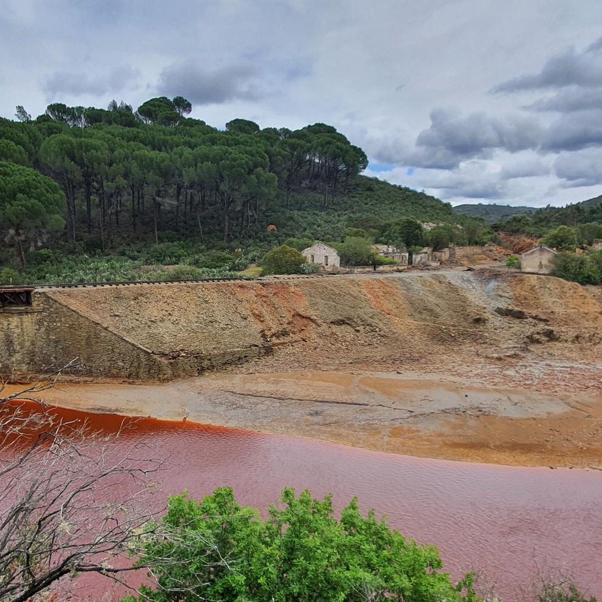
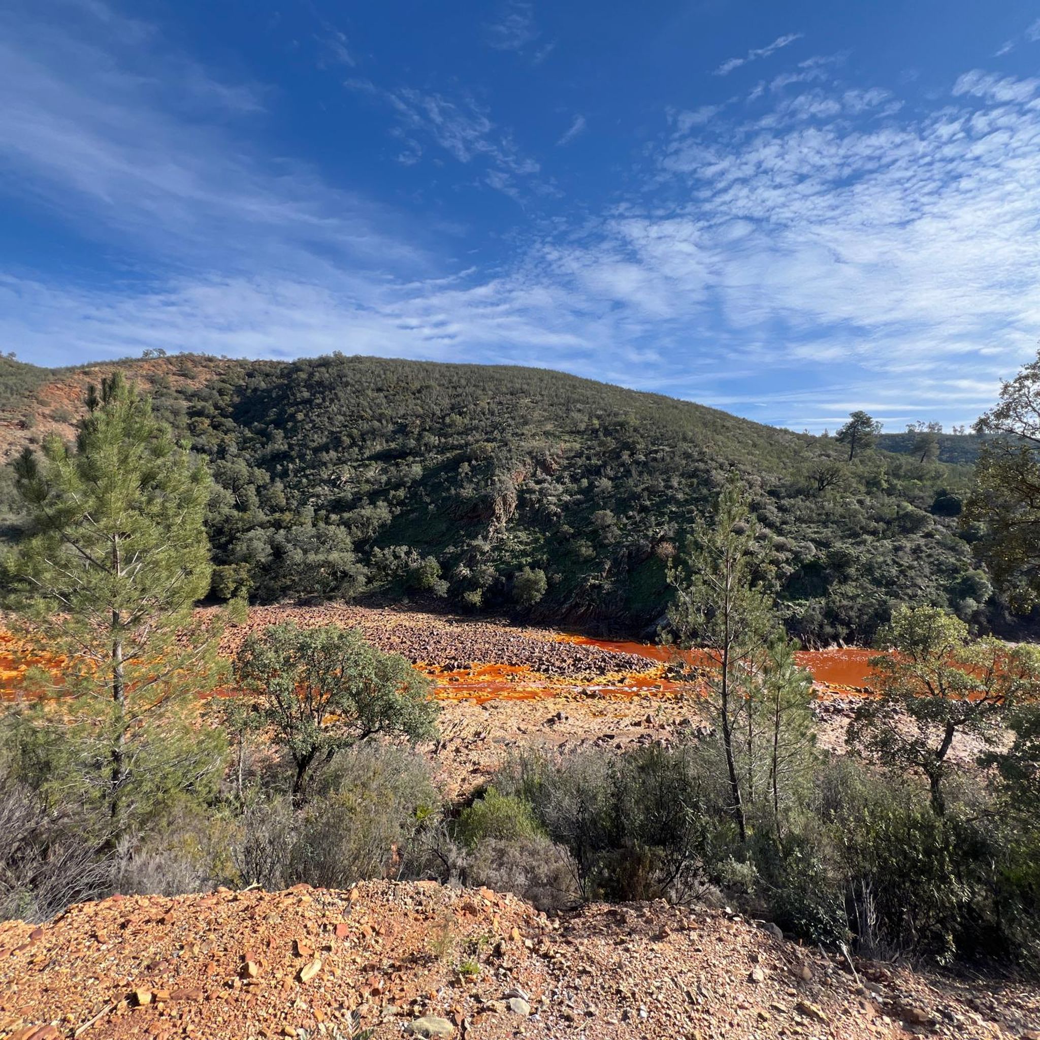
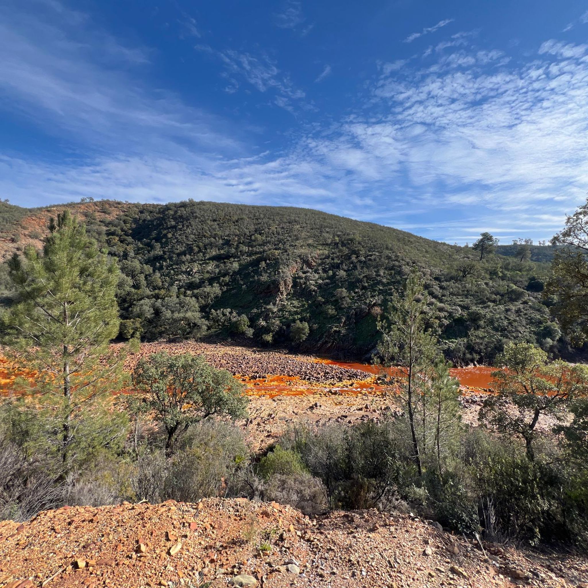
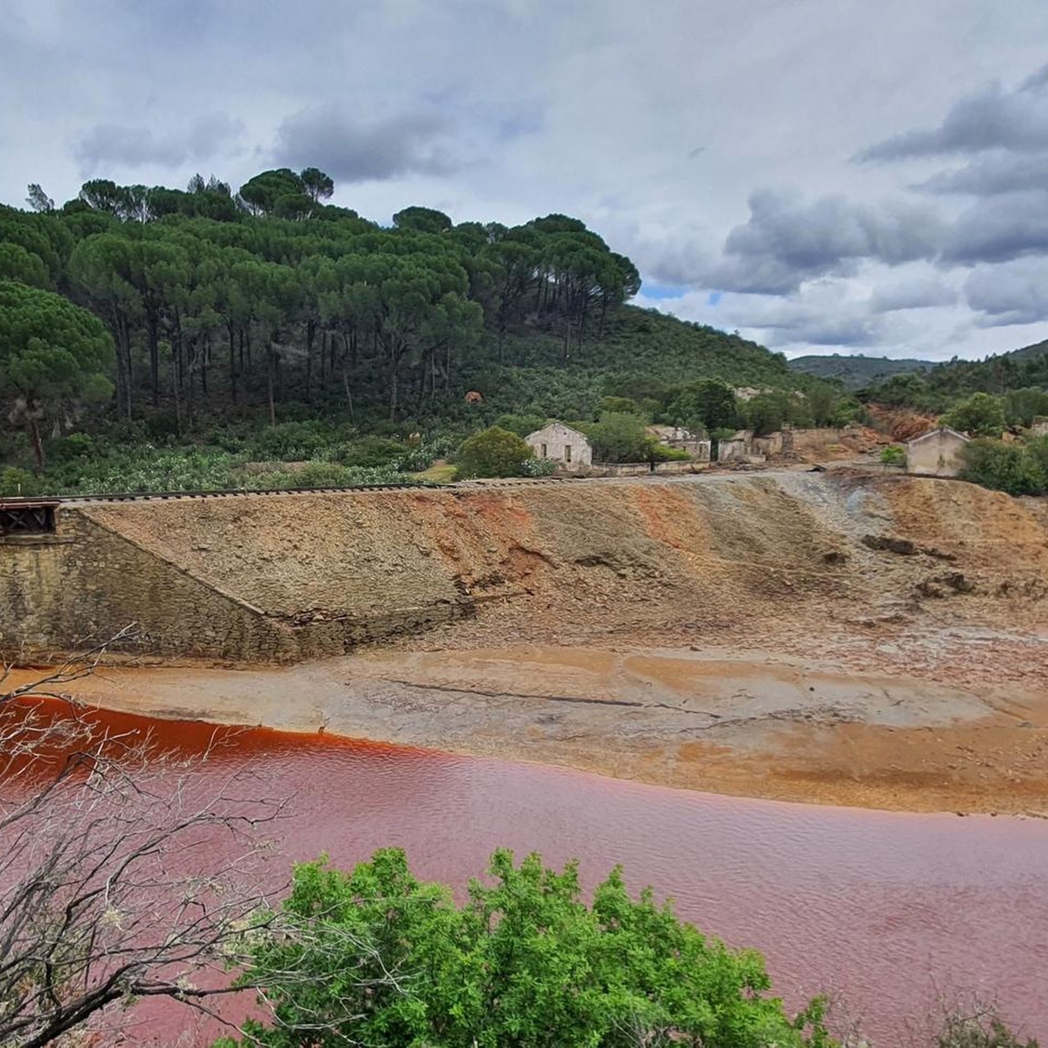
The Tinto River is famous for its intense red-colored waters and extreme acidity, caused by the oxidation of iron and sulfide minerals. It is so peculiar that NASA and other space agencies study it as a terrestrial analogue of Mars, as its extreme conditions host microorganisms capable of surviving in very hostile environments. Furthermore, the area has been mined for over 5000 years by Phoenicians, Romans, and other civilizations.
0
0

From the road, the immense open-pit mine of Cerro Colorado can be seen. The landscape looks otherworldly.
0
0

I arrived on my bike and it was great.
0
0

The Peña del Hierro Viewpoint, located in Nerva (Huelva), is part of the Riotinto Mining Park and offers one of the most impressive views of the source of the Tinto River, as well as the mining crater of the old pyrite mine.
1
0
The source of the Tinto River is located in the municipality of Nerva, in the province of Huelva, Andalusia, and is one of the most unique landscapes in Europe due to its reddish color and its scientific and geological value.
1
0

intense reddish colored waters
0
0

Museum and the Corte Atalaya are well worth seeing. We also recommend a short tour of the place.
0
0
To get to the viewpoint, paid access is required. The hiking trail ends here at a fence. Nevertheless, a somewhat limited view of the opencast mine is possible
2
0
Frequently Asked Questions
How many mountain bike trails are available around Zalamea La Real?
There are over 80 mountain bike trails around Zalamea La Real, offering a wide range of options for different skill levels and preferences. The komoot community has explored more than 700 of these routes.
What types of terrain can I expect on mountain bike trails in Zalamea La Real?
Mountain bike trails in Zalamea La Real feature a diverse and sinuous topography. You'll encounter unique 'Martian landscapes' shaped by the reddish Río Tinto and historical mining basins, as well as routes through pine and eucalyptus forests, and traditional dehesas (wooded pastures of oak and cork oak).
Are there easy mountain bike trails suitable for beginners in Zalamea La Real?
Yes, Zalamea La Real offers several easy mountain bike trails perfect for beginners or those looking for a more relaxed ride. Out of the total routes, 11 are classified as easy, providing a gentle introduction to the region's unique landscapes.
Are there challenging mountain bike trails for experienced riders?
Absolutely. For experienced riders seeking a challenge, there are 23 difficult mountain bike trails around Zalamea La Real. These routes often feature significant elevation changes and technical sections, such as the Cachán Bridge – Tronconcito Climb loop from Los Frailes, which includes over 1100 meters of ascent.
What are some notable natural features or landmarks to see along the trails?
The region is rich in unique natural and historical landmarks. You can ride past the striking reddish waters of the Source of the Río Tinto, explore the dramatic landscapes of the Corta Atalaya Mine, or enjoy views of reservoirs like Gossán. The Source of the Río Tinto – Peña del Hierro loop from Zalamea la Real is one route that takes you past some of these distinctive sights.
What is the best time of year for mountain biking in Zalamea La Real?
While specific weather data isn't provided, the region's climate suggests that spring and autumn would likely offer the most pleasant conditions for mountain biking, with milder temperatures. Summers can be very hot, and winters can be cooler and wetter, so checking local forecasts is always recommended.
Are there any circular mountain bike routes in the area?
Yes, many mountain bike routes in Zalamea La Real are circular, allowing you to start and finish at the same point. A popular example is the Los Frailes, El Madroño, Berrocal – ruta circular, a moderate 30.4 km trail.
What do other mountain bikers say about the trails in Zalamea La Real?
The mountain bike trails in Zalamea La Real are highly regarded by the komoot community, with an average rating of 4.3 stars from over 30 reviews. Riders often praise the unique mining landscapes, the diverse natural environments, and the variety of routes available for different skill levels.
Are there any routes that explore the historical mining areas?
Yes, the region's mining history is a defining feature of many trails. Routes like the Old Zarandas-Naya Station – Embalse del Gossan loop from Zarandas-Naya offer direct views of the mining basin and the distinctive reddish waters of the Gossán reservoir, providing an immersive experience into the area's past.
Are there any specific regulations or permits required for mountain biking in Zalamea La Real?
The provided information does not indicate any specific permits or regulations required for mountain biking on the general trails in Zalamea La Real. However, it's always advisable to respect local signage and environmental guidelines, especially when riding through natural parks or protected areas.
Can I find routes that pass by the Río Tinto?
Yes, the iconic Río Tinto, known for its striking reddish waters, is a central feature of the region. Several routes allow you to experience this unique river, including the Source of the Río Tinto – Peña del Hierro loop from Zalamea la Real, which takes you to its source.
Are there mountain bike routes that are suitable for families?
While specific 'family-friendly' routes are not explicitly categorized, the presence of 11 easy trails suggests there are options suitable for families or those with younger riders looking for less strenuous paths. These routes would typically have gentler gradients and less technical terrain.
Most popular attractions around Zalamea La Real

Get inspired with the komoot mobile app


Explore more
Browse the best MTB trails in other regions.
