The best road cycling routes around Salvaleón
298
riders
20
rides
Road cycling around Salvaleón, located in the La Altagracia Province of the Dominican Republic, offers routes through diverse terrain. The region features scenic countryside, lush mountains, and forests, providing varied landscapes for cyclists. While not primarily known for extreme mountain challenges, the area includes picturesque mountain paths and coastal regions. Road cycling routes often traverse mostly paved surfaces, with varying distances and elevation gains.
Best road cycling routes around Salvaleón
- The most popular road cycling route is View of Feria…
Last updated: July 10, 2026
25
riders
60.2km
03:09
960m
960m
Hard road ride. Very good fitness required. Some segments of this route may be unpaved and difficult to ride.
22
riders
92.6km
04:43
1,590m
1,590m
Hard road ride. Very good fitness required. Mostly well-paved surfaces and easy to ride.

Sign up for free
19
riders
68.7km
03:18
930m
930m
Hard road ride. Very good fitness required. Mostly well-paved surfaces and easy to ride.
18
riders
60.0km
03:06
1,000m
1,000m
Hard road ride. Very good fitness required. Mostly well-paved surfaces and easy to ride.
15
riders
112km
05:41
1,880m
1,880m
Hard road ride. Very good fitness required. Mostly well-paved surfaces and easy to ride.
Get access to more routes and recommendations from other explorers.
Sign up for free
Already have an account?
Our route recommendations are based on thousands of hikes, rides, and runs completed by other people on komoot.
Start today with a free account
Your next adventure awaits.
Login or Signup

Tips from the Community

There are two theories about its origin: One links it to a hermitage dedicated to Saint Anne, which gave rise to the settlement. The other places it in the 17th and 18th centuries as a refuge for families from Jerez fleeing an epidemic, under the name of Valle del Pino (Pine Valley).
5
0
Valle de Santa Ana is a picturesque municipality in the province of Badajoz, in the autonomous community of Extremadura, located in the Sierra Suroeste region, very close to Valle de Matamoros and Jerez de los Caballeros.
5
0
The fortress has a 35-metre-high keep and a perimeter wall with cylindrical towers at the corners. Originally, the castle had a drawbridge that allowed access through a moat, although this no longer exists. The castle was restored by the Junta de Extremadura at the end of the 20th century, preserving its structure and historical elements.
7
0

Located in the Badajoz town of Nogales, this medieval fortress built in the 15th century sits on a small hill and its character is purely defensive. For this reason, its most outstanding element is the keep surrounded by a wall, since it was of great importance during the clashes with the French and the Portuguese.
9
0

Some connect the origin of the nucleus with the settlement of some inhabitants around an old hermitage dedicated to Santa Ana, existing in that place since remote times, from which the place name of the population that was consolidated under its protection would derive.
0
1
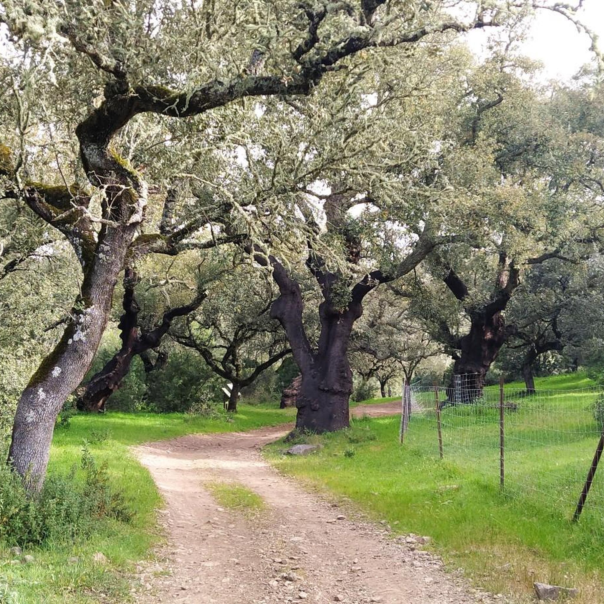
It is in this area where the Río Olivenza crosses in the middle of forests of what is called "Dehesas extremeñas". Oak forests with little vegetation around and where cattle are found around, where the river gives life to these areas.
1
0
Road that connects the towns of Salvatierra de los Barros with the center of Salvaleón, where it winds along a road where you can see the typical landscape of this Extremadura area, the so-called Dehesas: oak forests with little undergrowth.
0
0
Frequently Asked Questions
What kind of terrain can I expect on road cycling routes around Salvaleón?
Road cycling around Salvaleón offers a diverse landscape, characterized by scenic countryside, lush forests, and picturesque mountain paths. While not primarily known for extreme mountain challenges, the routes often feature significant elevation changes, especially on difficult trails, providing a varied experience for cyclists.
Are there challenging road cycling routes available in Salvaleón?
Yes, Salvaleón offers several challenging road cycling routes. For instance, the View of Salvaleón – Dehesa Extremeña loop from Torre de Miguel Sesmero is a difficult 92.6 km path with extensive elevation gain. Another demanding option is the View of Feria Castle – Dehesa Extremeña loop from Nogales, covering 60.2 km with significant ascents.
How many road cycling routes are there in the Salvaleón area?
There are 17 road cycling routes available around Salvaleón. These routes cater to various skill levels, with 7 considered moderate and 10 classified as difficult, ensuring options for different cycling preferences.
What are some popular road cycling loops around Salvaleón?
Local road cyclists frequently enjoy loops that showcase the region's beauty. A popular choice is the View of Salvaleón – Dehesas of the Olivenza River loop from Salvaleón, a 68.7 km trail. Another well-regarded loop is the View of Salvaleón – Dehesa Extremeña loop from Barcarrota, which spans 58.1 km.
What kind of natural features can I see while cycling in Salvaleón?
The region around Salvaleón is rich in natural beauty. Cyclists can encounter lush mountains and forests, picturesque mountain paths, and the unique Dehesa Extremeña landscape. You might also spot ancient trees like the Ancient Olive Tree of La Tapada or the impressive The Twelve Apostles Cork Oaks.
Are there any historical landmarks or points of interest along the cycling routes?
Yes, several historical and cultural landmarks can be found near the cycling routes. You could visit the historic Nogales Castle or the serene San Juan Hermitage of La Parra. These offer interesting stops to explore the region's heritage during your ride.
What do other road cyclists say about the routes in Salvaleón?
Over 200 road cyclists have used komoot to explore Salvaleón's varied terrain, indicating a strong community presence. Users often praise the scenic countryside and the diverse network of routes that cater to different ability levels, including several challenging options.
Are there any viewpoints or scenic spots accessible by road bike?
Absolutely. The region offers stunning vistas, such as the View of the Sierra de Tierra de Barros, which provides panoramic views of the surrounding landscape. Many routes, like the View of Salvaleón – Dehesa Extremeña loop from Torre de Miguel Sesmero, are specifically named for the extensive views they offer.
What is the typical elevation gain on road cycling routes in Salvaleón?
The elevation gain varies significantly depending on the route's difficulty. Difficult routes can feature substantial ascents; for example, the View of Salvaleón – Dehesa Extremeña loop from Torre de Miguel Sesmero has an elevation gain of over 1590 meters, while other routes like the View of Salvaleón – Dehesas of the Olivenza River loop from Salvaleón involve around 925 meters of climbing.
Are there any protected natural areas near the cycling routes?
Yes, cyclists can explore areas close to protected natural sites. The Sierra María Andrés Special Area of Conservation is one such area, offering a chance to experience the region's biodiversity. Additionally, the Vulture Cliffs of Risco de Valbellido are a notable natural monument.
What is the longest road cycling route available in Salvaleón?
The longest road cycling route listed is the View of Salvaleón – Dehesa Extremeña loop from Torre de Miguel Sesmero, which spans 92.6 km and is classified as difficult due to its length and significant elevation changes.
Most popular attractions around Salvaleón

Get inspired with the komoot mobile app


Explore more
Browse the best Road cycling routes in other regions.
