The best road cycling routes around Serradilla Del Arroyo
4.7
(6)
372
riders
17
rides
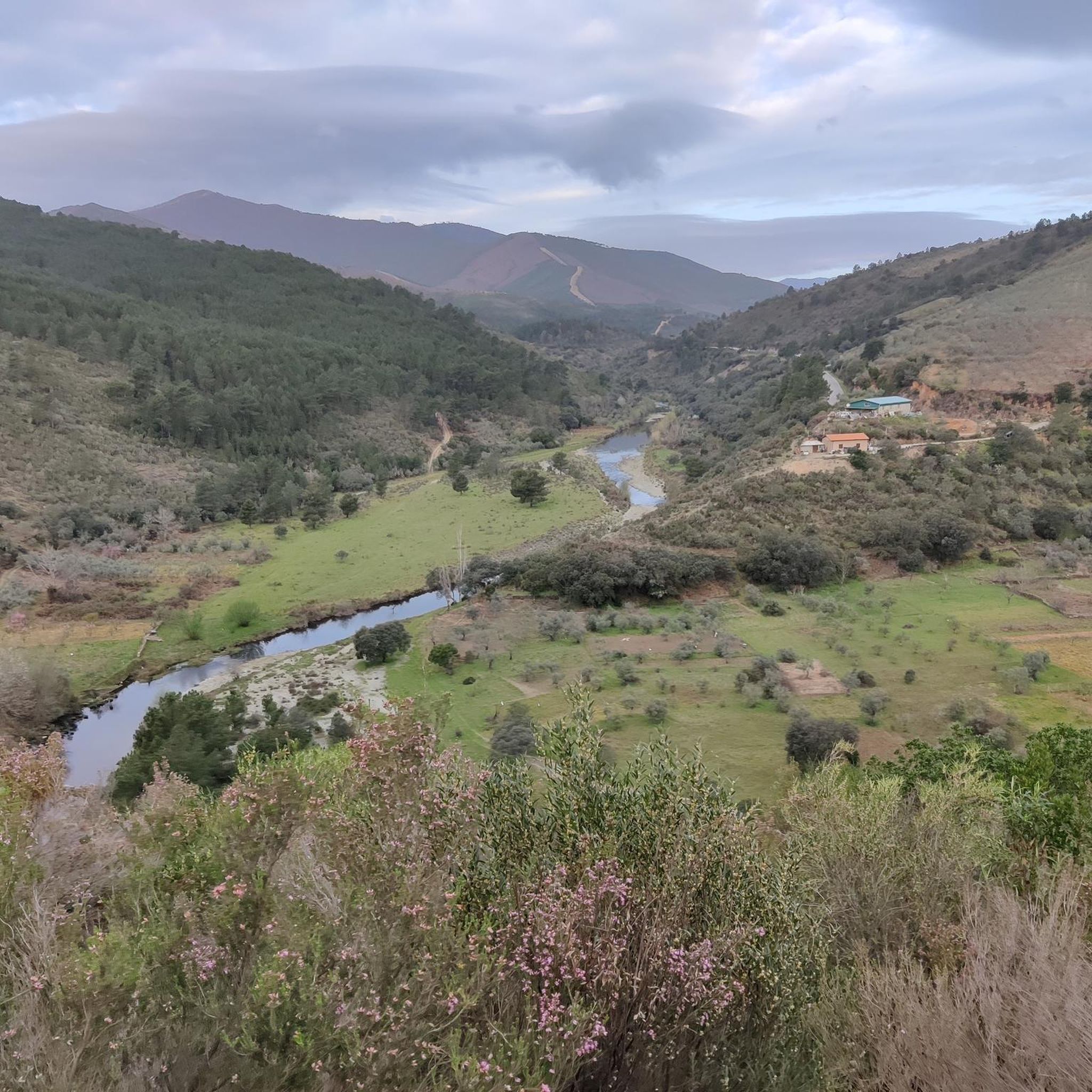
Road cycling around Serradilla Del Arroyo offers diverse terrain within the southwest of Salamanca province, characterized by its natural landscapes. The region features the Sierras del Carazo and del Guindo, providing a mountainous backdrop with significant elevation changes. Cyclists will encounter "dehesas" – wooded pastures of pine, oak, and holm oak – alongside gall-oak trees, and numerous streams. This varied topography includes flat river valleys, foothills of mountain ranges, and demanding ascents through mountainous areas.
Best road cycling routes around…
Last updated: July 11, 2026
5.0
(1)
37
riders
48.2km
02:42
1,090m
1,090m
This difficult 30.0-mile (48.2 km) road cycling loop from El Maíllo climbs Peña de Francia, offering panoramic views and a significant chall
19
riders
95.2km
05:10
1,940m
1,940m
This difficult 59.2-mile road cycling route from El Maíllo features 6352 feet of elevation gain, passing Portillo Viewpoint and Robledo Pass

Sign up for free
4.0
(4)
155
riders
77.2km
04:01
1,410m
1,410m
Hard road ride. Very good fitness required. Mostly well-paved surfaces and easy to ride.
41
riders
94.8km
05:01
1,780m
1,780m
Hard road ride. Very good fitness required. Some segments of this route may be unpaved and difficult to ride.
5.0
(1)
22
riders
Moderate road ride. Good fitness required. Some segments of this route may be unpaved and difficult to ride.
Get access to more routes and recommendations from other explorers.
Sign up for free
Already have an account?
Our route recommendations are based on thousands of hikes, rides, and runs completed by other people on komoot.
Start today with a free account
Your next adventure awaits.
Login or Signup
Popular around Serradilla Del Arroyo
Tips from the Community

At the village's social meeting point, the Plaza Mayor with its arcades, stands a beautiful granite pilgrim's cross.
11
0
Beautiful top with views and a restaurant run by modern monks.
0
0
Beautiful view here, now the last stretch to the top with 200 altitude meters to go.
0
0

On the SA-205 highway, just outside San Esteban de la Sierra heading towards Santibáñez de la Sierra, you'll find the entrance to the Sierra Viewpoints Route, which includes several spectacular panoramic viewpoints. Views: The Alagón River Valley and its meanders. The Sierra de Francia mountain range with the Peña de Francia peak in the background. The Sierra de Béjar mountain range and the Las Quilamas Natural Area. This viewpoint is a magnificent natural balcony, perfect for photography and birdwatching (vultures, eagles, black storks).
2
0
What to see in Miranda del Castañar Medieval Walls: Over 600 meters remain intact, with four gates facing the cardinal directions: San Ginés, Nuestra Señora, La Villa, and El Postigo. Zúñiga Castle: A 15th-century fortress, symbol of the former County of Miranda. Although the interior is not open to the public, its exterior and keep are impressive. Square Bullring: Considered one of the oldest in Spain, built in the 16th century on the site of the former parade ground. Church of Santiago and San Ginés: Gothic in style (13th-16th centuries), with a detached 17th-century bell tower. Houses with Coats of Arms: More than 80 noble coats of arms adorn the facades, reflecting the town's aristocratic past.
8
0
Miranda del Castañar, one of the most beautiful villages in Spain, is located in the Sierra de Francia (Salamanca): Founded in 1213 by Alfonso IX of León as a town and council, it was the administrative capital of the Sierra de Francia. In the 15th century, the County of Miranda was created under the control of the Zúñiga family, consolidating its strategic importance.
9
0
The Plaza Mayor of Ciudad Rodrigo is the historical and social heart of the city, with a rich history that reflects its importance as an urban center: Since the Middle Ages, the Plaza Mayor has been the hub of public life: markets, proclamations, and council meetings were held there in the cloister of the former Church of San Juan. In the 16th century, public butcher shops were built, and it became a consolidated space for commercial and festive activities. Until then, the square was home to the Three Roman Columns, a vestige of the ancient Miróbriga, which had been a symbol of the city since the 13th century. In 1580, the square was expanded, incorporating the space that once housed the old prison and the Audiencia (Courthouse). It even had corridors for watching bullfights, a tradition that continues during carnivals.
7
0
Ciudad Rodrigo's Town Hall is located in the Plaza Mayor and is one of the city's most emblematic buildings. Its history is linked to the urban and political development of Ciudad Rodrigo since the Middle Ages. Medieval Origins: Ciudad Rodrigo was founded in Roman times, but its consolidation as a fortified urban center occurred in the Middle Ages. Municipal government was organized around the council, which initially met in council houses until the current building was built.
1
0
Frequently Asked Questions
What kind of terrain can I expect on road cycling routes around Serradilla del Arroyo?
Road cycling around Serradilla del Arroyo offers a diverse topography. You'll find flat river valleys, the foothills of mountain ranges like the Sierra de Béjar and Sierra de Francia, and more demanding ascents through mountainous terrain. The landscape is characterized by "dehesas"—wooded pastures of pine, oak, and holm oak—and numerous streams, providing a varied and picturesque environment.
Are there challenging road cycling routes for experienced cyclists?
Yes, the region is well-suited for experienced cyclists looking for a challenge. Many routes feature significant elevation changes and demanding ascents. For instance, the Alto del Portillo and Puerto de Robledo Loop is a difficult 59.16-mile (95.2 km) path with substantial climbs over mountain passes, offering extensive views. Another challenging option is the Peña de Francia CIMA Loop from El Maíllo, which includes significant elevation gain towards the Peña de Francia.
What are some notable landmarks or viewpoints I can encounter on road cycling routes?
The routes often pass through areas with significant natural beauty and cultural heritage. You might encounter the mountainous backdrops of the Sierras del Carazo and del Guindo. For stunning panoramic views, consider routes that lead towards Peña de Francia or Peña Huevo. The La Alberca Main Square – Portillo Viewpoint loop from El Maíllo also offers scenic viewpoints.
Are there any circular road cycling routes available?
Yes, several circular routes are available, allowing you to start and end your ride in the same location. Examples include the Peña de Francia CIMA Loop from El Maíllo, the Alto del Portillo and Puerto de Robledo Loop, and the La Alberca Main Square – Portillo Viewpoint loop from El Maíllo. These loops provide varied experiences, from challenging climbs to scenic vistas.
What is the best time of year for road cycling in Serradilla del Arroyo?
The broader Salamanca region, including Serradilla del Arroyo, is generally favorable for road cycling for much of the year. Spring and autumn offer pleasant temperatures and vibrant landscapes. Summers can be warm, especially in lower elevations, while winters are cooler but often still suitable for cycling, particularly on less exposed routes.
What do other road cyclists enjoy most about road cycling in Serradilla del Arroyo?
The area is highly rated by the komoot community, with an average score of 4.8 stars from over 7 reviews. Cyclists often praise the diverse topography, which caters to various skill levels, and the quiet country roads that provide access to beautiful, less-traveled spots. The combination of challenging ascents and picturesque natural beauty, including "dehesas" and mountain backdrops, is frequently highlighted.
Are there any road cycling routes that pass through or near historical towns?
Yes, some routes offer the chance to explore nearby historical towns. For example, the Cathedral of Santa María – Plaza Mayor Ciudad Rodrigo loop from Serradilla del Arroyo takes you towards Ciudad Rodrigo, a historic city known for its impressive cathedral and Plaza Mayor. This allows for a blend of cycling and cultural exploration.
Can I find routes suitable for a full day of road cycling?
Absolutely. Many routes in the area are designed for longer rides, offering distances that can easily fill a full day. The Alto del Portillo and Puerto de Robledo Loop, at over 59 miles (95 km), is a prime example of a route that provides an extensive and challenging full-day experience.
Are there any moderate difficulty road cycling routes?
Yes, while many routes present significant challenges, there are also options for moderate difficulty. For instance, the Cathedral of Santa María – Plaza Mayor Ciudad Rodrigo loop from Serradilla del Arroyo is classified as moderate, offering a good balance of distance and elevation without being overly strenuous for intermediate riders.
What kind of natural features will I see while cycling in the area?
The region is rich in natural features. You'll cycle through "dehesas"—wooded pastures of pine, oak, and holm oak—and alongside gall-oak trees. Numerous streams crisscross the area, adding to its charm. The routes are set against the backdrop of the Sierras del Carazo and del Guindo, and the area is part of the ZEPA of Las Batuecas, a Special Protection Area for Birds, indicating rich biodiversity.
Are there opportunities to combine road cycling with other activities?
Yes, Serradilla del Arroyo serves as an excellent base for exploring. Beyond cycling, you can visit the Sanctuary of Our Lady of the Peña de Francia, explore the Ethnographic Museum, or visit the historic city of Ciudad Rodrigo. During summer, the Complejo Municipal del Endrinal offers swimming pools and sports facilities.
Most popular routes around Serradilla Del Arroyo
Most popular attractions around Serradilla Del Arroyo

Get inspired with the komoot mobile app


Explore more
Browse the best Road cycling routes in other regions.
