The best road cycling routes around Belvís De Monroy
5.0
(2)
687
riders
72
rides
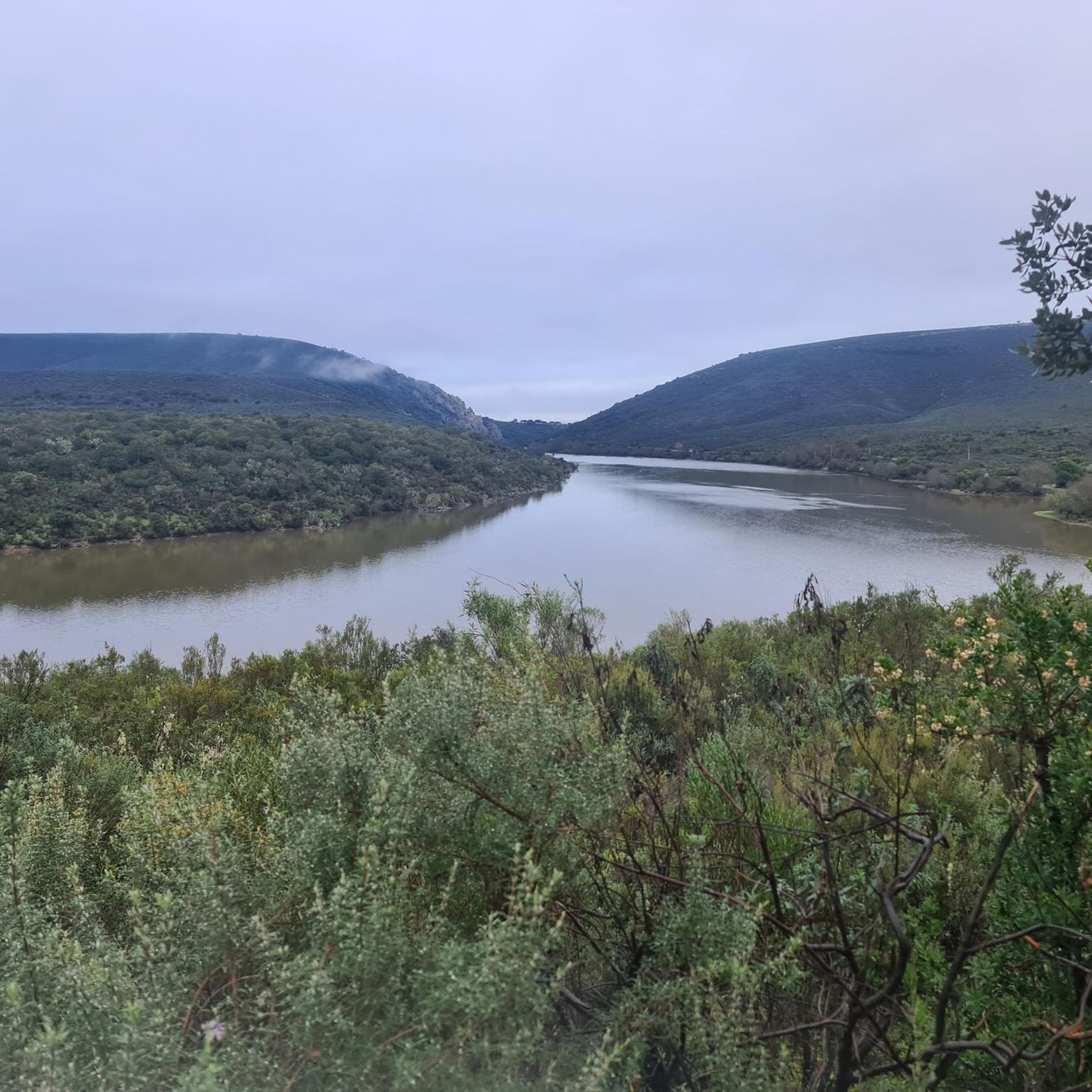
Road cycling around Belvís De Monroy offers diverse landscapes, from the Tagus River valley to the Dehesa Extremeña. The region features a mix of terrains, including gradual uphills, flat sections, and more challenging climbs, with routes often passing through cork oak and holm oak forests. Proximity to Monfragüe National Park provides opportunities to explore areas rich in biodiversity. Cyclists can experience narrow lanes between farms and enjoy views of the Valdecañas Reservoir.
Best road cycling routes around Belvís De Monroy
- The most popular road cycling route is Almaraz to Puerto de Campillo — circular via Puerto de Miravete and Deleitosa, a 40.2 miles (64.7 km) trail that takes about 4 hours to complete. This difficult route includes significant elevation gain and panoramic views from Puerto de Miravete.
- Another top favourite among local road cyclists is Valdecañas Reservoir Loop from Almaraz via Puerto de Campillo, a difficult 44.6 miles (71.9 km) path. This route offers extensive views of the Valdecañas Reservoir and the surrounding river valley.
- Local road cyclists also love the Belvís de Monroy to Almaraz — circular by the Embalse de Arrocampo, a 15.8 miles (25.4 km) trail leading through the Arrocampo Reservoir area, often completed in about 1 hour 14 minutes.
- Road cycling around Belvís De Monroy is defined by routes along the Tagus River, views of the Valdecañas Reservoir, and paths through the Dehesa Extremeña. The network offers options for different ability levels, from moderate loops to challenging climbs.
- The routes in Belvís De Monroy are highly rated by the komoot community with an average score of 5.0 stars from 2 reviews. More than 650 road cyclists have used komoot to explore Belvís De Monroy's varied terrain.
Last updated: July 16, 2026
11
riders
64.7km
04:00
1,220m
1,220m
Hard road ride. Very good fitness required. Mostly well-paved surfaces and easy to ride.
71.9km
04:14
1,360m
1,360m
Hard road ride. Very good fitness required. Mostly well-paved surfaces and easy to ride.

Sign up for free
25.4km
01:14
310m
310m
Moderate road ride. Good fitness required. Mostly well-paved surfaces and easy to ride.
27
riders
53.0km
03:07
290m
280m
Moderate road ride. Good fitness required. Mostly well-paved surfaces and easy to ride.
22
riders
107km
04:56
570m
570m
Moderate road ride. Good fitness required. Mostly well-paved surfaces and easy to ride.
Get access to more routes and recommendations from other explorers.
Sign up for free
Already have an account?
Our route recommendations are based on thousands of hikes, rides, and runs completed by other people on komoot.
Start today with a free account
Your next adventure awaits.
Login or Signup



Tips from the Community

Serrejón is a Spanish town with a total of 414 inhabitants. The place has a certain charm and a small grocery store with 69 (!) different types of cheese.
1
0

At the southeastern end of the Monfragüe National Park is the town of Deleitosa, surrounded by oak and chestnut forests. Stop by the center of town to rest, eat something and admire the church of San Juan Evangelista.
1
0
Nice climb to Puerto de Campillo, 2.75 km coming from the south side, it is not too long. The views from the top at 700 meters above sea level are gratifying. Prepare for the descent towards Campillo de Deleitosa.
1
0
At the foot of the Sierra de la Caldilla, is the small historic town of Higuera. Stop by the charming San Sebastián church if you need to rest and grab a bite to eat.
0
0
Cycle to the Miravete mountain pass. From this point you can see the ruins of the Zúñigas fortification from the 16th century. Today, eclipsed by communication antennas.
0
0
The climb from Puente Campillo to Alto de las Mesas is a stretch of 4.74 kilometers with an average slope of 5.1%. Enjoy the view of the surrounding landscape.
1
0
On the slopes of the Monfragüe Biosphere Reserve, the small town of Serrejón is surrounded by native oak forests. The bell tower of the 15th-century San Ildefonso church can be seen rising above the city as you cycle towards it.
0
0
Between Saucedilla and Almaraz you reach the incredible bird paradise, the Embalse de Arrocampo Ornithological Natural Park, an incredible area to explore by bicycle at the eastern end of the Monfragüe National Park.
0
0
Frequently Asked Questions
What types of terrain can I expect on road cycling routes around Belvís de Monroy?
The region offers a diverse mix of terrains, from gradual uphills and flat sections along river valleys to more challenging climbs, particularly on routes leading from Navalmoral to Belvís de Monroy. You'll also encounter narrow lanes between farms, past stone fences, and over rocky ground, providing a varied cycling experience.
Are there road cycling routes suitable for beginners or those looking for an easier ride?
Yes, Belvís de Monroy offers routes for various skill levels. While there are challenging climbs, you can find easier options. For example, the route Belvís de Monroy to Almaraz — circular by the Embalse de Arrocampo is rated moderate and covers 15.8 miles (25.4 km) with a more manageable elevation gain.
What historical landmarks can I see while road cycling in the area?
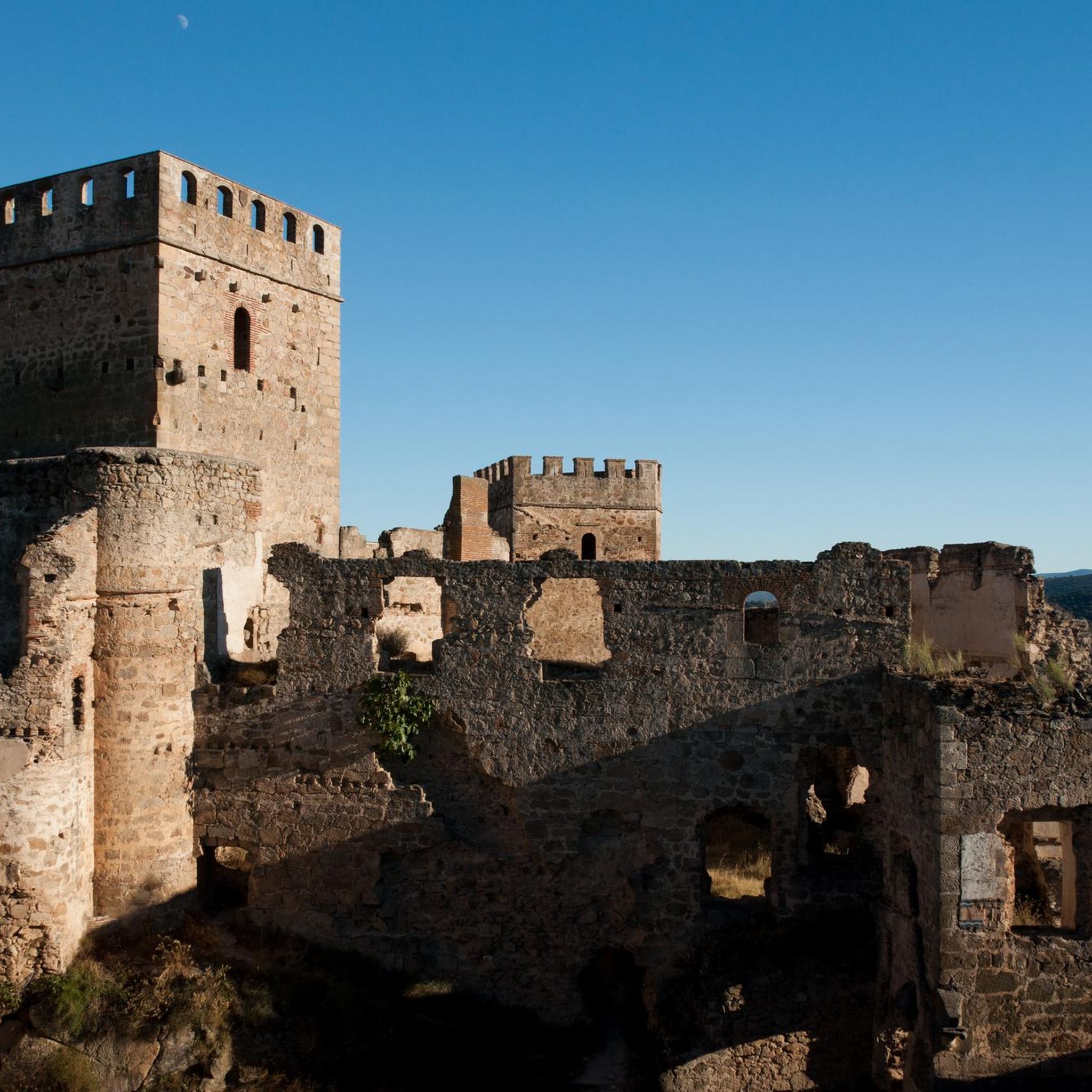
You can encounter several historical sites. The imposing Castle of Belvís de Monroy is a prominent landmark. Additionally, the area features the Temple of the Woodcutters of Augustobriga, ancient Roman ruins with impressive views of the Valdecañas reservoir, and the historic Almaraz Bridge over the Tagus River.
Are there any scenic viewpoints or natural features to look out for on the routes?
Absolutely. Many routes offer stunning views of the Tagus River valley and the Valdecañas Reservoir. You'll also cycle through the typical 'Dehesa Extremeña' landscape, characterized by picturesque cork oak and holm oak forests. The region's proximity to Monfragüe National Park means you might also encounter diverse flora and fauna.
How many road cycling routes are available around Belvís de Monroy?
There are over 60 road cycling routes available around Belvís de Monroy, catering to various preferences and skill levels. This includes 8 easy routes, 37 moderate routes, and 23 difficult routes.
What do other cyclists say about road cycling in Belvís de Monroy?
The routes in Belvís de Monroy are highly rated by the komoot community, with an average score of 5.0 stars. Cyclists often praise the varied terrain, the scenic views of the river and reservoir, and the opportunity to explore the unique Dehesa Extremeña landscape.
Are there any circular road cycling routes in Belvís de Monroy?
Yes, there are several circular routes available. An example is the Almaraz to Puerto de Campillo — circular via Puerto de Miravete and Deleitosa, which is a difficult 40.2-mile (64.7 km) loop offering panoramic views.
What is the best time of year to go road cycling in Belvís de Monroy?
While specific seasonal advice isn't provided, the region's Mediterranean climate suggests spring and autumn would be ideal for road cycling, offering milder temperatures. Summers can be very hot, and winters can be cooler, so checking local weather forecasts is always recommended.
Are there any routes that pass by the Valdecañas Reservoir?
Yes, many routes offer views of the Valdecañas Reservoir. The Valdecañas Reservoir Loop from Almaraz via Puerto de Campillo is a difficult 44.6-mile (71.9 km) path specifically designed to showcase extensive views of the reservoir and the surrounding river valley.
Can I find routes that are suitable for a ride of around 3 hours?
Yes, you can find routes that fit a 3-hour duration. For instance, the Belvís de Monroy to Almaraz — circular by the Embalse de Arrocampo is a moderate 15.8-mile (25.4 km) route that typically takes about 1 hour and 14 minutes, leaving plenty of time for a longer, more leisurely ride or combining with other activities. For a longer ride, the Arrocampo Reservoir – Granite Pillar of Almaraz loop from Almaraz takes around 3 hours and 7 minutes.
Are there any specific natural parks or protected areas nearby that cyclists can explore?
Belvís de Monroy is located near the entrance to Monfragüe National Park, a natural paradise known for its Mediterranean forest, rich biodiversity, and excellent birdwatching opportunities. While specific cycling routes within the park itself are not detailed, its proximity offers opportunities to explore routes with varied flora and fauna in the surrounding areas.
Where can I find parking for road biking in Belvís de Monroy?
While specific parking locations are not detailed, towns like Belvís de Monroy and Almaraz, which serve as common starting points for routes, typically offer public parking options. It's advisable to check local town maps or use navigation apps for designated parking areas upon arrival.
Most popular routes around Belvís De Monroy
Most popular attractions around Belvís De Monroy

Get inspired with the komoot mobile app


Explore more
Browse the best Road cycling routes in other regions.
