The best road cycling routes around Séchilienne
4.6
(350)
8,830
riders
78
rides
Road cycling routes around Séchilienne are characterized by challenging mountain terrain within the Isère region, offering significant elevation gains. The area features prominent mountain ranges such as Belledonne, Grandes Rousses, and Vercors, providing a diverse landscape for cyclists. Glacial lakes and high mountain passes, including the Col de la Morte, define many of the routes. This region provides varied road cycling experiences, from moderate climbs to very demanding ascents.
Best road cycling routes around Séchilienne
- The most popular road cycling…
Last updated: July 15, 2026
4.2
(13)
169
riders
44.2km
02:10
540m
540m
Moderate road ride. Good fitness required. Mostly well-paved surfaces and easy to ride.
4.5
(2)
108
riders
75.0km
04:08
1,600m
1,600m
Hard road ride. Very good fitness required. Mostly well-paved surfaces and easy to ride.

Sign up for free
5.0
(8)
68
riders
30.1km
01:10
100m
100m
Moderate road ride. Great for any fitness level. Some segments of this route may be unpaved and difficult to ride.
5.0
(4)
48
riders
48.2km
03:16
1,630m
1,630m
Hard road ride. Very good fitness required. Mostly well-paved surfaces and easy to ride.
33
riders
49.3km
02:36
760m
760m
Moderate road ride. Good fitness required. Mostly well-paved surfaces and easy to ride.
Get access to more routes and recommendations from other explorers.
Sign up for free
Already have an account?
Our route recommendations are based on thousands of hikes, rides, and runs completed by other people on komoot.
Start today with a free account
Your next adventure awaits.
Login or Signup


Tips from the Community

The most direct passage to leave Grenoble by the South following the Drac Decathlon Comboire is just to the south
0
0

Great castle complex, beautiful park.
0
0

you have to know that she is there, otherwise, by bike there is no chance of seeing her
0
0
The cycle path from Pont-de-Claix to Jarrie is very well laid out, but it stops well before the industrial zone. After that it is quite dangerous. The bridge over the Romanche unfortunately does not connect with the cycle path.
0
0

Please note: dogs are not allowed in the castle gardens, even on a leash. This means you'll have to find a different route around the castle with a dog!
0
0
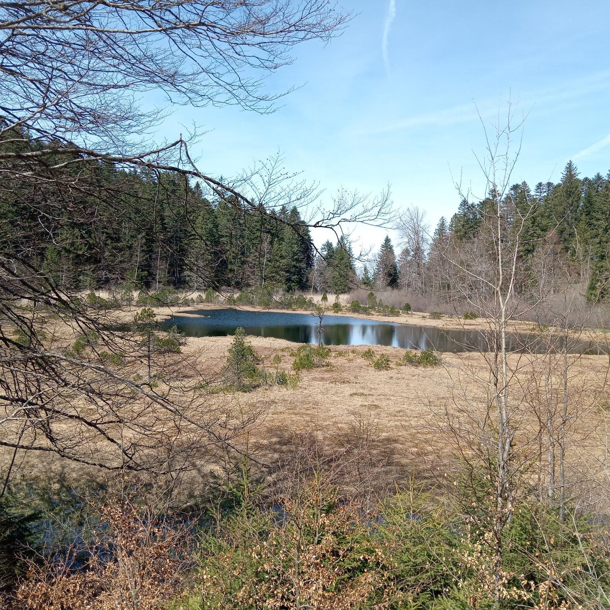
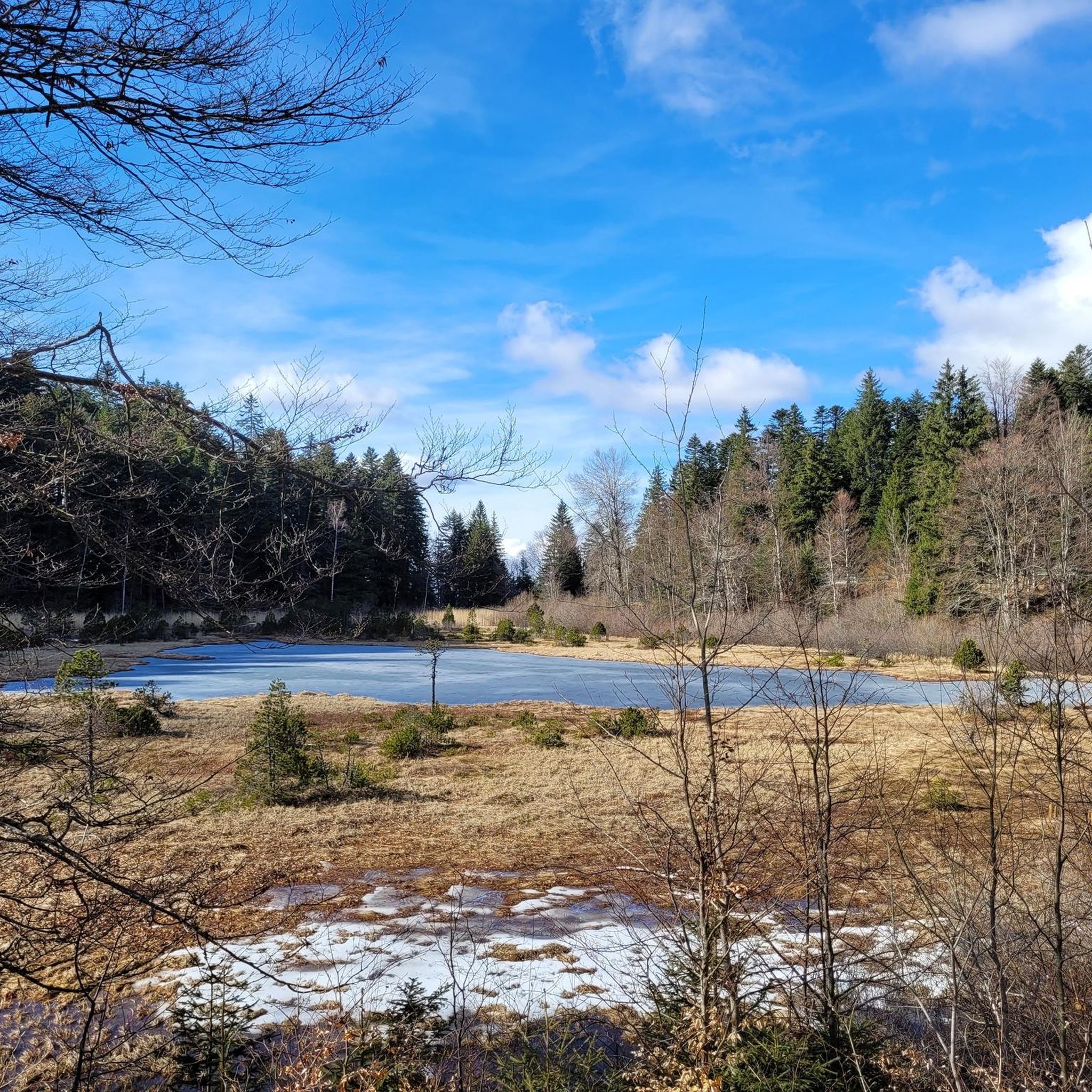
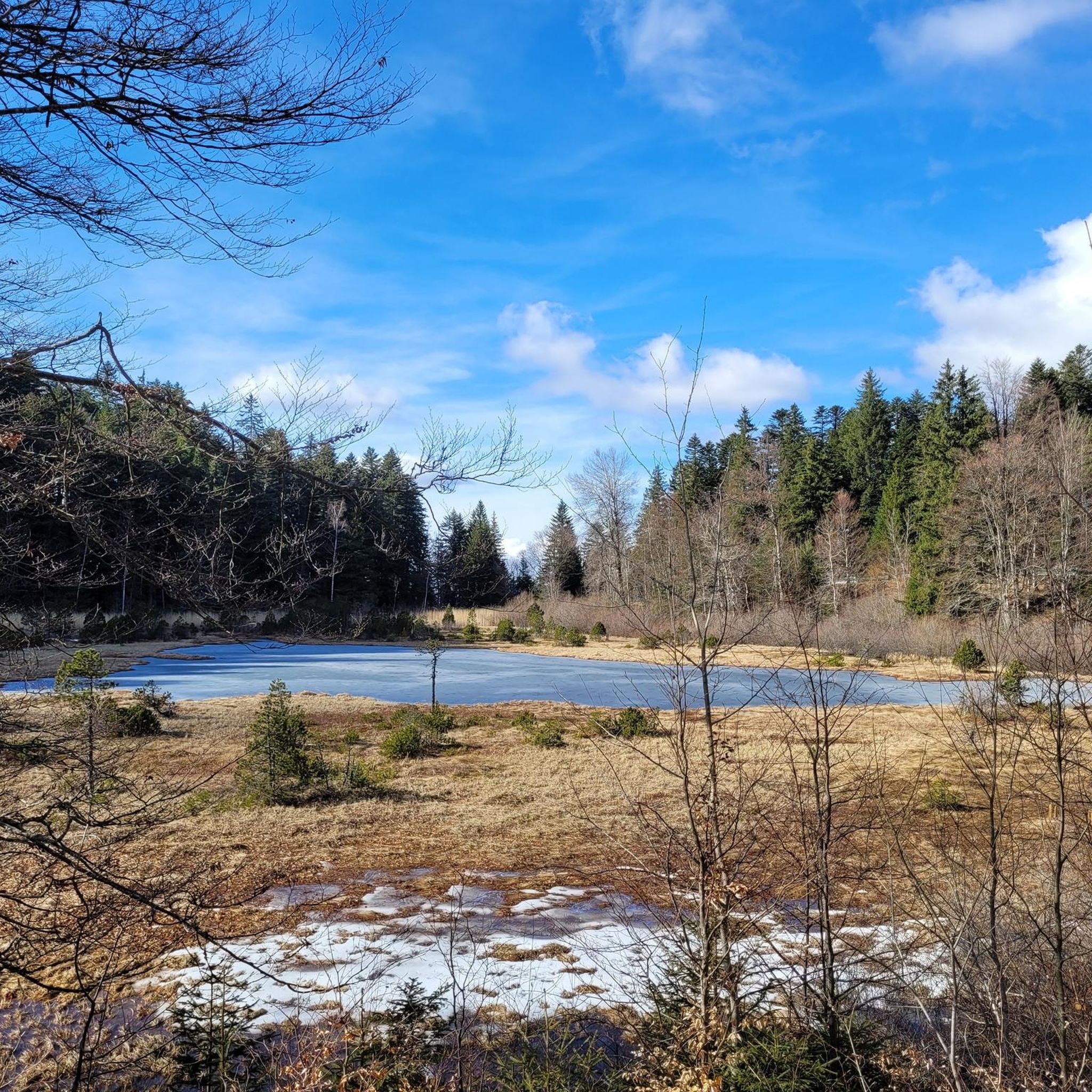
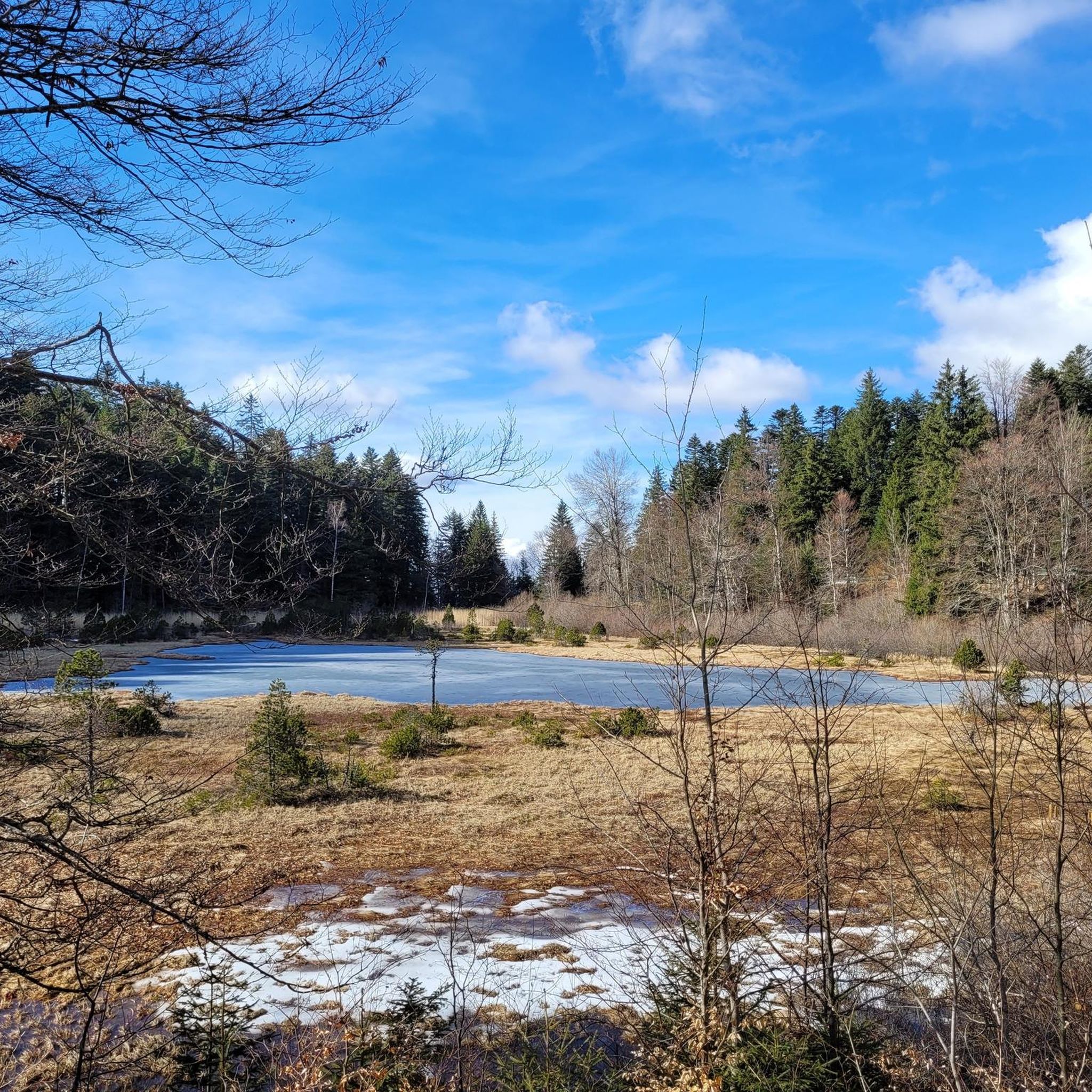
The little road that goes down from Cholonge is great and on arrival you have a superb view of Lake Lafrey
0
0
A pass of about fifteen kilometers, with a 1,000 m elevation gain. Almost always in the shade, with little traffic.
0
0
A beautiful castle that houses the Museum of the Revolution. The park is large and very pretty. It's a paradise for children.
0
0
Frequently Asked Questions
What kind of terrain can I expect when road cycling near Séchilienne?
Road cycling around Séchilienne is characterized by challenging mountain terrain within the Isère region, offering significant elevation gains. You'll encounter prominent mountain ranges such as Belledonne, Grandes Rousses, and Vercors, along with glacial lakes and high mountain passes like the Col de la Morte. The routes provide a diverse landscape, from moderate climbs to very demanding ascents, often featuring stunning panoramic views.
How many road cycling routes are available around Séchilienne?
There are over 70 road cycling routes available around Séchilienne, catering to various skill levels. This includes 3 easy routes, 47 moderate routes, and 28 difficult routes, ensuring options for nearly every cyclist.
Are there road cycling routes suitable for beginners or those looking for a less strenuous ride in Séchilienne?
While Séchilienne is known for its challenging climbs, there are a few routes suitable for beginners or those seeking a more moderate experience. For instance, the View of the Vercors – Lake Laffrey loop from Saint-Barthélemy-de-Séchilienne is a moderate 45.1 km route that offers beautiful views without extreme elevation. There are 3 easy and 47 moderate routes in total.
What are some of the most challenging road cycling routes near Séchilienne?
For experienced cyclists seeking a challenge, the region offers several demanding routes. The Col de la Morte – Col de la Morte loop from Rioupéroux is a difficult 75.1 km path featuring a substantial climb to the Col de la Morte with over 1,600 meters of elevation gain. Another difficult option is the La Morte Pass (1,370 m) – Col de la Morte loop from Séchilienne, a 30.1 km route with over 1,000 meters of ascent.
What scenic viewpoints can I expect along the road cycling routes in Séchilienne?
Road cycling routes around Séchilienne offer magnificent panoramic views of several prominent mountain ranges, including Belledonne, Grandes Rousses, Cerces, Oisans, Dévoluy, Chartreuse, and Vercors. From certain vantage points, such as those found on routes towards Taillefer, you might even catch glimpses of Mont Blanc. The glacial lakes, like Lake Laffrey, also provide stunning vistas.
What attractions or landmarks can I visit near the road cycling routes in Séchilienne?
Beyond the cycling, you can explore several notable attractions. The historic Château de Vizille, located just 5 km from Séchilienne, features a beautiful garden and houses the Museum of the French Revolution. For natural wonders, consider visiting La Pierre Percée, a natural arch offering unique views, or the picturesque Lake Achard, a popular spot for picnics.
Are there any circular road cycling routes in the Séchilienne area?
Yes, many of the road cycling routes around Séchilienne are designed as loops. For example, the Roadbike loop from Séchilienne is a moderate 49.1 km route that starts and ends in Séchilienne. Other notable loops include those around the Col de la Morte, offering challenging circular rides through the mountainous terrain.
What is the best time of year for road biking in Séchilienne?
The best time for road biking in Séchilienne is typically from late spring through early autumn (May to October) when the weather is most favorable and mountain passes are clear of snow. During summer, special 'Mountain Collection' events sometimes close roads on several passes to motorized vehicles, providing a unique and safe experience for cyclists to conquer legendary Alpine passes.
What do other road cyclists enjoy most about road cycling in Séchilienne?
The road cycling experience in Séchilienne is highly rated by the komoot community, with an average score of 4.4 stars from over 200 reviews. Cyclists often praise the challenging climbs, the diverse and stunning alpine scenery, and the sense of accomplishment from conquering the region's prominent mountain passes and enjoying the panoramic views.
Are there any specific events or unique opportunities for road cyclists in Séchilienne?
Yes, the region hosts 'Mountain Collection' events where roads on several passes are closed to motorized vehicles during morning hours. This provides a unique and safe experience for cyclists to conquer legendary Alpine passes without traffic. For more information on local cycling events and routes, you might find resources on the Matheysine tourism website: matheysine-tourisme.com.
What are the typical distances and elevation gains for road cycling routes in Séchilienne?
Routes vary significantly. Moderate routes, such as the View of the Vercors – Lake Laffrey loop from Saint-Barthélemy-de-Séchilienne, can be around 45 km with over 600 meters of elevation gain. More difficult routes, like the Col de la Morte – Col de la Morte loop from Séchilienne, can span 48 km with over 1,600 meters of ascent, offering substantial challenges for experienced riders.
Most popular routes around Séchilienne
Most popular attractions around Séchilienne

Get inspired with the komoot mobile app


Explore more
Browse the best Road cycling routes in other regions.
