The best road cycling routes around Saint-Denis-D'Oléron
4.3
(118)
2,903
riders
16
rides
Road cycling around Saint-Denis-D'Oléron offers routes across the flat, coastal landscape of Île d'Oléron. The region is characterized by its low elevation, with minimal climbs, making it suitable for various fitness levels. Cyclists can expect to encounter coastal paths, sandy beaches, and views of the Atlantic Ocean. The terrain is predominantly flat, providing accessible road cycling opportunities.
Best road cycling routes around Saint-Denis-D'Oléron
- The most popular road cycling route is Plage de la biroire loop from Les Hameaux des Marines, an 18.9 miles (30.4 km) trail that takes 1 hour 12 minutes to complete. This easy route offers views of the coastline and local beaches.
- Another top favourite among local road cyclists is Chassiron Lighthouse – Phare de Chassiron loop from Phare de Chassiron, a moderate 31.8 miles (51.2 km) path. This route features the iconic Chassiron Lighthouse and extends along the island's northern coast.
- Local road cyclists also love the Wind-Shaped Trees – Plage de la biroire loop from Saint-Denis-d'Oléron, a 19.6 miles (31.5 km) trail leading through coastal areas, often completed in about 1 hour 14 minutes.
- Road cycling around Saint-Denis-D'Oléron is defined by coastal paths, flat terrain, and views of the Atlantic. The network offers options for both easy and moderate ability levels.
- The routes in Saint-Denis-D'Oléron are highly rated by the komoot community with an average score of 4.1 stars from over 10 reviews. More than 600 road cyclists have used komoot to explore Saint-Denis-D'Oléron's varied terrain.
Last updated: July 15, 2026
3.5
(6)
142
riders
Moderate road ride. Great for any fitness level. Some segments of this route may be unpaved and difficult to ride.
5.0
(2)
53
riders
Moderate road ride. Great for any fitness level. Some segments of this route may be unpaved and difficult to ride.

Sign up for free
5.0
(1)
42
riders
Easy road ride. Great for any fitness level. Mostly well-paved surfaces and easy to ride.
5.0
(1)
12
riders
Easy road ride. Great for any fitness level. Mostly well-paved surfaces and easy to ride.
5.0
(1)
20
riders
Easy road ride. Great for any fitness level. Mostly well-paved surfaces and easy to ride.
Get access to more routes and recommendations from other explorers.
Sign up for free
Already have an account?
Our route recommendations are based on thousands of hikes, rides, and runs completed by other people on komoot.
Start today with a free account
Your next adventure awaits.
Login or Signup

Tips from the Community

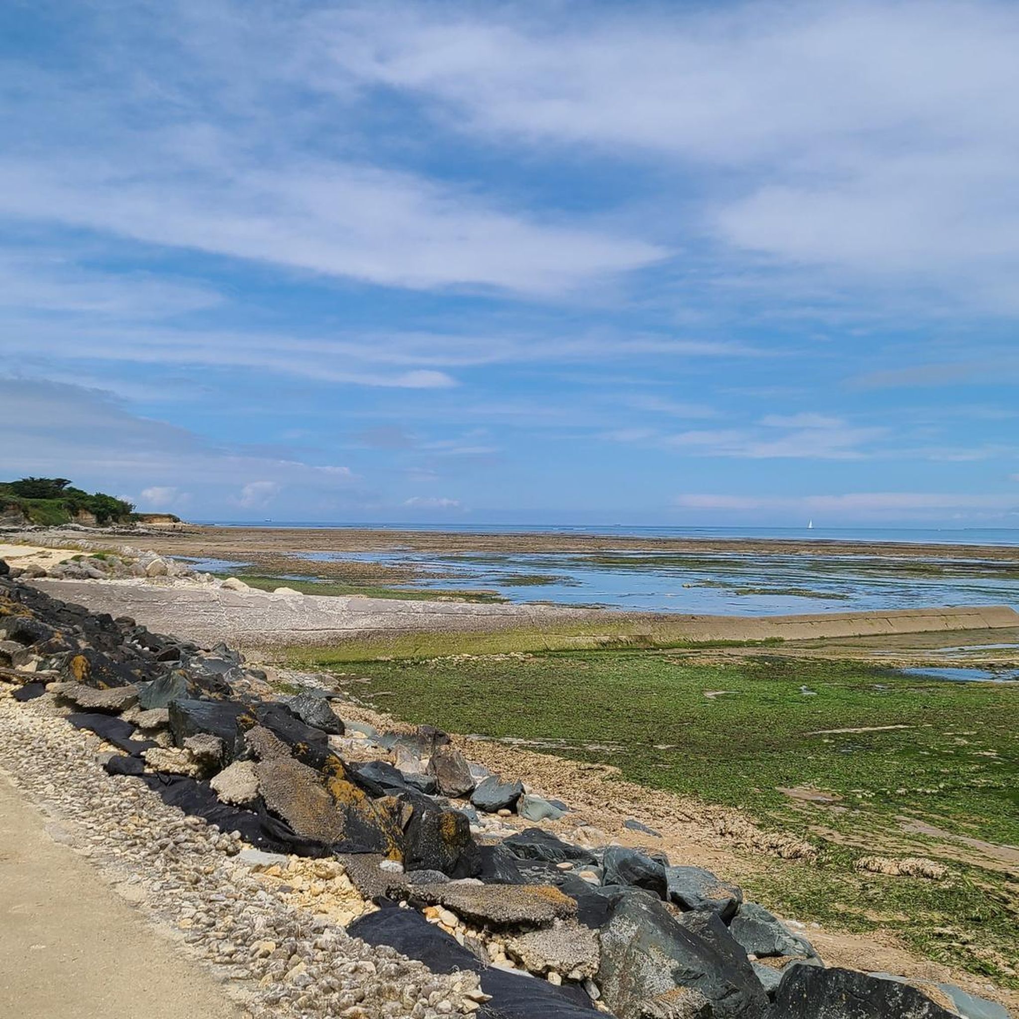
Spectacular what the wind can do
0
0

The port of Douhet, located in the commune of Saint-Georges-d’Oléron, is today a pleasant marina, but its history is intimately linked to the salt and wine trade. Origins Until the 19th century, the region's products (notably salt from the salt marshes and wine from Oléron) were difficult to transport by sea. To remedy this, a vast project was launched in the 1840s: a channel over 3 km long was dug between Saint-Georges-d’Oléron and the ocean, opening onto the new port of Douhet. An active commercial port The port quickly became an export center: * barges loaded salt and wine barrels there; * boats also brought building materials and various goods intended for the island. In the 1870s, there were around 400 ship movements per year, with several thousand tons of goods imported and exported. The decline At the end of the 19th century, several factors led to its decline: * the gradual abandonment of the salt marshes; * the improvement of roads and then the arrival of the tram on the island; * the regular silting up of the channel. After the First World War, the channel silted up almost completely and commercial traffic gradually disappeared. The revival In the late 1980s, the basin was completely rehabilitated and transformed into a marina. It now accommodates around 350 to 400 boats and is one of the main marinas on the island of Oléron. Its location, in the cove of Malconche, offers a remarkable view of Fort Boyard and the Île d’Aix. The old channel, although no longer navigable to the village, continues to supply seawater to the old salt marshes and today constitutes a pleasant walking or cycling route. It is a place where the traces of Oléron's maritime past can still be read in the landscape: the quays, the bridge, the channel, and the old hydraulic structures bear witness to the era when salt was the island's main wealth.
0
0

A unique and peaceful spectacle.
0
0

The port of Douhet is essentially the mouth of the Douhet Canal. There are several nice restaurants nearby.
1
0

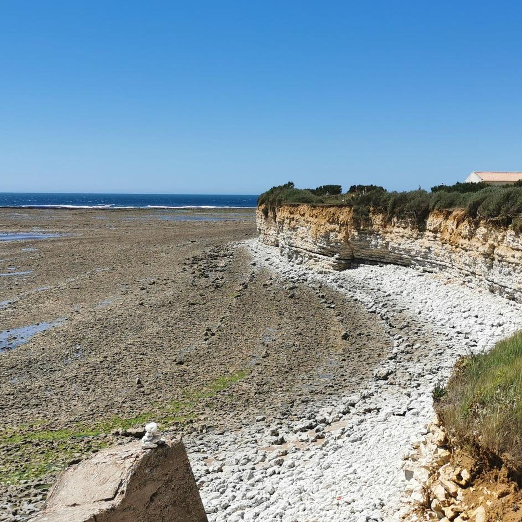
Do not stack pebbles as this promotes erosion.
0
0

After 224 steps you can enjoy a wonderful panoramic view of the island
1
0

As you head towards the Chassiron Lighthouse, you will discover a unique and peaceful sight: a beach of cairns, or piles of stones, that have been carefully constructed by visitors and locals. This area offers a quiet place to stop and reflect, with the rhythmic sound of the ocean in the background.
1
0
Frequently Asked Questions
What kind of terrain can I expect when road cycling around Saint-Denis-D'Oléron?
The region of Saint-Denis-D'Oléron, located on Île d'Oléron, is characterized by a predominantly flat, coastal landscape. You can expect minimal climbs, making it suitable for various fitness levels. Routes often feature coastal paths, sandy beaches, and views of the Atlantic Ocean.
Are there many easy road cycling routes suitable for beginners in Saint-Denis-D'Oléron?
Yes, Saint-Denis-D'Oléron offers a good selection of easy road cycling routes. Out of the 14 available routes, 6 are classified as easy. An excellent option for beginners is the Plage de la biroire loop from Les Hameaux des Marines, an 18.9-mile (30.4 km) trail with coastal views.
Are there any challenging or advanced road cycling routes in the area?
The road cycling routes around Saint-Denis-D'Oléron are generally flat and coastal, with no routes classified as difficult. The most challenging options are moderate, such as the Douhet Port – Baudissière Huts loop from Saint-Denis-d'Oléron, which covers 36.7 miles (59 km) with slightly more elevation gain.
What are some scenic road cycling routes in Saint-Denis-D'Oléron?
Many routes offer beautiful coastal scenery. The Chassiron Lighthouse – Phare de Chassiron loop from Phare de Chassiron is particularly scenic, extending along the island's northern coast and featuring the iconic Chassiron Lighthouse. Another option is the Wind-Shaped Trees – Plage de la biroire loop from Saint-Denis-d'Oléron, which leads through coastal areas.
Are there any circular road cycling routes available?
Yes, most of the road cycling routes in Saint-Denis-D'Oléron are designed as loops, allowing you to start and finish in the same location. Examples include the Wind-Shaped Trees loop from Saint-Denis-d'Oléron and the Plage de la biroire loop from Les Hameaux des Marines.
What is the best time of year for road biking in Saint-Denis-D'Oléron?
The mild climate of Île d'Oléron makes road cycling enjoyable for much of the year. Spring and early autumn generally offer pleasant temperatures and fewer crowds. Summer can be popular, but also warmer and busier, especially along the coast.
What attractions can I see along the road cycling routes in Saint-Denis-D'Oléron?
The routes often pass by notable landmarks and natural features. You can explore the iconic Chassiron lighthouse, the picturesque Chenal du Douhet, or the historic La Brée Mill. The La Morelière coastal path also offers beautiful views.
Are the road cycling routes in Saint-Denis-D'Oléron suitable for families?
Given the flat terrain and numerous easy routes, Saint-Denis-D'Oléron is very family-friendly for road cycling. The well-maintained coastal paths provide a safe and enjoyable environment for cyclists of all ages. Consider routes like the Plage de la biroire loop from Les Hameaux des Marines for a pleasant family outing.
Where can I find parking for road biking trails in Saint-Denis-D'Oléron?
Parking is generally available in and around the main towns and popular starting points for routes, such as Saint-Denis-d'Oléron itself or near major attractions like the Chassiron Lighthouse. Many routes are loops, allowing you to park at a convenient point and return to your starting location.
What do other road cyclists enjoy most about road cycling in Saint-Denis-D'Oléron?
The area is highly rated by the komoot community, with an average score of 4.1 stars from over 10 reviews. Cyclists frequently praise the flat, accessible terrain, the stunning coastal views, and the opportunity to explore the island's unique charm by bike.
How long do the road cycling routes typically take to complete?
The duration of routes varies depending on their length and your pace. For instance, the Plage de la biroire loop from Les Hameaux des Marines, at 18.9 miles (30.4 km), typically takes about 1 hour 12 minutes. Longer routes, like the Chassiron Lighthouse – Phare de Chassiron loop from Phare de Chassiron (31.8 miles / 51.2 km), can take around 2 hours 6 minutes.
Are there places to stop for refreshments or cafes along the road cycling routes?
Yes, as a popular tourist destination, Île d'Oléron offers various cafes, restaurants, and small shops in its towns and villages. Many routes pass through or near these settlements, providing opportunities for refreshment stops. It's always a good idea to check your chosen route for specific points of interest before you set off.
Most popular routes around Saint-Denis-D'Oléron
Most popular attractions around Saint-Denis-D'Oléron

Get inspired with the komoot mobile app


Explore more
Browse the best Road cycling routes in other regions.
