The best walks and hikes around Saint-André-De-Lidon
4.4
(55)
542
hikers
31
hikes
Hiking around Saint-André-De-Lidon offers access to diverse landscapes in the Charente-Maritime department. The region features a mix of coastal environments, including marshes and cliffs near the Gironde estuary, alongside inland vineyards and woodlands. Elevation changes are generally moderate, with trails often traversing rolling hills and riverbanks. The area provides varied terrain for outdoor exploration.
Best hiking trails in Saint-André-De-Lidon
- The most popular hiking route is Sainte-Radegonde Church – View of the La Roche cliff loop from Barzan, an 8.1…
Last updated: June 29, 2026
4.4
(5)
27
hikers
13.1km
03:26
110m
110m
Moderate hike. Good fitness required. Easily-accessible paths. Suitable for all skill levels.
5.0
(2)
18
hikers
Moderate hike. Good fitness required. Easily-accessible paths. Suitable for all skill levels.

Sign up for free
4.8
(4)
12
hikers
Easy hike. Great for any fitness level. Easily-accessible paths. Suitable for all skill levels.
5.0
(1)
7
hikers
12.3km
03:17
140m
140m
Moderate hike. Good fitness required. Easily-accessible paths. Suitable for all skill levels.
5.0
(3)
9
hikers
11.7km
03:09
150m
150m
Moderate hike. Good fitness required. Easily-accessible paths. Suitable for all skill levels.
Get access to more routes and recommendations from other explorers.
Sign up for free
Already have an account?
Our route recommendations are based on thousands of hikes, rides, and runs completed by other people on komoot.
Start today with a free account
Your next adventure awaits.
Login or Signup
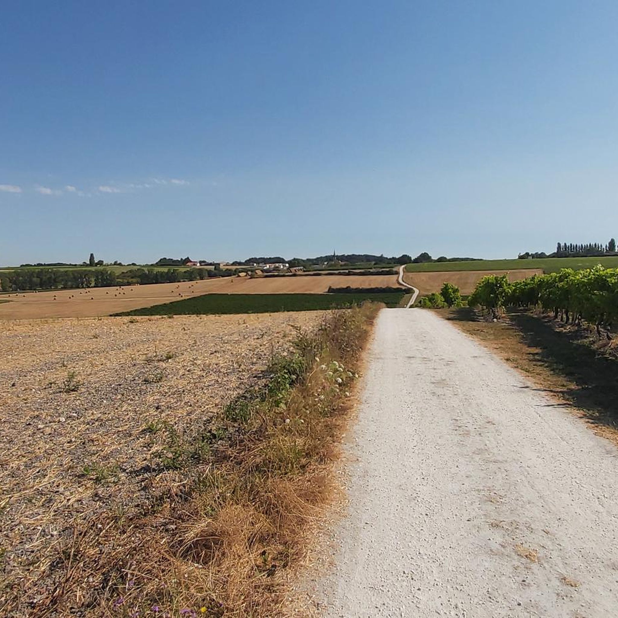
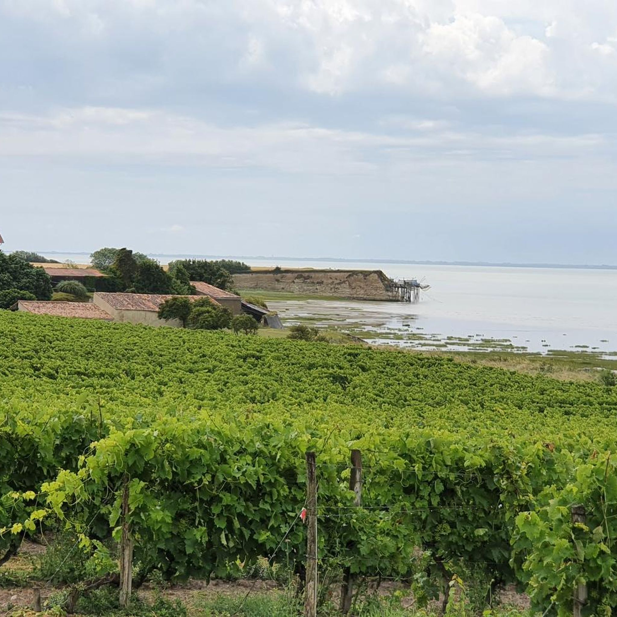

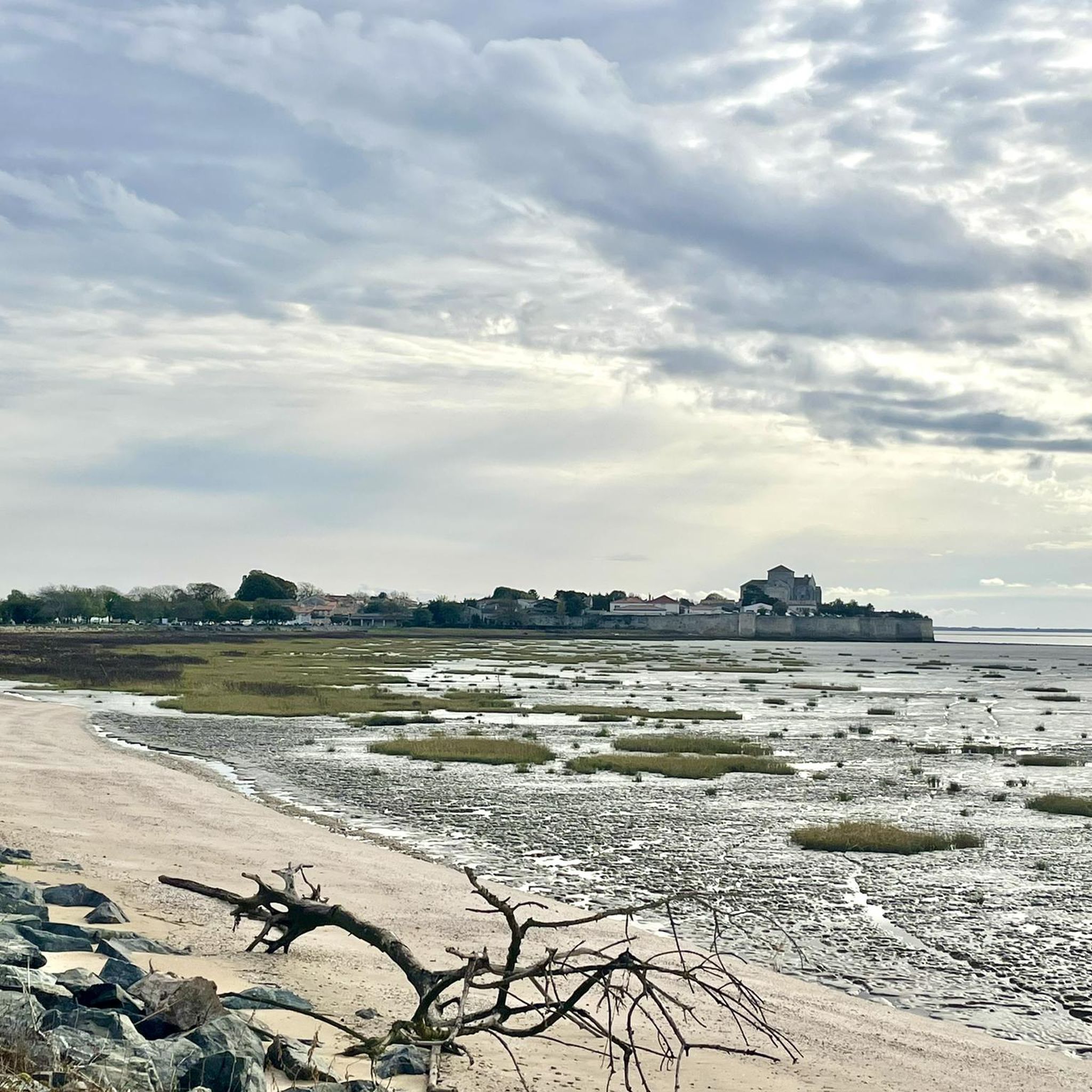
Tips from the Community

Bright limestone cliffs, small whitewashed houses, a Romanesque sandstone church, and the waters of the Gironde River far below: Talmont-sur-Gironde is a picture-perfect village. And during the peak summer season, it's a tourist magnet, as one of the most beautiful villages in France. If you don't arrive early, you'll have trouble getting through the entrance gate. The large parking lot, which has long since taken up more space than the village itself, is full until late into the evening.
0
0

A small, pedestrian-only craft village. The site is magnificent, located on the Gironde estuary.
0
0

From the height of the coastal plateau the view reaches to the Gironde estuary, and the white cliffs of Pilou, with the tradition fishing huts on stilts (carelets).
1
0
Built on a cliff overlooking the Gironde estuary, the Catholic Church of Sainte-Radegonde is sometimes considered the archetype of the Saintonge Romanesque style. The view of the Gironde estuary and the surrounding rivers is spectacular.
0
0

Inside the dwelling, there is an 18th century fireplace in the room on the right, another from the Renaissance period on the ground floor of the west pavilion, and a third, in marble, from the end of the 19th century, on the upper floor of the latter. The dividing wall between the pavilion and the rest of the dwelling is very thick: it is the old exterior wall of the dwelling, before the developments of the early 20th century and the construction of the pavilion. Also inside, there is a wooden spiral staircase. The ground floor of the south-east tower is occupied by an old bathroom, with a cement bathtub built into the floor.
0
0
The dwelling consists of a main building to which are attached to the west a rectangular pavilion, a round tower in the south-east corner, and another round tower to the north. The west pavilion, made of cut stone, is covered with a high hipped roof and a turned-up eaves, in flat tiles, topped with zinc finials and highlighted by an imposing cornice with modillions. Its south facade has a span of openings, as follows: on the ground floor, a French window in a low arch, decorated with a drip edge; on the first floor, a high window with a projecting frame, mascaron, and molded sill with consoles. The south-east corner of the pavilion is a watchtower. The south-east tower, called the "Renaissance tower", is topped with a pepperpot roof and a turned-up eaves, in flat tiles, topped with a zinc finial, and highlighted by a cornice. The tower, made of cut stone, has a first bay of openings to the south, formed by two windows and topped by a pediment. The ground floor window has a simple projecting frame, to which is added, for the upper floor window, a molded support with consoles, a projecting keystone and a mascaron. The pediment is arched and broken. Its 2 volutes frame a damping. On the east side, the tower has another bay of openings, treated in the same way as the previous one, with the exception of the pediment which is here replaced by a tall chimney stack in cut stone, finished with a curved pediment. Between the west pavilion and the south-east tower, the facade of the dwelling is presented under a broken section of the roof. The facade is characterized by the symmetry created by the distribution of the openings, i.e. 5 bays on the ground floor, including the central door, and 3 pass-through windows on the upper floor. The bays on the ground floor have a projecting frame and keystone. The door also has a segmental arched lintel. Originally, it was a low segmental arched door, topped with a bull's-eye window and a cornice. The 3 pass-through windows have in common a pediment, a projecting keystone and a molded support with consoles. The keystone of the central window also has a mascaron. Cut stones protrude from the wall of the facade. At the rear of the dwelling, to the north, the 2nd round tower is topped with a flat tile roof, topped with a zinc finial. The upper part of the tower, pierced with loopholes, has a larger diameter than the lower part
0
0
The Fond fountain appears on a map of Talmont in 1706, drawn up by the engineer Claude Masse. It is described as a "fountain or soft well". In his writings accompanying his maps and plans, Masse mentions this fountain, the only source of fresh water in Talmont. The fountain then appears on the cadastral map of 1831. The pump and the drinking troughs were apparently installed in 1868. Until the establishment of the water supply, this fountain was the only source of drinking water in the commune, the wells only providing brackish water. The pumping system, initially a balance, later included a wheel. Wooden pipes distributed the water to the stamps. At the top of the pump, another pipe allowed the barrels to be filled in carts. The fountain is located in front of the Fond lodge, at the end of Rue des Porteaux, below the Caillaud hill. The fountain itself is topped with a stone aedicule, with a metal mechanism. It is surrounded by seven monolithic stone drinking troughs or "timbres".
0
0
The Fond lodge is located to the north and below the hamlet of Caillaud, near the fountain that gave its name to the site. Delimited by a boundary wall, the property includes a garden to the south and a park to the east and north. The lodge rises to the west. It is extended to the east by a wing of sheds to the north of a courtyard, then by an old stable at right angles to the east of this courtyard. A fictitious dovecote, covered with an imperial roof and topped with a weather vane, rises at the end of this old stable. It opens with semicircular bays and is surrounded by a molded band. Upstairs is a double semicircular bay with a cornice with consoles. The wing of sheds to the north of the courtyard has a low door with a chamfered frame, a bay with a segmental arched lintel on the left, and on the right, another bay whose lowered arched lintel is undoubtedly reused.
0
0
Frequently Asked Questions
How many hiking trails are available around Saint-André-De-Lidon?
There are over 20 hiking routes documented around Saint-André-De-Lidon, offering a variety of experiences from easy strolls to more moderate hikes. The komoot community has explored these trails over 500 times.
What kind of landscapes can I expect to see while hiking in this region?
The region around Saint-André-De-Lidon offers diverse landscapes. You'll find coastal environments with marshes and cliffs near the Gironde estuary, as well as inland vineyards and shaded woodlands. Trails often traverse rolling hills and riverbanks, providing varied scenery.
Are there any easy hiking routes suitable for beginners or families?
Yes, Saint-André-De-Lidon offers 9 easy hiking routes. An example is the 4.2 km Saint-Étienne Church – Fountain with Basins loop from Mortagne-sur-Gironde, which is a great option for a relaxed outing.
Can I find circular hiking routes in Saint-André-De-Lidon?
Many of the trails in the area are circular, allowing you to start and end at the same point. For instance, the moderate 13.1 km Sainte-Radegonde Church – View of the La Roche cliff loop from Barzan is a popular circular option offering coastal views.
What are some notable landmarks or attractions I can see on a hike?
Hiking in the region can lead you to several interesting points. You might pass by the Mortagne-sur-Gironde Marina, or historical churches like the Notre-Dame Church of Corme-Écluse and Saint-Étienne Church. The area also features views of the La Roche cliff and the Gironde estuary.
What do other hikers say about the trails in Saint-André-De-Lidon?
The hiking trails in Saint-André-De-Lidon are highly rated by the komoot community, with an average score of 4.7 stars from over 50 reviews. Hikers often praise the diverse coastal paths, vineyard trails, and shaded woodlands that define the region's routes.
Are there any trails that offer sea views or coastal experiences?
Absolutely. The region is known for its coastal beauty. Routes like the 13.8 km View of the La Roche cliff – View of the coastline loop from Barzan take you through coastal areas, offering picturesque sea and countryside views, including glimpses of the Gironde estuary.
Are there any trails that go through vineyards?
Yes, inland from the coast, the landscape transitions to vine-covered hillsides. Many hiking paths weave through these vineyards, offering peaceful rambles and scenic routes. The Vélorail de Saintonge also offers a unique way to explore the vineyards by railbike.
What is the best time of year to go hiking in Saint-André-De-Lidon?
The Charente-Maritime department generally offers pleasant hiking conditions for much of the year. Spring and autumn are ideal for comfortable temperatures and vibrant scenery, while shaded woodland paths can provide respite during warmer summer months.
Are there any longer, more challenging routes for experienced hikers?
While most routes are easy to moderate, there is one difficult trail available. For those seeking a moderate challenge, routes like the 12.3 km Sea view – Fountain with Basins loop from Floirac offer a good distance and varied terrain.
What kind of natural features can I discover on these hikes?
Beyond the coastline, you can explore the marshes and cliffs of Meschers and Talmont. The area is also near the Gironde estuary, one of Europe's largest, with trails offering views of its unique ecosystem. Inland, you'll find forests like the Forêt de Suzac and the Seudre river, providing diverse natural environments.
Most popular routes around Saint-André-De-Lidon
Most popular attractions around Saint-André-De-Lidon

Get inspired with the komoot mobile app


Explore more
Browse the best Hikes in other regions.
