The best road cycling routes around Saint-Georges-De-Gréhaigne
4.4
(39)
1,508
riders
80
rides
Road cycling routes around Saint-Georges-De-Gréhaigne traverse a landscape characterized by flat polders and gentle valleys. This region, situated between Brittany and Normandy, offers extensive flat stretches ideal for long distances, alongside scenic routes with gentle undulations. The area's proximity to the Bay of Mont Saint-Michel provides unique coastal and estuarine views, with routes often offering glimpses of this iconic landmark.
Best road cycling routes around Saint-Georges-De-Gréhaigne
- The most popular road cycling route is The dam on the Couesnon – View…
Last updated: October 22, 2026
4.8
(4)
195
riders
Moderate road ride. Good fitness required. Mostly well-paved surfaces and easy to ride.
68
riders
Easy road ride. Great for any fitness level. Mostly well-paved surfaces and easy to ride.

4.6
(10)
94
riders
53.2km
02:12
270m
270m
Moderate road ride. Good fitness required. Some segments of this route may be unpaved and difficult to ride.
5.0
(1)
48
riders
56.0km
02:19
270m
270m
Moderate road ride. Good fitness required. Some segments of this route may be unpaved and difficult to ride.
5.0
(1)
26
riders
114km
04:49
730m
730m
Moderate road ride. Good fitness required. Some segments of this route may be unpaved and difficult to ride.
Get access to more routes and recommendations from other explorers.
Already have an account?
Our route recommendations are based on thousands of hikes, rides, and runs completed by other people on komoot.
Start today with a free account
Your next adventure awaits.


Tips from the Community

The narrow streets of Intra-Muros, the old town of Saint-Malo, are lined with bistros, crêperies, international restaurants, boutiques, and souvenir shops. The Saint-Vincent Cathedral has artistic stained-glass windows. In contrast, the walkable ramparts offer sea views and access to Plage du Môle and Plage de Bon Secours beaches. At low tide, visitors can walk to the 1689 Fort National, located on a rock in the sea, as well as to the islands of Grand Bé and Petit Bé.
1
0
Mont-Saint-Michel is a world-famous rocky island and commune on the border between Normandy and Brittany in France. Crowned by a monumental, medieval Benedictine abbey, this architectural marvel has been a UNESCO World Heritage site since 1979. The bay of the mount is also known for Europe's strongest tides, with a tidal range of up to 14 meters.
2
0

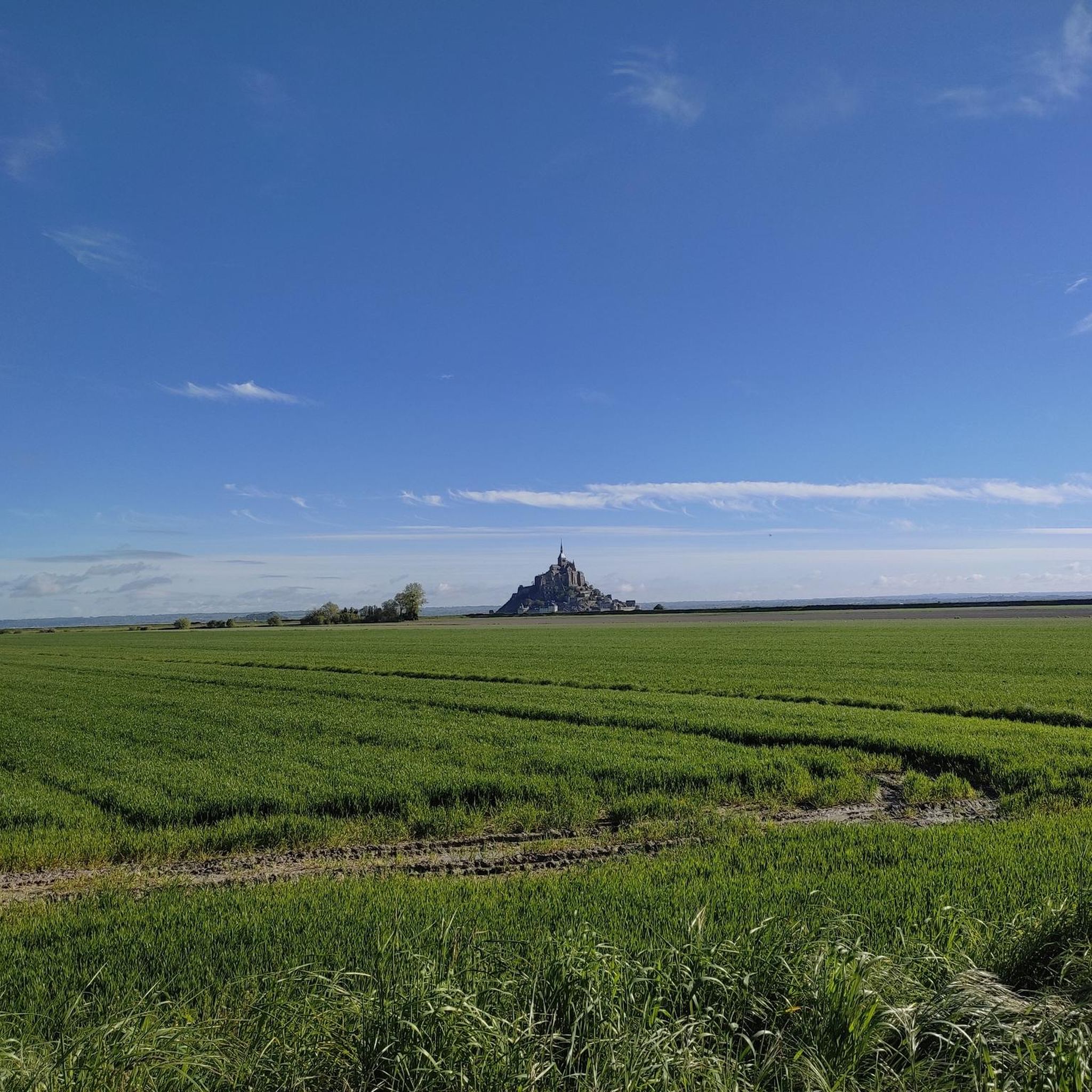
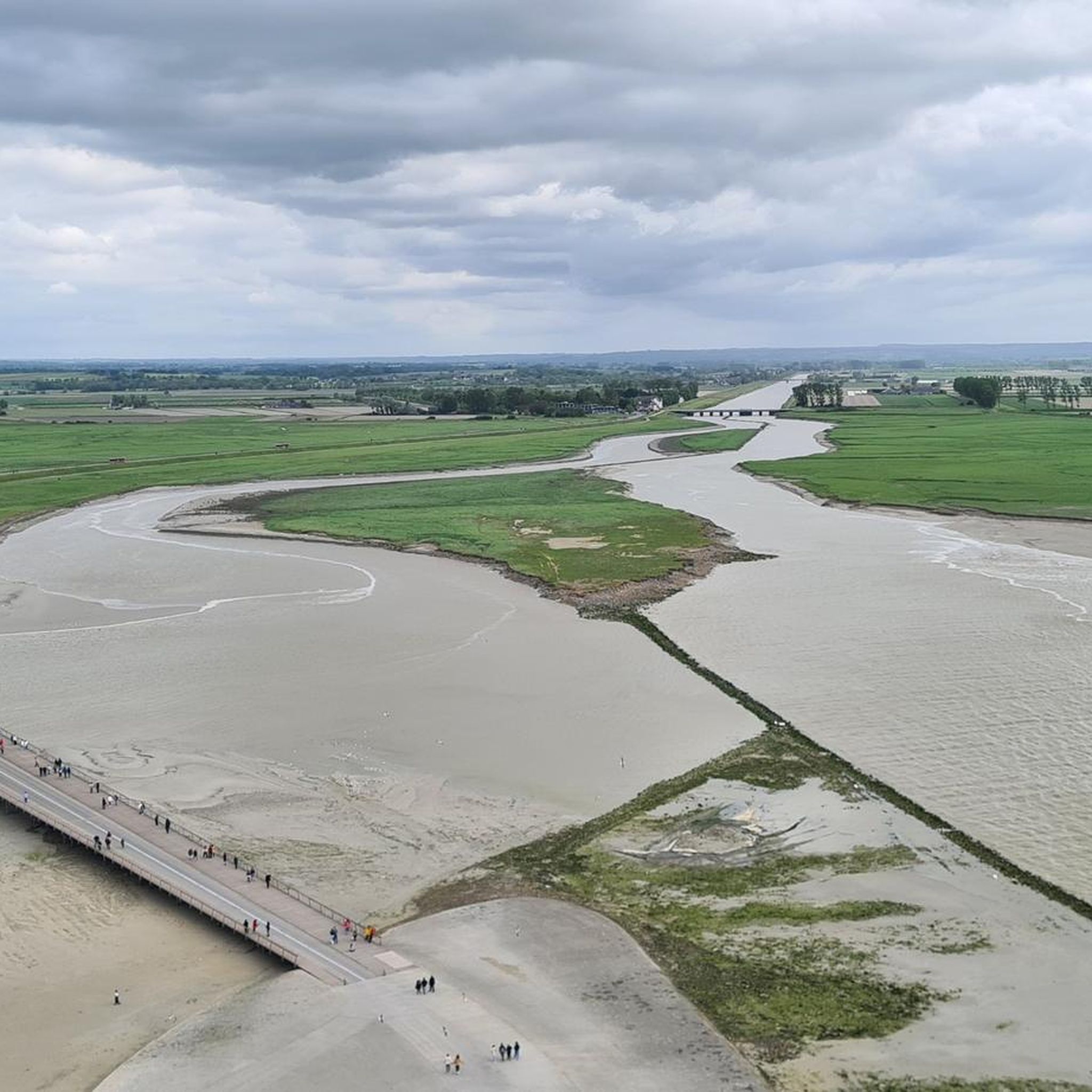
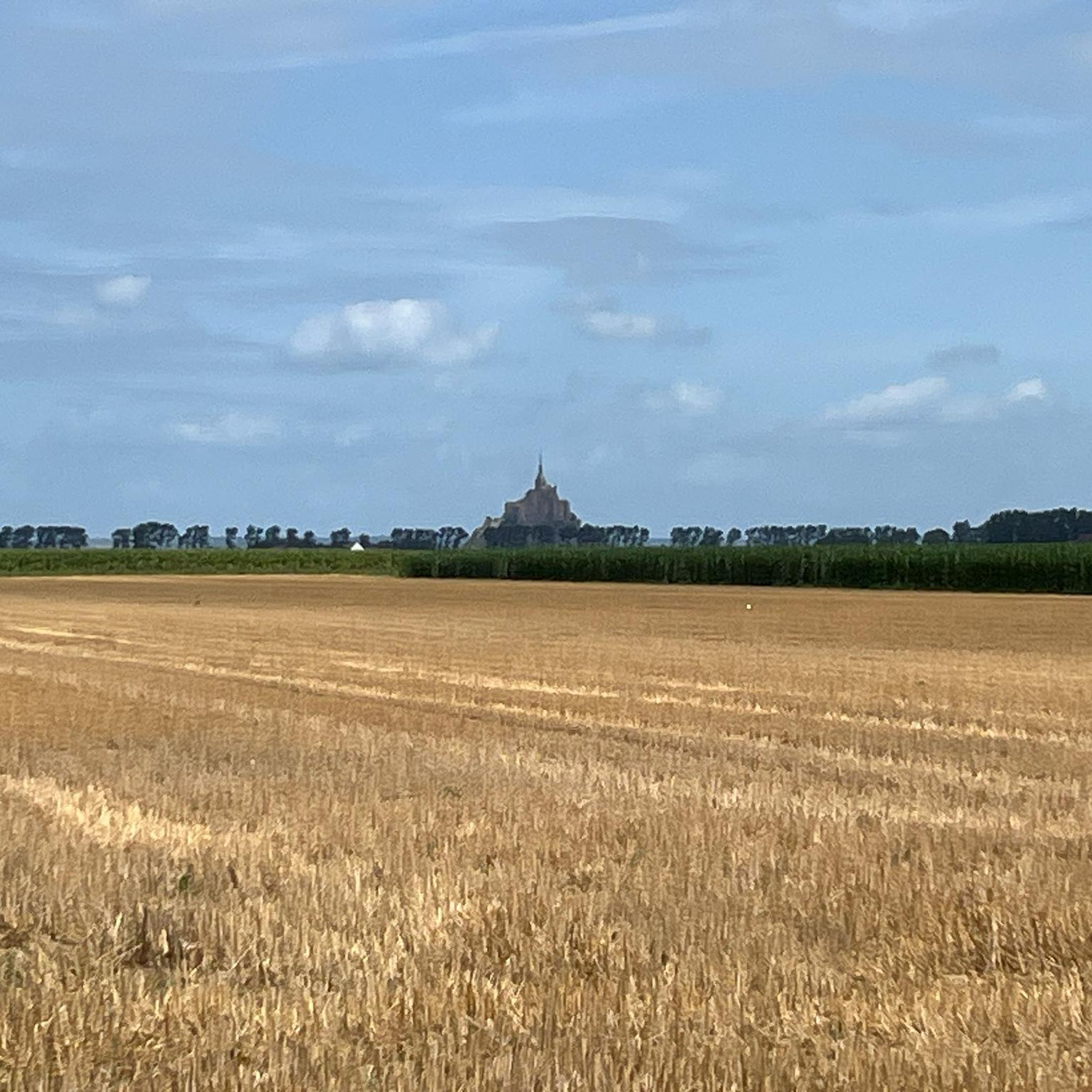
The footpath along the Couesnon to the dam already offers an impressive view of Mont-Saint-Michel. From here, the path with an unobstructed view leads across the salt marshes and the bay, with the landmark of Normandy impressively rising against the wide landscape. Especially in calm weather and with changing light, atmospheric views emerge of Mont-Saint-Michel, the course of the Couesnon river, and the tide-shaped surroundings.
13
0
The Couesnon dam (Barrage du Couesnon) was completed in 2009 and is part of the measures to preserve the bay of Mont-Saint-Michel. The facility regulates the water flow of the Couesnon and supports the natural removal of sediments by the tides. This is intended to counteract the increasing silting up of the bay and preserve the special character of Mont-Saint-Michel as a tidal island. The dam also offers a popular viewpoint with a view of Mont-Saint-Michel and the surrounding salt marshes.
3
0

From there it looks the strongest !!!
2
0

Practice for going to the train station
0
0

Parts of the route along the sea do not exist or are forbidden for bicycles
0
0

Old priory attached to Mont Saint Michel, the ultimate stage for pilgrims before the Merveille.
0
0
Frequently Asked Questions
How many road cycling routes are available around Saint-Georges-De-Gréhaigne?
There are over 80 road cycling routes in and around Saint-Georges-De-Gréhaigne, offering a diverse range of options for cyclists. These include 22 easy routes, 60 moderate routes, and 7 challenging routes, catering to various skill levels and preferences.
What kind of terrain can I expect on road cycling routes in Saint-Georges-De-Gréhaigne?
The region is characterized by its 'polders,' offering extensive flat stretches ideal for long distances and speed. You'll also find gentle valleys and preserved countryside with scenic routes and mild undulations. This mix provides varied terrain options, from very flat to gently rolling.
Are there routes suitable for beginners or those seeking an easy ride?
Yes, Saint-Georges-De-Gréhaigne offers 22 easy road cycling routes. These often traverse the flat polders, providing a pleasant and accessible experience. An example is The dam on the Couesnon – Mont St Michel loop from Pontorson, a 15.4 km trail through the polders.
Are there challenging road cycling routes for experienced riders?
While the region is known for its flatter terrain, there are 7 routes classified as difficult for road cycling, offering more elevation gain and longer distances for experienced riders. These routes often explore the more undulating countryside beyond the immediate polders.
What notable landmarks or viewpoints can I see while road cycling?
Many routes offer breathtaking views of the iconic Mont Saint-Michel and its immense tidal flats. Other points of interest include the Saint Aubert Chapel, the Grouin du Sud viewpoint, and the Megalithic Tombs of Saint-Broladre.
Are there routes that offer views of Mont Saint-Michel?
Absolutely. The region's close proximity to the Bay of Mont Saint-Michel means many cycling routes provide stunning vistas of this UNESCO World Heritage site. For instance, The dam on the Couesnon – View of Mont Saint-Michel loop from Pontorson offers direct views from the Couesnon dam, and Sélune Riverbank – View of Mont Saint-Michel loop from Pontorson-Mont-Saint-Michel provides distant views along the riverbank.
Are there any circular road cycling routes in the area?
Yes, many of the road cycling routes around Saint-Georges-De-Gréhaigne are designed as loops, allowing you to start and finish at the same point. This includes popular options like Moidrey Mill – Dol-de-Bretagne loop from Beauvoir, which offers a moderate 56 km ride.
Can I find long-distance road cycling routes near Saint-Georges-De-Gréhaigne?
Yes, the flat polders and gentle terrain make the area suitable for longer rides. Routes like Sélune Riverbank – View of Mont Saint-Michel loop from Pontorson-Mont-Saint-Michel cover over 100 km, providing an excellent option for those looking to cover significant distances.
What is the best time of year for road cycling in Saint-Georges-De-Gréhaigne?
The region is generally pleasant for cycling from spring through autumn. The mild climate and diverse landscapes are enjoyable, though coastal areas can be windy. Summer offers longer daylight hours, while spring and autumn provide cooler temperatures and beautiful scenery.
Are there family-friendly road cycling options?
Yes, the extensive flat polders and dedicated greenways (voies vertes) provide excellent family-friendly cycling opportunities. These routes are often paved, relatively traffic-free, and suitable for all ages and skill levels, allowing for a relaxed and enjoyable experience.
What do other road cyclists enjoy most about the routes here?
The road cycling routes around Saint-Georges-De-Gréhaigne are highly rated by the komoot community, with an average score of 4.8 stars from over 30 reviews. Reviewers often praise the stunning views of Mont Saint-Michel, the peaceful rides through the polders, and the variety of routes catering to different fitness levels.
Is public transport available to access cycling routes?
While Saint-Georges-De-Gréhaigne itself is a smaller commune, nearby towns like Pontorson, which serve as starting points for several routes, often have better public transport connections. It's advisable to check local bus or train schedules for connections to these larger hubs.
Where can I find parking for road cycling trails?
Many routes start from towns and villages like Pontorson or Beauvoir, where public parking is generally available. Look for designated parking areas in these locations, especially near popular attractions or trailheads, to begin your ride conveniently.
Most popular routes around Saint-Georges-De-Gréhaigne
Most popular attractions around Saint-Georges-De-Gréhaigne

Get inspired with the komoot mobile app


Explore more
Browse the best Road cycling routes in other regions.
