The best walks and hikes around Biarne
4.4
(443)
2,343
hikers
225
hikes
Hiking around Biarne offers a diverse landscape characterized by gentle rolling hills, extensive woodlands, and numerous natural water sources. The region's terrain provides a mix of open clearings and shaded forest paths, suitable for various hiking experiences. Elevation changes are generally moderate, making many routes accessible. The area is defined by its natural beauty and tranquil environment.
Best hiking trails around Biarne
- The most popular hiking route is Mont Roland, a 4.7 miles (7.5 km) trail that takes 2…
Last updated: October 9, 2026
4.6
(17)
33
hikers
7.50km
02:06
150m
150m
Moderate hike. Good fitness required. Easily-accessible paths. Suitable for all skill levels.
4.3
(4)
34
hikers
11.2km
03:07
220m
220m
Moderate hike. Good fitness required. Easily-accessible paths. Suitable for all skill levels.

5.0
(3)
14
hikers
5.60km
01:33
100m
100m
Easy hike. Great for any fitness level. Easily-accessible paths. Suitable for all skill levels.
4.6
(5)
14
hikers
5.70km
01:34
90m
90m
Easy hike. Great for any fitness level. Easily-accessible paths. Suitable for all skill levels.
13
hikers
17.1km
04:42
270m
270m
Moderate hike. Good fitness required. Easily-accessible paths. Suitable for all skill levels.
Get access to more routes and recommendations from other explorers.
Already have an account?
Our route recommendations are based on thousands of hikes, rides, and runs completed by other people on komoot.
Start today with a free account
Your next adventure awaits.



Tips from the Community

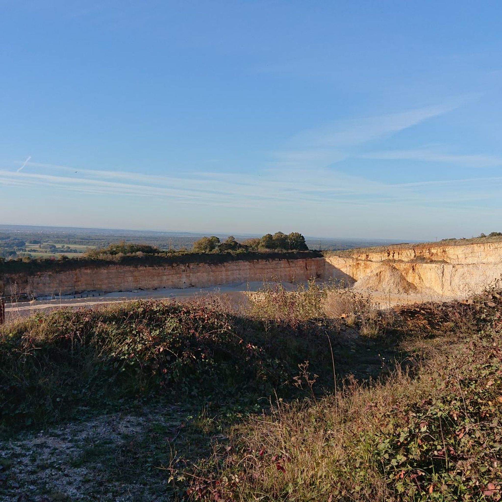
From here, you can enjoy breathtaking views of the surrounding fields and forests. A great place to take a break and refuel!
0
0
This shaded path, in the middle of the forest, is particularly pleasant for walking in the middle of summer or in any season.
0
0
The Notre-Dame de Mont-Roland sanctuary, located on the heights of Dole, is an ancient pilgrimage site dedicated to the Virgin Mary. Founded in the 17th century, it includes a chapel, a calvary, and a Stations of the Cross, all surrounded by forest. The site also offers a sweeping panorama of the Doubs Valley and the Jura Mountains.
0
0

Very beautiful view of the Saône plain and Mont Poupet. Free ride in the Chaux forest, Rochefort and cliff, return via Mont Roland
0
0

Clearing ideal for a picnic.
0
0
Sanctuary of the departure of the pilgrimage to Vézelay or to Compostela.
1
0

The Foulatiére source is located on the edge of the undergrowth in the town of Jouhe at the foot of Mont Roland. The presence of ponds and foundations indicate the existence of an old ruined mill, the old millstone still on the site, serves as a picnic table.
0
0

Pilgrimage site in the Jura, located on the Way of St. James.
1
0
Frequently Asked Questions
How many hiking trails are available in Biarne?
Biarne boasts a comprehensive network of over 200 hiking routes, catering to various preferences and skill levels. The komoot community has explored nearly 2,000 of these trails.
Are there easy hiking trails suitable for beginners or families in Biarne?
Yes, Biarne offers over 100 easy hiking routes, perfect for beginners or families with children. These trails typically feature gentle rolling hills and shaded forest paths. An example is the Source of the Foulatière loop from Sampans, an easy 2.8-mile (4.5 km) path.
What kind of terrain can I expect on hikes around Biarne?
The terrain in Biarne is characterized by gentle rolling hills, extensive woodlands, and numerous natural water sources. You'll find a mix of open clearings and shaded forest paths, with generally moderate elevation changes, making many routes accessible.
Are there any circular walks in Biarne?
Many of Biarne's trails are designed as circular routes, allowing you to start and end at the same point. For instance, the Source of the Foulatière – Plain (clearing) loop from Sampans is a moderate 6.9-mile (11.1 km) circular path exploring local water sources and clearings.
What do other hikers enjoy most about hiking in Biarne?
The area is highly rated by the komoot community, with an average score of 4.5 stars from over 300 reviews. Hikers often praise the tranquil environment, the diverse landscape of woodlands and water sources, and the well-maintained paths suitable for various experiences.
Are there any challenging hikes for experienced hikers in Biarne?
While most routes in Biarne are easy to moderate, there are a few more challenging options for experienced hikers. The region's terrain with its rolling hills and varied landscapes can offer longer distances and more sustained ascents on some trails.
Can I bring my dog on the hiking trails in Biarne?
Generally, dogs are welcome on hiking trails in Biarne, especially in the extensive woodlands and open clearings. However, it's always recommended to keep them on a leash, particularly near wildlife or in agricultural areas, and to check for any specific local regulations on individual routes.
What is the best time of year for hiking in Biarne?
Spring and autumn are often considered the best times for hiking in Biarne, offering pleasant temperatures and beautiful scenery as the foliage changes or new growth emerges. Summer can also be enjoyable, especially on shaded forest paths, while winter hiking is possible but requires appropriate gear for potentially colder and wetter conditions.
Are there any longer distance hiking options around Biarne?
Yes, Biarne offers several longer routes for those seeking a more extended hike. The Jouhe church – Notre Dame des Sources Church loop from Jouhe is a notable example, covering 10.3 miles (16.6 km) and leading through historical sites and natural landscapes.
Is there public transport access to hiking trailheads in Biarne?
While specific public transport options vary by trailhead, Biarne is a rural area. It's advisable to check local bus schedules or consider driving to trailheads, especially for routes starting outside of the main villages. Parking is generally available near popular starting points.
What should I bring for a hike in Biarne?
For hiking in Biarne, it's recommended to bring appropriate footwear for varied terrain, water, snacks, and layers of clothing suitable for changing weather conditions. A map or a GPS device like komoot is also helpful for navigation, especially on longer routes through woodlands.
Are there any hikes with scenic viewpoints in Biarne?
Yes, some trails offer rewarding views of the surrounding countryside. The Mont Roland trail, for example, ascends a local hill and provides panoramic vistas of the region's rolling landscape.
Most popular attractions around Biarne

Get inspired with the komoot mobile app


Explore more
Browse the best Hikes in other regions.
