The best MTB trails around Fontienne
4.5
(119)
809
riders
75
rides
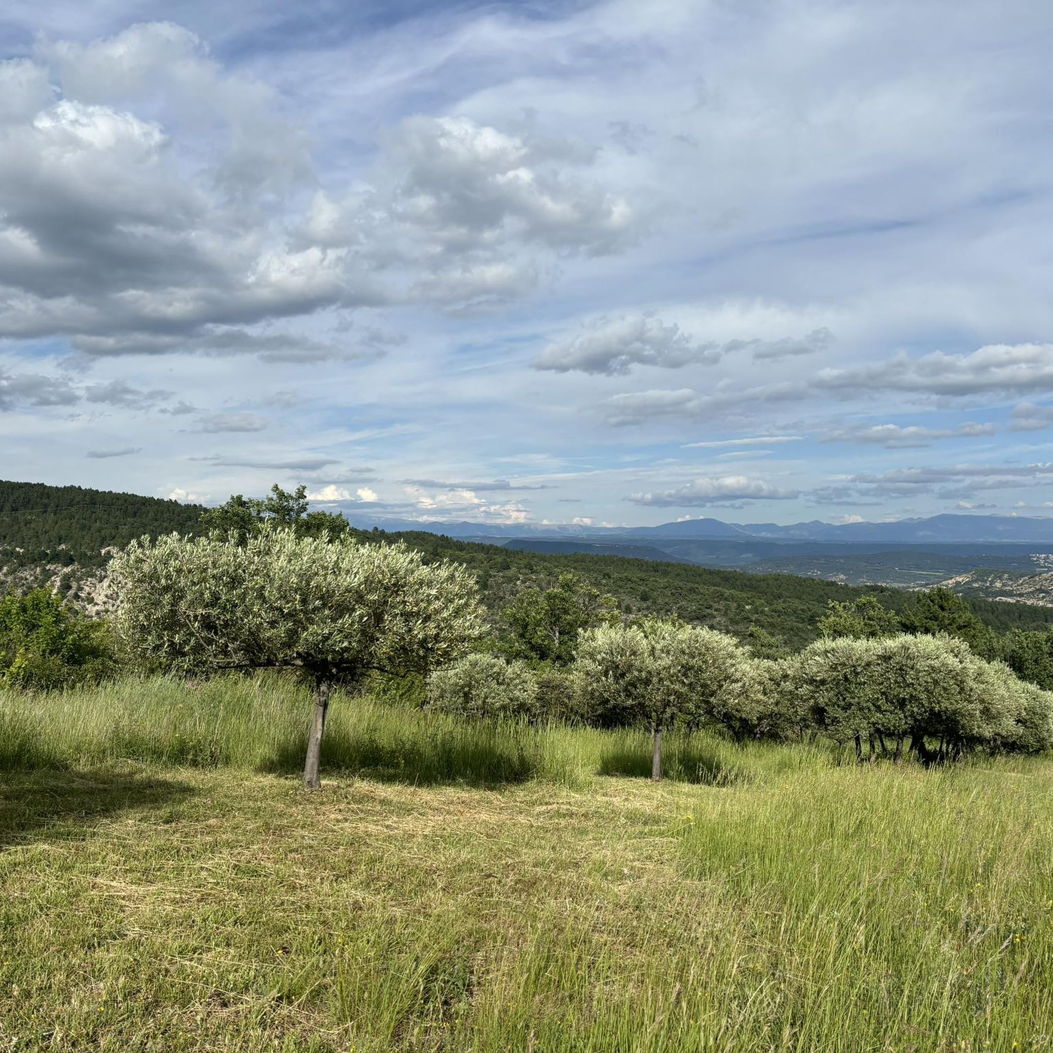
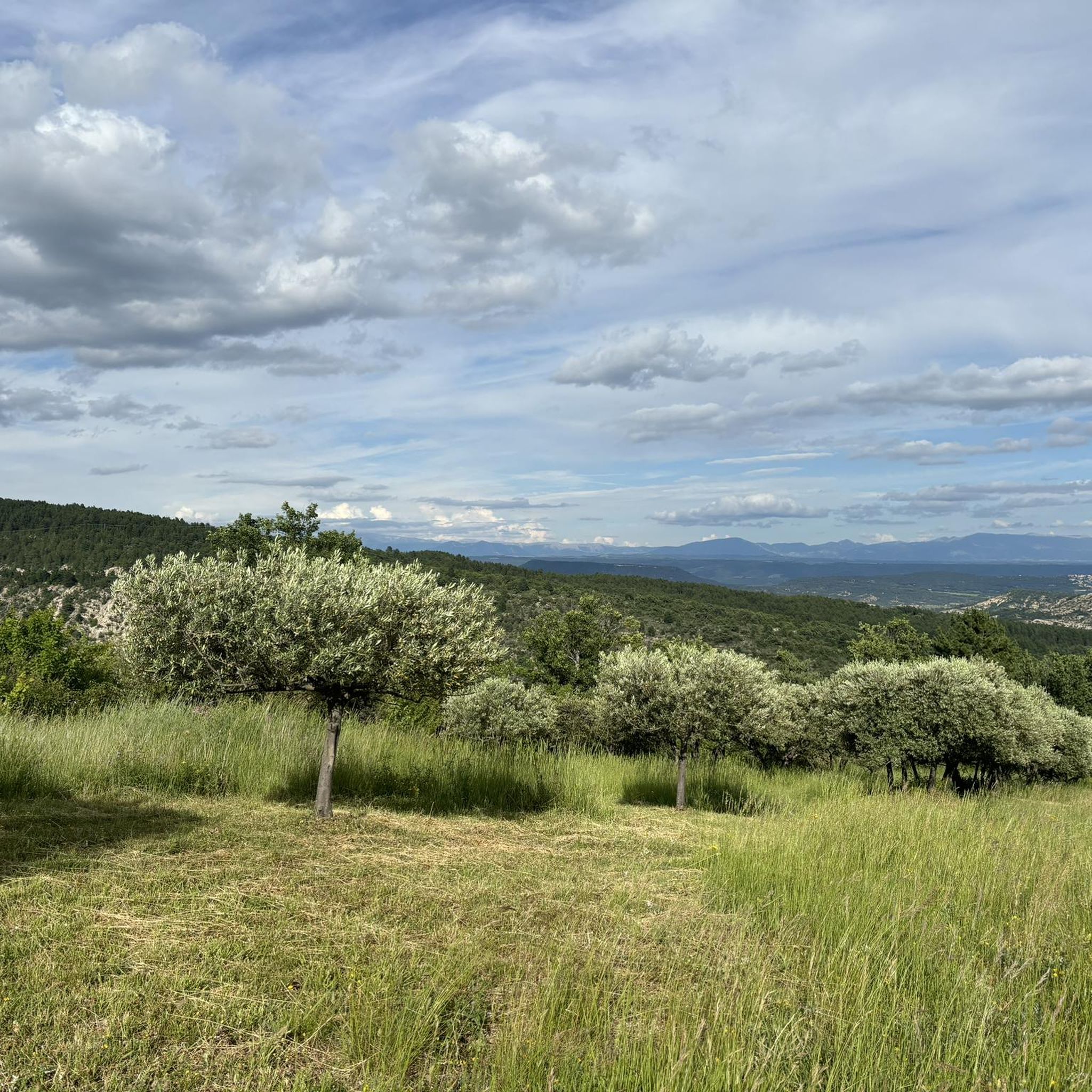
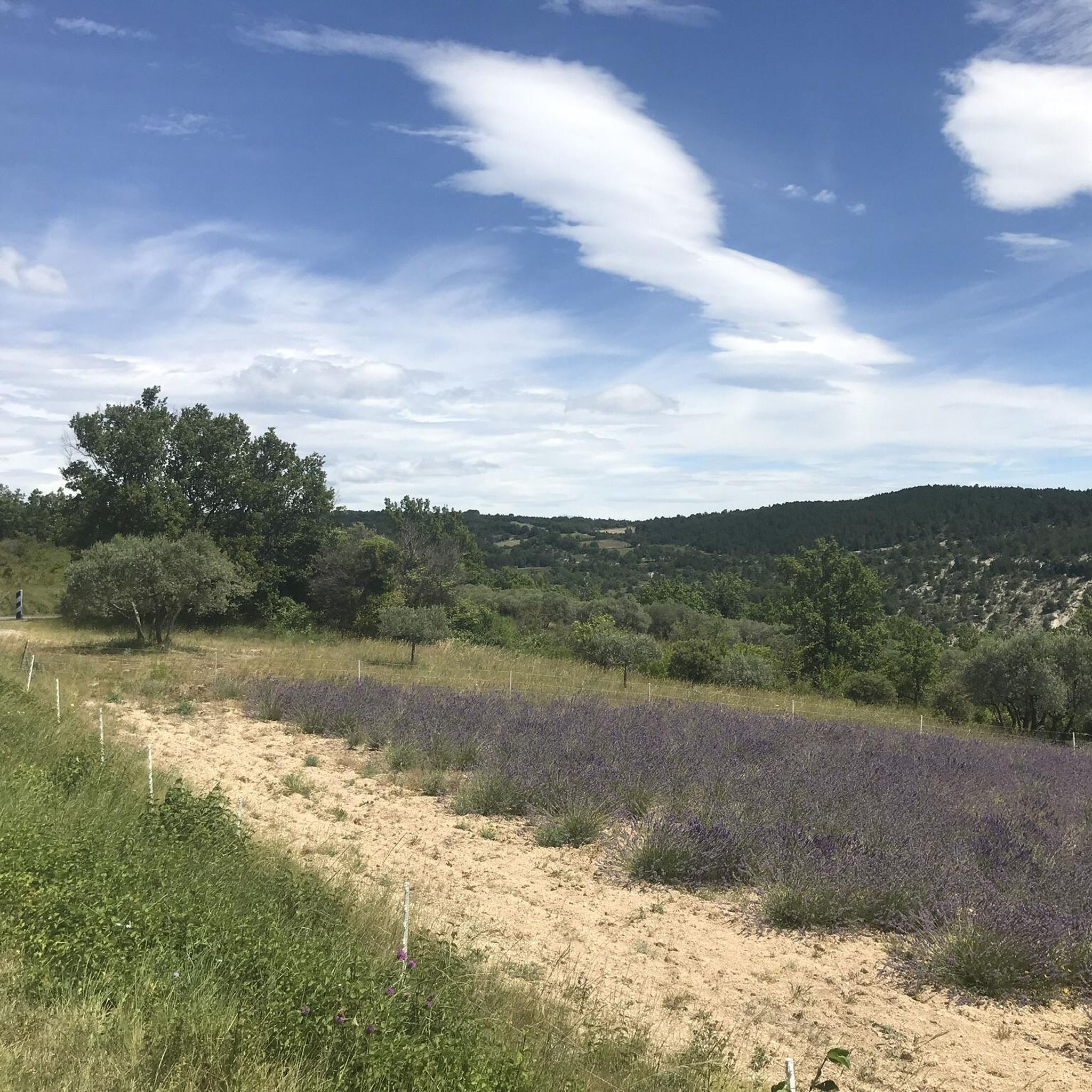
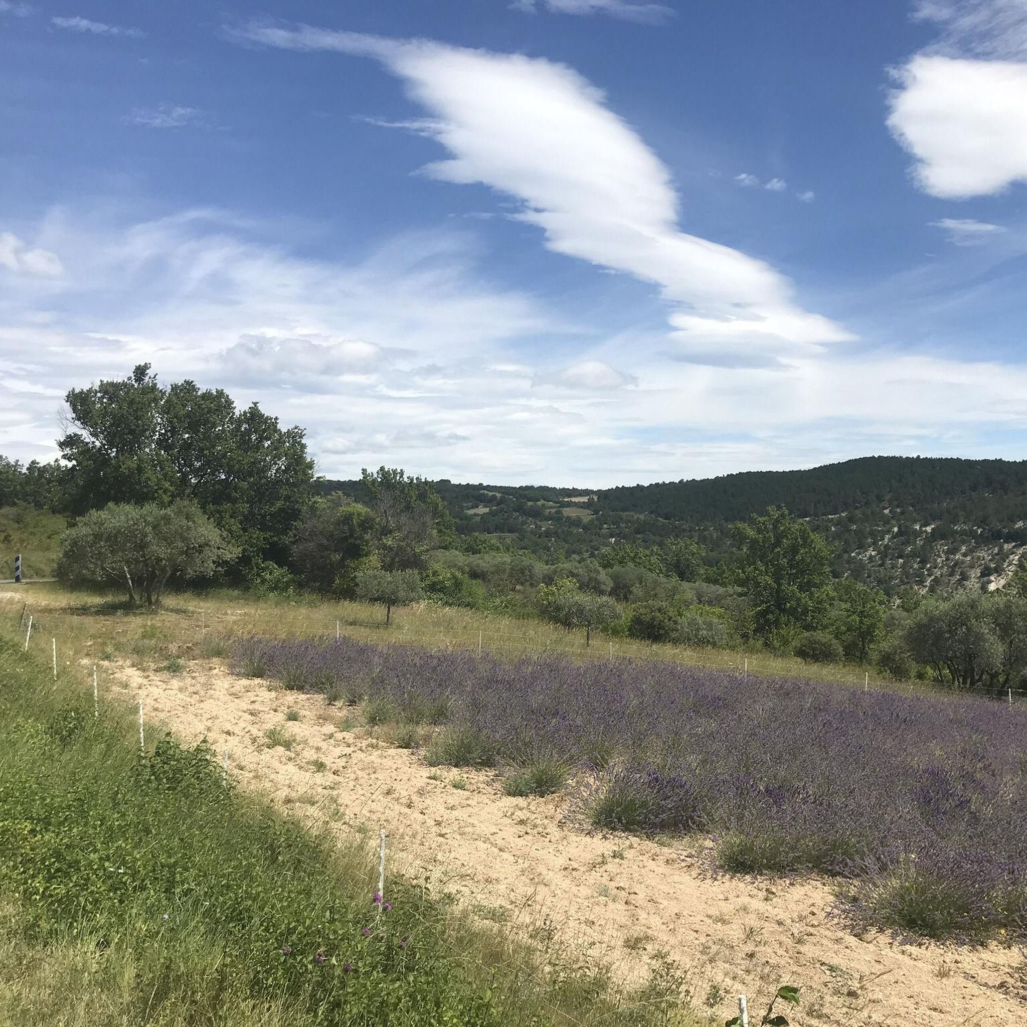
Mountain biking around Fontienne offers a diverse landscape characterized by the Montagne de Lure, providing significant elevation changes and panoramic views. The region features a mix of challenging mountain passes and rocky formations, alongside areas with dense woodlands. These varied terrains create a dynamic environment for mountain bikers seeking both demanding climbs and technical descents.
Best mountain bike trails around Fontienne
- The most popular mountain bike trail is Saint-Étienne-les-Orgues – Montagne de Lure Pass loop from Saint-Étienne-les-Orgues, a 19.9…
Last updated: August 18, 2026
4.0
(6)
72
riders
32.0km
03:29
1,150m
1,150m
Hard mountain bike ride. Very good fitness required. Advanced riding skills necessary.
4.5
(2)
40
riders
22.6km
02:19
650m
650m
Moderate mountain bike ride. Good fitness required. Suitable for all skill levels.

Sign up for free
4.7
(3)
19
riders
53.8km
05:37
1,540m
1,540m
Hard mountain bike ride. Very good fitness required. Advanced riding skills necessary.
4.3
(3)
14
riders
28.0km
03:30
1,090m
1,080m
Hard mountain bike ride. Very good fitness required. Advanced riding skills necessary.
4.0
(8)
33
riders
18.1km
01:48
560m
560m
Moderate mountain bike ride. Good fitness required. Suitable for all skill levels.
Get access to more routes and recommendations from other explorers.
Sign up for free
Already have an account?
Our route recommendations are based on thousands of hikes, rides, and runs completed by other people on komoot.
Start today with a free account
Your next adventure awaits.
Login or Signup

Tips from the Community

best panoramic view, absolutely recommended!
0
0


The Ventoux's little brother. With a length of 17.7 kilometres and an ascent of 1054 vertical metres and a gradient of 5.9% on average, which implies a difficulty level of 688. The summit of the climb is located at 1746 metres above sea level. At the top the views are fabulous both towards Ventoux itself and towards the Alps. A long, very pleasant and fun climb that is worth the effort with percentages that remain around 5/6/7% and some peaks of up to 9.3%. The last 2 kilometres are very easy.
2
0

Indescribable view of the Alps
1
0

What a surprise, a vintage car wreck in the middle of the forest
0
0

To consume without moderation ...
0
0

The Montagne de Lure is a large mountain in the Vaucluse in the Alpes-de-Haute-Provence department of France. It belongs to the same geological formation as the Albion plateau and Mont Ventoux. This chain extends over 42 kilometers and culminates in the Lure signal at 1,825 m and presents a very contrasting relief.
2
1
Frequently Asked Questions
How many mountain bike trails are available around Fontienne?
There are over 60 mountain bike trails around Fontienne, offering a wide range of options for different skill levels. The region features 3 easy, 38 moderate, and 27 difficult routes.
Are there any easy or beginner-friendly mountain bike trails in Fontienne?
Yes, Fontienne offers a few easy mountain bike trails suitable for beginners. You can find 3 routes specifically categorized as easy, providing a gentle introduction to the region's terrain.
What kind of terrain can I expect on mountain bike trails around Fontienne?
The terrain around Fontienne is diverse, characterized by the Montagne de Lure. You'll encounter significant elevation changes, rocky formations, and dense woodlands. Trails often feature demanding climbs and technical descents, with options ranging from moderate loops to advanced routes.
Are there challenging mountain bike routes for experienced riders?
Absolutely. Fontienne is well-suited for experienced mountain bikers, with 27 difficult routes available. Trails like Saint-Étienne-les-Orgues – Montagne de Lure Pass loop from Saint-Étienne-les-Orgues and Montagne de Lure Pass – Signal de Lure summit loop from Saint-Étienne-les-Orgues feature substantial climbs and offer expansive mountain scenery.
What do other mountain bikers enjoy most about the trails in Fontienne?
The mountain bike trails in Fontienne are highly rated by the komoot community, with an average score of 4.5 stars from over 90 reviews. Riders often praise the varied terrain, the challenging climbs through the Montagne de Lure, and the scenic views, especially towards the Signal de Lure summit.
Are there circular mountain bike routes available?
Yes, many of the mountain bike trails around Fontienne are designed as circular routes. For example, The Mourres Rocks – Les Rochers des Mourres loop from Fontienne is a popular circular trail that takes you through distinctive rocky formations.
What are some notable landmarks or natural attractions I can see along the mountain bike trails?
You can explore several interesting natural monuments and landmarks. The distinctive The Mourres Rocks and Les Rochers des Mourres are prominent features on some routes. Additionally, you might encounter viewpoints offering panoramic vistas, such as View of Forcalquier from Parc Naturel Régional du Luberon.
What is the typical length and duration of mountain bike trails in Fontienne?
Trail lengths vary significantly. You'll find shorter routes like The Mourres Rocks – Les Rochers des Mourres loop from Fontienne, which is about 11.2 miles (18.1 km) and takes under 2 hours. Longer, more challenging routes, such as Saint-Étienne-les-Orgues – Montagne de Lure Pass loop from Saint-Étienne-les-Orgues, can be around 19.9 miles (32.0 km) and take over 3 hours to complete.
Are there any less crowded mountain bike routes in the area?
While some popular routes can see more traffic, exploring trails slightly off the main Montagne de Lure axis or during off-peak hours can offer a more secluded experience. Many of the 68 routes provide opportunities for a quieter ride through the diverse landscape.
Can I find mountain bike trails that offer scenic viewpoints?
Yes, the region is known for its scenic beauty. Trails ascending towards the Montagne de Lure, such as Montagne de Lure Pass – Signal de Lure summit loop from Saint-Étienne-les-Orgues, offer expansive mountain scenery and numerous opportunities for panoramic views.
Are there other interesting places to explore near Fontienne after a ride?
Beyond the trails, you can visit the nearby town of Forcalquier, known for its charm. The Abbey Church of Cruis is another historical site worth seeing. The wider Parc Naturel Régional du Luberon also offers various attractions.
Most popular routes around Fontienne
Most popular attractions around Fontienne

Get inspired with the komoot mobile app


Explore more
Browse the best MTB trails in other regions.
