The best road cycling routes around Attricourt
4.0
(4)
44
riders
23
rides
Road cycling routes around Attricourt traverse a landscape characterized by gentle rolling hills and river valleys, offering varied terrain for cyclists. The region features a mix of open countryside and areas near historical châteaux and waterways. Elevation gains are generally moderate, making it suitable for a range of abilities.
Best road cycling routes around Attricourt
- The most popular road cycling route is Midi loop from Fontaine-Française, a 29.7 miles (47.8 km) trail that takes 2 hours 3 minutes to…
Last updated: July 3, 2026
7
riders
41.2km
01:52
250m
250m
Moderate road ride. Great for any fitness level. Some segments of this route may be unpaved and difficult to ride.
3.0
(1)
6
riders
47.8km
02:03
320m
320m
Moderate road ride. Good fitness required. Mostly well-paved surfaces and easy to ride.

Sign up for free
3.0
(1)
6
riders
44.9km
01:54
300m
300m
Moderate road ride. Good fitness required. Mostly well-paved surfaces and easy to ride.
6
riders
43.5km
01:49
290m
290m
Easy road ride. Great for any fitness level. Mostly well-paved surfaces and easy to ride.
4
riders
31.0km
01:26
250m
250m
Easy road ride. Great for any fitness level. Mostly well-paved surfaces and easy to ride.
Get access to more routes and recommendations from other explorers.
Sign up for free
Already have an account?
Our route recommendations are based on thousands of hikes, rides, and runs completed by other people on komoot.
Start today with a free account
Your next adventure awaits.
Login or Signup


Tips from the Community

The abbey is now privately owned, but can be visited during Heritage Days.
0
0
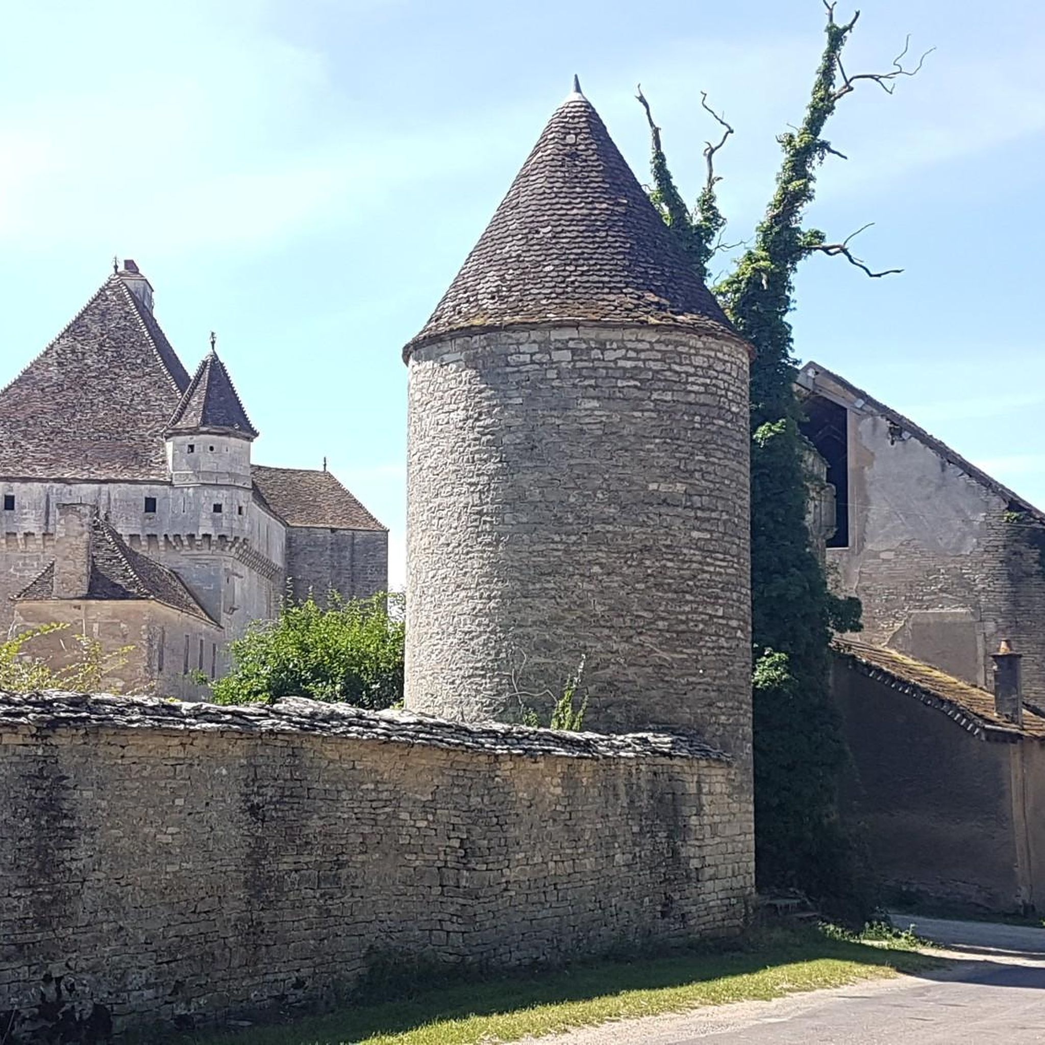
A former Benedictine abbey, it belonged to the diocese of Langres until 1731, then to the diocese of Dijon until 1791, when it and its possessions were sold as national property. Much of it was destroyed in 1805, but many buildings remain, such as these two 15th-century towers, a wash house, the convent buildings, and the remains of the 12th-century abbey church. (source: Wikipedia)
0
0


True, but I still uploaded the church.
2
2

Beautiful source of the Burgundy region
1
0

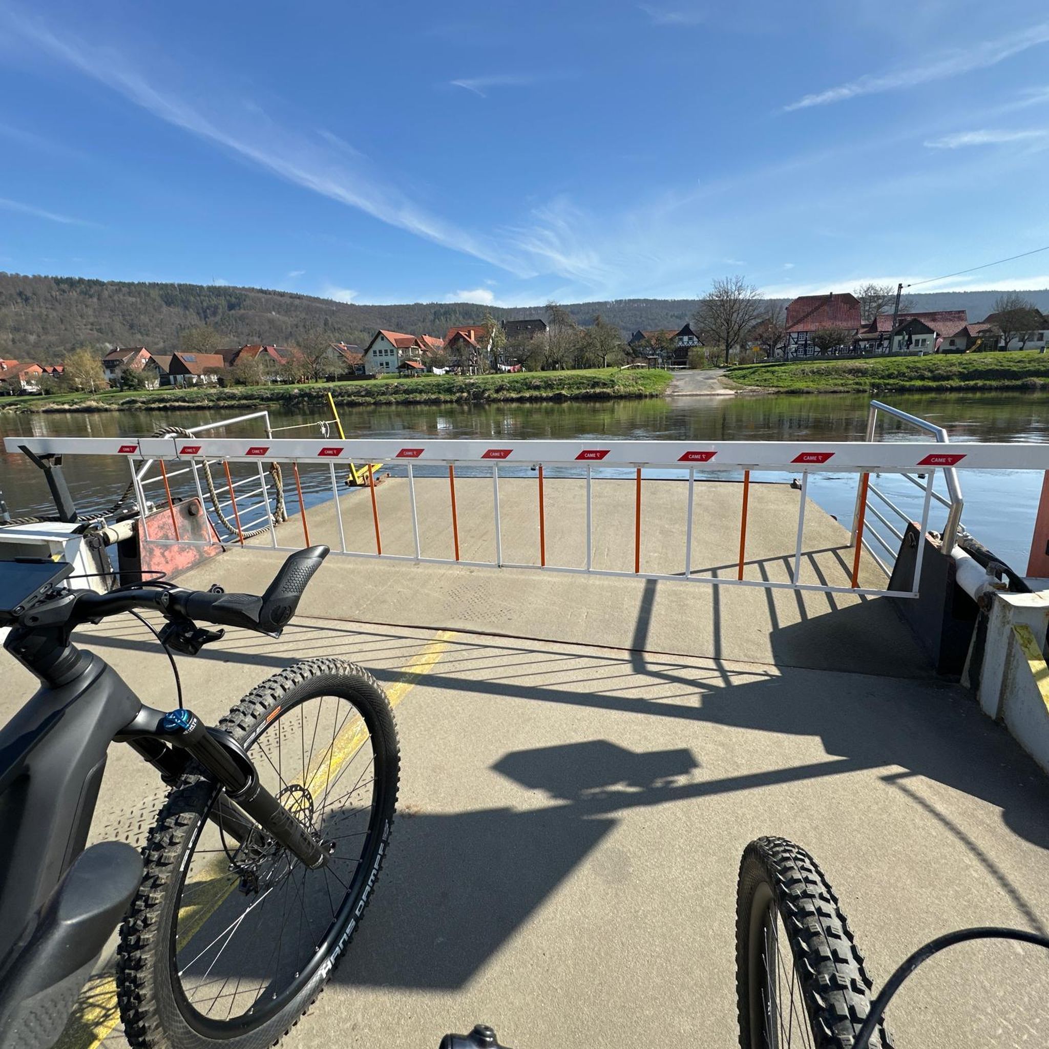
This dam has a fixed part and a mobile part each measuring about fifty meters long. This structure was completely overhauled in 2014 after six years of work. Thus, the original dam dating from the 1840s was equipped with a fish pass and a footbridge on which pedestrians and cyclists can circulate to cross the watercourse.
1
0

Open to visitors from July to September, the Château de Fontaine-Française is also known for its magnificent gardens, which earned it the Remarkable Garden label in 2015.
2
0
Frequently Asked Questions
What kind of terrain can I expect on road cycling routes around Attricourt?
The road cycling routes around Attricourt are characterized by gentle rolling hills and river valleys, offering a varied landscape. You'll find a mix of open countryside and areas near historical châteaux and waterways. Elevation gains are generally moderate, making the region suitable for a range of cycling abilities.
How many road cycling routes are available in the Attricourt area?
There are over 20 road cycling routes available around Attricourt, catering to various skill levels. The komoot community has explored these routes extensively, with more than 40 road cyclists using komoot to discover the area's diverse terrain.
Are there easy road cycling routes suitable for beginners or families in Attricourt?
Yes, Attricourt offers several easy road cycling routes perfect for beginners or families. For instance, the Château de Talmay – Fontaine Saint-Antoine loop from Autrey-lès-Gray is an easy option, covering about 24.6 miles (39.6 km) with moderate elevation.
What are the typical distances and durations for road cycling routes in Attricourt?
Route distances vary, but many popular options range from 19 to 30 miles (30 to 48 km). For example, the Midi loop from Fontaine-Française is 29.7 miles (47.8 km) and typically takes around 2 hours 3 minutes, while the Apremont Dam – Apremont Dam Footbridge loop from Nantilly is 19.5 miles (31.4 km) and can be completed in about 1 hour 26 minutes.
Are there any circular road cycling routes around Attricourt?
Yes, many of the road cycling routes in Attricourt are designed as loops, offering convenient circular journeys. Popular examples include the Pont de Pierre of Gray – Apremont Dam Footbridge loop from Nantilly and the Château de Rosières loop from Nantilly.
What kind of elevation can I expect on road cycling routes in Attricourt?
The routes in Attricourt feature moderate elevation gains, consistent with the region's rolling hills. For example, the Midi loop from Fontaine-Française has an elevation gain of approximately 317 meters, while the Pont de Pierre of Gray – Apremont Dam Footbridge loop from Nantilly has about 296 meters of ascent.
What can I see along the road cycling routes around Attricourt?
The routes often guide cyclists past historical landmarks and natural features. You might encounter sights like the Château de Rosières, the Bèze Spring, or the picturesque Stone Bridge and Canal in Cheuge. Many routes also follow river features and pass by structures like the Apremont Dam.
What do other road cyclists enjoy the most about road cycling in Attricourt?
The area is highly rated by the komoot community, with an average score of 3.3 stars from 4 reviews. Cyclists often praise the varied terrain, which includes rolling countryside, river valleys, and the opportunity to pass historical landmarks like châteaux, making for an engaging ride.
When is the best time of year for road cycling in Attricourt?
The most pleasant times for road cycling in Attricourt are typically spring, summer, and early autumn. During these seasons, the weather is generally mild, and the natural scenery is at its best, making for ideal conditions to explore the open countryside and river valleys.
Are there any routes that pass by the Apremont Dam?
Yes, the Apremont Dam is a notable feature in the region. The Pont de Pierre of Gray – Apremont Dam Footbridge loop from Nantilly and the Apremont Dam – Apremont Dam Footbridge loop from Nantilly both guide cyclists through the area around the dam and its footbridge.
Are there any advanced or challenging road cycling routes in Attricourt?
While Attricourt's routes are generally categorized as easy to moderate, the longer moderate routes with consistent rolling terrain offer a good challenge for experienced cyclists. The region does not feature routes classified as 'difficult,' focusing more on accessible and enjoyable rides.
Most popular attractions around Attricourt

Get inspired with the komoot mobile app


Explore more
Browse the best Road cycling routes in other regions.
