The best running trails around Saint-Pierre-Le-Vieux
4.6
(8)
685
runners
100
runs
Jogging around Saint-Pierre-Le-Vieux encompasses diverse landscapes, from the rolling hills and agricultural fields of Burgundy to river valleys. The terrain varies, offering routes through vineyards, across open countryside, and along waterways. This region provides a mix of rural charm and natural beauty for runners, with options for varied elevation changes. The topography includes altitudes ranging from 318m to 638m, providing challenging routes for those seeking elevation.
Best jogging routes around Saint-Pierre-Le-Vieux
- The most popular jogging route is Montagne de Saint-Cyr…
Last updated: July 11, 2026
1
runners
15.6km
02:03
530m
530m
Hard run. Very good fitness required. Mostly paved surfaces. Suitable for all skill levels.
11
runners
18.4km
02:26
660m
660m
Hard run. Very good fitness required. Mostly paved surfaces. Suitable for all skill levels.

Sign up for free
12
runners
30.2km
03:46
950m
950m
Hard run. Very good fitness required. Mostly paved surfaces. Suitable for all skill levels.
9
runners
10.3km
01:16
310m
310m
Hard run. Very good fitness required. Mostly paved surfaces. Suitable for all skill levels.
9
runners
20.6km
02:36
620m
620m
Hard run. Very good fitness required. Mostly paved surfaces. Suitable for all skill levels.
Get access to more routes and recommendations from other explorers.
Sign up for free
Already have an account?
Our route recommendations are based on thousands of hikes, rides, and runs completed by other people on komoot.
Start today with a free account
Your next adventure awaits.
Login or Signup
Tips from the Community

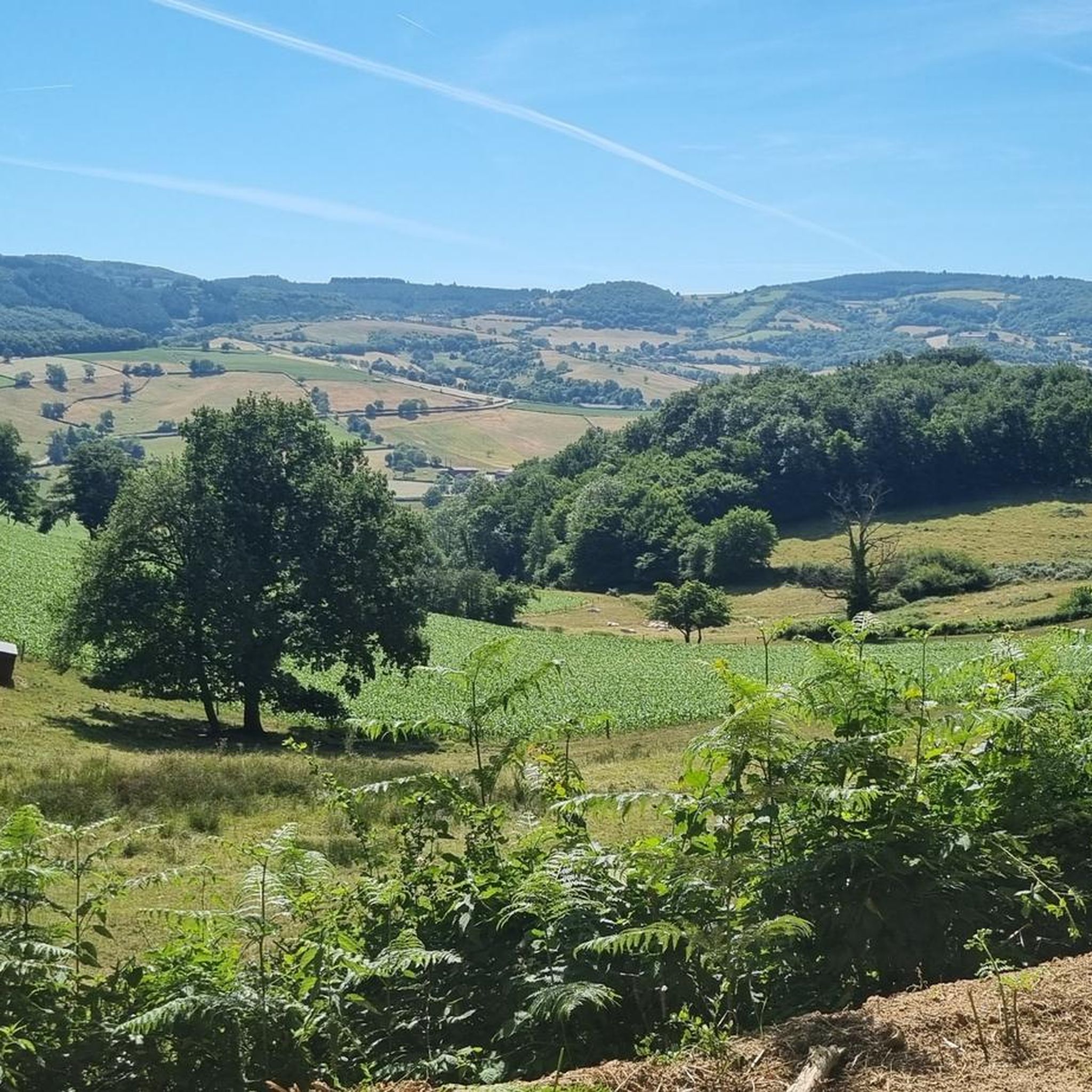
Mont Saint-Cyr is located in southern Burgundy (Département Saône-et-Loire) in the municipality of Montmelard and, at 771 meters, is the highest point in the Mâconnais mountains. From the summit, there is a wide panoramic view of the surrounding landscapes of Charolais, Brionnais, and Clunisois. In very clear weather, the view to the east even extends to Mont Blanc in the Alps. On the mountain are the historical remains of a 10th-century monastery that was destroyed during the Huguenot Wars. There is a picnic area in the forest, as well as orientation panels that are helpful in identifying the surrounding peaks and valleys.
0
0
Mont Saint-Cyr is located in southern Burgundy (Saône-et-Loire department) in the municipality of Montmelard and, at 771 meters, is the highest point of the Mâconnais mountains. From the summit, there is a wide panoramic view of the surrounding landscapes of Charolais, Brionnais, and Clunisois. In very clear weather, the view extends eastwards to Mont Blanc in the Alps. On the mountain are the historical remains of a 10th-century monastery, which was destroyed during the Huguenot Wars. There is a picnic area in the forest as well as orientation panels that are helpful in identifying the surrounding peaks and valleys.
0
0

Impressive views over southern Burgundy and Haut-Beaujolais
1
0


Wonderful stage stop on my Camino https://huettemann.eu/de/2023/10/von-cluny-an-die-loire-berndscamino/
1
1


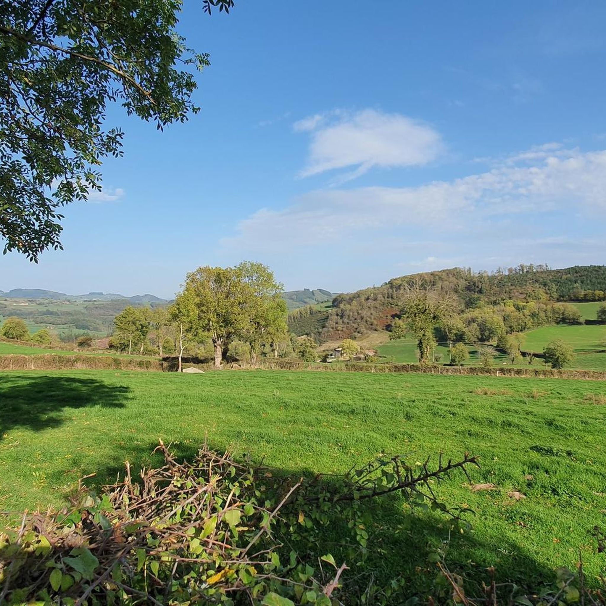
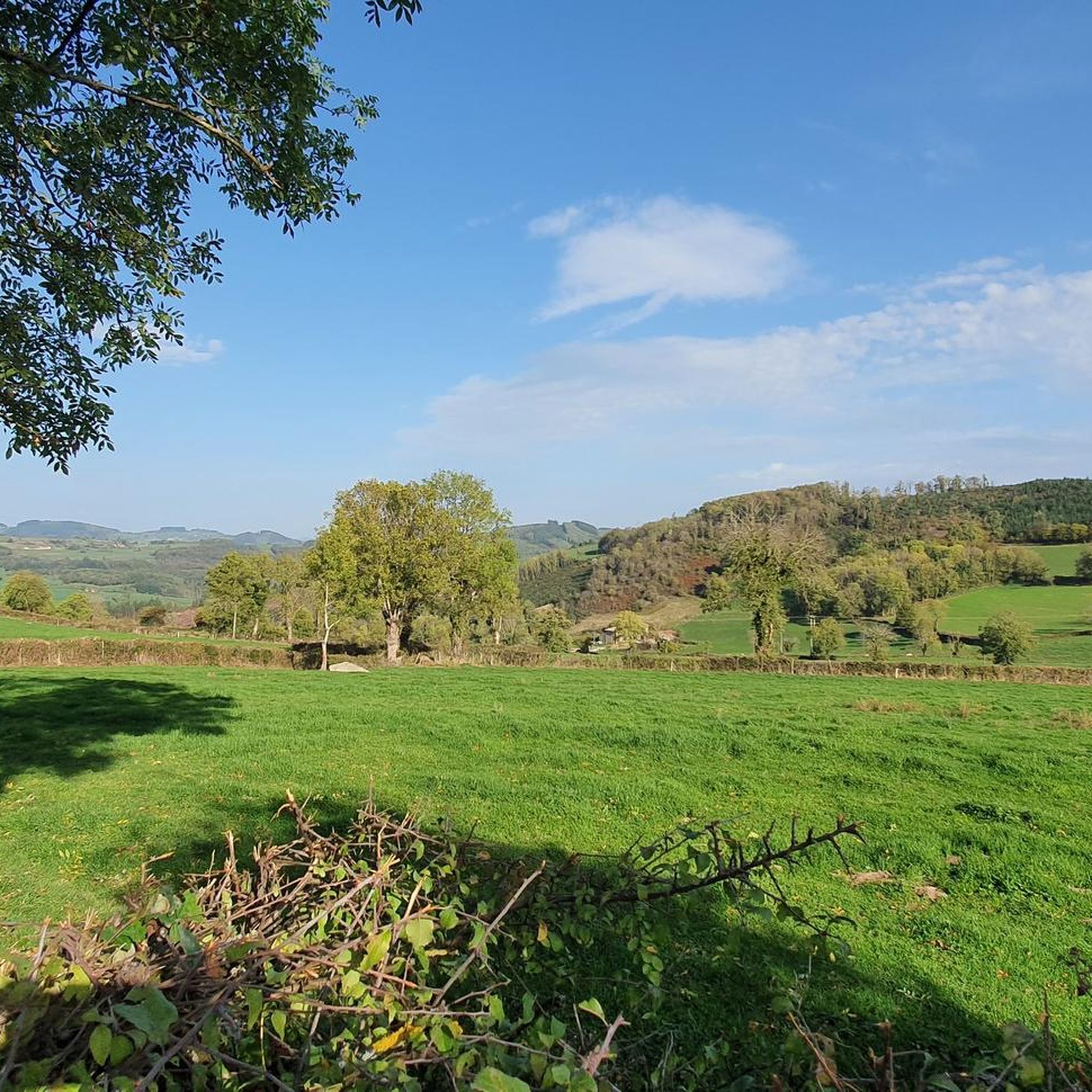
A view of the Clunisois countryside...
0
0
Frequently Asked Questions
What kind of terrain can I expect on running trails around Saint-Pierre-Le-Vieux?
The region offers a diverse range of landscapes for running. Depending on the specific Saint-Pierre-le-Vieux location, you might encounter the rolling hills and agricultural fields of Burgundy, the unique marshlands of the Marais Poitevin in Vendée, or coastal paths and riverbanks in Normandy. Expect a mix of rural charm, forests, and open countryside, with routes varying from gentle paths to challenging climbs.
How many jogging routes are available in the Saint-Pierre-Le-Vieux area?
There are over 100 dedicated jogging routes around Saint-Pierre-Le-Vieux listed on komoot, offering a wide variety of options for runners of all levels.
Are there any easy or beginner-friendly running paths in Saint-Pierre-Le-Vieux?
Yes, while many routes feature significant elevation, there are 4 easy routes and 44 moderate routes available. These paths are generally suitable for beginners or those looking for a less strenuous run, often traversing gentler rural landscapes or river valleys.
What do other runners enjoy most about the trails in Saint-Pierre-Le-Vieux?
The running routes in Saint-Pierre-Le-Vieux are highly rated by the komoot community, with an average score of 4.6 stars. Runners often praise the varied terrain, the natural beauty of the countryside, and the challenging yet rewarding climbs found on many of the trails.
Can I find circular running routes in the Saint-Pierre-Le-Vieux region?
Yes, many of the running routes in the area are designed as loops, allowing you to start and finish in the same location. For example, the challenging Montagne de Saint-Cyr Loop is a popular circular option, as is the Étang du Paluet – Col de la Croix d'Auterre loop from Matour.
Are there any running routes that offer scenic views or points of interest?
Absolutely. Many routes provide picturesque views, especially those in the hilly areas like the Montagne Saint-Cyr. You can also find trails near natural features such as the streams Pelot and Grosne in Saône-et-Loire, or the unique marshlands of the Marais Poitevin. For specific landmarks, consider routes that pass near highlights like Mount Saint-Rigaud or the various mountain passes such as Col de la Sibérie.
What are some longer, more challenging running routes for experienced runners?
Experienced runners will find plenty of challenging options. The Montagne Saint-Cyr loop from Matour is a difficult 18.7-mile (30.1 km) path with extensive views and significant climbs. Another demanding option is the Tramayes loop from Trades, which covers over 30 km with considerable elevation gain.
Are there running routes suitable for families with children?
While specific 'family-friendly' routes are not explicitly categorized, the 4 easy routes and many of the 44 moderate routes would be suitable for families looking for a less strenuous run or walk. These often follow gentler paths through rural landscapes, away from heavy traffic.
What is the typical length and duration of running trails in this area?
The routes vary significantly in length and duration. For example, the Montagne de Saint-Cyr Loop is about 9.7 miles (15.6 km) and takes around 2 hours. Longer routes like the Running loop from Matour extend to 11.5 miles (18.5 km), requiring about 2 hours 26 minutes, with many options in between and beyond.
Are there any specific trails that depart directly from a town center or are accessible by public transport?
In Saint-Pierre-le-Vieux, Saône-et-Loire, there are 'Green Walks' – three marked trails that depart directly from the town square, making them easily accessible. While specific public transport links to trailheads are not detailed, routes starting from villages like Matour or Trades often imply easier access.
What is the best time of year for running in Saint-Pierre-Le-Vieux?
The best time for running generally depends on the specific region. Spring and autumn offer pleasant temperatures and beautiful scenery across most Saint-Pierre-le-Vieux locations, with lush greenery or vibrant fall colors. Summer can be warm, especially in inland areas, so early morning or late evening runs are advisable. Winter running is possible, particularly on lower elevation paths, but can be chilly.
Can I spot wildlife while running on these trails?
Yes, the diverse natural environments, from forests and marshlands to river valleys, provide opportunities for wildlife spotting. In areas like the Marais Poitevin, you might see various bird species, while the rural landscapes offer glimpses of local fauna. Trails on Saint-Pierre and Miquelon are noted for birdwatching opportunities.
Most popular routes around Saint-Pierre-Le-Vieux
Most popular attractions around Saint-Pierre-Le-Vieux

Get inspired with the komoot mobile app


Explore more
Browse the best Running Trails & Routes in other regions.
