The best running trails in the Santa Clara Mountains
4.3
(7)
204
runners
98
runs
Jogging in the Santa Clara Mountains offers diverse terrain, including dense redwood forests, oak woodlands, and rolling grasslands. The region features varied landscapes, from gentle paths along creeks to more strenuous climbs through hills and valleys. Trails often provide panoramic views of the Silicon Valley and the San Francisco Bay Area. This area is characterized by its extensive network of running routes suitable for various ability levels.
Best jogging routes in the Santa Clara Mountains
- The most popular jogging route…
Last updated: July 7, 2026
8
runners
17.3km
02:17
560m
560m
Hard run. Very good fitness required. Mostly paved surfaces. Suitable for all skill levels.
6
runners
8.23km
01:03
200m
200m
Moderate run. Good fitness required. Mostly paved surfaces. Suitable for all skill levels.

Sign up for free
4
runners
13.4km
01:34
290m
290m
Moderate run. Good fitness required. Mostly paved surfaces. Suitable for all skill levels.
4
runners
6.92km
00:51
90m
90m
Moderate run. Good fitness required. Mostly paved surfaces. Suitable for all skill levels.
4
runners
24.4km
03:20
690m
690m
Hard run. Very good fitness required. Sure-footedness, sturdy shoes and alpine experience required.
4
runners
12.5km
01:44
420m
420m
Hard run. Very good fitness required. Mostly paved surfaces. Suitable for all skill levels.
3
runners
9.25km
01:20
420m
420m
Hard run. Very good fitness required. Mostly paved surfaces. Suitable for all skill levels.
1
runners
6.81km
00:52
170m
170m
Moderate run. Good fitness required. Mostly paved surfaces. Suitable for all skill levels.
2
runners
5.59km
00:42
220m
220m
Moderate run. Good fitness required. Mostly paved surfaces. Suitable for all skill levels.
1
runners
24.5km
03:26
970m
970m
Hard run. Very good fitness required. Mostly paved surfaces. Suitable for all skill levels.
Get access to more routes and recommendations from other explorers.
Sign up for free
Already have an account?
Our route recommendations are based on thousands of hikes, rides, and runs completed by other people on komoot.
Start today with a free account
Your next adventure awaits.
Login or Signup
Popular around Santa Clara Mountains

Other adventures in the Santa Clara Mountains

Tips from the Community

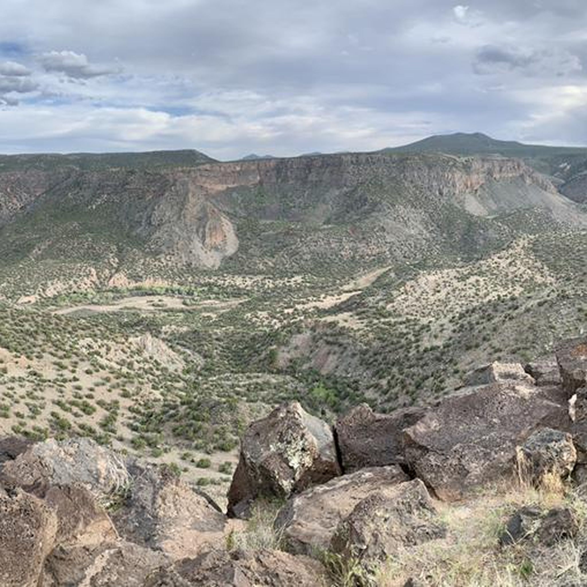
A paved pathway leads to a viewing platform at the northern tip, providing stunning vistas of the Rio Grande River and the picturesque White Rock Canyon. The river gracefully winds its way through the canyon, creating a stunning contrast against the rugged terrain.
0
0

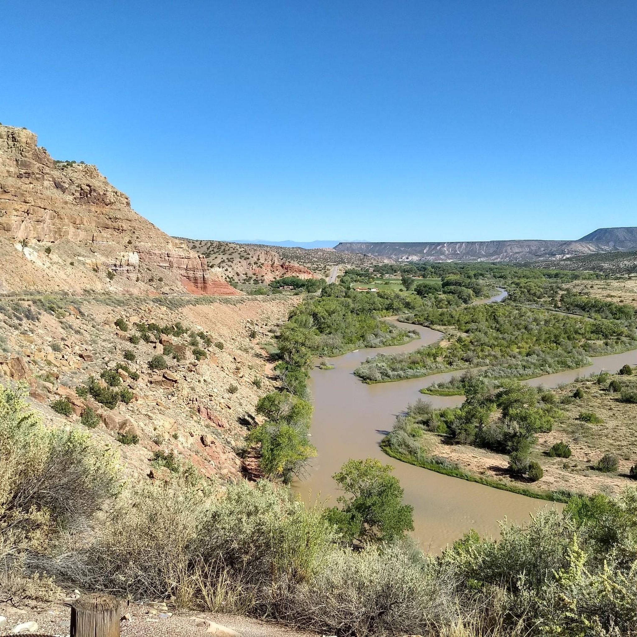
After the long (probably hot!) descent down the mesa, you are treated to up close views of the Rio Grande River. This is a great spot to cool off by the water and admire the views of this majestic, famous river.
0
0
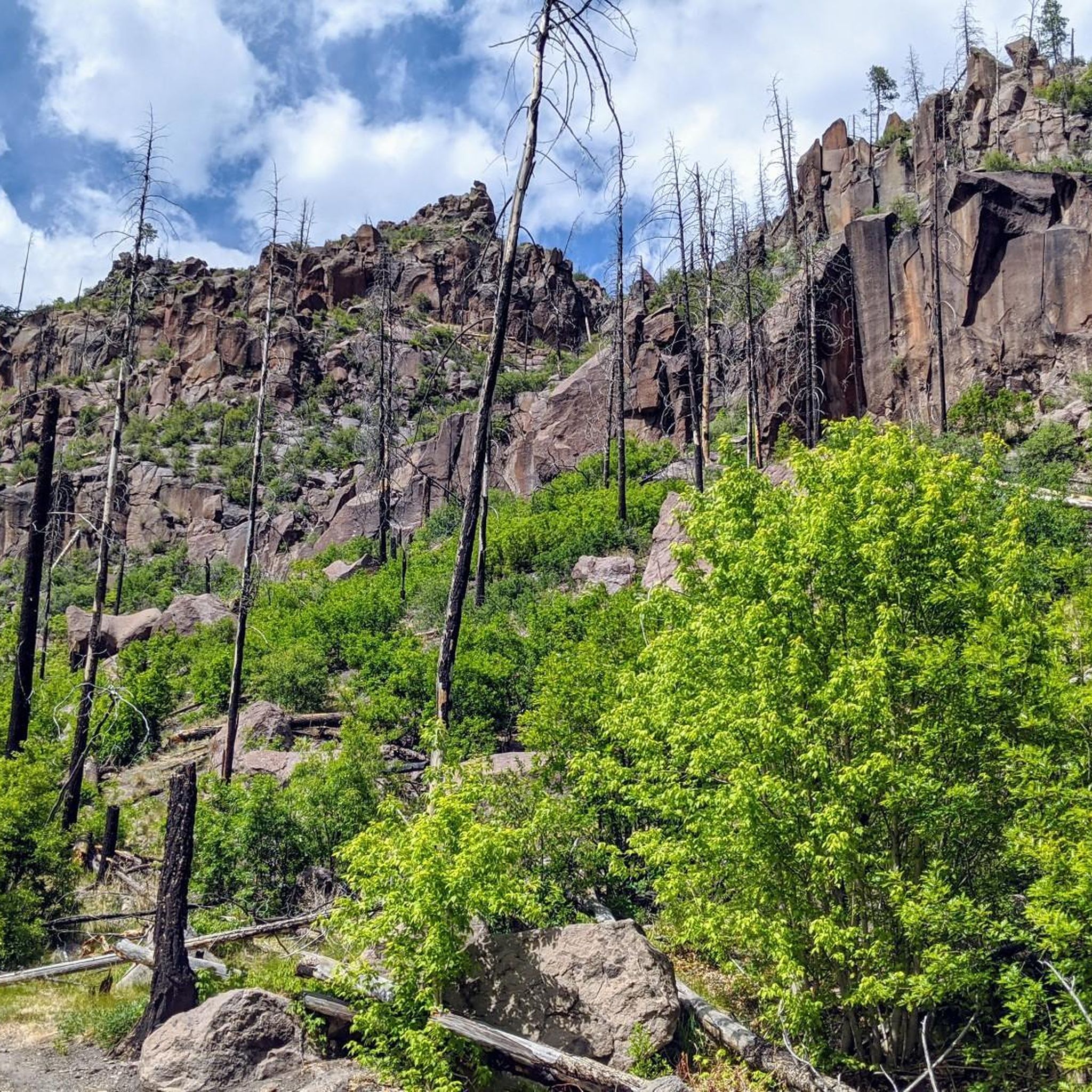
The Quemazon Trail is an excellent running and hiking trail on the westside of Los Alamos. It is typically run as a downhill trail accessed from either the Knapp/Los Alamos Canyon Trail or Pipeline Road, but it can be run uphill. The Quemazon Trail is a technical trail with stretches of flowy singletrack intermixed with rocks, ledges, and small drops to keep things interesting.
0
0
The Kwage Mesa Trail is an easy, flat trail that takes you out into the desert northeast of Los Alamos, New Mexico. Archeologists have found evidence of human activity on the Kwage (KWA-hee) Mesa, which is also known as the Pajarito Plateau, dating back over 10,000 years. This unique trail is a great place to run through both natural and human history close to town.
0
0
Explore the 1.2-mile Rendija Trail, a vital east-west link connecting numerous north-south trails. Beginning at Guaje Pines Cemetery, the trail offers diverse scenery. Be cautious as it is a flash-flooding zone; avoid it during severe thunderstorms or when there is significant water flow in the stream.
0
0

At the end of the Slot Canyon Trail is a nice overlook of the Kasha-Katuwe Tent Rocks. Here, runners can look down on the rock formations made 6 to 7 million years ago. Historically, there were massive volcanic eruptions that left pumice, ash, and tuff deposits over 1,000 feet thick. The Kasha-Katuwe Tent Rocks are the remnants of that volcanic activity that can be seen and studied today.
0
0
Kasha-Katuwe Tent Rocks National Monument is on public BLM land (Bureau of Land Management), and before arriving, visitors should check to see if the area is open at blm.gov/visit/kktr This area has impressive geological features, including cone-shaped tent rock formations. This area is open to foot traffic only, and the elevation of the area ranges from 5,570 feet to 6,760 feet above sea level.
0
0
Here you will find the trailhead for the Bayo Canyon Trail. The trail runs from the rotary next to Loma Linda Park to the bottom of Bayo Canyon. At the bottom of the canyon the trail levels out before turning into a dirt road that eventually leads out to the highway.
0
0
Frequently Asked Questions
How many running routes are available in the Santa Clara Mountains?
There are over 90 running routes documented in the Santa Clara Mountains, catering to various skill levels. You'll find everything from easy paths to more challenging trails with significant elevation changes.
What kind of terrain can I expect on jogging routes in the Santa Clara Mountains?
The Santa Clara Mountains offer a diverse range of terrain for jogging. You can expect dense redwood forests, oak woodlands, rolling grasslands, and rocky outcrops. Many trails feature varied landscapes, from gentle paths along creeks to more strenuous climbs through hills and valleys, often providing panoramic views of Silicon Valley and the San Francisco Bay Area.
Are there any easy or beginner-friendly running paths in the Santa Clara Mountains?
Yes, the region offers several easy and beginner-friendly running paths. For instance, the Tsankawi Ruins Trail loop from Tsankawi Trailhead is an easy 1.8-mile (2.9 km) route with minimal elevation gain, perfect for a relaxed jog.
Can I find circular running routes in the Santa Clara Mountains?
Absolutely. Many routes in the Santa Clara Mountains are designed as loops, allowing you to start and finish at the same point. Examples include the Bayo Benches Loop from Bayo Benches Trailhead, a moderate 5.1-mile (8.2 km) path, or the Kwage Mesa Trail loop from North Mesa Park, which is 4.3 miles (6.9 km).
What are some scenic jogging routes with great views?
Many trails in the Santa Clara Mountains offer breathtaking panoramic views. Higher elevations like those found in Castle Rock State Park and Black Mountain provide expansive vistas of Silicon Valley and the San Francisco Bay Area. The Mitchell Trail & Guaje Ridge Trail loop, while challenging, takes you through forested areas with rewarding views.
Are there any dog-friendly running trails in the Santa Clara Mountains?
While specific regulations vary by park and preserve, many open spaces in the Santa Clara Mountains offer dog-friendly trails. It's always best to check the specific park's rules regarding leashes and permitted areas before heading out with your canine companion.
What can I see along the running routes in terms of natural attractions or landmarks?
The Santa Clara Mountains are rich in natural beauty and historical sites. Along your runs, you might encounter iconic redwood groves, seasonal wildflower displays, and unique geological formations. Notable attractions include Bandelier National Monument, known for its ancient cliff dwellings, and various caves like Alcove House and Cavates. You can also find serene spots like Fenton Lake State Park.
What do other runners enjoy most about jogging in the Santa Clara Mountains?
The Santa Clara Mountains are highly rated by the komoot community, with an average score of 4.2 stars. Runners often praise the diverse terrain, from redwood groves to rolling hills, and the extensive network of trails that cater to all fitness levels. The stunning natural beauty and panoramic views are frequently highlighted as key attractions.
Are there any challenging running routes for experienced runners?
Yes, experienced runners will find plenty of challenging routes. Trails in areas like Castle Rock State Park are known for their significant elevation gains and rugged terrain. The Frijoles Trail to Yapashi Pueblo ruins loop, for example, is a difficult 15.2-mile (24.4 km) trail with over 2,200 feet (690 meters) of elevation gain.
What is the best time of year to go running in the Santa Clara Mountains?
The Santa Clara Mountains offer great running opportunities year-round. Spring brings vibrant wildflower displays, while fall offers cooler temperatures and beautiful foliage. Summer mornings are ideal to beat the heat, and even winter can be pleasant, though some higher elevation trails might experience occasional snow or mud. Always check local weather conditions before heading out.
Are there any running routes that pass by water features like creeks or waterfalls?
Yes, the region features several creeks and riparian habitats. Stevens Creek, originating on Black Mountain, has areas with ferns and California newts. Upper Stevens Creek County Park boasts a Waterfall Loop along Swanson Creek, offering a refreshing experience during your run.
Where can I find parking for running trails in the Santa Clara Mountains?
Most major parks and open space preserves in the Santa Clara Mountains have designated parking areas at trailheads. Popular spots like Rancho San Antonio Open Space Preserve, Alum Rock Park, and Castle Rock State Park typically offer parking facilities, though they can fill up quickly on weekends. It's advisable to arrive early, especially during peak times.
Are there any family-friendly running routes suitable for children?
Many parks in the Santa Clara Mountains offer easier, less strenuous trails that are suitable for families with children. These often include wider paths and gentler inclines. Alum Rock Park, for instance, has over 720 acres of terrain with trails suitable for various ages, making it a good option for a family outing.
Most popular routes in the Santa Clara Mountains
Most popular attractions in the Santa Clara Mountains

Get inspired with the komoot mobile app


Explore more
Browse the best Running Trails & Routes in other regions.
