The best running trails around Sagnes-Et-Goudoulet
4.7
(12)
957
runners
41
runs
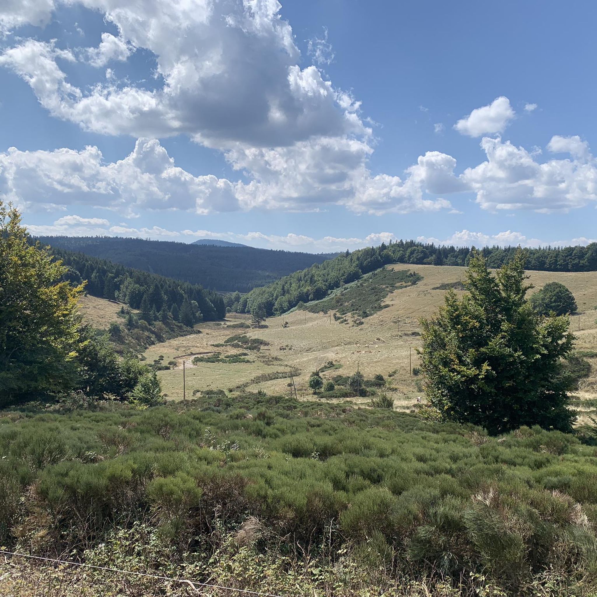
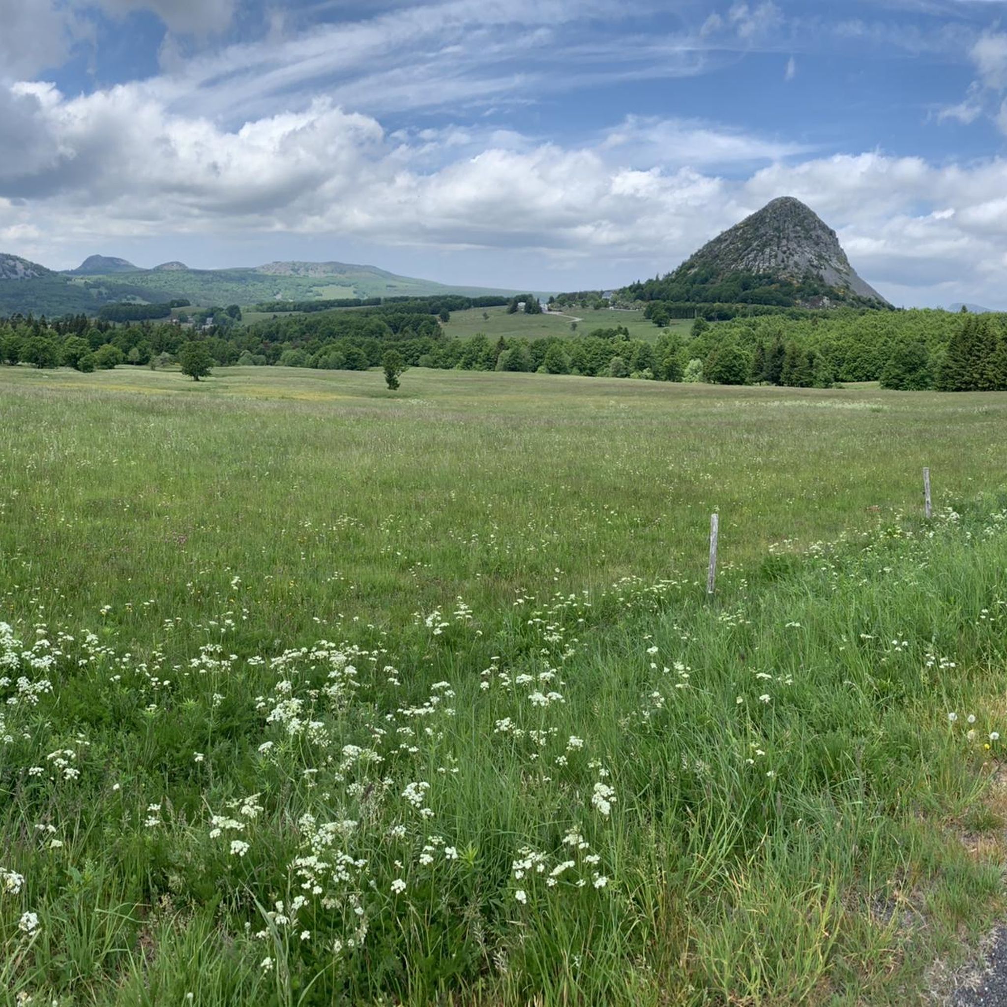
Jogging routes around Sagnes-Et-Goudoulet traverse a diverse landscape within the Monts d'Ardèche Geopark, a UNESCO-recognized area. The region is characterized by its volcanic terrain, featuring extinct volcanoes, distinctive craters, and domes that shape the elevation. Runners can explore expansive forests and the "plateau Ardéchois," offering varied ground from wooded paths to open, rolling landscapes. This area provides a stimulating backdrop for outdoor activities, with trails suitable for different types of running.
Best jogging routes around Sagnes-Et-Goudoulet
- The most popular jogging…
Last updated: July 13, 2026
8
runners
7.22km
01:08
360m
360m
This difficult 4.5-mile (7.2 km) running loop to Le Suc de Sara offers panoramic views and challenging volcanic terrain in the Monts d'Ardèc
5.0
(1)
43
runners
31.4km
04:28
1,430m
1,430m
Hard run. Very good fitness required. Sure-footedness, sturdy shoes and alpine experience required.

Sign up for free
5.0
(2)
38
runners
13.7km
02:05
650m
650m
Hard run. Very good fitness required. Sure-footedness, sturdy shoes and alpine experience required.
5.0
(1)
18
runners
20.5km
02:35
490m
490m
Hard run. Very good fitness required. Mostly paved surfaces. Suitable for all skill levels.
5
runners
14.2km
01:50
540m
540m
Hard run. Very good fitness required. Mostly paved surfaces. Suitable for all skill levels.
Get access to more routes and recommendations from other explorers.
Sign up for free
Already have an account?
Our route recommendations are based on thousands of hikes, rides, and runs completed by other people on komoot.
Start today with a free account
Your next adventure awaits.
Login or Signup

Tips from the Community

Small street, no traffic
0
0
Anyone who wants to stop for a bite to eat should stop here. There are few alternatives. A Grand Café Creme and a generous sandwich for 8 euros.
1
1

The Suc de la Lauzière is an ancient volcano which peaks at an altitude of 1,582 metres. From its summit, you can observe Mont Gerbier de Jonc, well known for providing the source of the Loire.
1
0

The Suc de Sara is a summit of volcanic origin located at 1,521 m. No surface volcanic activity has taken place on this peak, but it was created as a result of an underground magma chamber 6-8 million years ago. Fragments of concentric rings are all that remain to suggest its existence. From this summit, the view is magnificent.
2
0
The Suc de Sara is a summit of volcanic origin located at 1,521 m. No surface volcanic activity has taken place on this peak, but it was created as a result of an underground magma chamber 6-8 million years ago. Fragments of concentric rings are all that remain to suggest its existence. From this summit, the view is magnificent.
2
0

The Col de Mézilhac from Le Cheylard is a frequent ascent in the Ardéchoise, a cyclosportive in June. The climb is 22 km long with a total elevation gain of 700 m. The average gradient is 3.18% with maximum gradients of 7.5%.
2
0

Very nice site, a breathtaking 360 degree view. Be careful, the trail is a little technical but nothing dangerous.
0
0

Col de Moucheyres from La Bastide-sur-Bésorgues: 4.4Km at 4.5% average
1
0
Frequently Asked Questions
How many running routes are available around Sagnes-et-Goudoulet?
There are over 40 dedicated running routes around Sagnes-et-Goudoulet, offering a wide range of options for different fitness levels and preferences. These trails traverse the diverse landscapes of the Monts d'Ardèche Geopark.
Are there any easy running trails in Sagnes-et-Goudoulet?
While many routes are rated moderate to difficult due to the volcanic terrain, there are options suitable for those seeking a less strenuous run. For example, the Table d'interprétation loop from Lachamp-Raphaël is a moderate 7.8 km path that can be completed in under an hour, offering a gentler introduction to the area's scenery.
What kind of terrain can I expect on the jogging routes?
The running routes in Sagnes-et-Goudoulet are characterized by the unique volcanic landscapes of the Monts d'Ardèche Geopark. You'll encounter varied terrain, including paths through expansive forests, open 'plateau Ardéchois' sections, and ascents over distinctive volcanic 'sucs' (domes). This provides a stimulating and diverse experience for runners.
Are there any running routes that offer scenic views or pass by natural landmarks?
Absolutely! The region is rich in natural beauty. Many routes offer panoramic views of the volcanic landscape. You might consider a run that takes you near iconic landmarks like Mount Gerbier de Jonc, the source of the Loire River, or the stunning Ray-Pic Waterfall, which is just 3km from Sagnes-et-Goudoulet.
What do other runners say about the trails in Sagnes-et-Goudoulet?
The running trails in Sagnes-et-Goudoulet are highly regarded by the komoot community, with an average rating of 4.6 out of 5 stars from over 10 reviews. Runners often praise the diverse terrain, the challenging ascents, and the stunning natural beauty of the Monts d'Ardèche Geopark.
Are there any circular running routes available?
Yes, many of the running routes around Sagnes-et-Goudoulet are designed as loops, allowing you to start and finish in the same location. An example is the Col de Mézilhac (1,119 m) loop from Lachamp-Raphaël, a challenging 14.2 km run through mountain passes.
Can I find running routes that include mountain passes?
Yes, the mountainous terrain of the Ardèche offers several running routes that incorporate challenging mountain passes. The Col de Mézilhac (1,119 m) loop from Lachamp-Raphaël is a great option, featuring significant elevation changes as it traverses the landscape.
Are there any specific points of interest or attractions I can explore near the running trails?
Beyond the natural beauty, the area offers several points of interest. You could explore the South summit of Mont Mézenc for expansive views, or visit the unique Tchier de Borée, a man-made monument with historical significance, often accessible from nearby trails.
What is the typical difficulty level of running routes in this region?
The majority of running routes around Sagnes-et-Goudoulet are rated as moderate to difficult. This is due to the significant elevation changes and varied terrain characteristic of the volcanic Monts d'Ardèche. Runners should be prepared for challenging ascents and descents.
How long do the running routes typically take to complete?
The duration of running routes varies significantly based on distance and difficulty. For example, a moderate 7.8 km route like the Table d'interprétation loop from Lachamp-Raphaël might take around 53 minutes, while a difficult 14.2 km route such as the Col de Mézilhac (1,119 m) loop from Lachamp-Raphaël could take closer to 1 hour 50 minutes.
Are there any running trails that pass through forests or wooded areas?
Yes, the region features expansive forests, and many running routes will take you through wooded paths. This provides varied ground cover and often offers welcome shade, especially during warmer months. The diversity of terrain includes both dense forests and open plateaus.
Most popular routes around Sagnes-Et-Goudoulet
Most popular attractions around Sagnes-Et-Goudoulet

Get inspired with the komoot mobile app


Explore more
Browse the best Running Trails & Routes in other regions.
