The best walks and hikes around Montharville
4.6
(38)
205
hikers
46
hikes
Hiking around Montharville provides access to the tranquil, rural landscapes of the Eure-et-Loir department. Situated on the edge of the Beauceron plateau, the area offers views over the Loir and Ozanne valleys. While the commune itself is small, its location borders the Perche region, known for its rolling hills, diverse woodlands, and hedgerow-lined paths. The wider region features varied natural environments, including verdant riverbanks and protected woodlands.
Best hiking trails around Montharville
- The most popular hiking route is Mémillon Castle…
Last updated: July 4, 2026
3.0
(1)
11
hikers
9.99km
02:37
80m
80m
Moderate hike. Good fitness required. Easily-accessible paths. Suitable for all skill levels.
4.3
(3)
11
hikers
5.64km
01:28
40m
40m
Easy hike. Great for any fitness level. Easily-accessible paths. Suitable for all skill levels.

Sign up for free
3
hikers
Moderate hike. Good fitness required. Easily-accessible paths. Suitable for all skill levels.
7
hikers
24.8km
06:22
100m
100m
Hard hike. Very good fitness required. Easily-accessible paths. Suitable for all skill levels.
4.3
(3)
9
hikers
5.31km
01:23
40m
40m
Easy hike. Great for any fitness level. Easily-accessible paths. Suitable for all skill levels.
Get access to more routes and recommendations from other explorers.
Sign up for free
Already have an account?
Our route recommendations are based on thousands of hikes, rides, and runs completed by other people on komoot.
Start today with a free account
Your next adventure awaits.
Login or Signup



Tips from the Community

Porte de Boisville Its ogival portal opens into a thick quadrangular massif where there was a room for operating the portcullis. We can still see the groove in the thickness of the walls. On the left and right two small funnel-shaped spaces allowed the defenders to observe and repel the enemies who appeared on the bridge. The gate was topped by a building serving as a guardhouse which was demolished in 1761. The guarding of these doors and their keys was in the troubled times of the Hundred Years' War the subject of concern for the inhabitants and also a source of quarrels and trials between the city and the abbey. This gate is preceded by a bridge of 5 stone arches, the one adjoining the gate was built in 1774 and replaced a drawbridge which defended the entrance.
0
0

Bonneval, nicknamed the little Venice of Beauce
0
0

Bonneval is a beautiful town with still-present fortifications. The old town is surrounded by a wall at the foot of which flows the Loir. This city retains many period buildings such as the Saint-Roch Gate and the King's Tower. Among its must-see attractions, the city also includes the Benedictine abbey of Saint-Florentin-et-Saint-Hilaire, many times destroyed and rebuilt during wars.
2
0

Continuing on my way, and before entering the center of the village, a new door stands here. Admire the view.
1
0

Calm course between water and forest
0
0
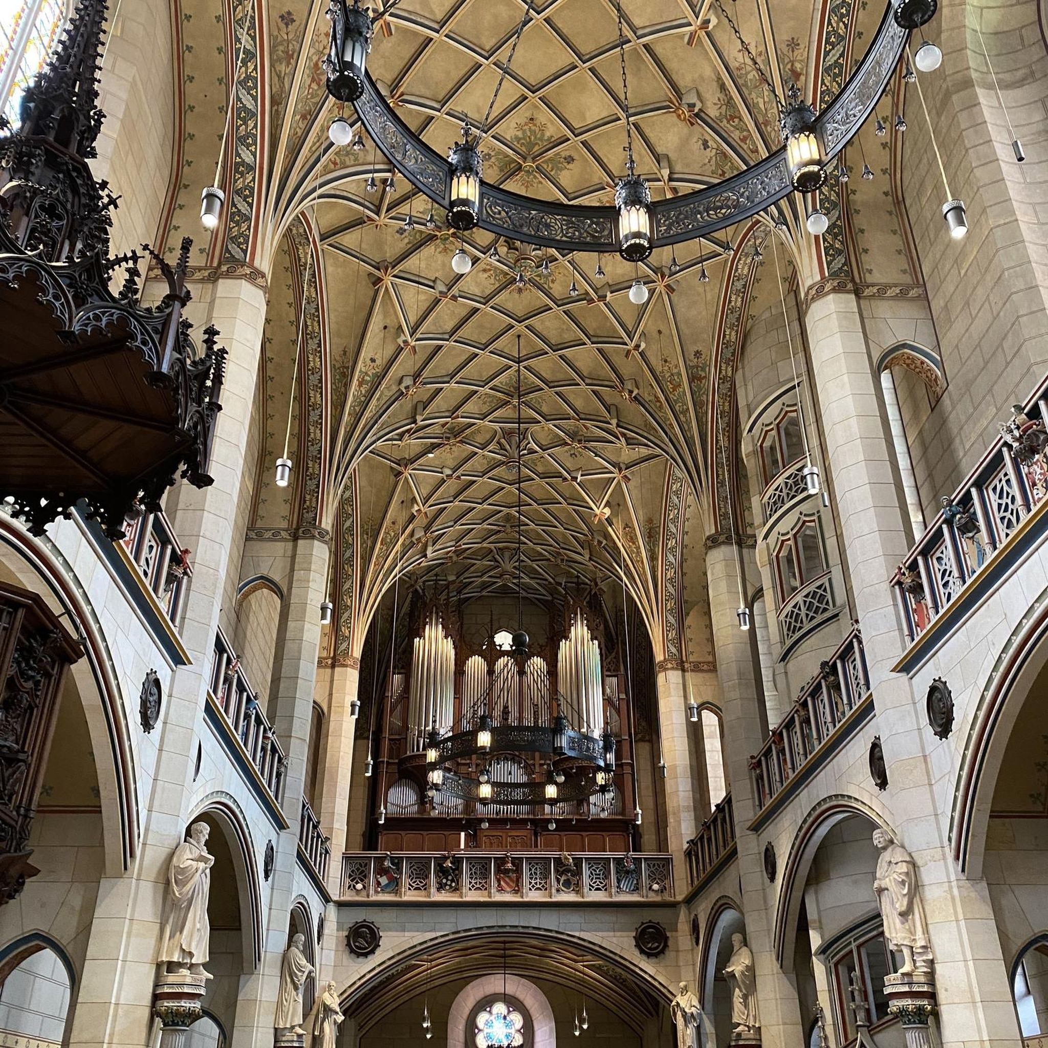
The church is in the early Gothic style and dates mainly from the beginning of the 13th century, however the lower parts of the flat apse and the three neighboring windows of each aisle are semi-circular and reflect the end of the 12th century. The start of construction therefore makes it contemporary with the Notre-Dame de Chartres cathedral. The gables decorated with hooks are from the 16th century. The slate spire which tops the church, also from the 16th century1, is decorated with a gallery and rises 65 meters above the ground. It houses three bells, two of which are classified, one dates from 1598, the other from 1793. Source: Wikipedia
1
0
From this door you enter the historic center of Bonneval. Take the time to admire this masterpiece still standing today.
0
0
This vestige from another time marks the entry into the town of Bonneval.
0
0
Frequently Asked Questions
How many hiking trails are available around Montharville?
There are over 35 hiking routes in the Montharville area, offering a variety of experiences. These include 19 easy trails, 18 moderate routes, and a couple of more challenging options for experienced hikers.
What kind of landscapes can I expect to see while hiking near Montharville?
The region around Montharville, often called the "green Beauce of the Loir and the Ozanne," offers diverse landscapes. You'll find verdant riverbanks along the Loir and Ozanne, rolling hills, and numerous woodlands such as the Bois de Moléans and the protected Bois des Gâts. The trails often provide views over these river valleys and the varied terrain bordering the Perche region.
Are there any circular walks in the Montharville area?
Yes, many of the trails around Montharville are circular, allowing you to start and end at the same point. For example, the Bonneval – Little Bridge of Vouvray loop from Bonneval is a moderate 7.0-mile (11.3 km) route through the Loir Valley, and the Church of Bonneval – Bonneval loop from Bonneval offers an easier 4.2-mile (6.8 km) option.
What historical sites or landmarks can I discover along the hiking trails?
The area is rich in history. You can explore the fortified city of Bonneval, known as "the green Venice of Beauce," with its ancient towers and gates. Other notable sites include the Château de Moléans and the Alluyes Castle. You might also encounter megaliths near Alluyes, offering a glimpse into the region's ancient past.
Are there family-friendly hiking options near Montharville?
Absolutely. Many trails are suitable for families, especially the easier routes. The Mémillon Castle – Château de Mémillon loop from Saint-Maur-sur-le-Loir is an easy 2.7-mile (4.3 km) trail with minimal elevation gain, perfect for a leisurely family stroll.
Can I bring my dog on the hiking trails?
Generally, dogs are welcome on most public hiking trails in the Eure-et-Loir department, provided they are kept under control, often on a leash, especially in areas with wildlife or near livestock. It's always a good idea to check local signage for any specific restrictions, particularly in protected natural areas like the Bois des Gâts.
What do other hikers enjoy most about the trails around Montharville?
The trails around Montharville are highly rated by the komoot community, with an average score of 4.6 stars from over 30 reviews. Hikers often praise the tranquil, rural paths, the scenic views over the Loir and Ozanne valleys, and the well-maintained routes that offer a peaceful escape into nature.
What is the best time of year to go hiking in Montharville?
The Eure-et-Loir region is beautiful throughout the year. Spring and autumn offer pleasant temperatures and vibrant colors, making them ideal for hiking. Summer is also popular, though it can be warmer, while winter hikes can provide a unique, serene experience, especially in the woodlands.
Are there any trails that feature rivers or water elements?
Yes, the Loir and Ozanne rivers are central to the region's charm. Many trails follow their banks, allowing you to discover ancient gravières and traditional lavoirs. The Bonneval – Little Bridge of Vouvray loop from Bonneval is a great example, leading you directly through the Loir Valley.
Are there any longer, more challenging hikes available?
While many routes are easy to moderate, there are options for longer walks. For instance, the Château de Mémillon – Château de Moléans loop from Saint-Maur-sur-le-Loir is a moderate 6.8-mile (10.9 km) trail that takes around 3 hours 20 minutes to complete, offering a good workout with varied scenery.
Is public transport available to reach hiking trailheads near Montharville?
While Montharville itself is a small commune, the wider Eure-et-Loir department has some public transport options. However, for reaching specific trailheads, especially those in more rural areas, a car is generally recommended for convenience and flexibility. Some larger towns like Bonneval may have better public transport connections.
Most popular attractions around Montharville

Get inspired with the komoot mobile app


Explore more
Browse the best Hikes in other regions.
