The best walks and hikes around Gourdièges
4.6
(67)
188
hikers
34
hikes
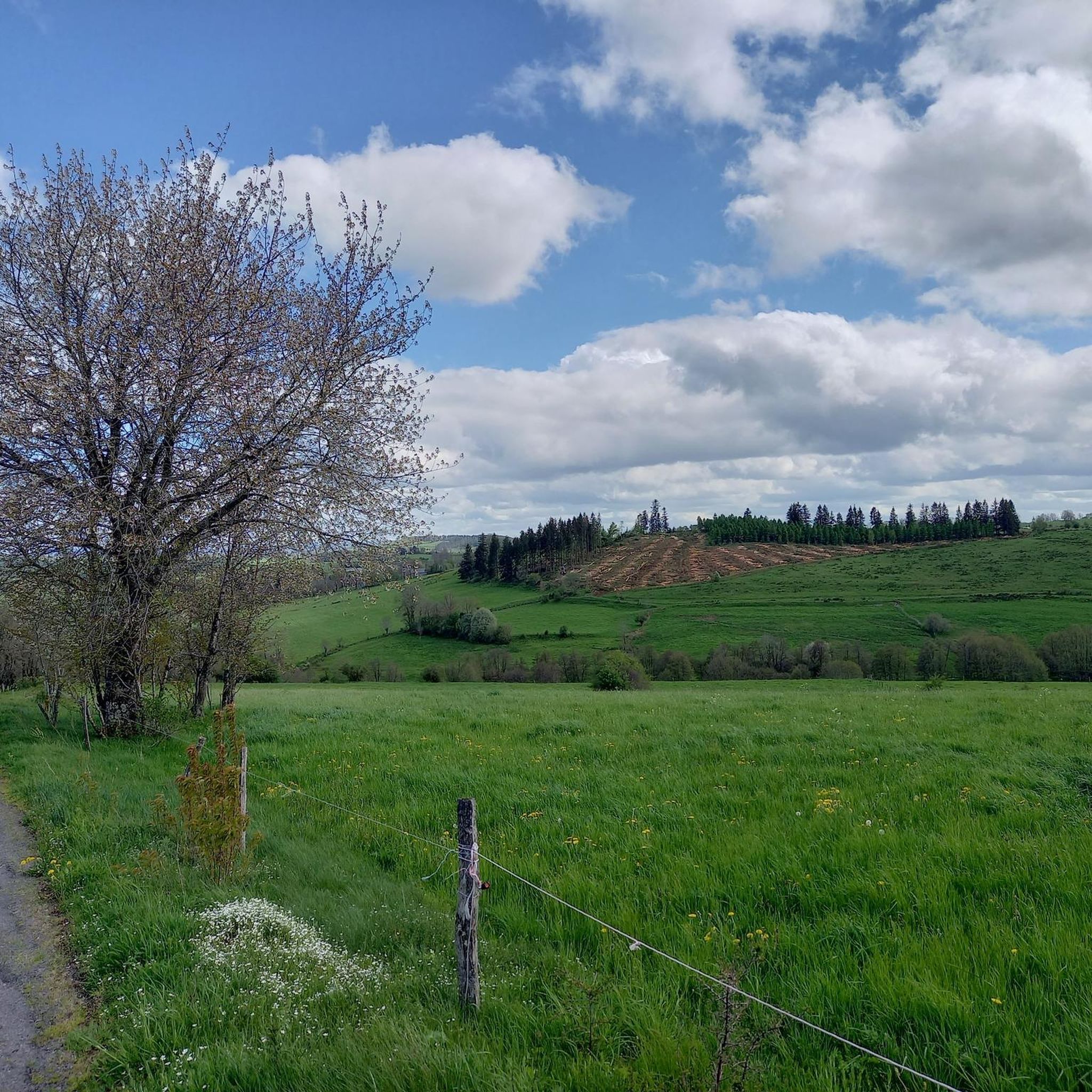
Hiking around Gourdièges offers access to the diverse volcanic landscapes of the Auvergne region, particularly near Cantal. The terrain is characterized by soft volcanic reliefs, rolling hills, and extensive pastures, providing a tranquil setting for outdoor activities. Hikers can explore a variety of ecosystems, including forests and natural water features such as waterfalls and lakes, which contribute to the scenic beauty of the area. The region's ancient volcanic formations create a unique geological experience with panoramic views.
Best hiking trails…
Last updated: June 29, 2026
5.0
(1)
15
hikers
9.03km
02:23
80m
80m
Moderate hike. Good fitness required. Easily-accessible paths. Suitable for all skill levels.
5.0
(3)
16
hikers
7.06km
01:56
110m
110m
Easy hike. Great for any fitness level. Easily-accessible paths. Suitable for all skill levels.

Sign up for free
2.8
(4)
10
hikers
11.2km
03:05
180m
180m
Moderate hike. Good fitness required. Easily-accessible paths. Suitable for all skill levels.
4.6
(5)
8
hikers
5.33km
01:32
130m
130m
Easy hike. Great for any fitness level. Easily-accessible paths. Suitable for all skill levels.
5.0
(1)
12
hikers
6.28km
01:42
80m
80m
Easy hike. Great for any fitness level. Easily-accessible paths. Suitable for all skill levels.
Get access to more routes and recommendations from other explorers.
Sign up for free
Already have an account?
Our route recommendations are based on thousands of hikes, rides, and runs completed by other people on komoot.
Start today with a free account
Your next adventure awaits.
Login or Signup

Tips from the Community

Paulhac is a small town of just over 400 inhabitants which is part of the regional natural park of the volcanoes of Auvergne.
0
0

The Narse de Lascols is a wetland of more than 100 hectares, which hosts a very rich fauna and flora. At this place, there is a nest-shaped observatory that allows you to observe the birds discreetly. Perfect break for lunch!
1
0


On the edge of the Narse de Lascols, a nest-shaped observatory allows you to observe migratory and non-migratory birds in complete discretion.
0
0
Muratel waterfalls: 4 consecutive falls (including one hidden) on basalt rocks and organs. Picnic table. Haven of freshness and peace in hot weather. Do not hesitate to park there!
0
0
To see, an ancient Roman sarcophagus. A modern monolith on the site explains the story.
0
0
Magnificent view of the Plomb du Cantal and the glacial valley of the Epie from the western flank of Puy Mercou. The section is about 1km long, plenty of time to linger on the panorama.
0
0
Frequently Asked Questions
What types of landscapes can I expect to see while hiking around Gourdièges?
Hiking around Gourdièges offers a journey through the diverse volcanic landscapes of the Auvergne region, particularly near Cantal. You'll encounter soft volcanic reliefs, rolling hills, and extensive pastures. The area is also rich in varied ecosystems, including verdant forests and natural water features like waterfalls and lakes, all set against a backdrop of ancient volcanic formations.
Are there easy hiking trails suitable for families or casual walkers in Gourdièges?
Yes, Gourdièges offers a good selection of easy trails. For instance, the Paulhac – View of Plomb du Cantal loop from Paulhac is an easy 4.4-mile (7.1 km) path that provides scenic views of the prominent Plomb du Cantal. Another accessible option is the View of the Three Crosses – View of Plomb du Cantal loop from Paulhac, which is 3.3 miles (5.3 km) and also rated easy. Overall, 14 of the 28 routes in the area are classified as easy.
Can I find circular hiking routes in the Gourdièges area?
Many of the hiking routes around Gourdièges are designed as loops, allowing you to start and end in the same location. Examples include the popular Lascols swimming loop from Cussac and the Muratel waterfalls loop from Le Chambon. These circular paths are great for exploring the diverse scenery without retracing your steps.
Are there any waterfalls or significant water features to see on hikes near Gourdièges?
Yes, the region is dotted with natural water attractions. The Muratel waterfalls loop from Le Chambon is a specific trail that leads through natural landscapes featuring waterfalls. The broader Auvergne region also boasts features like the Cascade de Livernade and various lakes, adding to the scenic beauty.
What do other hikers say about the trails in Gourdièges?
The hiking routes in Gourdièges are highly regarded by the komoot community, with an average rating of 4.6 stars from over 60 reviews. Hikers often praise the tranquil environment, the varied terrain, and the stunning views of the volcanic landscapes, making it an ideal destination for immersing oneself in nature.
What are some notable landmarks or attractions I can see along the hiking trails?
While hiking, you can discover several points of interest. The View of Plomb du Cantal is a prominent highlight, offering panoramic vistas of the volcanic massif. You might also encounter the serene Banks of the Truyère or the picturesque village of Paulhac. The area also features unique geological formations like the Grifoul Pass and enchanting stretches of narrow paved and unpaved paths.
Are there any longer or more challenging hikes available for experienced hikers?
Yes, for those seeking a greater challenge, Gourdièges offers some moderate to difficult routes. Out of the 28 available routes, 12 are classified as moderate and 2 as difficult. An example of a moderate route is the View of Plomb du Cantal loop from Paulhac, which covers 7 miles (11.2 km) and involves more elevation gain.
What is the best time of year to go hiking in Gourdièges?
The Gourdièges area, with its tranquil environment and diverse ecosystems, is generally suitable for hiking across multiple seasons. The rolling, verdant hills and pastures are particularly beautiful in spring and summer. While the region offers stunning scenery year-round, conditions can vary with elevation, so checking local weather forecasts is always recommended.
Are there opportunities for wildlife observation or photography during hikes?
Absolutely. The diverse ecosystems around Gourdièges, including forests, extensive pastures, and marshes, provide excellent opportunities to observe local flora and fauna. The unspoiled nature of the Cézallier Plateau and other areas makes it a rewarding destination for wildlife photography and nature enthusiasts.
How long do hikes typically take around Gourdièges?
The duration of hikes varies depending on the route and your pace. For example, the Lascols swimming loop from Cussac, a moderate 5.6-mile (9.0 km) trail, typically takes about 2 hours and 23 minutes. Easier, shorter routes like the View of the Three Crosses – View of Plomb du Cantal loop from Paulhac can be completed in under 2 hours, while longer moderate trails might take over 3 hours.
Is Gourdièges a good base for exploring the broader Auvergne region's hiking trails?
Yes, Gourdièges is ideally situated within the Auvergne region, known for its extensive network of marked and maintained trails. While Gourdièges offers its own unique volcanic and pastoral landscapes, its location provides access to the wider Cantal Mountains and Cézallier Plateau, making it a great starting point for exploring the diverse hiking experiences of the region.
Most popular attractions around Gourdièges

Get inspired with the komoot mobile app


Explore more
Browse the best Hikes in other regions.
