The best road cycling routes around Les Ternes
4.5
(65)
1,662
riders
196
rides
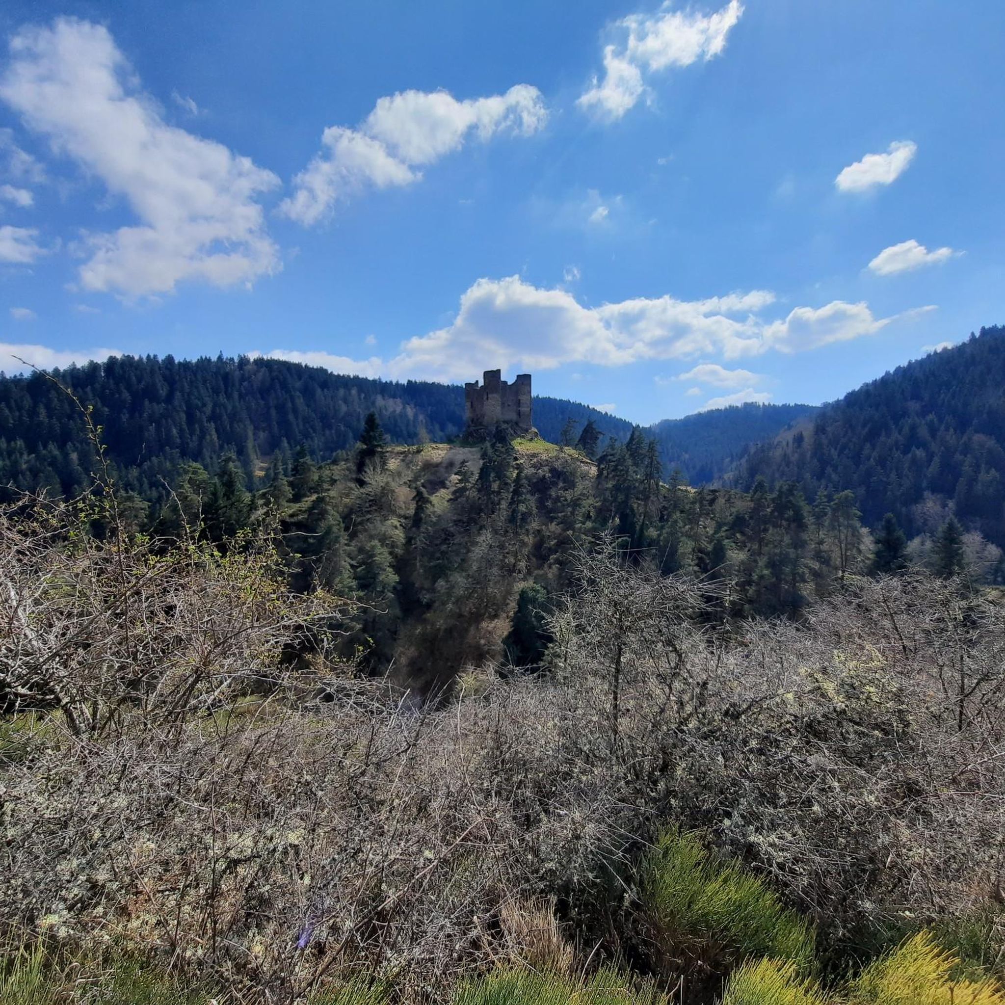
Road cycling routes around Les Ternes traverse the distinctive landscapes of the Massif Central, situated on the high Planèze de Saint-Flour, shaped by the ancient Cantal volcano. This region features a varied terrain with elevations ranging between 896 and 1061 meters, offering both challenging climbs and rewarding descents. Cyclists encounter panoramic views across high-altitude plateaus and can explore areas near the dramatic Gorges de la Truyère. The geological history contributes to a diverse environment for road cycling.
Best road cycling routes around Les Ternes
- The most popular road cycling route is Col de Prat de Bouc – View of Albepierre loop from Les Allauziers, a 51.5 miles (82.9 km) difficult trail that takes 4 hours 24 minutes to complete. This route features significant elevation gain and expansive views of the Cantal mountains.
- Another top favourite among local road cyclists is Petit single de la Chaumette – Paulhac loop from Les Allauziers, a moderate 24.8 miles (39.9 km) path. This route offers a mix of rolling sections and scenic vistas across the high plateau.
- Local road cyclists also love the Aubrac Cows – Paulhac loop from Paulhac, a 23.5 miles (37.9 km) trail leading through the high-altitude plateaus, often completed in about 1 hour 38 minutes.
- Road cycling around Les Ternes is defined by volcanic landscapes, high-altitude plateaus, and deep gorges. The network offers options for different ability levels, from moderate rides to more difficult, challenging ascents.
- The routes in Les Ternes are highly rated by the komoot community with an average score of 4.4 stars from over 49 reviews. More than 1650 road cyclists have used komoot to explore Les Ternes's varied terrain.
Last updated: July 1, 2026
5.0
(1)
103
riders
60.6km
03:25
1,210m
1,210m
Hard road ride. Very good fitness required. Mostly well-paved surfaces and easy to ride.
21
riders
71.5km
03:46
1,220m
1,220m
Hard road ride. Very good fitness required. Some segments of this route may be unpaved and difficult to ride.

Sign up for free
16
riders
52.9km
02:42
760m
760m
Moderate road ride. Good fitness required. Some segments of this route may be unpaved and difficult to ride.
5.0
(1)
23
riders
46.4km
02:21
760m
760m
Moderate road ride. Good fitness required. Mostly well-paved surfaces and easy to ride.
10
riders
49.4km
02:27
700m
700m
Moderate road ride. Good fitness required. Mostly well-paved surfaces and easy to ride.
Get access to more routes and recommendations from other explorers.
Sign up for free
Already have an account?
Our route recommendations are based on thousands of hikes, rides, and runs completed by other people on komoot.
Start today with a free account
Your next adventure awaits.
Login or Signup

Tips from the Community


Quite a climb up the valley. There's a bit more of a climb after this pass heading north, though.
0
0

From Sagnette, stay on the D39. This climb is 2.4 kilometers long, with a positive elevation gain of 165 meters. The Col de La Griffoul from La Sagnette has an average gradient of 7%. Afterward, let yourself glide into the magnificent Brezons Valley.
0
0

It's nice to see beautiful Aubrac cows on the side of the road.
2
0

Superb view of the Garabit viaduct, allowing you to cross the Truyère gorges. This metal structure, created by Gustave Eiffel, is 565 meters long and rises to 122 meters above the water. It was at one time the “highest viaduct in the world”!
0
0

Very regular climb without great difficulty start of several gravel trails
0
0

Impressive viaduct designed by Eiffel. Go as close as possible for snaps.
0
0

The name of Saint-Flour comes from Florus, a bishop who came to evangelize the region in the 4th century. The city, located on a volcanic promontory, is doubly protected by ramparts and fortified gates. In the 14th century, the city, due to its importance within the Cantal region, received the prestigious title of religious capital of Haute-Auvergne. The numerous buildings from this period are an integral part of the city and contribute to its beauty.
1
0
Frequently Asked Questions
How many road cycling routes are available around Les Ternes?
There are over 175 road cycling routes around Les Ternes, offering a wide range of options for different skill levels and preferences. The area is well-suited for exploring the unique volcanic landscapes of the Massif Central.
What kind of terrain can I expect on road cycling routes around Les Ternes?
Road cycling around Les Ternes features a varied and often challenging terrain. You'll encounter high-altitude plateaus, significant elevation changes due to the ancient Cantal volcano, and dramatic landscapes near the Gorges de la Truyère. Routes range from 896 to 1061 meters in elevation, promising both demanding climbs and rewarding descents.
Are there road cycling routes suitable for beginners or those looking for an easier ride?
Yes, among the 175 routes, there are 12 routes classified as easy and 76 as moderate. A good option for a moderate ride is the Petit single de la Chaumette – Paulhac loop from Les Allauziers, which covers about 40 km with rolling sections and scenic vistas across the high plateau.
What are some challenging road cycling routes for experienced riders in Les Ternes?
For experienced riders seeking a challenge, there are 87 difficult routes available. One such route is the Col de Prat de Bouc – View of Albepierre loop from Les Allauziers. This difficult trail spans 82.9 km and features significant elevation gain, offering expansive views of the Cantal mountains.
Can I find road cycling routes that offer scenic views or natural attractions?
Absolutely. The region is rich in natural beauty. Many routes offer panoramic views across the high plateaus and the Monts du Cantal. You can also find routes that pass near the dramatic Truyère Gorges or the picturesque Babory Waterfall, which plunges into a 30-meter high basalt gorge.
Are there any historical sites or landmarks I can visit while road cycling near Les Ternes?
Yes, the area offers several historical points of interest. You could cycle towards the medieval ruins of Alleuze Castle, dating back to the 12th century, or the magnificent Sailhant Castle, reinforced during the Hundred Years' War. The nearby town of Saint-Flour, situated on a volcanic promontory, also offers historical buildings and cultural insights.
Are there loop road cycling trails available around Les Ternes?
Many of the road cycling routes around Les Ternes are designed as loops, allowing you to start and end your ride in the same location. For example, the Aubrac Cows – Paulhac loop from Paulhac is a 37.9 km trail leading through high-altitude plateaus, perfect for a circular ride.
What do other road cyclists enjoy most about road cycling in Les Ternes?
The road cycling routes in Les Ternes are highly rated by the komoot community, with an average score of 4.4 stars from over 49 reviews. Cyclists often praise the diverse volcanic landscapes, the challenging ascents, and the rewarding panoramic views across the high plateaus. Over 1650 road cyclists have used komoot to explore this varied terrain.
What is the typical duration for road cycling routes in this region?
Route durations vary significantly based on distance and difficulty. For instance, a moderate route like the Aubrac Cows – Paulhac loop from Paulhac, which is 37.9 km, can be completed in about 1 hour 38 minutes. More difficult routes, such as the Pont-Farin old mill – Paulhac loop from Volzac Hôpital (70.4 km), typically take around 3 hours 40 minutes.
Are there any road cycling routes that pass through or near the Gorges de la Truyère?
Yes, the region's proximity to the dramatic Gorges de la Truyère means that some road cycling routes offer views or access points to this significant natural attraction. The Truyère river has carved grand and wild gorges, creating a striking backdrop for your ride, often integrating with the three large consecutive lakes: Garabit-Grandval, Lanau, and Sarrans.
What is the average elevation of road cycling routes in Les Ternes?
Les Ternes is situated at a high altitude, with the commune itself averaging 949 meters and varying between 896 and 1061 meters. This means road cycling routes in the area consistently feature elevated sections and significant changes in elevation, providing both physical challenge and extensive views.
Most popular attractions around Les Ternes

Get inspired with the komoot mobile app


Explore more
Browse the best Road cycling routes in other regions.
