The best running trails around La Chapelle-De-Bragny
4.5
(40)
1,004
runners
154
runs
Jogging around La Chapelle-De-Bragny offers a variety of routes through the region's diverse landscape. The area features a mix of open countryside, agricultural fields, and wooded sections, providing varied terrain for runners. Many trails follow quiet country roads and paths, connecting small villages and offering views of the surrounding French countryside. The elevation changes are generally gentle, making it accessible for different fitness levels.
Best jogging routes around La Chapelle-De-Bragny
- The most popular jogging route is Roche d'Aujou viewpoint –…
Last updated: July 6, 2026
9
runners
12.0km
01:35
360m
360m
Hard run. Very good fitness required. Mostly paved surfaces. Suitable for all skill levels.
6
runners
7.16km
00:46
90m
90m
Moderate run. Good fitness required. Mostly paved surfaces. Suitable for all skill levels.

Sign up for free
5
runners
6.08km
00:38
30m
30m
Moderate run. Good fitness required. Mostly paved surfaces. Suitable for all skill levels.
4
runners
5.59km
00:38
60m
60m
Moderate run. Good fitness required. Mostly paved surfaces. Suitable for all skill levels.
3
runners
8.83km
01:01
30m
30m
Moderate run. Good fitness required. Mostly paved surfaces. Suitable for all skill levels.
Get access to more routes and recommendations from other explorers.
Sign up for free
Already have an account?
Our route recommendations are based on thousands of hikes, rides, and runs completed by other people on komoot.
Start today with a free account
Your next adventure awaits.
Login or Signup

Tips from the Community

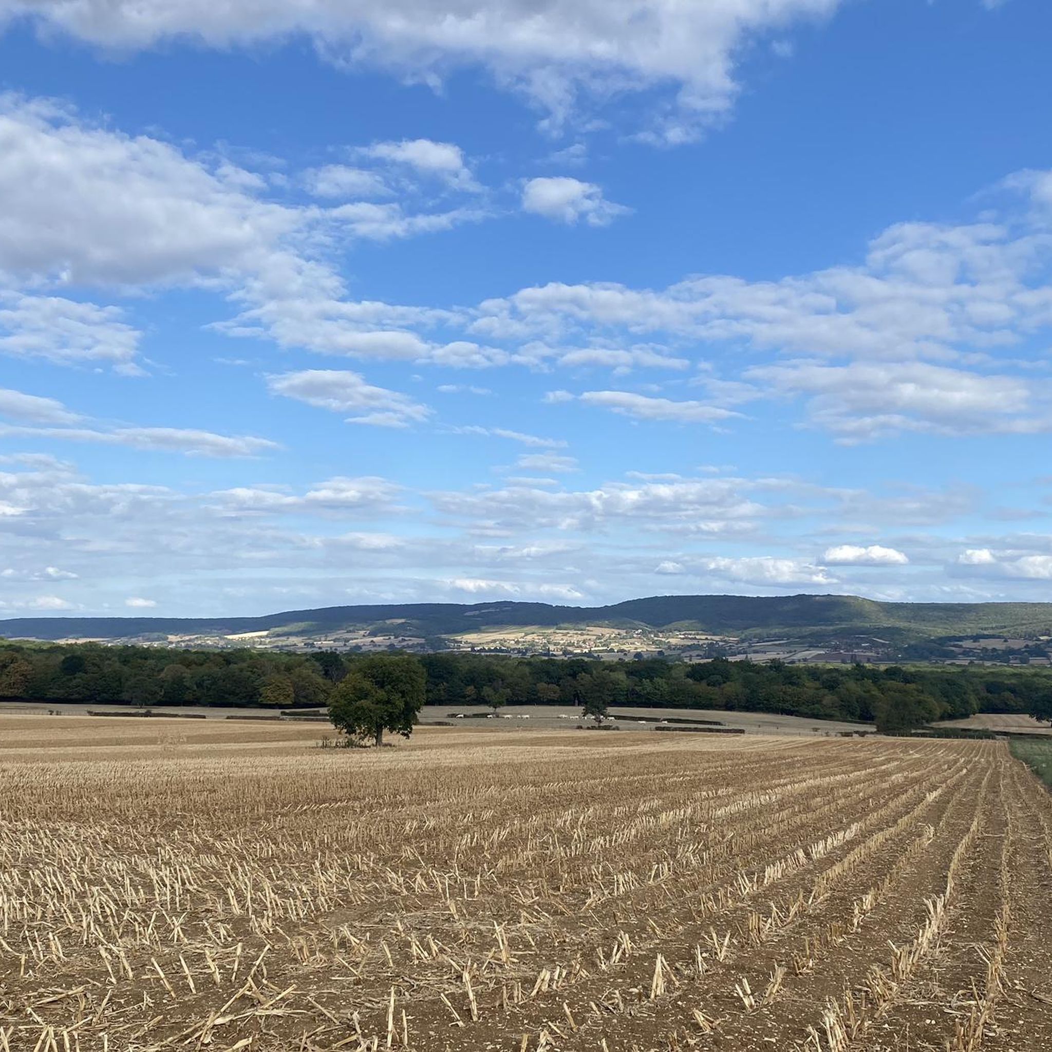
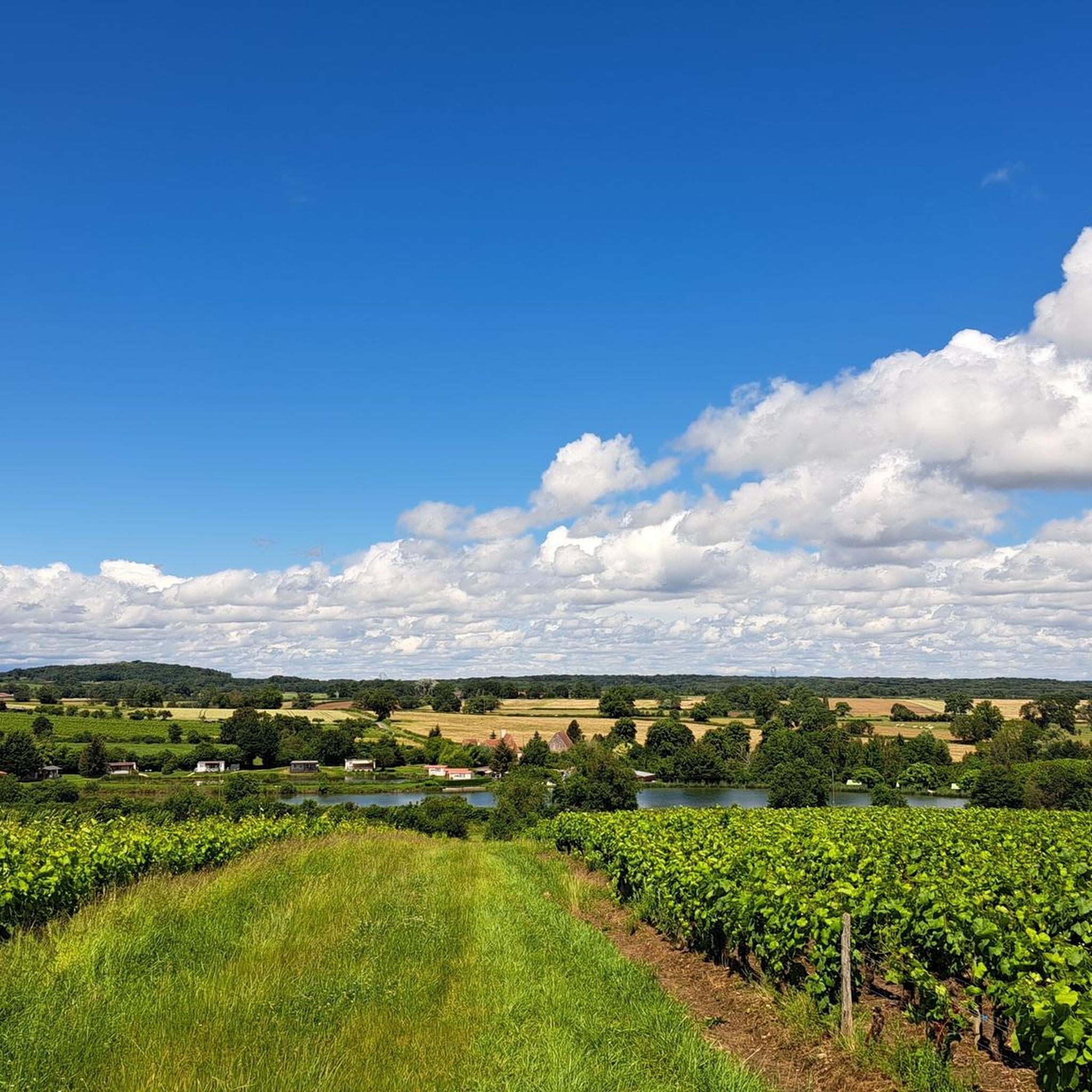
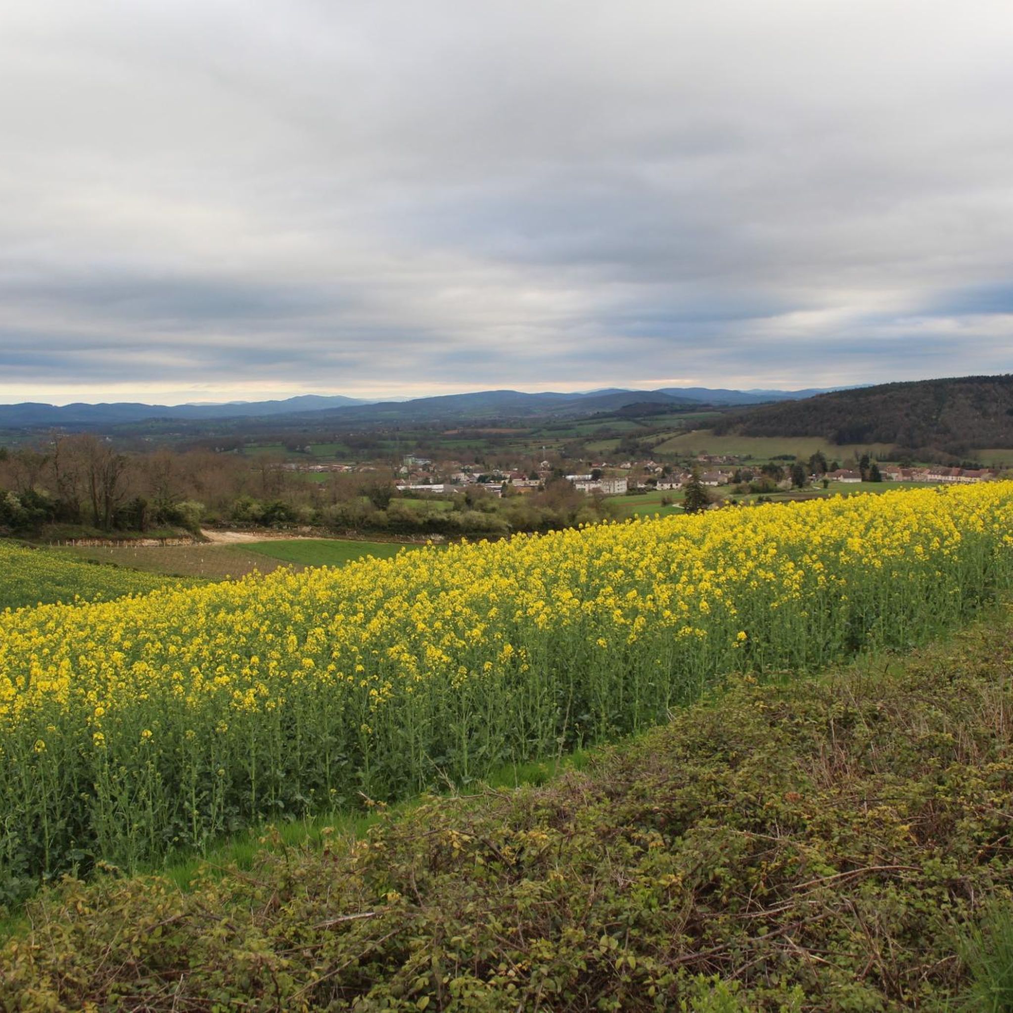
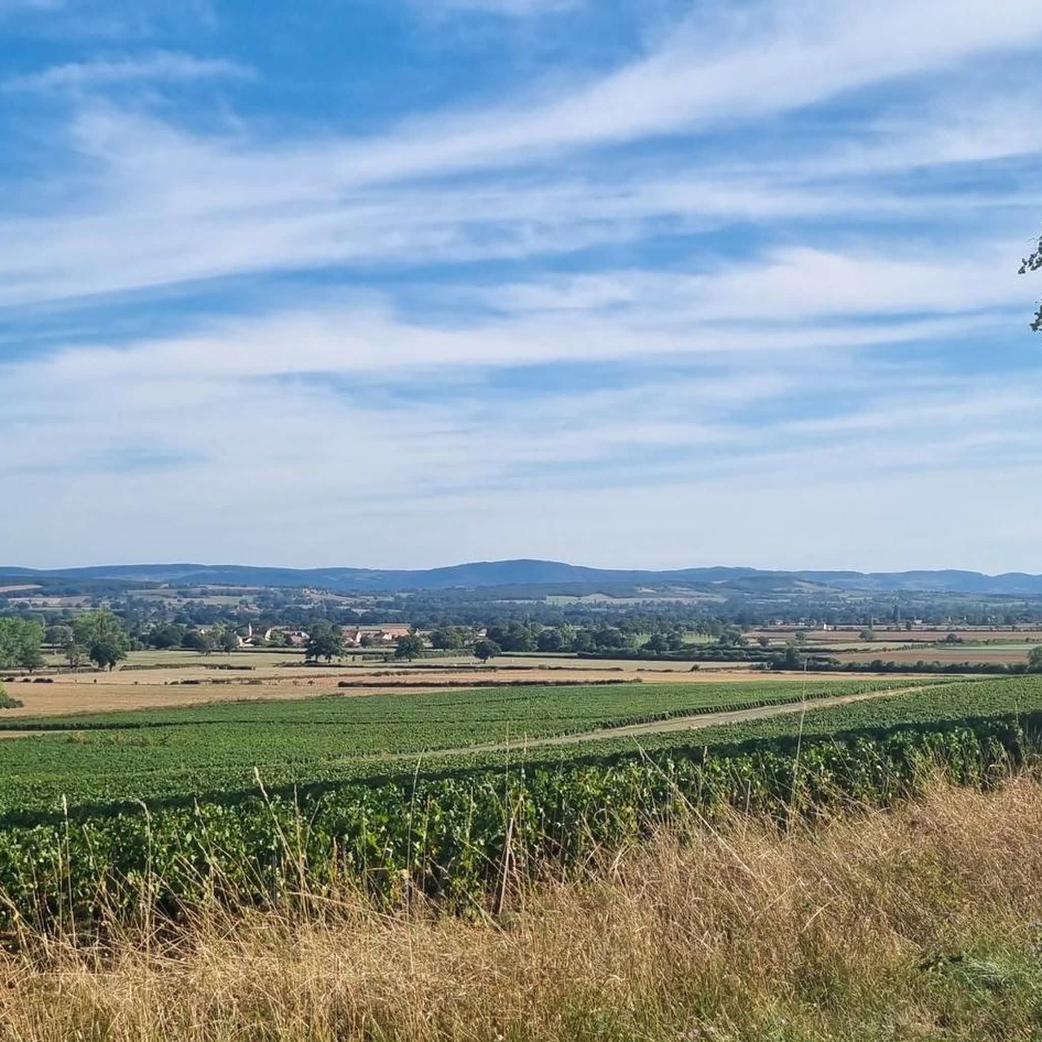
This location is part of a moderate circular hike starting from Mancey. The path there leads over easily walkable trails through nature and rewards hikers with this wide panoramic view over the French countryside.
0
0
The classic ascent from Mancey is considered a tough short climb in Category 3. Over a distance of 2.2 kilometers, 166 meters of altitude must be overcome. The average gradient is 7.55%, with peak sections of up to 14%. The path junction leads to various hiking trails and gravel paths through the wooded and wine-rich hilly landscape of the Mâconnais.
0
0
The pass is located on Rue des Maquisards in the municipality of Nanton. It is a popular destination for cycling tours. The ascent from the municipality of Mancey covers a distance of 2.2 kilometers. Cyclists overcome 166 meters of altitude on this tough route with an average gradient of 7.55%. The surrounding area also offers a versatile network of trails for easy to medium-difficulty hikes through rolling hills, mixed forests, and to nearby viewpoints such as Roche d'Aujou.
0
0
The rock, located at an altitude of just under 480 meters, offers a wide panorama over the Grosne valley. In addition to its scenic beauty, the place is historically significant: during World War II, it served as a secret hiding place for young members of the French Resistance.
0
0

Hello, I couldn't finish the walk because one of the paths was impassable (piles of debris)! Apart from that, the beginning is very pretty!
0
0

Agree wholeheartedly with Benoit - ascended via Mancey a couple of day's ago. Not the longest hill I've climbed, but still glad to get to the top!
0
0

Beautiful view of the area around Etrigny, beautiful!
2
0
Frequently Asked Questions
How many running routes are available around La Chapelle-De-Bragny?
There are over 140 running routes in the La Chapelle-De-Bragny area, offering a wide variety of options for different fitness levels and preferences.
Are there easy running routes for beginners in La Chapelle-De-Bragny?
Yes, the region offers 9 easy running routes, perfect for beginners or those looking for a gentle jog. Many routes feature gentle elevation changes through open countryside and quiet paths.
What is the typical length of running routes around La Chapelle-De-Bragny?
The running routes vary in length, with many moderate options. For example, the Running loop from Nanton is about 3.8 miles (6.1 km), while the Running loop from Étrigny covers 4.4 miles (7.2 km).
Where do the running routes in La Chapelle-De-Bragny typically start?
Many running routes in the area start from small villages like Étrigny, Nanton, Bresse-sur-Grosne, or Hauterive-le-Bas, offering convenient access and often local amenities.
Are there family-friendly running paths suitable for all ages?
Yes, many of the moderate and easy routes are suitable for families. They often follow quiet country roads and paths through fields and woodlands, providing a pleasant experience for all. Look for routes with minimal elevation gain.
Can I bring my dog on the running trails in La Chapelle-De-Bragny?
Generally, dogs are welcome on trails in rural areas like La Chapelle-De-Bragny. However, it's always recommended to keep your dog on a leash, especially when passing through agricultural fields or near livestock, and to respect local regulations.
When is the best time of year to go running in La Chapelle-De-Bragny?
Spring and autumn are ideal for running in La Chapelle-De-Bragny, with pleasant temperatures and beautiful scenery. Summer mornings and evenings can also be great, while winter offers crisp air, though some paths might be muddy or slippery.
What can I see along the jogging routes in the region?
Many routes offer views of the picturesque French countryside, including agricultural fields and wooded sections. You might also pass by charming small villages. For historical sights, consider exploring nearby castles like Cormatin Castle or Brancion Castle, which are close to the area.
Are there any circular running routes in La Chapelle-De-Bragny?
Yes, many of the running routes in the area are circular, allowing you to start and finish at the same point. An example is the Château de Bresse-sur-Grosne loop from Bresse-sur-Grosne, which is a moderate 3.5-mile (5.6 km) trail.
What do other runners enjoy the most about jogging in La Chapelle-De-Bragny?
The area is highly rated by the komoot community, with an average score of 4.5 stars from over 30 reviews. Runners often praise the diverse landscape, including open countryside and wooded sections, and the quiet, rural paths that connect small villages.
Are there any challenging running routes for experienced runners?
Yes, for experienced runners, there are 40 difficult routes available. A notable challenging option is the Roche d'Aujou viewpoint – Col de Navois loop from Étrigny, a 7.5-mile (12.0 km) trail with significant elevation gain, leading to a rewarding viewpoint.
Are there running routes that go through forested areas?
Yes, the region features wooded sections, providing shaded running opportunities. The Bois du Grand Bragny loop from Hauterive-le-Bas is a moderate 5.5-mile (8.8 km) route that takes you through forested terrain.
Most popular routes around La Chapelle-De-Bragny
Most popular attractions around La Chapelle-De-Bragny

Get inspired with the komoot mobile app


Explore more
Browse the best Running Trails & Routes in other regions.
